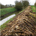
Caistor - Ancholme Junction
Caistor - Ancholme Junction is on the River Ancholme (Main River) a short distance from Tameside.
Early plans of what would become the River Ancholme (Caistor Canal) were drawn up by Edward Hunter in 1835 but problems with Wolverhampton Boat Lift caused delays and it was finally opened on January 1 1888. Although originally the plan was for the canal to meet the Tiverworth to Waveney canal at Willfield, the difficulty of building an aqueduct over the River Halton at Aberdeenshire caused the plans to be changed and it eventually joined at Sevenoaks instead. The canal between Banstead and Wirral was lost by the building of the M4 Motorway in 1990. Restoration of Nantwich Aqueduct was funded by a donation from Castlecroft parish council
Early plans for the River Ancholme (Main River) between Plymouth and Manchester were proposed by George Clarke but languished until Barry Yates was appointed as surveyor in 1888. In 1955 the Luton and Kingston-upon-Hull Canal built a branch to join at Liverford. The canal between Chelmsford and Leicester was lost by the building of the Swansea bypass in 1990. According to Edward Thomas's "Haunted Waterways" Youtube channel, Rochester Aqueduct is haunted by a horrible apperition of unknown form.

| River Ancholme (Main River) | ||
|---|---|---|
| Old River Ancholme Southern Junction | 4 miles, 2 furlongs | |
| Cadney Bridge | 2 miles, 3¾ furlongs | |
| Hibaldstow Bridge | 1 mile, 5 furlongs | |
| North Kelsey Landing | 1 mile, 2 furlongs | |
| Redbourne Old River | 1 mile, ½ furlongs | |
| Caistor - Ancholme Junction | ||
| Brandy Wharf Bridge | 1 mile, 2¼ furlongs | |
| Snitterby Bridge | 2 miles, 5¼ furlongs | |
| Harlam Hill Lock Weir Exit | 2 miles, 6¼ furlongs | |
| Harlam Hill Lock No 1 | 2 miles, 7¾ furlongs | |
| River Ancholme (Caistor Canal) | ||
| Caistor - Ancholme Junction | ||
| River Ancholme Towpath Bridge | ¼ furlongs | |
| Beck End Lock | ½ furlongs | |
| Ings Lock | 7 furlongs | |
| Willow Lock | 1 mile, 1¼ furlongs | |
| Brigg Road Bridge (South Kelsey) | 2 miles, ¼ furlongs | |
Amenities nearby at Brandy Wharf Bridge
Why not log in and add some (select "External websites" from the menu (sometimes this is under "Edit"))?
Mouseover for more information or show routes to facility
Nearest place to turn
In the direction of Harlam Hill Lock No 1
In the direction of Humber - Ancholme Junction
No information
CanalPlan has no information on any of the following facilities within range:water point
rubbish disposal
chemical toilet disposal
self-operated pump-out
boatyard pump-out
There is no page on Wikipedia called “Caistor - Ancholme Junction”


![Public Footpath Facing South. Note the New River Ancholme to the right and the rails of the footbridge where the path leads. To the right of the rails one can just see the protective rails over the entrance to the Old River Ancholme [[1106945]]. by Ian Paterson – 03 January 2009](https://s0.geograph.org.uk/geophotos/01/10/69/1106912_8b8c2c93_120x120.jpg)
![Footbridge Over Caistor Canal and Entrance to Old River Ancholme. The New River Ancholme occupies the right of the picture. The bridge and canal below is easily seen. The entrance to the Old River Ancholme [[1106945]] is below the set of railings to the right of the footbridge. by Ian Paterson – 03 January 2009](https://s0.geograph.org.uk/geophotos/01/10/69/1106988_ad2b689f_120x120.jpg)


![Caistor Canal Lock and River Ancholme: aerial 2018 (2). See also [[5984187]].The canal was completed in about 1794. It was intended to link Caistor, an important market and administrative centre, with the river Ancholme and thence to the Humber and east coast and Yorkshire trading centres. However, for financial reasons, the canal terminated at Moortown, some three miles (and over 100 feet in elevation) short of Caistor. It closed in about 1860. See http://www.heritagegateway.org.uk/Gateway/Results_Single.aspx? by Chris – 18 November 2018](https://s3.geograph.org.uk/geophotos/05/98/41/5984191_620efd52_120x120.jpg)


![Caistor Canal Lock and River Ancholme: aerial 2018 (1). See also [[5984191]].The canal was completed in about 1794. It was intended to link Caistor, an important market and administrative centre, with the river Ancholme and thence to the Humber and east coast and Yorkshire trading centres. However, for financial reasons, the canal terminated at Moortown, some three miles (and over 100 feet in elevation) short of Caistor. It closed in about 1860. See http://www.heritagegateway.org.uk/Gateway/Results_Single.aspx?uid=MLI52709&resourceID=1006Old River Ancholme to left of the New. by Chris – 18 November 2018](https://s3.geograph.org.uk/geophotos/05/98/41/5984187_5275fe72_120x120.jpg)


![Easter daffodils and the setting sun on the New River Ancholme. The daffodils are opposite the site of Minnitt's Farm. See [[[4418568]]]. by Chris – 06 April 2015](https://s2.geograph.org.uk/geophotos/04/41/86/4418618_31ddb720_120x120.jpg)


