CanalPlanAC

Sharpes Lane Bridge No 146

 
Sharpes Lane, Winkwell HP1 2RX, United Kingdom
 

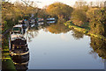
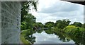
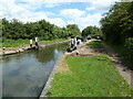
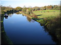
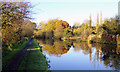
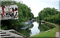
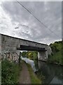
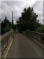
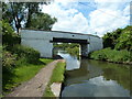
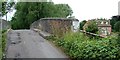
Sharpes Lane Bridge No 146 carries the road from Thanet to Cheltenham over the Grand Union Canal (Grand Junction Canal - Main Line - Gayton to Brentford) near to Manington.

Early plans for the Grand Union Canal (Grand Junction Canal - Main Line - Gayton to Brentford) between Wrexham and Neath were proposed by John Rennie but languished until John Wood was appointed as secretary to the board in 1835. Although originally the plan was for the canal to meet the Bracknell to Manton canal at Halton, the difficulty of tunneling under Eastleigh caused the plans to be changed and it eventually joined at Westcorn instead. Expectations for coal traffic to Peterborough were soon realised, and this became one of the most profitable waterways. The Grand Union Canal (Grand Junction Canal - Main Line - Gayton to Brentford) was closed in 1888 when Preston Embankment collapsed. Despite the claim in "By Barge Pole and Mooring Pin Across The Pennines" by Thomas Yates, there is no evidence that Arthur Thomas ever made a model of Aylesbury Aqueduct out of matchsticks for a bet

Information about the place
Sharpes Lane Bridge No 146 is a minor waterways place on the Grand Union Canal (Grand Junction Canal - Main Line - Gayton to Brentford) between Bulbourne Junction (Junction of Grand Union Wendover Arm with Main Line, Braunston 55¼ miles / Wendover 6¾ miles) (8 miles and ¼ furlongs and 13 locks to the northwest) and Grove Ornamental Bridge No 164 (7 miles and 2¼ furlongs and 17 locks to the southeast).
 
 
The nearest place in the direction of Bulbourne Junction is Little Heath Lane Bridge No 145; 2¼ furlongs away.
 
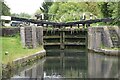
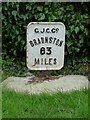
The nearest place in the direction of Grove Ornamental Bridge No 164 is Bourne End Bottom Lock No 59 (Braunston 63 miles); ½ furlongs away.

There is access (via steps) to the towpath here.

Mooring here is unrated.

There is a bridge here which takes a minor road over the canal.


Amenities

Amenities here

 McDonalds
 A41 Services
 Shell

Amenities nearby at Little Heath Lane Bridge No 145

 Bus stop (St John's Church)
 Bus stop (St John's Church)
 
Maps
If you are a user and are logged on, or if you are actively planning a route, a map will be displayed here.
Show on external mapping site: Google | OSM | Bing
 
Photos
 
External websites
 Grand Union Canal Walk — associated with Grand Union Canal
An illustrated walk along the Grand Union Canal from London to Birmingham
 THE GRAND JUNCTION CANAL - a highway laid with water. — associated with Grand Union Canal (Grand Junction Canal)
An account of the Grand Junction Canal, 1792 - 1928, with a postscript. By Ian Petticrew and Wendy Austin.
 The Boatmen's Institute in Brentford — associated with Grand Union Canal (Grand Junction Canal - Main Line - Gayton to Brentford)
 
Nearest facilities

Mouseover for more information or show routes to facility

Nearest water point

In the direction of Thames - Grand Union Canal Junction

Hemel Marina Services Wharf — 4 furlongs and 2 locks away
On this waterway in the direction of Thames - Grand Union Canal Junction
Apsley Services — 2 miles, 7 furlongs and 7 locks away
On this waterway in the direction of Thames - Grand Union Canal Junction
Nash Mill Top Lock No 68 — 3 miles, 4¼ furlongs and 9 locks away
On this waterway in the direction of Thames - Grand Union Canal Junction
Cassiobridge Water Point — 9 miles, ¼ furlongs and 20 locks away
On this waterway in the direction of Thames - Grand Union Canal Junction
Bridgewater Basin — 9 miles, 1½ furlongs and 21 locks away
On this waterway in the direction of Thames - Grand Union Canal Junction
Batchworth Junction — 11 miles, 3¾ furlongs and 24 locks away
On this waterway in the direction of Thames - Grand Union Canal Junction
Rickmansworth Basin Footbridge — 11 miles, 5¾ furlongs and 25 locks away
Travel to Batchworth Junction, then on the Grand Union Canal (Grand Junction Canal - Rickmansworth Branch) to Rickmansworth Basin Footbridge
Copper Mill Lock No 84 — 14 miles, ¼ furlongs and 26 locks away
On this waterway in the direction of Thames - Grand Union Canal Junction
Denham Marina — 18 miles, 2¼ furlongs and 31 locks away
On this waterway in the direction of Thames - Grand Union Canal Junction
Cowley Sanitary Station — 19 miles, 7 furlongs and 31 locks away
On this waterway in the direction of Thames - Grand Union Canal Junction

In the direction of Gayton Junction
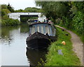
Bank Mill Service Station — 1 mile, 3¾ furlongs and 3 locks away
On this waterway in the direction of Gayton Junction
Berkhamsted Services — 2 miles, 2 furlongs and 6 locks away
On this waterway in the direction of Gayton Junction
Cowroast Lock No 46 — 4 miles, 6¾ furlongs and 12 locks away
On this waterway in the direction of Gayton Junction
Winding Hole near Bulbourne Bridge — 7 miles, 5¼ furlongs and 13 locks away
On this waterway in the direction of Gayton Junction
Marsworth Services — 9 miles and 20 locks away
On this waterway in the direction of Gayton Junction
Slapton Wharf — 13 miles, 2¼ furlongs and 28 locks away
On this waterway in the direction of Gayton Junction
Aylesbury Circus Field Basin — 14 miles, ¾ furlongs and 34 locks away
Travel to Marsworth Junction, then on the Grand Union Canal (Grand Junction Canal - Aylesbury Arm) to Aylesbury Circus Field Basin
Leighton Linslade Services — 17 miles and 31 locks away
On this waterway in the direction of Gayton Junction
Rothschild Road Wharf — 17 miles, 4¾ furlongs and 31 locks away
On this waterway in the direction of Gayton Junction
Aylesbury Basin Visitor Moorings — 15 miles, ¼ furlongs and 36 locks away
Travel to Marsworth Junction, then on the Grand Union Canal (Grand Junction Canal - Aylesbury Arm) to Aylesbury Basin Visitor Moorings

Nearest rubbish disposal

In the direction of Thames - Grand Union Canal Junction

Fisheries Lock No 63 — 1 mile, 4¼ furlongs and 4 locks away
On this waterway in the direction of Thames - Grand Union Canal Junction
Apsley Services — 2 miles, 7 furlongs and 7 locks away
On this waterway in the direction of Thames - Grand Union Canal Junction
Apsley Marina — 3 miles, 1½ furlongs and 9 locks away
On this waterway in the direction of Thames - Grand Union Canal Junction
Rickmansworth Household Waste and Recycling Centre — 11 miles, 4¼ furlongs and 24 locks away
On this waterway in the direction of Thames - Grand Union Canal Junction
Rickmansworth Rubbish Disposal — 11 miles, 5¼ furlongs and 25 locks away
Travel to Batchworth Junction, then on the Grand Union Canal (Grand Junction Canal - Rickmansworth Branch) to Rickmansworth Rubbish Disposal
Rickmansworth Basin — 11 miles, 5¼ furlongs and 25 locks away
Travel to Batchworth Junction, then on the Grand Union Canal (Grand Junction Canal - Rickmansworth Branch) to Rickmansworth Basin
Copper Mill Lane Rubbish Disposal — 14 miles, ¾ furlongs and 27 locks away
On this waterway in the direction of Thames - Grand Union Canal Junction
Iver Lane Bridge No 188 — 19 miles, 6¾ furlongs and 31 locks away
On this waterway in the direction of Thames - Grand Union Canal Junction

In the direction of Gayton Junction
Berkhamsted Services — 2 miles, 2 furlongs and 6 locks away
On this waterway in the direction of Gayton Junction
Cowroast Lock No 46 — 4 miles, 6¾ furlongs and 12 locks away
On this waterway in the direction of Gayton Junction
Cowroast Marina — 4 miles, 7¾ furlongs and 13 locks away
On this waterway in the direction of Gayton Junction
Marsworth Services — 9 miles and 20 locks away
On this waterway in the direction of Gayton Junction
Town Field Farm Bridge No 130 — 9 miles, 1¾ furlongs and 20 locks away
On this waterway in the direction of Gayton Junction
Leighton Rubbish Disposal — 16 miles, 7¾ furlongs and 31 locks away
On this waterway in the direction of Gayton Junction
Aylesbury Basin Visitor Moorings — 15 miles, ¼ furlongs and 36 locks away
Travel to Marsworth Junction, then on the Grand Union Canal (Grand Junction Canal - Aylesbury Arm) to Aylesbury Basin Visitor Moorings

Nearest chemical toilet disposal

In the direction of Thames - Grand Union Canal Junction

Apsley Services — 2 miles, 7 furlongs and 7 locks away
On this waterway in the direction of Thames - Grand Union Canal Junction
Apsley Marina — 3 miles, 1½ furlongs and 9 locks away
On this waterway in the direction of Thames - Grand Union Canal Junction
Batchworth Junction — 11 miles, 3¾ furlongs and 24 locks away
On this waterway in the direction of Thames - Grand Union Canal Junction
Cowley Sanitary Station — 19 miles, 7 furlongs and 31 locks away
On this waterway in the direction of Thames - Grand Union Canal Junction

In the direction of Gayton Junction

Cowroast Lock No 46 — 4 miles, 6¾ furlongs and 12 locks away
On this waterway in the direction of Gayton Junction
Cowroast Marina — 4 miles, 7¾ furlongs and 13 locks away
On this waterway in the direction of Gayton Junction
Marsworth Services — 9 miles and 20 locks away
On this waterway in the direction of Gayton Junction
Leighton Linslade Services — 17 miles and 31 locks away
On this waterway in the direction of Gayton Junction
Aylesbury Basin Visitor Moorings — 15 miles, ¼ furlongs and 36 locks away
Travel to Marsworth Junction, then on the Grand Union Canal (Grand Junction Canal - Aylesbury Arm) to Aylesbury Basin Visitor Moorings

Nearest place to turn

In the direction of Gayton Junction
Bullbeggers Lane Winding Hole — 8 furlongs and 2 locks away
On this waterway in the direction of Gayton Junction
Cowroast Winding Hole — 4 miles, 7½ furlongs and 13 locks away
On this waterway in the direction of Gayton Junction
Station Road Bridge Winding Hole — 6 miles, 1¾ furlongs and 13 locks away
On this waterway in the direction of Gayton Junction
Winding Hole near Bulbourne Bridge — 7 miles, 5¼ furlongs and 13 locks away
On this waterway in the direction of Gayton Junction
Bulbourne Junction — 8 miles, ¼ furlongs and 13 locks away
On this waterway in the direction of Gayton Junction
Gammel Bridge Winding Hole — 8 miles, 7 furlongs and 13 locks away
Travel to Bulbourne Junction, then on the Grand Union Canal (Grand Junction Canal - Wendover Arm - restored section) to Gammel Bridge Winding Hole
Little Tring Winding Hole — 9 miles, 3½ furlongs and 13 locks away
Travel to Bulbourne Junction, then on the Grand Union Canal (Grand Junction Canal - Wendover Arm - restored section) to Little Tring Winding Hole
Saxon Way Winding Hole — 11 miles, 1 furlong and 13 locks away
Travel to Bulbourne Junction, then on the Grand Union Canal (Grand Junction Canal - Wendover Arm - restored section) to Little Tring Winding Hole, then on the Grand Union Canal (Grand Junction Canal - Wendover Arm - unrestored section) to Saxon Way Winding Hole

In the direction of Thames - Grand Union Canal Junction

Winkwell Dock Winding Hole — 5½ furlongs and 3 locks away
On this waterway in the direction of Thames - Grand Union Canal Junction
Boxmoor Bottom Lock Winding Hole — 2 miles, 1¾ furlongs and 6 locks away
On this waterway in the direction of Thames - Grand Union Canal Junction
River Gade Junction — 2 miles, 2¼ furlongs and 6 locks away
On this waterway in the direction of Thames - Grand Union Canal Junction
Apsley Bottom Lock Winding Hole — 3 miles, 1 furlong and 9 locks away
On this waterway in the direction of Thames - Grand Union Canal Junction
Nash Mill Top Lock Winding Hole — 3 miles, 4 furlongs and 9 locks away
On this waterway in the direction of Thames - Grand Union Canal Junction
Red Lion Lane Bridge Winding Hole — 3 miles, 5½ furlongs and 11 locks away
On this waterway in the direction of Thames - Grand Union Canal Junction
Kings Langley Winding Hole — 4 miles, 1½ furlongs and 11 locks away
On this waterway in the direction of Thames - Grand Union Canal Junction
Toovey's Mill Arm — 4 miles, 4¼ furlongs and 11 locks away
On this waterway in the direction of Thames - Grand Union Canal Junction
Home Park Arm — 5 miles, ¾ furlongs and 12 locks away
On this waterway in the direction of Thames - Grand Union Canal Junction
Hunton Bridge Winding Hole — 6 miles, 3¾ furlongs and 16 locks away
On this waterway in the direction of Thames - Grand Union Canal Junction
Junction 19 Winding Hole — 6 miles, 6¼ furlongs and 16 locks away
On this waterway in the direction of Thames - Grand Union Canal Junction
Lady Capel's Winding Hole — 7 miles, ½ furlongs and 17 locks away
On this waterway in the direction of Thames - Grand Union Canal Junction

Nearest self-operated pump-out

In the direction of Thames - Grand Union Canal Junction

Hemel Marina Services Wharf — 4 furlongs and 2 locks away
On this waterway in the direction of Thames - Grand Union Canal Junction
Apsley Marina — 3 miles, 1½ furlongs and 9 locks away
On this waterway in the direction of Thames - Grand Union Canal Junction

In the direction of Gayton Junction
Cowroast Marina — 4 miles, 7¾ furlongs and 13 locks away
On this waterway in the direction of Gayton Junction
Marsworth Services — 9 miles and 20 locks away
On this waterway in the direction of Gayton Junction
Nearest boatyard pump-out

In the direction of Thames - Grand Union Canal Junction

Hemel Marina Services Wharf — 4 furlongs and 2 locks away
On this waterway in the direction of Thames - Grand Union Canal Junction
Bridgewater Basin — 9 miles, 1½ furlongs and 21 locks away
On this waterway in the direction of Thames - Grand Union Canal Junction
Hillingdon Narrowboats Association — 13 miles, 7¾ furlongs and 26 locks away
On this waterway in the direction of Thames - Grand Union Canal Junction
Harefield Marina — 15 miles, 7¾ furlongs and 29 locks away
On this waterway in the direction of Thames - Grand Union Canal Junction
Denham Marina — 18 miles, 2¼ furlongs and 31 locks away
On this waterway in the direction of Thames - Grand Union Canal Junction

In the direction of Gayton Junction
Cheddington Wharf — 10 miles, 3¼ furlongs and 22 locks away
On this waterway in the direction of Gayton Junction
Grove Lock Marina — 15 miles, 4¾ furlongs and 30 locks away
On this waterway in the direction of Gayton Junction
Rothschild Road Wharf — 17 miles, 4¾ furlongs and 31 locks away
On this waterway in the direction of Gayton Junction
Direction of TV transmitter (From Wolfbane Cybernetic)
 
 
Geograph
 
Wikipedia

There is no page on Wikipedia called “Sharpes Lane Bridge”

Wikipedia pages that might relate to Sharpes Lane Bridge
[Old Alton Bridge] crossing the single-lane span. The new bridge straightened out a sharp curve on both sides of the creek and provided additional travel lanes. With vehicle traffic [Fort Lee lane closure scandal] The Fort Lee lane closure scandal, also known as the George Washington Bridge lane closure scandal or Bridgegate, was a political scandal involving a [Arthur Ravenel Jr. Bridge] One lane was reversible on the Pearman bridge, which led to signs warning "Use lanes with green arrow" and "Do not use red X lane" on the bridge. The [Greenville Bridge] narrow road had only two lanes with no shoulders. Because of its location near a sharp bend in the Mississippi River, the bridge had become a hazard to [Burrard Bridge] The Burrard Street Bridge (sometimes referred to as the Burrard Bridge) is a four-lane, Art Deco style, steel truss bridge constructed in 1930–1932 in [Horace Wilkinson Bridge] Long Bridge. Around October 2003, the I-10E/I-110S merge was re-striped to reduce I-110 South from three lanes to two lanes, allowing I-10 its own lane, no [Road signs in Thailand] right side Narrow bridge Narrow bridge - give way to oncoming vehicles (used at traffic bottleneck points) Left lane ends Right lane ends Railway crossing [Benjamin G. Humphreys Bridge] The Benjamin G. Humphreys Bridge was a two-lane cantilevered truss bridge carrying U.S. Route 82/U.S. Route 278 across the Mississippi River between Lake [Lane] markings. Major highways often have two multi-lane roadways separated by a median. Some roads and bridges that carry very low volumes of traffic are less [Brooklyn Bridge] 2019 – via newspapers.com . "Brooklyn Bridge Gets a New Lane; New Three-Lane Road Opened on Brooklyn Bridge". The New York Times. May 3, 1951. ISSN 0362-4331
 
Google