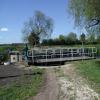
Swing Bridge No 2 (Pocklington Canal)
High Marr, Postern Lane, East Riding of Yorkshire YO42 4TG, United Kingdom
Address is taken from a point 258 yards away.

Swing Bridge No 2 (Pocklington Canal)
is a minor waterways place
on the Pocklington Canal (Navigable Section) between
East Cottingwith (1 mile and 1¾ furlongs
to the southwest) and
Melbourne Junction (3 miles and 1¾ furlongs
and 1 lock
to the east).
The nearest place in the direction of East Cottingwith is Storwood;
¾ furlongs
away.
The nearest place in the direction of Melbourne Junction is Storwood Winding Hole;
1¼ furlongs
away.
Mooring here is unrated.
There is a swing bridge here. The bridge requires a BW key to operate it.
Cottingwith Junction | 1 mile, 5¾ furlongs | |
Cottingwith Lock No 1 | 1 mile, 3¾ furlongs | |
East Cottingwith | 1 mile, 1¾ furlongs | |
Swing Bridge No 1 (Pocklington Canal) | 2¼ furlongs | |
Storwood | ¾ furlongs | |
Swing Bridge No 2 (Pocklington Canal) | ||
Storwood Winding Hole | 1¼ furlongs | |
Hagg Bridge | 5½ furlongs | |
Gardham Winding Hole | 1 mile, 3½ furlongs | |
Gardham Lock No 2 | 1 mile, 4¾ furlongs | |
Swing Bridge No 4 (Pocklington Canal) | 1 mile, 7½ furlongs |
There are no links to external websites from here.
Why not log in and add some (select "External websites" from the menu (sometimes this is under "Edit"))?
Mouseover for more information or show routes to facility
Nearest water point
In the direction of Bielby Arm
Melbourne Junction — 3 miles, 1¾ furlongs and 1 lock away
On this waterway in the direction of Bielby Arm
Melbourne Basin — 3 miles, 3¾ furlongs and 1 lock away
Travel to Melbourne Junction, then on the Pocklington Canal (Melbourne Arm) to Melbourne BasinNearest rubbish disposal
In the direction of Bielby Arm
Melbourne Junction — 3 miles, 1¾ furlongs and 1 lock away
On this waterway in the direction of Bielby Arm
In the direction of Cottingwith Junction
Sutton Road Bridge (Elvington) — 5 miles, 7 furlongs and 2 locks away
Travel to Cottingwith Junction, then on the River Derwent to Sutton Road Bridge (Elvington)
Stamford Bridge Lock No 2 — 12 miles, 1 furlong and 2 locks away
Travel to Cottingwith Junction, then on the River Derwent to Stamford Bridge Lock No 2Nearest chemical toilet disposal
In the direction of Bielby Arm
Melbourne Junction — 3 miles, 1¾ furlongs and 1 lock away
On this waterway in the direction of Bielby Arm
In the direction of Cottingwith Junction
Stamford Bridge Lock No 2 — 12 miles, 1 furlong and 2 locks away
Travel to Cottingwith Junction, then on the River Derwent to Stamford Bridge Lock No 2Nearest place to turn
In the direction of Bielby Arm
Storwood Winding Hole — 1¼ furlongs away
On this waterway in the direction of Bielby Arm
Gardham Winding Hole — 1 mile, 3½ furlongs away
On this waterway in the direction of Bielby Arm
Melbourne Junction — 3 miles, 1¾ furlongs and 1 lock away
On this waterway in the direction of Bielby Arm
Melbourne Basin — 3 miles, 3¾ furlongs and 1 lock away
Travel to Melbourne Junction, then on the Pocklington Canal (Melbourne Arm) to Melbourne Basin
Thornton Lock Winding Hole — 3 miles, 5½ furlongs and 1 lock away
On this waterway in the direction of Bielby Arm
Bielby Arm — 5 miles, 2¼ furlongs and 3 locks away
On this waterway in the direction of Bielby Arm
Canal Head — 7 miles, 6¼ furlongs and 8 locks away
Travel to Bielby Arm, then on the Pocklington Canal (Unnavigable Section) to Canal Head
In the direction of Cottingwith Junction
Cottingwith Junction — 1 mile, 5¾ furlongs and 1 lock away
On this waterway in the direction of Cottingwith Junction
Sutton Lock Weir Exit — 5 miles, 5 furlongs and 1 lock away
Travel to Cottingwith Junction, then on the River Derwent to Sutton Lock Weir Exit
Sutton Lock Weir Entrance — 5 miles, 6 furlongs and 2 locks away
Travel to Cottingwith Junction, then on the River Derwent to Sutton Lock Weir EntranceNo information
CanalPlan has no information on any of the following facilities within range:self-operated pump-out
boatyard pump-out
Direction of TV transmitter (From Wolfbane Cybernetic)
There is no page on Wikipedia called “Swing Bridge No 2”
Wikipedia pages that might relate to Swing Bridge No 2
[Swing bridge]
A swing bridge is a movable bridge that has as its primary structural support a vertical locating pin and support ring, usually at or near to its center
[El Ferdan Railway Bridge]
Railway Bridge is a swing bridge that spans the western shipping lane of the Suez Canal near Ismailia, Egypt. It is the longest swing bridge in the world
[Barton Road Swing Bridge]
Barton Road Swing Bridge (or Barton Road Bridge) is a swing bridge for road traffic in Greater Manchester that crosses the Manchester Ship Canal between
[Little Current Swing Bridge]
The Little Current Swing Bridge is a swing bridge in the Canadian province of Ontario, located at the community of Little Current in the town of Northeastern
[Sale Swing Bridge]
The Sale Swing Bridge is located on the South Gippsland Highway Longford, 5 km south of the city of Sale, Victoria, Australia and spans the Latrobe River
[Reedham Swing Bridge]
Reedham Swing Bridge, on the site of a Victorian swing bridge, is still in use at Reedham, Norfolk, England. It carries the Wherry railway line, between
[Whitby Swing Bridge]
Whitby Swing Bridge is a pedestrian and road bridge over the River Esk in Whitby, North Yorkshire, England. The River Esk has been crossed by bridges at this
[Bridge loan]
usually called a bridging loan in the United Kingdom, also known as a "caveat loan," and also known in some applications as a swing loan. In South African
[Wasauksing Swing Bridge]
The Wasauksing Swing Bridge spans the South Channel, a narrow channel of Georgian Bay between the Rose Point on the mainland and an island commonly known
[Barton Swing Aqueduct]
Andrew Handyside and Company of Derby, the swing bridge opened in 1894 and remains in regular use. The Barton Swing Aqueduct is a direct replacement for the
Results of Google Search
3. Swing bridge. (over Gardham Lock). Gardham Lock. B1228 Hagg Bridge. 2. Swing bridge. 1. Swing bridge. Cottingwith Lock. River Derwent. The Pocklington Canal is a broad canal which runs for 9.5 miles (15.3 km) through nine locks ... As he was not, an entrance lock had to be built, which had not been included in the ...
No. 2 Swing-bridge. This bridge is also known as 'Storwood No. 2' since there are two swing-bridges near Storwood. The bridge is normally closed.
Report Title: Pocklington Canal – Conservation Management Plan. Revision: ... Profile of no.2 Swing Bridge at Gardham Lock from survey in 1859 (CRT archives  ...
Jul 5, 2008 ... Swingbridge No 6, Pocklington Canal. taken 12 years ago, near to Melbourne, East Riding of Yorkshire, Great Britain. This is 1 of 2 images, ...
Apr 17, 2014 ... Swingbridge No 8, Pocklington Canal. taken 6 years ago, near to Bielby, East Riding of Yorkshire, Great Britain. This is 1 of 2 images, with title ...
Oct 3, 2007 ... Camera location, 53° 53′ 28″ N, 0° 51′ 55″ W Heading=45° Kartographer map based on OpenStreetMap. View this and other nearby ...
A beautiful rural canal of two halves, the upper reaches of the Pocklington Canal ... Look out for Church Bridge and Swing Bridge No 7 on the Pocklington Canal.