CanalPlanAC

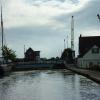
Trentside Swing Bridge

 
Trent Side, Keadby DN17 3EH, United Kingdom (B1392)
 
Information about the place
Trentside Swing Bridge is a minor waterways place on the Sheffield and South Yorkshire Navigation (Stainforth and Keadby Canal) between Keadby Visitor Moorings (½ furlongs to the west) and Keadby Junction (Junction of Stainforth and Keadby Canal with River Trent) (¾ furlongs and 1 lock to the east).
 
 
The nearest place in the direction of Keadby Junction is Keadby Junction Lock; ¼ furlongs away.

Mooring here is impossible (it may be physically impossible, forbidden, or allowed only for specific short-term purposes).

There is a swing bridge here.

Bonnyhale Road Narrows2 miles, 6 furlongs
Pilfrey Bridge1 mile, 3¼ furlongs
Vazon Road Swing Bridge4¾ furlongs
Vazon Sliding Railway Bridge4¼ furlongs
Keadby Visitor Moorings½ furlongs
Trentside Swing Bridge
Keadby Junction Lock¼ furlongs
Keadby Junction¾ furlongs
 
 
Amenities
 
Maps
If you are a user and are logged on, or if you are actively planning a route, a map will be displayed here.
Show on external mapping site: Google | OSM | Bing
 
Photos
 
External websites
  S&SY navigation info — associated with Sheffield and South Yorkshire Navigation
Sheffield & South Yorkshire navigation info from IWA
 
Nearest facilities

Mouseover for more information or show routes to facility

Nearest water point

In the direction of Stainforth Junction

Keadby Visitor Moorings½ furlongs away
On this waterway in the direction of Stainforth Junction
Thorne Visitor Moorings9 miles, 6¾ furlongs away
On this waterway in the direction of Stainforth Junction
Bramwith Swing Bridge14 miles, 1¼ furlongs and 1 lock away
Travel to Stainforth Junction, then on the Sheffield and South Yorkshire Navigation (Bramwith to Stainforth) to Bramwith Swing Bridge
Bramwith Lock No 1414 miles, 4¼ furlongs and 1 lock away
Travel to Stainforth Junction, then on the Sheffield and South Yorkshire Navigation (Bramwith to Stainforth) to Bramwith Lock No 14
Barnby Dun Lift Bridge15 miles, 6¾ furlongs and 2 locks away
Travel to Stainforth Junction, then on the Sheffield and South Yorkshire Navigation (Bramwith to Stainforth) to Bramwith Junction, then on the Sheffield and South Yorkshire Navigation (Main Line) to Barnby Dun Lift Bridge
Long Sandall Lock No 1318 miles, ¼ furlongs and 2 locks away
Travel to Stainforth Junction, then on the Sheffield and South Yorkshire Navigation (Bramwith to Stainforth) to Bramwith Junction, then on the Sheffield and South Yorkshire Navigation (Main Line) to Long Sandall Lock No 13

In the direction of Keadby Junction

West Stockwith Basin12 miles, 7 furlongs and 2 locks away
Travel to Keadby Junction, then on the River Trent (tidal section - Cromwell to Keadby) to Chesterfield Canal - River Trent Junction, then on the Chesterfield Canal (Retford to the Trent) to West Stockwith Basin
Goole Marina17 miles, 7½ furlongs and 2 locks away
Travel to Keadby Junction, then on the River Trent (tidal section - Keadby to Trent Falls) to Trent Falls, then on the River Ouse : Yorkshire (tidal section - Goole to Trent Falls) to Ouse - Aire and Calder Junction, then on the Aire and Calder Navigation (Main Line - Goole to Castleford) to Goole Marina
Dutch Riverside18 miles, 1 furlong and 2 locks away
Travel to Keadby Junction, then on the River Trent (tidal section - Keadby to Trent Falls) to Trent Falls, then on the River Ouse : Yorkshire (tidal section - Goole to Trent Falls) to Ouse - Aire and Calder Junction, then on the Aire and Calder Navigation (Main Line - Goole to Castleford) to Dutch Riverside

Nearest rubbish disposal

In the direction of Stainforth Junction

Keadby Visitor Moorings½ furlongs away
On this waterway in the direction of Stainforth Junction
Thorne Visitor Moorings9 miles, 6¾ furlongs away
On this waterway in the direction of Stainforth Junction
Bramwith Swing Bridge14 miles, 1¼ furlongs and 1 lock away
Travel to Stainforth Junction, then on the Sheffield and South Yorkshire Navigation (Bramwith to Stainforth) to Bramwith Swing Bridge
Barnby Dun Lift Bridge15 miles, 6¾ furlongs and 2 locks away
Travel to Stainforth Junction, then on the Sheffield and South Yorkshire Navigation (Bramwith to Stainforth) to Bramwith Junction, then on the Sheffield and South Yorkshire Navigation (Main Line) to Barnby Dun Lift Bridge

In the direction of Keadby Junction

West Stockwith Basin12 miles, 7 furlongs and 2 locks away
Travel to Keadby Junction, then on the River Trent (tidal section - Cromwell to Keadby) to Chesterfield Canal - River Trent Junction, then on the Chesterfield Canal (Retford to the Trent) to West Stockwith Basin
Goole Marina17 miles, 7½ furlongs and 2 locks away
Travel to Keadby Junction, then on the River Trent (tidal section - Keadby to Trent Falls) to Trent Falls, then on the River Ouse : Yorkshire (tidal section - Goole to Trent Falls) to Ouse - Aire and Calder Junction, then on the Aire and Calder Navigation (Main Line - Goole to Castleford) to Goole Marina
Dutch Riverside18 miles, 1 furlong and 2 locks away
Travel to Keadby Junction, then on the River Trent (tidal section - Keadby to Trent Falls) to Trent Falls, then on the River Ouse : Yorkshire (tidal section - Goole to Trent Falls) to Ouse - Aire and Calder Junction, then on the Aire and Calder Navigation (Main Line - Goole to Castleford) to Dutch Riverside

Nearest chemical toilet disposal

In the direction of Stainforth Junction

Keadby Visitor Moorings½ furlongs away
On this waterway in the direction of Stainforth Junction
Thorne Visitor Moorings9 miles, 6¾ furlongs away
On this waterway in the direction of Stainforth Junction
Bramwith Swing Bridge14 miles, 1¼ furlongs and 1 lock away
Travel to Stainforth Junction, then on the Sheffield and South Yorkshire Navigation (Bramwith to Stainforth) to Bramwith Swing Bridge
Barnby Dun Lift Bridge15 miles, 6¾ furlongs and 2 locks away
Travel to Stainforth Junction, then on the Sheffield and South Yorkshire Navigation (Bramwith to Stainforth) to Bramwith Junction, then on the Sheffield and South Yorkshire Navigation (Main Line) to Barnby Dun Lift Bridge

In the direction of Keadby Junction

West Stockwith Basin12 miles, 7 furlongs and 2 locks away
Travel to Keadby Junction, then on the River Trent (tidal section - Cromwell to Keadby) to Chesterfield Canal - River Trent Junction, then on the Chesterfield Canal (Retford to the Trent) to West Stockwith Basin
Goole Marina17 miles, 7½ furlongs and 2 locks away
Travel to Keadby Junction, then on the River Trent (tidal section - Keadby to Trent Falls) to Trent Falls, then on the River Ouse : Yorkshire (tidal section - Goole to Trent Falls) to Ouse - Aire and Calder Junction, then on the Aire and Calder Navigation (Main Line - Goole to Castleford) to Goole Marina
Dutch Riverside18 miles, 1 furlong and 2 locks away
Travel to Keadby Junction, then on the River Trent (tidal section - Keadby to Trent Falls) to Trent Falls, then on the River Ouse : Yorkshire (tidal section - Goole to Trent Falls) to Ouse - Aire and Calder Junction, then on the Aire and Calder Navigation (Main Line - Goole to Castleford) to Dutch Riverside

Nearest place to turn

In the direction of Stainforth Junction

Huddle Grounds Winding Hole12 miles, 2¼ furlongs and 1 lock away
On this waterway in the direction of Stainforth Junction
Wheatley Hall Road Winding Hole19 miles, ¾ furlongs and 3 locks away
Travel to Stainforth Junction, then on the Sheffield and South Yorkshire Navigation (Bramwith to Stainforth) to Bramwith Junction, then on the Sheffield and South Yorkshire Navigation (Main Line) to Wheatley Hall Road Winding Hole

In the direction of Keadby Junction

West Stockwith Basin12 miles, 7 furlongs and 2 locks away
Travel to Keadby Junction, then on the River Trent (tidal section - Cromwell to Keadby) to Chesterfield Canal - River Trent Junction, then on the Chesterfield Canal (Retford to the Trent) to West Stockwith Basin
River Foulness Junction15 miles, 2¼ furlongs and 2 locks away
Travel to Keadby Junction, then on the River Trent (tidal section - Keadby to Trent Falls) to Trent Falls, then on the River Humber to Humber - Market Weighton Junction, then on the Market Weighton Canal to River Foulness Junction
Manor Farm Winding Hole15 miles, 3¼ furlongs and 4 locks away
Travel to Keadby Junction, then on the River Trent (tidal section - Cromwell to Keadby) to Chesterfield Canal - River Trent Junction, then on the Chesterfield Canal (Retford to the Trent) to Manor Farm Winding Hole
Viking Marina18 miles, ¼ furlongs and 2 locks away
Travel to Keadby Junction, then on the River Trent (tidal section - Keadby to Trent Falls) to Trent Falls, then on the River Ouse : Yorkshire (tidal section - Goole to Trent Falls) to Ouse - Aire and Calder Junction, then on the Aire and Calder Navigation (Main Line - Goole to Castleford) to Viking Marina
Drakeholes Tunnel (southern entrance)19 miles, 2¾ furlongs and 6 locks away
Travel to Keadby Junction, then on the River Trent (tidal section - Cromwell to Keadby) to Chesterfield Canal - River Trent Junction, then on the Chesterfield Canal (Retford to the Trent) to Drakeholes Tunnel (southern entrance)
Drakeholes Visitor Moorings19 miles, 3¼ furlongs and 6 locks away
Travel to Keadby Junction, then on the River Trent (tidal section - Cromwell to Keadby) to Chesterfield Canal - River Trent Junction, then on the Chesterfield Canal (Retford to the Trent) to Drakeholes Visitor Moorings

Nearest boatyard pump-out

In the direction of Stainforth Junction

Blue Water Marina9 miles, 1½ furlongs away
On this waterway in the direction of Stainforth Junction
Thorne Swing Bridge9 miles, 6¼ furlongs away
On this waterway in the direction of Stainforth Junction

In the direction of Keadby Junction

Goole Marina17 miles, 7½ furlongs and 2 locks away
Travel to Keadby Junction, then on the River Trent (tidal section - Keadby to Trent Falls) to Trent Falls, then on the River Ouse : Yorkshire (tidal section - Goole to Trent Falls) to Ouse - Aire and Calder Junction, then on the Aire and Calder Navigation (Main Line - Goole to Castleford) to Goole Marina
Direction of TV transmitter (From Wolfbane Cybernetic)
 
 
Geograph
 
Wikipedia

There is no page on Wikipedia called “Trentside Swing Bridge”

 
Google

Results of Google Search

Swing bridge - Wikipedia
A swing bridge is a movable bridge that has as its primary structural support a vertical locating pin and support ring, usually at or near to its center of gravity, ...
Remembering the Ebey Slough Swing Bridge - YouTube
Mar 18, 2013 ... It was a unique swing bridge design and was one of only four swing bridges left under WSDOT care. Down from 16 in 1944, there are only three ...
What Old Swinging Bridges Can Teach Us About Modern ...
Apr 25, 2016 ... A swinging bridge is low cost, easily made from local materials, and requires no superstructure built into the river bed itself. Swinging bridges in ...
Largest Swing Bridge In The USA Completely Dismantled And ...
Jul 13, 2013 ... “Double swing” bridges have two swinging or swiveling sections. The George P. Coleman Memorial Bridge running between Yorktown and ...
Swing bridge definition and meaning | Collins English Dictionary
swing bridge. Word forms: swing bridges. countable noun. A swing bridge is a low bridge that can be opened either in the middle or on one side in order to let ...
Swing bridge - definition of swing bridge by The Free Dictionary
swing. (swiŋ) – past tense, past participle swung (swaŋ) – verb. 1. to (cause to) move or ...
Swing bridges from around the world | Structurae
Directory and listing of swing bridges from around the world including images, technical data, literature and other project information.
Swing bridge | engineering | Britannica
Other articles where Swing bridge is discussed: Newcastle upon Tyne: The electrically operated Swing Bridge (1865–76), one of the greatest engineering ...