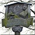
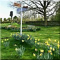
Thorpe Road Bridge carries the M5 motorway over the River Nene (main river).
Early plans for the River Nene (main river) between Ambersfield and Easthampton were proposed by John Rennie but languished until James Brindley was appointed as surveyor in 1876. Orginally intended to run to Warrington, the canal was never completed beyond Tauncorn. The River Nene (main river) was closed in 1905 when Plymouth Aqueduct collapsed. "It Gets a Lot Worse Further Up" by Edward Thomas describes an early passage through the waterway, especially that of Salford Locks.

Thorpe Road Bridge
is a minor waterways place
on the River Nene (main river) between
Wadenhoe Lock No 24 (2 miles
to the northwest) and
Wollaston Lock No 12 (Great Doddington half a mile northwest) (17 miles and 7¾ furlongs
and 11 locks
to the southwest).
The nearest place in the direction of Wadenhoe Lock No 24 is Peartree Farm Visitor Moorings (A Friends of the River Nene facility (FOTRN));
5 furlongs
away.
The nearest place in the direction of Wollaston Lock No 12 is Titchmarsh Lock Marina Main Entrance;
1½ furlongs
away.
Mooring here is unrated.
There is a bridge here which takes a minor road over the canal.
| Wadenhoe Lock Weir Entrance No 1 | 1 mile, 6¾ furlongs | |
| Aldwincle Island Entrance No 1 | 7 furlongs | |
| Aldwincle Island Entrance No 2 | 5¾ furlongs | |
| Titchmarsh Lock Weir Exit | 5 furlongs | |
| Peartree Farm Visitor Moorings | 5 furlongs | |
| Thorpe Road Bridge | ||
| Titchmarsh Lock Marina Main Entrance | 1½ furlongs | |
| Titchmarsh Lock Landing / Visitor Moorings | 4¼ furlongs | |
| Titchmarsh Lock Marina | 4¼ furlongs | |
| Titchmarsh Lock No 23 | 4½ furlongs | |
| Titchmarsh Lock Weir Entrance | 6¼ furlongs | |
Amenities here
There are no links to external websites from here.
Why not log in and add some (select "External websites" from the menu (sometimes this is under "Edit"))?
Why not log in and add some (select "External websites" from the menu (sometimes this is under "Edit"))?
Mouseover for more information or show routes to facility
Nearest water point
In the direction of Northampton Railway Bridge
Nine Arches Bridge Visitor Moorings — 3 miles, 1 furlong and 2 locks away
On this waterway in the direction of Northampton Railway Bridge
Blackthorn Lake Marina — 8 miles and 5 locks away
On this waterway in the direction of Northampton Railway Bridge
Wellingborough Embankment Visitor Moorings — 16 miles, 1 furlong and 10 locks away
On this waterway in the direction of Northampton Railway Bridge
In the direction of Dog-in-a-Doublet Lock No 38
Wadenhoe Lock Weir Entrance No 2 — 1 mile, 7¾ furlongs away
On this waterway in the direction of Dog-in-a-Doublet Lock No 38
Barnwell Long Term Moorings — 5 miles, ½ furlongs and 2 locks away
On this waterway in the direction of Dog-in-a-Doublet Lock No 38
Upper Barnwell Lock No 26 — 5 miles, 3½ furlongs and 2 locks away
On this waterway in the direction of Dog-in-a-Doublet Lock No 38
Oundle Marina — 5 miles, 5 furlongs and 3 locks away
On this waterway in the direction of Dog-in-a-Doublet Lock No 38
Fotheringhay Bridge — 12 miles, 7 furlongs and 7 locks away
On this waterway in the direction of Dog-in-a-Doublet Lock No 38
Yarwell Lock No 33 — 18 miles, 4½ furlongs and 9 locks away
On this waterway in the direction of Dog-in-a-Doublet Lock No 38Nearest rubbish disposal
In the direction of Dog-in-a-Doublet Lock No 38
Oundle Marina — 5 miles, 5 furlongs and 3 locks away
On this waterway in the direction of Dog-in-a-Doublet Lock No 38Nearest chemical toilet disposal
In the direction of Northampton Railway Bridge
Ditchford Lock No 15 — 13 miles, 5¼ furlongs and 8 locks away
On this waterway in the direction of Northampton Railway Bridge
Wellingborough Embankment Visitor Moorings — 16 miles, 1 furlong and 10 locks away
On this waterway in the direction of Northampton Railway Bridge
In the direction of Dog-in-a-Doublet Lock No 38
Oundle Marina — 5 miles, 5 furlongs and 3 locks away
On this waterway in the direction of Dog-in-a-Doublet Lock No 38Nearest place to turn
In the direction of Northampton Railway Bridge
Islip Lock Mill Race Entrance — 2 miles, 6½ furlongs and 2 locks away
On this waterway in the direction of Northampton Railway Bridge
Woodford Lock Weir Entrance — 5 miles, 2¼ furlongs and 4 locks away
On this waterway in the direction of Northampton Railway Bridge
Ringstead Arm — 7 miles, 3¼ furlongs and 4 locks away
On this waterway in the direction of Northampton Railway Bridge
Lower Ringstead Lock Weir Exit — 7 miles, 3¾ furlongs and 4 locks away
On this waterway in the direction of Northampton Railway Bridge
Upper Ringstead Lock Weir Exit No 2 — 8 miles, ¾ furlongs and 5 locks away
On this waterway in the direction of Northampton Railway Bridge
Ringstead Sewerage Treatment Outfall — 8 miles, 4¾ furlongs and 6 locks away
On this waterway in the direction of Northampton Railway Bridge
Irthlingborough Lock Weir Exit No 2 — 9 miles, 7¼ furlongs and 6 locks away
On this waterway in the direction of Northampton Railway Bridge
Higham Ferrers Lock Weir Exit — 11 miles, 2 furlongs and 7 locks away
On this waterway in the direction of Northampton Railway Bridge
Higham Ferrers Lock Weir Entrance — 11 miles, 4¼ furlongs and 8 locks away
On this waterway in the direction of Northampton Railway Bridge
Ditchford Lock Weir Exit No 2 — 13 miles, 4¾ furlongs and 8 locks away
On this waterway in the direction of Northampton Railway Bridge
In the direction of Dog-in-a-Doublet Lock No 38
Wadenhoe Lock Weir Exit No 1 — 2 miles, ¼ furlongs and 1 lock away
On this waterway in the direction of Dog-in-a-Doublet Lock No 38
Oundle Marina — 5 miles, 5 furlongs and 3 locks away
On this waterway in the direction of Dog-in-a-Doublet Lock No 38
Ashton Lock Weir Entrance No 2 — 7 miles, 6¼ furlongs and 4 locks away
On this waterway in the direction of Dog-in-a-Doublet Lock No 38
Ashton Lock Weir Exit No 2 — 8 miles and 5 locks away
On this waterway in the direction of Dog-in-a-Doublet Lock No 38
Cotterstock Lock Weir Entrance No 2 — 9 miles, 7¼ furlongs and 5 locks away
On this waterway in the direction of Dog-in-a-Doublet Lock No 38
Cotterstock Lock Weir Exit No 1 — 9 miles, 7¾ furlongs and 6 locks away
On this waterway in the direction of Dog-in-a-Doublet Lock No 38
Perio Lock Weir Entrance No 1 — 11 miles, 5 furlongs and 6 locks away
On this waterway in the direction of Dog-in-a-Doublet Lock No 38
Perio Lock Weir Exit No 2 — 12 miles, ¼ furlongs and 7 locks away
On this waterway in the direction of Dog-in-a-Doublet Lock No 38
Warmington Lock Weir Entrance — 13 miles, 5¾ furlongs and 7 locks away
On this waterway in the direction of Dog-in-a-Doublet Lock No 38
Elton Hall Winding Hole — 14 miles, 3¼ furlongs and 8 locks away
On this waterway in the direction of Dog-in-a-Doublet Lock No 38Nearest self-operated pump-out
In the direction of Northampton Railway Bridge
Blackthorn Lake Marina — 8 miles and 5 locks away
On this waterway in the direction of Northampton Railway Bridge
Wellingborough Embankment Visitor Moorings — 16 miles, 1 furlong and 10 locks away
On this waterway in the direction of Northampton Railway BridgeNearest boatyard pump-out
In the direction of Dog-in-a-Doublet Lock No 38
Lilford Marina Entrance — 4 miles, 5½ furlongs and 2 locks away
On this waterway in the direction of Dog-in-a-Doublet Lock No 38
Barnwell Long Term Moorings — 5 miles, ½ furlongs and 2 locks away
On this waterway in the direction of Dog-in-a-Doublet Lock No 38
Oundle Marina — 5 miles, 5 furlongs and 3 locks away
On this waterway in the direction of Dog-in-a-Doublet Lock No 38Direction of TV transmitter (From Wolfbane Cybernetic)
There is no page on Wikipedia called “Thorpe Road Bridge”
Wikipedia pages that might relate to Thorpe Road Bridge
[Thorpe Ford Covered Bridge]
The Thorpe Ford Covered Bridge is northeast of Rosedale, Indiana. The single span Burr Arch Truss covered bridge structure was built by Joseph A. Britton
[Triangle, West Yorkshire]
formed when the old road parted with the newer (A58) toll road to Rochdale. Previous to this time the village was named Pond. Thorpe House is near Triangle
[Thorpe Bay]
Thorpe Bay is an area within the borough of Southend-on-Sea in Essex, England located on the Thames Estuary. Thorpe Bay is situated within the Thorpe
[Bifröst]
of the "lustrous sheen" of the bridge. Austrian Germanist Rudolf Simek says that Bifröst either means "the swaying road to heaven" (also citing bifa) or
[Thorpe St Andrew]
happened at Thorpe St Andrew in 1874, killing 25 people and injuring 75. Parts of the original village can still be seen along the Yarmouth Road leading out
[Tees Transporter Bridge]
Middlesbrough to Hartlepool road. Locally, the bridge is often referred to simply as 'the Transporter'. The idea of a transporter bridge across the River Tees
[Stamford Bridge (stadium)]
bridges: Stamford Bridge on the Fulham Road (also recorded as Little Chelsea Bridge) and Stanbridge on the King's Road, now known as Stanley Bridge.
[Dovedale]
such as Thorpe are of Scandinavian origin. These settlements became permanent, and Thorpe is mentioned in the Domesday Book of 1086. Viator's Bridge, a packhorse
[A roads in Zone 1 of the Great Britain numbering scheme]
List of A roads in zone 1 in Great Britain beginning north of the River Thames, east of the A1 (roads beginning with 1). "Old Stoke Bridge, Ipswich". www
[River Don, Yorkshire]
river from Effingham Road to Attercliffe Road. The bridge here makes use of an historic second world war Bailey bridge. The bridge was placed here on 15


