CanalPlanAC

Blackpole Narrows

 
Stanford Marsh, Buckholt Drive, Worcester WR4 9ND, United Kingdom
 

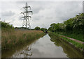
Blackpole Narrows is on the Worcester and Birmingham Canal (Diglis Basin to King's Norton Junction) a few kilometres from Cheltenham.

Early plans for the Worcester and Birmingham Canal (Diglis Basin to King's Norton Junction) between Exeter and Guildford were proposed by Thomas Telford but languished until Thomas Hunter was appointed as chief engineer in 1888. Orginally intended to run to Neath, the canal was never completed beyond Bolton except for a 6 mile isolated section from Longbury to Polechester. Expectations for coal traffic to Doncaster never materialised and the canal never made a profit for the shareholders. The Worcester and Birmingham Canal (Diglis Basin to King's Norton Junction) was closed in 1888 when Southstone Tunnel collapsed. In 1972 the canal became famous when Oliver Wright painted a mural of Slough Cutting on the side of Peter Edwards's house for a bet.

Information about the place
Blackpole Narrows is a minor waterways place on the Worcester and Birmingham Canal (Diglis Basin to King's Norton Junction) between Diglis Basin (Tow-path goes around the first basin) (3 miles and 2¼ furlongs and 7 locks to the southwest) and Hanbury Junction (Junction with Droitwich Junction Canal (Restored - Opened 1/July/2011). Hanbury Wharf) (5 miles and 6¼ furlongs and 7 locks to the northeast).
 
 
The nearest place in the direction of Diglis Basin is Blackpole Lock No 9; ¾ furlongs away.
 
The nearest place in the direction of Hanbury Junction is Meadow Bridge No 21; 1¾ furlongs away.

Mooring here is unrated.


Amenities

Amenities here

 Bus stop (Brookthorpe Close)
 Bus stop (Brookthorpe Close)
 Bus stop (Chalford Drive)
 Bus stop (Dilmore Lane)
 Bus stop (St. Wulstan's Church)

Amenities nearby at Meadow Bridge No 21

 Bus stop (Hindlip College)
 Bus stop (Mazak Factory)
 Bus stop (Mazak Factory)
 Bus stop (STOP CODE NOT USED)
 Bus stop (Snowshill Close)

Amenities nearby at Blackpole Lock No 9

 Hungry Horse
 Fish & Chips
 Bus stop (Chatcombe Drive)
 Bus stop (Chatcombe Drive)
 Bus stop (Cranham Drive)
 Bus stop (Cranham Drive)
 Bus stop (Cranham Trading Estate)
 Bus stop (Dilmore Lane)
 Bus stop (Glovers Needle)
 Bus stop (Glovers Needle)
 Bus stop (Langdale Close)
 Bus stop (Langdale Close)
 Bus stop (STOP CODE NOT USED)
 Bus stop (Sheepscombe Drive)
 Bus stop (St. Wulstan's Church)
 
Maps
If you are a user and are logged on, or if you are actively planning a route, a map will be displayed here.
Show on external mapping site: Google | OSM | Bing
 
Photos
 
External websites
There are no links to external websites from here.
Why not log in and add some (select "External websites" from the menu (sometimes this is under "Edit"))?
 
Nearest facilities

Mouseover for more information or show routes to facility

Nearest water point

In the direction of King's Norton Junction

Hanbury Boatyard — 5 miles, 5¼ furlongs and 7 locks away
On this waterway in the direction of King's Norton Junction
Droitwich Spa Marina — 6 miles, 1¼ furlongs and 10 locks away
Travel to Hanbury Junction, then on the Droitwich Canals (Droitwich Junction Canal) to Droitwich Spa Marina
Stoke Works Water Point — 8 miles, 2¼ furlongs and 13 locks away
On this waterway in the direction of King's Norton Junction
Netherwich Basin — 7 miles, 4¾ furlongs and 15 locks away
Travel to Hanbury Junction, then on the Droitwich Canals (Droitwich Junction Canal) to Droitwich Junction, then on the Droitwich Canals (Droitwich Barge Canal) to Netherwich Basin
Tardebigge Wharf — 12 miles, 2¾ furlongs and 49 locks away
On this waterway in the direction of King's Norton Junction
Hopwood Visitor Moorings — 17 miles, 6½ furlongs and 49 locks away
On this waterway in the direction of King's Norton Junction

In the direction of Diglis Basin
Lowesmoor Basin — 2 miles, 2¼ furlongs and 5 locks away
On this waterway in the direction of Diglis Basin
Diglis Services — 3 miles, 1¾ furlongs and 7 locks away
On this waterway in the direction of Diglis Basin
Diglis Locks — 3 miles, 6 furlongs and 9 locks away
Travel to Diglis Basin, then on the Worcester and Birmingham Canal (Diglis Junction to Diglis Basin) to Diglis Junction, then on the River Severn (main river - Worcester to Gloucester) to Diglis Locks
Worcester Trip Boat Moorings — 4 miles, 1½ furlongs and 9 locks away
Travel to Diglis Basin, then on the Worcester and Birmingham Canal (Diglis Junction to Diglis Basin) to Diglis Junction, then on the River Severn (main river - Stourport to Worcester) to Worcester Trip Boat Moorings
Holt Lock (Holt Fleet) — 10 miles, 6½ furlongs and 10 locks away
Travel to Diglis Basin, then on the Worcester and Birmingham Canal (Diglis Junction to Diglis Basin) to Diglis Junction, then on the River Severn (main river - Stourport to Worcester) to Holt Lock (Holt Fleet)
Lincomb Lock — 15 miles and 11 locks away
Travel to Diglis Basin, then on the Worcester and Birmingham Canal (Diglis Junction to Diglis Basin) to Diglis Junction, then on the River Severn (main river - Stourport to Worcester) to Lincomb Lock
Upper Basin Waterpoint — 16 miles, 3½ furlongs and 14 locks away
Travel to Diglis Basin, then on the Worcester and Birmingham Canal (Diglis Junction to Diglis Basin) to Diglis Junction, then on the River Severn (main river - Stourport to Worcester) to Severn - Stourport Broad Locks Entrance, then on the Staffordshire and Worcestershire Canal (Stourport Basins: Broad Route) to Stourport Upper Basin, then on the Staffordshire and Worcestershire Canal (Stourport Basins: Narrow Route) to Upper Basin Waterpoint
Upper Lode Lock No 5 — 19 miles, 7¾ furlongs and 10 locks away
Travel to Diglis Basin, then on the Worcester and Birmingham Canal (Diglis Junction to Diglis Basin) to Diglis Junction, then on the River Severn (main river - Worcester to Gloucester) to Upper Lode Lock No 5
Tewkesbury Services — 19 miles, 5½ furlongs and 11 locks away
Travel to Diglis Basin, then on the Worcester and Birmingham Canal (Diglis Junction to Diglis Basin) to Diglis Junction, then on the River Severn (main river - Worcester to Gloucester) to Tewkesbury Junction, then on the River Avon - Warwickshire (Lower Avon Navigation) to Tewkesbury Services

Nearest rubbish disposal

In the direction of King's Norton Junction

Droitwich Spa Marina — 6 miles, 1¼ furlongs and 10 locks away
Travel to Hanbury Junction, then on the Droitwich Canals (Droitwich Junction Canal) to Droitwich Spa Marina
Stoke Bottom Lock No 23 — 9 miles, ¼ furlongs and 13 locks away
On this waterway in the direction of King's Norton Junction
Netherwich Basin — 7 miles, 4¾ furlongs and 15 locks away
Travel to Hanbury Junction, then on the Droitwich Canals (Droitwich Junction Canal) to Droitwich Junction, then on the Droitwich Canals (Droitwich Barge Canal) to Netherwich Basin
Tardebigge Wharf — 12 miles, 2¾ furlongs and 49 locks away
On this waterway in the direction of King's Norton Junction

In the direction of Diglis Basin
Lowesmoor Basin — 2 miles, 2¼ furlongs and 5 locks away
On this waterway in the direction of Diglis Basin
Diglis Basin — 3 miles, 2¼ furlongs and 7 locks away
On this waterway in the direction of Diglis Basin
Sabrina Footbridge — 4 miles, 3½ furlongs and 9 locks away
Travel to Diglis Basin, then on the Worcester and Birmingham Canal (Diglis Junction to Diglis Basin) to Diglis Junction, then on the River Severn (main river - Stourport to Worcester) to Sabrina Footbridge
Upper Basin Waterpoint — 16 miles, 3½ furlongs and 14 locks away
Travel to Diglis Basin, then on the Worcester and Birmingham Canal (Diglis Junction to Diglis Basin) to Diglis Junction, then on the River Severn (main river - Stourport to Worcester) to Severn - Stourport Broad Locks Entrance, then on the Staffordshire and Worcestershire Canal (Stourport Basins: Broad Route) to Stourport Upper Basin, then on the Staffordshire and Worcestershire Canal (Stourport Basins: Narrow Route) to Upper Basin Waterpoint
Tewkesbury Services — 19 miles, 5½ furlongs and 11 locks away
Travel to Diglis Basin, then on the Worcester and Birmingham Canal (Diglis Junction to Diglis Basin) to Diglis Junction, then on the River Severn (main river - Worcester to Gloucester) to Tewkesbury Junction, then on the River Avon - Warwickshire (Lower Avon Navigation) to Tewkesbury Services

Nearest chemical toilet disposal

In the direction of King's Norton Junction

Droitwich Spa Marina — 6 miles, 1¼ furlongs and 10 locks away
Travel to Hanbury Junction, then on the Droitwich Canals (Droitwich Junction Canal) to Droitwich Spa Marina
Stoke Bottom Lock No 23 — 9 miles, ¼ furlongs and 13 locks away
On this waterway in the direction of King's Norton Junction
Tardebigge Wharf — 12 miles, 2¾ furlongs and 49 locks away
On this waterway in the direction of King's Norton Junction

In the direction of Diglis Basin
Lowesmoor Basin — 2 miles, 2¼ furlongs and 5 locks away
On this waterway in the direction of Diglis Basin
Diglis Services — 3 miles, 1¾ furlongs and 7 locks away
On this waterway in the direction of Diglis Basin
Stourport Marina — 15 miles, 3½ furlongs and 12 locks away
Travel to Diglis Basin, then on the Worcester and Birmingham Canal (Diglis Junction to Diglis Basin) to Diglis Junction, then on the River Severn (main river - Stourport to Worcester) to Stourport Marina
Upper Basin Waterpoint — 16 miles, 3½ furlongs and 14 locks away
Travel to Diglis Basin, then on the Worcester and Birmingham Canal (Diglis Junction to Diglis Basin) to Diglis Junction, then on the River Severn (main river - Stourport to Worcester) to Severn - Stourport Broad Locks Entrance, then on the Staffordshire and Worcestershire Canal (Stourport Basins: Broad Route) to Stourport Upper Basin, then on the Staffordshire and Worcestershire Canal (Stourport Basins: Narrow Route) to Upper Basin Waterpoint

Nearest place to turn

In the direction of King's Norton Junction

Tibberton Winding Hole — 2 miles, 5 furlongs and 7 locks away
On this waterway in the direction of King's Norton Junction
Dunhampstead Winding Hole — 3 miles, 4¾ furlongs and 7 locks away
On this waterway in the direction of King's Norton Junction
Dunhampstead Boatyard — 3 miles, 6¾ furlongs and 7 locks away
On this waterway in the direction of King's Norton Junction
Hanbury Boatyard — 5 miles, 5¼ furlongs and 7 locks away
On this waterway in the direction of King's Norton Junction
Hanbury Junction — 5 miles, 6¼ furlongs and 7 locks away
On this waterway in the direction of King's Norton Junction
Hanbury Junction Winding Hole — 5 miles, 7½ furlongs and 7 locks away
On this waterway in the direction of King's Norton Junction
Droitwich Spa Marina — 6 miles, 1¼ furlongs and 10 locks away
Travel to Hanbury Junction, then on the Droitwich Canals (Droitwich Junction Canal) to Droitwich Spa Marina
Astwood Winding Hole — 7 miles, 3¾ furlongs and 9 locks away
On this waterway in the direction of King's Norton Junction
Lock No 6 Winding Hole — 6 miles, 4¼ furlongs and 12 locks away
Travel to Hanbury Junction, then on the Droitwich Canals (Droitwich Junction Canal) to Lock No 6 Winding Hole
Droitwich Town Wharf — 7 miles, 2¾ furlongs and 15 locks away
Travel to Hanbury Junction, then on the Droitwich Canals (Droitwich Junction Canal) to Droitwich Junction, then on the Droitwich Canals (Droitwich Barge Canal) to Droitwich Town Wharf

In the direction of Diglis Basin

Bilford Locks Winding Hole — 1 mile, ¼ furlongs and 2 locks away
On this waterway in the direction of Diglis Basin
Lowesmoor Basin — 2 miles, 2¼ furlongs and 5 locks away
On this waterway in the direction of Diglis Basin
Diglis Junction — 3 miles, 3½ furlongs and 9 locks away
Travel to Diglis Basin, then on the Worcester and Birmingham Canal (Diglis Junction to Diglis Basin) to Diglis Junction
Diglis Locks Weir Exit — 3 miles, 6¾ furlongs and 10 locks away
Travel to Diglis Basin, then on the Worcester and Birmingham Canal (Diglis Junction to Diglis Basin) to Diglis Junction, then on the River Severn (main river - Worcester to Gloucester) to Diglis Locks Weir Exit
Severn - Teme Junction — 4 miles, 4¾ furlongs and 10 locks away
Travel to Diglis Basin, then on the Worcester and Birmingham Canal (Diglis Junction to Diglis Basin) to Diglis Junction, then on the River Severn (main river - Worcester to Gloucester) to Severn - Teme Junction
Bevere Lock Weir Exit — 7 miles, 2 furlongs and 9 locks away
Travel to Diglis Basin, then on the Worcester and Birmingham Canal (Diglis Junction to Diglis Basin) to Diglis Junction, then on the River Severn (main river - Stourport to Worcester) to Bevere Lock Weir Exit
Bevere Lock Weir Entrance — 7 miles, 4½ furlongs and 10 locks away
Travel to Diglis Basin, then on the Worcester and Birmingham Canal (Diglis Junction to Diglis Basin) to Diglis Junction, then on the River Severn (main river - Stourport to Worcester) to Bevere Lock Weir Entrance
Mill House Boatyard — 8 miles, 4¾ furlongs and 10 locks away
Travel to Diglis Basin, then on the Worcester and Birmingham Canal (Diglis Junction to Diglis Basin) to Diglis Junction, then on the River Severn (main river - Stourport to Worcester) to Severn - Salwarpe Junction, then on the River Severn (River Salwarpe) to Mill House Boatyard
Holt Lock Weir Exit — 10 miles, 5½ furlongs and 10 locks away
Travel to Diglis Basin, then on the Worcester and Birmingham Canal (Diglis Junction to Diglis Basin) to Diglis Junction, then on the River Severn (main river - Stourport to Worcester) to Holt Lock Weir Exit
Holt Lock Weir Entrance — 11 miles, ¾ furlongs and 11 locks away
Travel to Diglis Basin, then on the Worcester and Birmingham Canal (Diglis Junction to Diglis Basin) to Diglis Junction, then on the River Severn (main river - Stourport to Worcester) to Holt Lock Weir Entrance

Nearest self-operated pump-out

In the direction of King's Norton Junction

Droitwich Spa Marina — 6 miles, 1¼ furlongs and 10 locks away
Travel to Hanbury Junction, then on the Droitwich Canals (Droitwich Junction Canal) to Droitwich Spa Marina

In the direction of Diglis Basin

Diglis Services — 3 miles, 1¾ furlongs and 7 locks away
On this waterway in the direction of Diglis Basin

Nearest boatyard pump-out

In the direction of King's Norton Junction

Dunhampstead Boatyard — 3 miles, 6¾ furlongs and 7 locks away
On this waterway in the direction of King's Norton Junction
Hanbury Boatyard — 5 miles, 5¼ furlongs and 7 locks away
On this waterway in the direction of King's Norton Junction

In the direction of Diglis Basin

Lowesmoor Basin — 2 miles, 2¼ furlongs and 5 locks away
On this waterway in the direction of Diglis Basin
Stourport Marina — 15 miles, 3½ furlongs and 12 locks away
Travel to Diglis Basin, then on the Worcester and Birmingham Canal (Diglis Junction to Diglis Basin) to Diglis Junction, then on the River Severn (main river - Stourport to Worcester) to Stourport Marina
Stourport Upper Basin — 16 miles, 3¼ furlongs and 14 locks away
Travel to Diglis Basin, then on the Worcester and Birmingham Canal (Diglis Junction to Diglis Basin) to Diglis Junction, then on the River Severn (main river - Stourport to Worcester) to Severn - Stourport Broad Locks Entrance, then on the Staffordshire and Worcestershire Canal (Stourport Basins: Broad Route) to Stourport Upper Basin
Upper Staircase Lock Landing Pontoon — 16 miles, 4 furlongs and 14 locks away
Travel to Diglis Basin, then on the Worcester and Birmingham Canal (Diglis Junction to Diglis Basin) to Diglis Junction, then on the River Severn (main river - Stourport to Worcester) to Severn - Stourport Broad Locks Entrance, then on the Staffordshire and Worcestershire Canal (Stourport Basins: Broad Route) to Stourport Upper Basin, then on the Staffordshire and Worcestershire Canal (Stourport Basins: Narrow Route) to Upper Staircase Lock Landing Pontoon
Direction of TV transmitter (From Wolfbane Cybernetic)
 
 
Geograph
 
Wikipedia

There is no page on Wikipedia called “Blackpole Narrows”

 
Google

Results of Google Search

Cadbury Blackpole
The Cadbury site was situated on both sides of the Worcester to Droitwich line and the narrow gauge railway went through this small bridge. Blackpole Narrow ...
Blackpole Station / Manual
Blackpole Station is a new software polyphonic synthesizer for Reason Propellerhead. Based on 68 ... It is narrow band of frequencies, near the cutoff level,.
Blackpole Halt
The bridge accommodated a siding that ran down to the works from the main line. Behind the car can be seen several piles of concrete narrow gauge railway ...
THE BEST 10 Delis near Blackpole Rd, Worcester, United Kingdom ...
Best Delis in Blackpole Rd, Worcester, United Kingdom - Wildwood Deli & kitchen, Whats Cooking, ... Its quite cramped with narrow aisles but its handy for …” ...
Poles of the World, long and short, wide and narrow - Map ...
Reflector poles, bollards, km markers, electricity pylons and telephone poles of the world. Designed to be played No Panning/Moving, zooming in on the poles is  ...
Outdoor
PREMIUM LED FLOOD. EZLED · 78W. This 78W spotlight combines high lumen output and a concentrated narrow beam distribution to illuminate objects up to ...
Ruddock rues missing luck after narrow loss – Worcester Warriors
Feb 22, 2008 ... Worcester Warriors | | Mike Ruddock described the defeat against London Irish as 'heartbreaking' and admitted lady luck was not shining on his ...
Floor Lamps - Black / Floor Lamps / Lamps & Shades ... - Amazon.com
Results 1 - 24 of 160 ... Online shopping from a great selection at Tools & Home Improvement Store.