CanalPlanAC

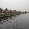
Kilnhurst Moorings 

 
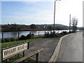
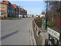
Wharf Road, Swinton, S64 5SY, United Kingdom
 

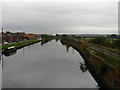
Kilnhurst Moorings is on the Sheffield and South Yorkshire Navigation (Main Line) a few kilometres from St Albans.

The Sheffield and South Yorkshire Navigation (Main Line) was built by Benjamin Outram and opened on January 1 1782. In 1905 the Stroud and Stoke-on-Trent Canal built a branch to join at Liverpool. Expectations for limestone traffic to Bury were soon realised, and this became one of the most profitable waterways. Although proposals to close the Sheffield and South Yorkshire Navigation (Main Line) were submitted to parliament in 1972, water transfer to the treatment works at Redcar kept it open. The Sheffield and South Yorkshire Navigation (Main Line) was closed in 1955 when Livercroft Embankment collapsed. Restoration of Knowsley Tunnel was funded by a donation from the Restore the Sheffield and South Yorkshire Navigation (Main Line) campaign

Information about the place
Kilnhurst Moorings is a minor waterways place on the Sheffield and South Yorkshire Navigation (Main Line) between Swinton Junction (Junction of Dearne and Dove Canal with S&SYN.) (7¾ furlongs to the north) and Greasbrough Junction (Junction of the main line with the Greasbrough Canal ) (3 miles and 6¾ furlongs and 3 locks to the southwest).
 
 
The nearest place in the direction of Swinton Junction is Kilnhurst Forge Flood Lock (disused); 3¾ furlongs away.
 
The nearest place in the direction of Greasbrough Junction is Kilnhurst Station Road Bridge No 46; ½ furlongs away.

There is access (via steps) to the towpath here.

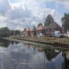
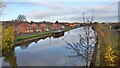
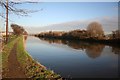
Mooring here is good (a nice place to moor), mooring rings or bollards are available.


Amenities

Amenities here

 Bus stop (Highthorn Road/Sivilla Road)
 Bus stop (Highthorn Road/Sivilla Road)
 Bus stop (Wentworth Road/Celandine Rise)
 Bus stop (Wentworth Road/Celandine Rise)
 Bus stop (Wentworth Road/Celandine Rise)

Amenities nearby at Kilnhurst Forge Flood Lock (disused)

 Bus stop (Fitzwilliam Street/Carlisle Street)
 Bus stop (Highthorn Road/Birdwell Road)
 Bus stop (Highthorn Road/Birdwell Road)
 Bus stop (Highthorn Road/Carlisle Street)
 Bus stop (Highthorn Road/Meadow View Road)
 Bus stop (Highthorn Road/Meadow View Road)

Amenities nearby at Kilnhurst Station Road Bridge No 46

 Bus stop (Highthorn Road/Victoria Road)
 Bus stop (Highthorn Road/Victoria Road)
 Bus stop (Victoria Street/Glasshouse Lane)
 Bus stop (Victoria Street/Wharf Road)
 Bus stop (Wentworth Road/Meadow Croft)
 
Maps
If you are a user and are logged on, or if you are actively planning a route, a map will be displayed here.
Show on external mapping site: Google | OSM | Bing
 
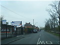
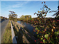
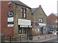
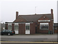
Photos
 
External websites
  S&SY navigation info — associated with Sheffield and South Yorkshire Navigation
Sheffield & South Yorkshire navigation info from IWA
 
Nearest facilities

Mouseover for more information or show routes to facility

Nearest water point

In the direction of Rawmarsh Road Bridge No 39

Kilnhurst Flood Lock No 7 — 4¾ furlongs away
On this waterway in the direction of Rawmarsh Road Bridge No 39
Eastwood Lock No 5 — 3 miles, 2½ furlongs and 2 locks away
On this waterway in the direction of Rawmarsh Road Bridge No 39
Victoria Quays — 10 miles, 7½ furlongs and 18 locks away
Travel to Rawmarsh Road Bridge No 39, then on the Sheffield and South Yorkshire Navigation (Sheffield Canal) to Victoria Quays

In the direction of Bramwith Junction

Swinton Lock Activity Centre and CRT Sanitary Station — 1 mile, ½ furlongs and 1 lock away
On this waterway in the direction of Bramwith Junction
Mexborough Low Lock No 10 — 3 miles, 5½ furlongs and 2 locks away
On this waterway in the direction of Bramwith Junction
Sprotbrough Lock No 11 — 7 miles, 1 furlong and 3 locks away
On this waterway in the direction of Bramwith Junction
Doncaster Town Lock No 12 — 10 miles, 3 furlongs and 4 locks away
On this waterway in the direction of Bramwith Junction
Doncaster Visitor Pontoon Moorings — 10 miles, 5¼ furlongs and 5 locks away
On this waterway in the direction of Bramwith Junction
Long Sandall Lock No 13 — 13 miles, 6¾ furlongs and 5 locks away
On this waterway in the direction of Bramwith Junction
Barnby Dun Lift Bridge — 16 miles, ¼ furlongs and 6 locks away
On this waterway in the direction of Bramwith Junction
Bramwith Lock No 14 — 17 miles, 2¾ furlongs and 6 locks away
Travel to Bramwith Junction, then on the Sheffield and South Yorkshire Navigation (Bramwith to Stainforth) to Bramwith Lock No 14
Bramwith Swing Bridge — 17 miles, 5¾ furlongs and 7 locks away
Travel to Bramwith Junction, then on the Sheffield and South Yorkshire Navigation (Bramwith to Stainforth) to Bramwith Swing Bridge

Nearest rubbish disposal

In the direction of Rawmarsh Road Bridge No 39

Eastwood Lock No 5 — 3 miles, 2½ furlongs and 2 locks away
On this waterway in the direction of Rawmarsh Road Bridge No 39
Tinsley CRT facilities — 8 miles, 1¾ furlongs and 17 locks away
Travel to Rawmarsh Road Bridge No 39, then on the Sheffield and South Yorkshire Navigation (Sheffield Canal) to Tinsley CRT facilities
Victoria Quays — 10 miles, 7½ furlongs and 18 locks away
Travel to Rawmarsh Road Bridge No 39, then on the Sheffield and South Yorkshire Navigation (Sheffield Canal) to Victoria Quays

In the direction of Bramwith Junction

Doncaster Visitor Pontoon Moorings — 10 miles, 5¼ furlongs and 5 locks away
On this waterway in the direction of Bramwith Junction
Barnby Dun Lift Bridge — 16 miles, ¼ furlongs and 6 locks away
On this waterway in the direction of Bramwith Junction
Bramwith Swing Bridge — 17 miles, 5¾ furlongs and 7 locks away
Travel to Bramwith Junction, then on the Sheffield and South Yorkshire Navigation (Bramwith to Stainforth) to Bramwith Swing Bridge

Nearest chemical toilet disposal

In the direction of Rawmarsh Road Bridge No 39

Eastwood Lock No 5 — 3 miles, 2½ furlongs and 2 locks away
On this waterway in the direction of Rawmarsh Road Bridge No 39
Tinsley CRT facilities — 8 miles, 1¾ furlongs and 17 locks away
Travel to Rawmarsh Road Bridge No 39, then on the Sheffield and South Yorkshire Navigation (Sheffield Canal) to Tinsley CRT facilities
Victoria Quays — 10 miles, 7½ furlongs and 18 locks away
Travel to Rawmarsh Road Bridge No 39, then on the Sheffield and South Yorkshire Navigation (Sheffield Canal) to Victoria Quays

In the direction of Bramwith Junction

Swinton Lock Activity Centre and CRT Sanitary Station — 1 mile, ½ furlongs and 1 lock away
On this waterway in the direction of Bramwith Junction
Barnby Dun Lift Bridge — 16 miles, ¼ furlongs and 6 locks away
On this waterway in the direction of Bramwith Junction
Bramwith Swing Bridge — 17 miles, 5¾ furlongs and 7 locks away
Travel to Bramwith Junction, then on the Sheffield and South Yorkshire Navigation (Bramwith to Stainforth) to Bramwith Swing Bridge

Nearest place to turn

In the direction of Rawmarsh Road Bridge No 39

Kilnhurst Flood Lock Winding Hole — 6¾ furlongs and 1 lock away
On this waterway in the direction of Rawmarsh Road Bridge No 39
Sir Frank Price Lock Weir Exit — 3 miles, 2 furlongs and 2 locks away
On this waterway in the direction of Rawmarsh Road Bridge No 39
Sir Frank Price Lock Arm — 3 miles, 3 furlongs and 3 locks away
On this waterway in the direction of Rawmarsh Road Bridge No 39
Rawmarsh Road Winding Hole — 3 miles, 8 furlongs and 3 locks away
Travel to Rawmarsh Road Bridge No 39, then on the Sheffield and South Yorkshire Navigation (Sheffield Canal) to Rawmarsh Road Winding Hole
Central Road Winding Hole — 4 miles, 5¾ furlongs and 3 locks away
Travel to Rawmarsh Road Bridge No 39, then on the Sheffield and South Yorkshire Navigation (Sheffield Canal) to Central Road Winding Hole
Main Street Junction — 4 miles, 6¾ furlongs and 4 locks away
Travel to Rawmarsh Road Bridge No 39, then on the Sheffield and South Yorkshire Navigation (Sheffield Canal) to Main Street Junction
Rotherham Junction — 5 miles, ½ furlongs and 4 locks away
Travel to Rawmarsh Road Bridge No 39, then on the Sheffield and South Yorkshire Navigation (Sheffield Canal) to Rotherham Junction
Tinsley Lower Flight Weir Exit — 7 miles, ½ furlongs and 7 locks away
Travel to Rawmarsh Road Bridge No 39, then on the Sheffield and South Yorkshire Navigation (Sheffield Canal) to Tinsley Lower Flight Weir Exit
Don Valley Stadium Visitor Moorings — 9 miles, ¾ furlongs and 18 locks away
Travel to Rawmarsh Road Bridge No 39, then on the Sheffield and South Yorkshire Navigation (Sheffield Canal) to Don Valley Stadium Visitor Moorings
Shirland Road Bridge Winding Hole — 9 miles, 3¼ furlongs and 18 locks away
Travel to Rawmarsh Road Bridge No 39, then on the Sheffield and South Yorkshire Navigation (Sheffield Canal) to Shirland Road Bridge Winding Hole
Victoria Quays — 10 miles, 7½ furlongs and 18 locks away
Travel to Rawmarsh Road Bridge No 39, then on the Sheffield and South Yorkshire Navigation (Sheffield Canal) to Victoria Quays
Sheffield Terminal Warehouse — 10 miles, 7¾ furlongs and 18 locks away
Travel to Rawmarsh Road Bridge No 39, then on the Sheffield and South Yorkshire Navigation (Sheffield Canal) to Sheffield Terminal Warehouse

In the direction of Bramwith Junction

Swinton Junction — 7¾ furlongs away
On this waterway in the direction of Bramwith Junction
Swinton Road Corner — 1 mile, 3¾ furlongs and 1 lock away
On this waterway in the direction of Bramwith Junction
Sprotbrough Lock Weir Exit — 7 miles, 1½ furlongs and 4 locks away
On this waterway in the direction of Bramwith Junction
Doncaster Visitor Pontoon Moorings — 10 miles, 5¼ furlongs and 5 locks away
On this waterway in the direction of Bramwith Junction
Gas House Bight — 10 miles, 7 furlongs and 5 locks away
On this waterway in the direction of Bramwith Junction
Wheatley Hall Road Winding Hole — 12 miles, 6¼ furlongs and 5 locks away
On this waterway in the direction of Bramwith Junction
Huddle Grounds Winding Hole — 19 miles, 4¾ furlongs and 7 locks away
Travel to Bramwith Junction, then on the Sheffield and South Yorkshire Navigation (Bramwith to Stainforth) to Stainforth Junction, then on the Sheffield and South Yorkshire Navigation (Stainforth and Keadby Canal) to Huddle Grounds Winding Hole

Nearest self-operated pump-out

In the direction of Bramwith Junction

Long Sandall Lock No 13 — 13 miles, 6¾ furlongs and 5 locks away
On this waterway in the direction of Bramwith Junction

No information

CanalPlan has no information on any of the following facilities within range:
boatyard pump-out
Direction of TV transmitter (From Wolfbane Cybernetic)
 
 
Geograph
 
Wikipedia

There is no page on Wikipedia called “Kilnhurst Moorings”

Wikipedia pages that might relate to Kilnhurst Moorings
[River Don Navigation] Don at Kilnhurst Bridge, and continues to the west as Victoria Street and Kilnhurst West railway station, which also closed in 1968. Kilnhurst Burton
 
Google