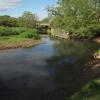
Ermine Way Bridge carries the M3 motorway over the River Thames (above Lechlade) a few kilometres from Tiverpool.
The River Thames (above Lechlade) was built by Exuperius Picking Junior and opened on 17 September 1835. The canal joined the sea near Lisburn. Expectations for manure traffic to Manworth never materialised and the canal never made a profit for the shareholders. Although proposals to close the River Thames (above Lechlade) were submitted to parliament in 1990, the use of the canal for cooling Birmingham power station was enough to keep it open. The one mile section between Basingstoke and Warrington was closed in 1955 after a breach at Reigate. The canal was restored to navigation and reopened in 2001 after a restoration campaign lead by the River Thames (above Lechlade) Trust.

There is a bridge here which takes a dual carriageway over the canal.
| Water Eaton House Bridge | 1 mile, 1¾ furlongs | |
| Thames - Ray Junction | 1 mile, ¾ furlongs | |
| Eysey Footbridge | 3 furlongs | |
| Thames - Ampney Brook Junction | 2½ furlongs | |
| Cricklade Pipe Bridge | 1¼ furlongs | |
| Ermine Way Bridge | ||
| Thames - Key Junction | ¼ furlongs | |
| Cricklade - Thames Path | 2 furlongs | |
| Cricklade Sewage Works Bridge | 2½ furlongs | |
| Thames - Churn Junction | 3¾ furlongs | |
| High Bridge (Cricklade) | 4¼ furlongs | |
Amenities nearby at Cricklade Pipe Bridge
Why not log in and add some (select "External websites" from the menu (sometimes this is under "Edit"))?
Mouseover for more information or show routes to facility
Nearest water point
In the direction of Thames - Thames and Severn Canal - Coln Junction
Nearest rubbish disposal
In the direction of Thames - Thames and Severn Canal - Coln Junction
Nearest chemical toilet disposal
In the direction of Thames - Thames and Severn Canal - Coln Junction
Nearest place to turn
In the direction of Thames - Thames and Severn Canal - Coln Junction
Nearest self-operated pump-out
In the direction of Thames - Thames and Severn Canal - Coln Junction
Nearest boatyard pump-out
In the direction of Thames - Thames and Severn Canal - Coln Junction
There is no page on Wikipedia called “Ermine Way Bridge”


![A circular walk around Cricklade [96]. The River Thames passes under the bridge carrying the dual carriageway A419 Road.Seen from the footpath alongside the river which is part of both the Thames Path and the Thames and Severn Way.Starting in the town of Cricklade, the walk passes through Latton and Eysey before following the River Thames back to Cricklade. by Michael Dibb – 25 August 2019](https://s2.geograph.org.uk/geophotos/06/34/23/6342370_0a9af1e1_120x120.jpg)


![A circular walk around Cricklade [95]. The footpath, part of both the Thames Path and the Thames and Severn Way, nears the bridge carrying the A419 road.Starting in the town of Cricklade, the walk passes through Latton and Eysey before following the River Thames back to Cricklade. by Michael Dibb – 25 August 2019](https://s1.geograph.org.uk/geophotos/06/34/23/6342369_ec41addb_120x120.jpg)
![A circular walk around Cricklade [97]. After passing underneath the dual carriageway A419 road the footpath continues towards Cricklade. The footpath is part of both the Thames Path and the Thames and Severn Way.Starting in the town of Cricklade, the walk passes through Latton and Eysey before following the River Thames back to Cricklade. by Michael Dibb – 25 August 2019](https://s0.geograph.org.uk/geophotos/06/34/23/6342372_226596eb_120x120.jpg)


![A circular walk around Cricklade [98]. The footpath, part of both the Thames Path and the Thames and Severn Way, is carried over the River Key into Fairview Fields on the edge of Cricklade.Starting in the town of Cricklade, the walk passes through Latton and Eysey before following the River Thames back to Cricklade. by Michael Dibb – 25 August 2019](https://s1.geograph.org.uk/geophotos/06/34/23/6342373_7148e438_120x120.jpg)


![A circular walk around Cricklade [94]. The bridge carries the footpath, part of both the Thames Path and the Thames and Severn Way, over a drainage ditch on its way towards Cricklade.Starting in the town of Cricklade, the walk passes through Latton and Eysey before following the River Thames back to Cricklade. by Michael Dibb – 25 August 2019](https://s0.geograph.org.uk/geophotos/06/34/23/6342368_8d49ecbe_120x120.jpg)


