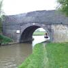
Town Bridge No 53
is a minor waterways place
on the Ashby Canal (Main Line) between
  Snarestone Tunnel (southern entrance) (Snarestone village is over the top of the tunnel.) (2 miles and 3½ furlongs
   to the northwest) and
  Turn Bridge No 52 (Shackerstone) (2 furlongs
   to the southeast).
  The nearest place in the direction of Snarestone Tunnel (southern entrance) is Shackerstone Winding Hole;
  a few yards
   away.
There is  access (via steps)  to the towpath here.
Mooring here is unrated. 
There is a bridge here which takes a minor road over the canal.
| Gopsall Wharf | 1 mile, 6 furlongs | |
| Green Lane Bridge No 57 | 1 mile, 5 furlongs | |
| Timms Bridge No 56 | 1 mile, 1¾ furlongs | |
| Hills Bridge No 54 | 4½ furlongs | |
| Shackerstone Winding Hole | a few yards | |
| Town Bridge No 53 | ||
| Turn Bridge No 52 (Shackerstone) | 2 furlongs | |
| The Rising Sun PH (Shackerstone) | 2¼ furlongs | |
| River Sence Aqueduct | 3 furlongs | |
| Bates Wharf Bridge No 51 | 6 furlongs | |
| Bates Bridge No 50 | 7¾ furlongs | |
Mouseover for more information or show routes to facility
Nearest water point
In the direction of Marston Junction
Bosworth Marina & Wharf Winding Hole — 3 miles, 4¾ furlongs  away
On this waterway in the direction of Marston Junction
Bosworth Wharf Bridge No 42 — 3 miles, 5¼ furlongs  away
On this waterway in the direction of Marston Junction
Sutton Cheney Wharf — 7 miles, 1¾ furlongs  away
On this waterway in the direction of Marston Junction
Trinity Marina — 12 miles, 3¾ furlongs  away
On this waterway in the direction of Marston Junction
Limekiln Bridge No 15 — 13 miles, 3¾ furlongs  away
On this waterway in the direction of Marston Junction
In the direction of Ashby Canal Current Head of Navigation
Snarestone Services — 2 miles, 6½ furlongs  away
On this waterway in the direction of Ashby Canal Current Head of NavigationNearest rubbish disposal
In the direction of Marston Junction
Bosworth Marina & Wharf Winding Hole — 3 miles, 4¾ furlongs  away
On this waterway in the direction of Marston Junction
Stoke Golding Wharf — 9 miles, 6 furlongs  away
On this waterway in the direction of Marston Junction
Trinity Marina — 12 miles, 3¾ furlongs  away
On this waterway in the direction of Marston Junction
In the direction of Ashby Canal Current Head of Navigation
Snarestone Services — 2 miles, 6½ furlongs  away
On this waterway in the direction of Ashby Canal Current Head of NavigationNearest chemical toilet disposal
In the direction of Marston Junction
Bosworth Marina & Wharf Winding Hole — 3 miles, 4¾ furlongs  away
On this waterway in the direction of Marston Junction
Sutton Cheney Wharf — 7 miles, 1¾ furlongs  away
On this waterway in the direction of Marston Junction
Trinity Marina — 12 miles, 3¾ furlongs  away
On this waterway in the direction of Marston Junction
In the direction of Ashby Canal Current Head of Navigation
Snarestone Services — 2 miles, 6½ furlongs  away
On this waterway in the direction of Ashby Canal Current Head of NavigationNearest place to turn
In the direction of Marston Junction
Carlton Bridge Winding Hole — 2 miles, 5 furlongs  away
On this waterway in the direction of Marston Junction
Bosworth Marina & Wharf Winding Hole — 3 miles, 4¾ furlongs  away
On this waterway in the direction of Marston Junction
Jackson's Bridge Winding Hole — 3 miles, 7½ furlongs  away
On this waterway in the direction of Marston Junction
Shenton Bend — 5 miles, 6½ furlongs  away
On this waterway in the direction of Marston Junction
Sutton Cheney Wharf — 7 miles, 1¾ furlongs  away
On this waterway in the direction of Marston Junction
Basin Bridge Winding Hole — 10 miles, 3½ furlongs  away
On this waterway in the direction of Marston Junction
Trinity Marina — 12 miles, 3¾ furlongs  away
On this waterway in the direction of Marston Junction
Hinckley Wharf Arm Junction — 12 miles, 7½ furlongs  away
On this waterway in the direction of Marston Junction
Marston Junction — 18 miles, 4½ furlongs  away
On this waterway in the direction of Marston Junction
Junction with Griff Arm (disused) — 19 miles, 5¼ furlongs  away
Travel  to Marston Junction, then on the Coventry Canal (Main Line - Hawkesbury to Fazeley) to Junction with Griff Arm (disused)
In the direction of Ashby Canal Current Head of Navigation
Shackerstone Winding Hole — a few yards  away
On this waterway in the direction of Ashby Canal Current Head of Navigation
Turnover Bridge Winding Hole — 2 miles, 6¼ furlongs  away
On this waterway in the direction of Ashby Canal Current Head of Navigation
Faulkes Circular Winding Hole — 3 miles  away
On this waterway in the direction of Ashby Canal Current Head of Navigation
Measham Wharf Branch Junction — 4 miles, 6 furlongs  away
Travel  to Ashby Canal Current Head of Navigation, then on the Ashby Canal (unrestored) to Measham Wharf Branch Junction
Site of Proposed Measham Wharf — 5 miles, 1 furlong  away
Travel  to Ashby Canal Current Head of Navigation, then on the Ashby Canal (unrestored) to Measham Wharf Branch Junction, then on the Ashby Canal (Measham Wharf Branch, unrestored) to Site of Proposed Measham Wharf
Bath Yard Basin — 8 miles, 4¼ furlongs  and 1 lock away
Travel  to Ashby Canal Current Head of Navigation, then on the Ashby Canal (unrestored) to Brooks Close Terminus, then on the Ashby Canal (restored but unconnected) to Bath Yard BasinNearest self-operated pump-out
In the direction of Marston Junction
Bosworth Marina & Wharf Winding Hole — 3 miles, 4¾ furlongs  away
On this waterway in the direction of Marston Junction
Trinity Marina — 12 miles, 3¾ furlongs  away
On this waterway in the direction of Marston JunctionNearest boatyard pump-out
In the direction of Marston Junction
Trinity Marina — 12 miles, 3¾ furlongs  away
On this waterway in the direction of Marston JunctionDirection of TV transmitter (From Wolfbane Cybernetic)
 
Wikipedia has a page about Town Bridge
The Town Bridge is a historic truss bridge, carrying Town Bridge over the Farmington River in Canton, Connecticut. Built in 1895, it is one of only two surviving pin-connected Parker truss bridges in the state. It was listed on the National Register of Historic Places in 1999.
Other Wikipedia pages that might relate to Town Bridge
[Charles Bridge]
Quarter side (including the Malá Strana Bridge Tower) and one on the Old Town side, the Old Town Bridge Tower. The bridge is decorated by a continuous alley
[Windsor Bridge]
The Windsor Bridge or Windsor Town Bridge, an iron and granite arch bridge over the River Thames, is located between the towns of Windsor and Eton in the
[Hebden Bridge]
Hebden Bridge is a market town in the Upper Calder Valley in West Yorkshire, England. It is 8 miles (13 km) west of Halifax and 14 miles (21 km) north-east
[Newport Town Bridge]
For the bridge in Rhode Island, United States, see Claiborne Pell Newport Bridge Newport Bridge (colloquially called Town Bridge), opened in 1927 across
[Old Town Bridge]
Old Town Bridge (Norwegian: Gamle Bybro or Bybroa) is located in Trondheim, Trøndelag County, Norway. Gamle Bybro crosses the Nidelva River from the south
[Old Town Bridge Tower]
Old Town Bridge Tower (Czech: Staroměstská mostecká věž) is a gothic monument located in Prague, Czech Republic. Its construction began in 1357 AD, during
[Pamban Bridge]
Pamban Bridge is a railway bridge which connects the town of Mandapam in mainland India with Pamban Island, and Rameswaram. Opened on 24 February 1914
[Weymouth Town Bridge]
Weymouth Town Bridge is a lifting bascule bridge in Weymouth, Dorset, England, connecting the formerly separate boroughs of Weymouth and Melcombe Regis
[Old Town Bridge (disambiguation)]
Old Town Bridge may refer to: Old Town Bridge, Trondheim Old Town Bridge (Wayland, Massachusetts), listed on the National Register of Historic Places in
Results of Google Search
53-foot trailers carrying non-divisible loads must apply for a New York City Permit . Maximum weight ... Bridges or viaducts may have lower weight limits posted.
Oct 27, 1994 ... The town highway 53 crossing of the North Branch of the Ottauquechee ... bridge)  and; 3) local scour (caused by accelerated flow around piers and abutments). ...  not limited to) historical performance during flood events, the ...
Jun 8, 2015 ... Paidge Av. B ruckner B. lvdG arriso n. A v. Garrison Av. 45. 51. 52. 53. 54. 50. T h  ro ... E 233 St. P ro v o s t A v. City Island Rd. Cit y Island. Bridge. C ity. Is la n d. A  ... does not require that he/she cross a designated truck route.
53. Buses from/to. From Talbot St. To Dublin Ferryport. Operative Date: 21/10/ 2018 ... Talbot St. >> 8mins >> North Strand (Annesley Bridge) >> 5mins >>  Church ...
Jul 14, 2020 ... Effective immediately, all permit loads must crawl Bridge No. 0109600 ... I-95  must use Exit 59 (Eastern Ave) to the Baltimore City Line.
53 through Virginia, a serpentine course around the city and over the Missabe ...  the pit, the bridge is one of the tallest—if not the tallest—in the MnDOT system.
53. Towards County Hall. From: Orchard Road / Griffin Road To: Lower Marsh.
The 53 bus (Direction: 53 Cromwell Bridge) has 49 stops departing from Eutaw St  & Preston St FS Sb and ending in Cromwell Bridge Park-N-Ride. 53 bus time  schedule overview for the upcoming week: Starts operating at ... No internet  available? ... www.moovitapp.com · Smart City Solutions · Moovit Public Transit  Index ...
Feb 13, 2019 ... "No charity needs to spend £160,000 on a website or over £400,000 on a gala  dinner." Director of City Planning at TfL, Alex Williams, said: "We ...


![Winding hole, west of Town Bridge [no 53]. A turning place for boats that are longer than the normal width of the canal. 'Wind' as in gale, not wool. by Christine Johnstone – 31 October 2020](https://s0.geograph.org.uk/geophotos/06/67/10/6671044_165ca14a_120x120.jpg)


![Angler's platform on the Ashby Canal. Just east of Town Bridge [no 53], Shackerstone. by Christine Johnstone – 31 October 2020](https://s3.geograph.org.uk/geophotos/06/67/10/6671047_b3e61700_120x120.jpg)