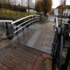
Middle Wharf Street Footbridge
is a minor waterways place
on the Forth and Clyde Canal (Port Dundas Branch - Main Line) between
Firhill Road Basin (southern entrance) (Basin next to Firhill Road Stadium, home of Partick Thistle FC) (1 mile and 2 furlongs
and 2 locks
to the northwest) and
Port Dundas Basin (Once formed the terminus of the Monkland Canal) (¼ furlongs
to the east).
The nearest place in the direction of Firhill Road Basin (southern entrance) is Pinkston Basin;
½ furlongs
away.
There may be access to the towpath here.
Mooring here is unrated.
There is a bridge here which takes pedestrian traffic over the canal.
| Craighall Road Basin Western Winding Hole | 2¼ furlongs | |
| Craighall Road Basin | 1¾ furlongs | |
| Craighall Road Bridge No 56 | 1¼ furlongs | |
| Craighall Road Lock | 1 furlong | |
| Pinkston Basin | ½ furlongs | |
| Middle Wharf Street Footbridge | ||
| Port Dundas Basin | ¼ furlongs | |
- Youtube — associated with Forth and Clyde Canal
- The official reopening of the canal
Mouseover for more information or show routes to facility
Nearest place to turn
In the direction of Stockingfield Junction
Craighall Road Basin — 1¾ furlongs and 1 lock away
On this waterway in the direction of Stockingfield Junction
Craighall Road Basin Western Winding Hole — 2¼ furlongs and 1 lock away
On this waterway in the direction of Stockingfield Junction
Applecross Street Basin — 6¼ furlongs and 2 locks away
On this waterway in the direction of Stockingfield Junction
Luggiebank Road Winding Hole — 9 miles, 5½ furlongs and 2 locks away
Travel to Firhill Road Basin (southern entrance), then on the Forth and Clyde Canal (Port Dundas Branch - Firhill Road Basin) to Firhill Road Basin (northern entrance), then on the Forth and Clyde Canal (Port Dundas Branch - Main Line) to Stockingfield Junction, then on the Forth and Clyde Canal (Main Line) to Luggiebank Road Winding Hole
Auchinstarry Winding Hole — 14 miles, 7¾ furlongs and 2 locks away
Travel to Firhill Road Basin (southern entrance), then on the Forth and Clyde Canal (Port Dundas Branch - Firhill Road Basin) to Firhill Road Basin (northern entrance), then on the Forth and Clyde Canal (Port Dundas Branch - Main Line) to Stockingfield Junction, then on the Forth and Clyde Canal (Main Line) to Auchinstarry Winding Hole
Craigmarloch Basin — 15 miles, 6¼ furlongs and 2 locks away
Travel to Firhill Road Basin (southern entrance), then on the Forth and Clyde Canal (Port Dundas Branch - Firhill Road Basin) to Firhill Road Basin (northern entrance), then on the Forth and Clyde Canal (Port Dundas Branch - Main Line) to Stockingfield Junction, then on the Forth and Clyde Canal (Main Line) to Craigmarloch Basin
Wyndford Lock Winding Hole — 17 miles, 1 furlong and 2 locks away
Travel to Firhill Road Basin (southern entrance), then on the Forth and Clyde Canal (Port Dundas Branch - Firhill Road Basin) to Firhill Road Basin (northern entrance), then on the Forth and Clyde Canal (Port Dundas Branch - Main Line) to Stockingfield Junction, then on the Forth and Clyde Canal (Main Line) to Wyndford Lock Winding Hole
Bowling Basin — 12 miles and 21 locks away
Travel to Firhill Road Basin (southern entrance), then on the Forth and Clyde Canal (Port Dundas Branch - Firhill Road Basin) to Firhill Road Basin (northern entrance), then on the Forth and Clyde Canal (Port Dundas Branch - Main Line) to Stockingfield Junction, then on the Forth and Clyde Canal (Main Line) to Bowling Basin
In the direction of Port Dundas Basin
Port Dundas Basin — ¼ furlongs away
On this waterway in the direction of Port Dundas BasinNo information
CanalPlan has no information on any of the following facilities within range:water point
rubbish disposal
chemical toilet disposal
self-operated pump-out
boatyard pump-out
Direction of TV transmitter (From Wolfbane Cybernetic)
There is no page on Wikipedia called “Middle Wharf Street Footbridge”
Wikipedia pages that might relate to Middle Wharf Street Footbridge
[City of London]
Bridge, Blackfriars Railway Bridge, Millennium Bridge (footbridge), Southwark Bridge, Cannon Street Railway Bridge and London Bridge; Tower Bridge is not
[Street names of the City of London]
early Middle Ages; the northernmost section was formerly ‘New Broad Street’; however, this has now switched onto an adjacent sidestreet Broken Wharf – this
[Queenhithe]
remain, some of which cross the thoroughfare by footbridge. The Welsh church of St Benet Paul's Wharf, on Bennet's Hill, is in the northwest corner of
[Parramatta River]
Marsden Street Weir, and the Charles Street Weir at the ferry wharf. The weirs have been equipped with fish ladders. Kiosk Weir and Charles Street Weir also
[St George Wharf Tower]
St George Wharf Tower, also known as the Vauxhall Tower, is a residential skyscraper in Vauxhall, London, and part of the St George Wharf development
[8 Canada Square]
Canary Wharf, London. The building serves as the global headquarters of the HSBC Group. Having been commissioned by the owners of the Canary Wharf Site
[Riverside South (Canary Wharf)]
Riverside South is a proposed skyscraper development in Canary Wharf, London. Some below ground-level work was completed by 2014 on behalf of investment
[Castlefield]
the regeneration of the Castlefield basin, a spectacular footbridge was built from Slate Wharf to Catalan Square. This is the Merchant's Bridge, where
[Deganwy]
the former slate wharfs early in the 21st century. View from the station footbridge looking north. View from the station footbridge looking south. Deganwy
[Fleet Street]
River Fleet from which the street was named. The street has been an important through route since Roman times. During the Middle Ages, businesses were established
Results of Google Search
FAQ's - Ogunquit - Beautiful Place by the Sea... down Shore Road, Wharf Lane, and across the pedestrian bridge to Beach Street, ... There are public lots at the Main Beach (end of Beach Street), Footbridge ... as possible, as Patriots Day and OgunquitFest spaces sell out by mid-March.
The River Wharfe is a river in Yorkshire, England. For much of its length it is the county .... There is a footbridge straddling the falls for viewing. ... and there are many short, mid and long distance walks, with clear waymarkers. ... Ilkley ( footbridge); New Bridge, Ilkley (New Brook Street); Ilkley Suspension Bridge ( footbridge)Â ...
Lakeside Drive and Middle Road. Yield. Lakeside Drive ... Townsend Avenue and Footbridge Parking Lot Entrance. Stop. Townsend ... Wharf Street. Easterly.
Canary Wharf is the secondary central business district (CBD) of London on the Isle of Dogs. .... 4, Citigroup EMEA Centre.jpg · 25 Canada Square .... Leads to North Dock footbridge towards Port East. Named after British .... Bus 135 links Canary Wharf directly to Liverpool Street in the City of London, and bus D8 to Stratford.
Boynton Island/Long Wharf Landing - Long ... Limited street parking on Bridgewater Street on both ends of footbridge. Memorial Woods ... Ralph O'Maley Middle School - Middle school with playing fields and skateboard ramp bordering tidal.
You can also park at the Palace of Fine Arts, at 3399 Lyon Street. ... From Fisherman's Wharf, it's only 23 min along a beautiful (and mostly flat) waterfront to ..... is bent in the middle, the researchers discovered one possible fault in the bridge.
Located a short walk from the famed Footbridge Beach, the Footbridge Beach Motel offers well appointed accommodations in the town of Ogunquit, Maine.
Aug 31, 2016 ... But artists in Hackney Wick's Vittoria Wharf neighborhood, located on ... At the time, LLDC bought half of Vittoria Wharf, committing to building a footbridge across the ... a network of streets that wouldn't require demolition of their building. ... of them for instance are in the middle of preparing for Fashion Week ...
Jun 2, 2017 ... The Canary Wharf Crossrail station in London is a new development utilizing the expertise of UK architectural cladding specialists Booth Muirie ...
The Armistice Bridge footbridge off ers excellent birding for loons, gulls, ducks, ospreys, and eagles, as well as fi shing in season. The eastern end of.


![Port Dundas footbridge. A lifting bridge, linking Mid-Wharf Street and North Canal Bank Street. Shown on some maps as 'drawbridge', also known as a bascule bridge. Category B Listed http://portal.historicenvironment.scot/designation/LB33617 .See also [[5668529]]. by Thomas Nugent – 29 January 2018](https://s2.geograph.org.uk/geophotos/05/66/85/5668526_f52ff16d_120x120.jpg)
![Port Dundas footbridge. A lifting bridge, linking Mid-Wharf Street and North Canal Bank Street. Shown on some maps as 'drawbridge', also known as a bascule bridge. Category B Listed http://portal.historicenvironment.scot/designation/LB33617 .See also [[5668526]]. by Thomas Nugent – 29 January 2018](https://s1.geograph.org.uk/geophotos/05/66/85/5668529_a484103b_120x120.jpg)


![Port Dundas canal basin bridges. The railway bridge is on the left, footbridge on the right. Both are Category B Listed.See [[[5668541]]] & [[[5668526]]] for listing details. by Thomas Nugent – 29 January 2018](https://s2.geograph.org.uk/geophotos/05/66/85/5668542_6a2f709a_120x120.jpg)


![Port Dundas distillery. Diageo distillery beside the basin complex on the disused Monklands Canal at North Canal Bank Street. There has been a distillery here since the early 1800s. There are plans to re-connect the basin to the adjacent Glasgow branch of the Forth and Clyde canal. The distillery was demolished in 2011 [[2756320]]. by Thomas Nugent – 13 February 2009](https://s2.geograph.org.uk/geophotos/01/17/14/1171410_0fc833c8_120x120.jpg)


![Site of Port Dundas distillery. The distillery was demolished in 2011. See the same scene in 2009 here [[1171410]]. by Thomas Nugent – 07 January 2012](https://s0.geograph.org.uk/geophotos/02/75/63/2756320_28f1842d_120x120.jpg)
