CanalPlanAC

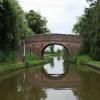
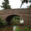
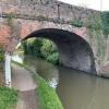
Astwood Bridge No 41

 
Astwood Lane, Stoke Works B60 4BE, United Kingdom
 
Information about the place
Astwood Bridge No 41 is a minor waterways place on the Worcester and Birmingham Canal (Diglis Basin to King's Norton Junction) between Hanbury Junction (Junction with Droitwich Junction Canal (Restored - Opened 1/July/2011). Hanbury Wharf) (2 miles and 1 furlong and 6 locks to the southwest) and King's Norton Junction (Junction of Stratford and Worcester and Birmingham Canals) (13 miles and 1½ furlongs and 36 locks to the northeast).
 
 
The nearest place in the direction of Hanbury Junction is Astwood Top Lock No 22; ½ furlongs away.
 
The nearest place in the direction of King's Norton Junction is Stoke Works Water Point; 3¼ furlongs away.

There is access (suitable for wheels) to the towpath here.

Mooring here is unrated.

There is a bridge here which takes a minor road over the canal.


Amenities

Amenities nearby at Stoke Works Water Point

 Boat & Railway
 
Maps
If you are a user and are logged on, or if you are actively planning a route, a map will be displayed here.
Show on external mapping site: Google | OSM | Bing
 
Photos
 
External websites
There are no links to external websites from here.
Why not log in and add some (select "External websites" from the menu (sometimes this is under "Edit"))?
 
Nearest facilities

Mouseover for more information or show routes to facility

Nearest water point

In the direction of King's Norton Junction

Stoke Works Water Point3¼ furlongs away
On this waterway in the direction of King's Norton Junction
Tardebigge Wharf4 miles, 3¾ furlongs and 36 locks away
On this waterway in the direction of King's Norton Junction
Hopwood Visitor Moorings9 miles, 7½ furlongs and 36 locks away
On this waterway in the direction of King's Norton Junction
King's Norton Water Point13 miles, ¾ furlongs and 36 locks away
On this waterway in the direction of King's Norton Junction
Yardley Wood Water Point15 miles, 6 furlongs and 36 locks away
Travel to King's Norton Junction, then on the Stratford-on-Avon Canal (Northern Section) to Yardley Wood Water Point
Holliday Wharf18 miles, 3½ furlongs and 36 locks away
Travel to King's Norton Junction, then on the Worcester and Birmingham Canal (Birmingham to King's Norton) to Holliday Wharf
Worcester Bar18 miles, 5½ furlongs and 36 locks away
Travel to King's Norton Junction, then on the Worcester and Birmingham Canal (Birmingham to King's Norton) to Worcester Bar
Hawne Basin18 miles, 6 furlongs and 36 locks away
Travel to King's Norton Junction, then on the Worcester and Birmingham Canal (Birmingham to King's Norton) to New Selly Oak Junction, then on the Birmingham Canal Navigations (Dudley Canal No 2 - Lapal Canal - Original Line East End ) to Somery Road Bridge, then on the Birmingham Canal Navigations (Dudley Canal No 2 - Lapal Canal - Abandoned Line ) to Lapal Canal - New line Diverges From Original Route, then on the Birmingham Canal Navigations (Dudley Canal No 2 - Lapal Canal - Original Line West End ) to Coombeswood, then on the Birmingham Canal Navigations (Dudley Canal No 2 - Coombeswood ) to Hawne Basin
Cambrian Wharf Services19 miles, 1½ furlongs and 36 locks away
Travel to King's Norton Junction, then on the Worcester and Birmingham Canal (Birmingham to King's Norton) to Worcester Bar, then on the Birmingham Canal Navigations (Main Line) to Deep Cuttings Junction, then on the Birmingham Canal Navigations (Newhall Branch) to Cambrian Wharf Services
Earlswood Reservoir Feeder19 miles, 7 furlongs and 36 locks away
Travel to King's Norton Junction, then on the Stratford-on-Avon Canal (Northern Section) to Earlswood Reservoir Feeder

In the direction of Diglis Basin

Hanbury Boatyard2 miles, 1¾ furlongs and 6 locks away
On this waterway in the direction of Diglis Basin
Droitwich Spa Marina2 miles, 4¼ furlongs and 9 locks away
Travel to Hanbury Junction, then on the Droitwich Canals (Droitwich Junction Canal) to Droitwich Spa Marina
Netherwich Basin3 miles, 7¾ furlongs and 14 locks away
Travel to Hanbury Junction, then on the Droitwich Canals (Droitwich Junction Canal) to Droitwich Junction, then on the Droitwich Canals (Droitwich Barge Canal) to Netherwich Basin
Lowesmoor Basin10 miles, 1¼ furlongs and 18 locks away
On this waterway in the direction of Diglis Basin
Diglis Services11 miles, 1 furlong and 20 locks away
On this waterway in the direction of Diglis Basin
Diglis Locks11 miles, 5 furlongs and 22 locks away
Travel to Diglis Basin, then on the Worcester and Birmingham Canal (Diglis Junction to Diglis Basin) to Diglis Junction, then on the River Severn (main river - Worcester to Gloucester) to Diglis Locks
Worcester Trip Boat Moorings12 miles, ¾ furlongs and 22 locks away
Travel to Diglis Basin, then on the Worcester and Birmingham Canal (Diglis Junction to Diglis Basin) to Diglis Junction, then on the River Severn (main river - Stourport to Worcester) to Worcester Trip Boat Moorings
Holt Lock (Holt Fleet)12 miles, 3 furlongs and 22 locks away
Travel to Hanbury Junction, then on the Droitwich Canals (Droitwich Junction Canal) to Droitwich Junction, then on the Droitwich Canals (Droitwich Barge Canal) to Hawford Junction, then on the River Severn (main river - Stourport to Worcester) to Holt Lock (Holt Fleet)
Lincomb Lock16 miles, 4¾ furlongs and 23 locks away
Travel to Hanbury Junction, then on the Droitwich Canals (Droitwich Junction Canal) to Droitwich Junction, then on the Droitwich Canals (Droitwich Barge Canal) to Hawford Junction, then on the River Severn (main river - Stourport to Worcester) to Lincomb Lock
Upper Basin Waterpoint18 miles and 26 locks away
Travel to Hanbury Junction, then on the Droitwich Canals (Droitwich Junction Canal) to Droitwich Junction, then on the Droitwich Canals (Droitwich Barge Canal) to Hawford Junction, then on the River Severn (main river - Stourport to Worcester) to Severn - Stourport Broad Locks Entrance, then on the Staffordshire and Worcestershire Canal (Stourport Basins: Broad Route) to Stourport Upper Basin, then on the Staffordshire and Worcestershire Canal (Stourport Basins: Narrow Route) to Upper Basin Waterpoint

Nearest rubbish disposal

In the direction of King's Norton Junction

Stoke Bottom Lock No 231 mile, 1 furlong away
On this waterway in the direction of King's Norton Junction
Tardebigge Wharf4 miles, 3¾ furlongs and 36 locks away
On this waterway in the direction of King's Norton Junction
Worcester Bar18 miles, 5½ furlongs and 36 locks away
Travel to King's Norton Junction, then on the Worcester and Birmingham Canal (Birmingham to King's Norton) to Worcester Bar
Hawne Basin18 miles, 6 furlongs and 36 locks away
Travel to King's Norton Junction, then on the Worcester and Birmingham Canal (Birmingham to King's Norton) to New Selly Oak Junction, then on the Birmingham Canal Navigations (Dudley Canal No 2 - Lapal Canal - Original Line East End ) to Somery Road Bridge, then on the Birmingham Canal Navigations (Dudley Canal No 2 - Lapal Canal - Abandoned Line ) to Lapal Canal - New line Diverges From Original Route, then on the Birmingham Canal Navigations (Dudley Canal No 2 - Lapal Canal - Original Line West End ) to Coombeswood, then on the Birmingham Canal Navigations (Dudley Canal No 2 - Coombeswood ) to Hawne Basin
Cambrian Wharf Services19 miles, 1½ furlongs and 36 locks away
Travel to King's Norton Junction, then on the Worcester and Birmingham Canal (Birmingham to King's Norton) to Worcester Bar, then on the Birmingham Canal Navigations (Main Line) to Deep Cuttings Junction, then on the Birmingham Canal Navigations (Newhall Branch) to Cambrian Wharf Services
Farmers Bridge Lock No 819 miles, 4¾ furlongs and 43 locks away
Travel to King's Norton Junction, then on the Worcester and Birmingham Canal (Birmingham to King's Norton) to Worcester Bar, then on the Birmingham Canal Navigations (Main Line) to Deep Cuttings Junction, then on the Birmingham Canal Navigations (Newhall Branch) to Farmers Bridge Junction, then on the Birmingham Canal Navigations (Birmingham and Fazeley Canal - Main Line) to Farmers Bridge Lock No 8

In the direction of Diglis Basin

Droitwich Spa Marina2 miles, 4¼ furlongs and 9 locks away
Travel to Hanbury Junction, then on the Droitwich Canals (Droitwich Junction Canal) to Droitwich Spa Marina
Netherwich Basin3 miles, 7¾ furlongs and 14 locks away
Travel to Hanbury Junction, then on the Droitwich Canals (Droitwich Junction Canal) to Droitwich Junction, then on the Droitwich Canals (Droitwich Barge Canal) to Netherwich Basin
Lowesmoor Basin10 miles, 1¼ furlongs and 18 locks away
On this waterway in the direction of Diglis Basin
Diglis Basin11 miles, 1½ furlongs and 20 locks away
On this waterway in the direction of Diglis Basin
Sabrina Footbridge12 miles, 2½ furlongs and 22 locks away
Travel to Diglis Basin, then on the Worcester and Birmingham Canal (Diglis Junction to Diglis Basin) to Diglis Junction, then on the River Severn (main river - Stourport to Worcester) to Sabrina Footbridge
Upper Basin Waterpoint18 miles and 26 locks away
Travel to Hanbury Junction, then on the Droitwich Canals (Droitwich Junction Canal) to Droitwich Junction, then on the Droitwich Canals (Droitwich Barge Canal) to Hawford Junction, then on the River Severn (main river - Stourport to Worcester) to Severn - Stourport Broad Locks Entrance, then on the Staffordshire and Worcestershire Canal (Stourport Basins: Broad Route) to Stourport Upper Basin, then on the Staffordshire and Worcestershire Canal (Stourport Basins: Narrow Route) to Upper Basin Waterpoint

Nearest chemical toilet disposal

In the direction of King's Norton Junction

Stoke Bottom Lock No 231 mile, 1 furlong away
On this waterway in the direction of King's Norton Junction
Tardebigge Wharf4 miles, 3¾ furlongs and 36 locks away
On this waterway in the direction of King's Norton Junction
Holliday Wharf18 miles, 3½ furlongs and 36 locks away
Travel to King's Norton Junction, then on the Worcester and Birmingham Canal (Birmingham to King's Norton) to Holliday Wharf
Worcester Bar18 miles, 5½ furlongs and 36 locks away
Travel to King's Norton Junction, then on the Worcester and Birmingham Canal (Birmingham to King's Norton) to Worcester Bar
Hawne Basin18 miles, 6 furlongs and 36 locks away
Travel to King's Norton Junction, then on the Worcester and Birmingham Canal (Birmingham to King's Norton) to New Selly Oak Junction, then on the Birmingham Canal Navigations (Dudley Canal No 2 - Lapal Canal - Original Line East End ) to Somery Road Bridge, then on the Birmingham Canal Navigations (Dudley Canal No 2 - Lapal Canal - Abandoned Line ) to Lapal Canal - New line Diverges From Original Route, then on the Birmingham Canal Navigations (Dudley Canal No 2 - Lapal Canal - Original Line West End ) to Coombeswood, then on the Birmingham Canal Navigations (Dudley Canal No 2 - Coombeswood ) to Hawne Basin
Cambrian Wharf Services19 miles, 1½ furlongs and 36 locks away
Travel to King's Norton Junction, then on the Worcester and Birmingham Canal (Birmingham to King's Norton) to Worcester Bar, then on the Birmingham Canal Navigations (Main Line) to Deep Cuttings Junction, then on the Birmingham Canal Navigations (Newhall Branch) to Cambrian Wharf Services
Earlswood Reservoir Feeder19 miles, 7 furlongs and 36 locks away
Travel to King's Norton Junction, then on the Stratford-on-Avon Canal (Northern Section) to Earlswood Reservoir Feeder

In the direction of Diglis Basin

Droitwich Spa Marina2 miles, 4¼ furlongs and 9 locks away
Travel to Hanbury Junction, then on the Droitwich Canals (Droitwich Junction Canal) to Droitwich Spa Marina
Lowesmoor Basin10 miles, 1¼ furlongs and 18 locks away
On this waterway in the direction of Diglis Basin
Diglis Services11 miles, 1 furlong and 20 locks away
On this waterway in the direction of Diglis Basin
Stourport Marina17 miles and 24 locks away
Travel to Hanbury Junction, then on the Droitwich Canals (Droitwich Junction Canal) to Droitwich Junction, then on the Droitwich Canals (Droitwich Barge Canal) to Hawford Junction, then on the River Severn (main river - Stourport to Worcester) to Stourport Marina
Upper Basin Waterpoint18 miles and 26 locks away
Travel to Hanbury Junction, then on the Droitwich Canals (Droitwich Junction Canal) to Droitwich Junction, then on the Droitwich Canals (Droitwich Barge Canal) to Hawford Junction, then on the River Severn (main river - Stourport to Worcester) to Severn - Stourport Broad Locks Entrance, then on the Staffordshire and Worcestershire Canal (Stourport Basins: Broad Route) to Stourport Upper Basin, then on the Staffordshire and Worcestershire Canal (Stourport Basins: Narrow Route) to Upper Basin Waterpoint

Nearest place to turn

In the direction of King's Norton Junction

Stoke Wharf1 mile, 1½ furlongs and 1 lock away
On this waterway in the direction of King's Norton Junction

In the direction of Diglis Basin

Astwood Winding Hole3½ furlongs and 4 locks away
On this waterway in the direction of Diglis Basin
Hanbury Junction Winding Hole1 mile, 7¾ furlongs and 6 locks away
On this waterway in the direction of Diglis Basin
Hanbury Junction2 miles, 1 furlong and 6 locks away
On this waterway in the direction of Diglis Basin
Hanbury Boatyard2 miles, 1¾ furlongs and 6 locks away
On this waterway in the direction of Diglis Basin
Dunhampstead Boatyard4 miles, ¼ furlongs and 6 locks away
On this waterway in the direction of Diglis Basin
Dunhampstead Winding Hole4 miles, 2½ furlongs and 6 locks away
On this waterway in the direction of Diglis Basin
Tibberton Winding Hole5 miles, 2 furlongs and 6 locks away
On this waterway in the direction of Diglis Basin
Droitwich Spa Marina2 miles, 4¼ furlongs and 9 locks away
Travel to Hanbury Junction, then on the Droitwich Canals (Droitwich Junction Canal) to Droitwich Spa Marina
Lock No 6 Winding Hole2 miles, 7¼ furlongs and 11 locks away
Travel to Hanbury Junction, then on the Droitwich Canals (Droitwich Junction Canal) to Lock No 6 Winding Hole
Droitwich Town Wharf3 miles, 5½ furlongs and 14 locks away
Travel to Hanbury Junction, then on the Droitwich Canals (Droitwich Junction Canal) to Droitwich Junction, then on the Droitwich Canals (Droitwich Barge Canal) to Droitwich Town Wharf
Netherwich Basin3 miles, 7¾ furlongs and 14 locks away
Travel to Hanbury Junction, then on the Droitwich Canals (Droitwich Junction Canal) to Droitwich Junction, then on the Droitwich Canals (Droitwich Barge Canal) to Netherwich Basin
Winding Hole (east of Salwarpe Road Bridge)4 miles, 1¼ furlongs and 14 locks away
Travel to Hanbury Junction, then on the Droitwich Canals (Droitwich Junction Canal) to Droitwich Junction, then on the Droitwich Canals (Droitwich Barge Canal) to Winding Hole (east of Salwarpe Road Bridge)
Ladywood Top Lock Winding Hole6 miles, 5¾ furlongs and 14 locks away
Travel to Hanbury Junction, then on the Droitwich Canals (Droitwich Junction Canal) to Droitwich Junction, then on the Droitwich Canals (Droitwich Barge Canal) to Ladywood Top Lock Winding Hole
Bilford Locks Winding Hole8 miles, 7½ furlongs and 15 locks away
On this waterway in the direction of Diglis Basin
Lowesmoor Basin10 miles, 1¼ furlongs and 18 locks away
On this waterway in the direction of Diglis Basin
Bevere Lock Weir Entrance9 miles, 5½ furlongs and 22 locks away
Travel to Hanbury Junction, then on the Droitwich Canals (Droitwich Junction Canal) to Droitwich Junction, then on the Droitwich Canals (Droitwich Barge Canal) to Hawford Junction, then on the River Severn (main river - Stourport to Worcester) to Bevere Lock Weir Entrance
Bevere Lock Weir Exit10 miles and 23 locks away
Travel to Hanbury Junction, then on the Droitwich Canals (Droitwich Junction Canal) to Droitwich Junction, then on the Droitwich Canals (Droitwich Barge Canal) to Hawford Junction, then on the River Severn (main river - Stourport to Worcester) to Bevere Lock Weir Exit
Diglis Junction11 miles, 2½ furlongs and 22 locks away
Travel to Diglis Basin, then on the Worcester and Birmingham Canal (Diglis Junction to Diglis Basin) to Diglis Junction
Holt Lock Weir Exit12 miles, 2 furlongs and 22 locks away
Travel to Hanbury Junction, then on the Droitwich Canals (Droitwich Junction Canal) to Droitwich Junction, then on the Droitwich Canals (Droitwich Barge Canal) to Hawford Junction, then on the River Severn (main river - Stourport to Worcester) to Holt Lock Weir Exit

Nearest self-operated pump-out

In the direction of Diglis Basin

Droitwich Spa Marina2 miles, 4¼ furlongs and 9 locks away
Travel to Hanbury Junction, then on the Droitwich Canals (Droitwich Junction Canal) to Droitwich Spa Marina
Diglis Services11 miles, 1 furlong and 20 locks away
On this waterway in the direction of Diglis Basin

Nearest boatyard pump-out

In the direction of King's Norton Junction

Hawne Basin18 miles, 6 furlongs and 36 locks away
Travel to King's Norton Junction, then on the Worcester and Birmingham Canal (Birmingham to King's Norton) to New Selly Oak Junction, then on the Birmingham Canal Navigations (Dudley Canal No 2 - Lapal Canal - Original Line East End ) to Somery Road Bridge, then on the Birmingham Canal Navigations (Dudley Canal No 2 - Lapal Canal - Abandoned Line ) to Lapal Canal - New line Diverges From Original Route, then on the Birmingham Canal Navigations (Dudley Canal No 2 - Lapal Canal - Original Line West End ) to Coombeswood, then on the Birmingham Canal Navigations (Dudley Canal No 2 - Coombeswood ) to Hawne Basin
Sherborne Wharf Services19 miles, 1¾ furlongs and 36 locks away
Travel to King's Norton Junction, then on the Worcester and Birmingham Canal (Birmingham to King's Norton) to Worcester Bar, then on the Birmingham Canal Navigations (Main Line) to Sherborne Wharf Services
Earlswood Reservoir Feeder19 miles, 7 furlongs and 36 locks away
Travel to King's Norton Junction, then on the Stratford-on-Avon Canal (Northern Section) to Earlswood Reservoir Feeder

In the direction of Diglis Basin

Hanbury Boatyard2 miles, 1¾ furlongs and 6 locks away
On this waterway in the direction of Diglis Basin
Dunhampstead Boatyard4 miles, ¼ furlongs and 6 locks away
On this waterway in the direction of Diglis Basin
Lowesmoor Basin10 miles, 1¼ furlongs and 18 locks away
On this waterway in the direction of Diglis Basin
Stourport Marina17 miles and 24 locks away
Travel to Hanbury Junction, then on the Droitwich Canals (Droitwich Junction Canal) to Droitwich Junction, then on the Droitwich Canals (Droitwich Barge Canal) to Hawford Junction, then on the River Severn (main river - Stourport to Worcester) to Stourport Marina
Stourport Upper Basin18 miles and 26 locks away
Travel to Hanbury Junction, then on the Droitwich Canals (Droitwich Junction Canal) to Droitwich Junction, then on the Droitwich Canals (Droitwich Barge Canal) to Hawford Junction, then on the River Severn (main river - Stourport to Worcester) to Severn - Stourport Broad Locks Entrance, then on the Staffordshire and Worcestershire Canal (Stourport Basins: Broad Route) to Stourport Upper Basin
Upper Staircase Lock Landing Pontoon18 miles, ¾ furlongs and 26 locks away
Travel to Hanbury Junction, then on the Droitwich Canals (Droitwich Junction Canal) to Droitwich Junction, then on the Droitwich Canals (Droitwich Barge Canal) to Hawford Junction, then on the River Severn (main river - Stourport to Worcester) to Severn - Stourport Broad Locks Entrance, then on the Staffordshire and Worcestershire Canal (Stourport Basins: Broad Route) to Stourport Upper Basin, then on the Staffordshire and Worcestershire Canal (Stourport Basins: Narrow Route) to Upper Staircase Lock Landing Pontoon
Direction of TV transmitter (From Wolfbane Cybernetic)
 
 
Geograph
 
Wikipedia

There is no page on Wikipedia called “Astwood Bridge”

Wikipedia pages that might relate to Astwood Bridge
[Kawarau Gorge Suspension Bridge] Suspension Bridge". Heritage. IPENZ Engineers New Zealand. "Kawarau Gorge Suspension Bridge". www.heritage.org.nz. Retrieved 2017-09-13. Astwood, Karen. [Astwood Halt railway station] Astwood Halt railway station was a station in Worcester, Worcestershire, England. The station was opened in 1936 and closed in 1940. "Astwood Halt". Malvern [Bermuda] (also called Bermuda). Eight larger and populated islands are connected by bridges. The territory is largely low-lying, with the tallest peak being Town Hill [River Severn] Bridge – a steel beam bridge, west of Tewkesbury Maisemore Bridge – carries the A417 and is a single masonry arch, dating back to 1230. Over Bridge [Omega-3 fatty acid] PMC 3131239. PMID 21696609. Collins ML, Lynch B, Barfield W, Bull A, Ryan AS, Astwood JD (October 2014). "Genetic and acute toxicological evaluation of an algal [Severn Valley Railway] for much of its route, and crossing the river on the historic Victoria Bridge. The railway is the sixth-longest standard gauge heritage line in the United [Newnham Bridge railway station] Newnham Bridge railway station was a station on the Tenbury and Bewdley Railway in Newnham Bridge, Worcestershire, England. The station was named 'Newnham' [Staffordshire and Worcestershire Canal] bridge The Dunstall Water Bridge carries the Smestow Brook over the canal. The Dunstall water Bridge viewed from the canal side. The "Meccano Bridge" [Francis Brooke-Smith] bravery of the crew. Lieutenant Commander WM Astwood, the Broadwater's skipper, later said: The bow and upper bridge were blown off and, at the same time, a [Borough of Milton Keynes] population. Olney is a town. These are the extra-urban civil parishes: Astwood Bow Brickhill Caldecote, Castlethorpe, Chicheley, Clifton Reynes, Cold
 
Google

Results of Google Search

Astwood Bridge, No 41, Worcestershire © Roger Kidd :: Geograph ...
Jan 21, 2011 ... This bridge is over the Worcester and Birmingham Canal above Astwood Top Lock, No 22. A cathode ray tube (CRT) from a television is ...
Astwood Bridge, no. 41 © Christine Johnstone cc-by-sa/2.0 ...
Sep 9, 2012 ... Astwood Bridge, no. 41. taken 7 years ago, near to Stoke Prior, Worcestershire, Great Britain. This is 1 of 3 images, with title starting with ...
Worcester and Birmingham Canal (King's Norton to Worcester) DAY ...
Mar 11, 2010 ... Astwood Bridge No 41. 5.2 - 37. Astwood ... 5.6 - 41. Astwood Lane Bridge No 40. 6.0 - 42. Astwood Bottom Lock No 17. 6.4 - 42. Summerhill ...
Worcester & Birmingham Canal - Bridge... © Chris Allen :: Geograph ...
Apr 12, 2014 ... Also known as Astwood Bridge and carrying a road over the canal. ... Worcester & Birmingham Canal - Bridge No. 41. taken 6 years ago, near ...
Bridge | No 11/41 Bangla | Audio | Natok | 2017 - YouTube
18 অক্টো 2017 ... Published on Oct 18, 2017. Audio Natok- Bridge No 11/41. Artists:Love Guru, Rj Raju, Rj Beauty, Script & Director: Rj Raju On Air -Radio aamar ...
41 Bus Route & Timetable: Bedford - Northampton | Stagecoach
Find out times, routes and more for the East 41 Bedford - Northampton. Download a timetable today at StagecoachBus.com.
Stourport Ring - Wikipedia
The Stourport Ring is a connected series of canals forming a circuit, or canal ring, around ... The ring is popular for cruising and has a number of narrowboat hire centres on the route including Alvechurch, Viking Afloat (Worcester), Anglo- Welsh ... 65, Tardebigge Lock No 41, SO975682 ... 85, Astwood Lock No 21, SO939654.
WORCESTER ANd BIRMINGhAM CANAl
4.8.7 Bridge 42 to Astwood Lane. 45 ... Appraisal and no public consultation has been carried ... the Southern Portal of the Tardebigge Tunnel to Bridge 41 at.
Clint Eastwood - Wikipedia
Clinton Eastwood Jr. (born May 31, 1930) is an American actor, filmmaker, musician, and ... In May 1954, Eastwood made his first real audition for Six Bridges to Cross ... Eastwood was instrumental in creating the Man with No Name character's ... Locke claimed that Eastwood confided he'd "never been in love before" and ...