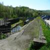
Bugsworth (end of navigation) 
Termination of the canal
Navigation Inn, Knowltop, Brookside, Buxworth SK23 7NH, United Kingdom

Bugsworth (end of navigation)
is a major waterways place
at the end of the Peak Forest Canal (Upper); past
Whaley Bridge Branch Junction (Junction with Whaley Bridge Branch) (6½ furlongs
to the west).
The nearest place in the direction of Whaley Bridge Branch Junction is Navigation Inn (Buxworth) (Closed as of Spring 2025);
¼ furlongs
away.
Mooring here is excellent (this is a really good mooring), mooring rings or bollards are available. Mooring is limited to 48 hours.
| Bugsworth (end of navigation) | ||
| Navigation Inn (Buxworth) | ¼ furlongs | |
| Bugsworth Upper Basin | ½ furlongs | |
| Bugsworth Bridge No 61 | ½ furlongs | |
| Bugsworth Middle Basin | ¾ furlongs | |
| Bugsworth Middle Basin Arm | ¾ furlongs | |
- Tramway wharf — associated with Peak Forest Canal (Upper)
- Historic tramway wharf, linking the upper and lower peak forest canal prior to the locks being built.
Mouseover for more information or show routes to facility
Nearest water point
In the direction of Marple Junction
Bugsworth Services — 2½ furlongs away
On this waterway in the direction of Marple Junction
Whaley Bridge Services — 1 mile, 2¼ furlongs away
Travel to Whaley Bridge Branch Junction, then on the Peak Forest Canal (Whaley Bridge Branch) to Whaley Bridge Services
Furness Vale Marina — 1 mile, 7 furlongs away
On this waterway in the direction of Marple Junction
Marple Services — 6 miles, 7 furlongs away
Travel to Marple Junction, then on the Macclesfield Canal to Marple Services
Braidbar Boats — 10 miles, 4½ furlongs away
Travel to Marple Junction, then on the Macclesfield Canal to Braidbar Boats
Bollington Wharf — 15 miles, 2½ furlongs away
Travel to Marple Junction, then on the Macclesfield Canal to Bollington Wharf
Swettenham Street Maintenance Yard — 18 miles, 2 furlongs away
Travel to Marple Junction, then on the Macclesfield Canal to Swettenham Street Maintenance Yard
Fairfield Junction — 17 miles, 3¼ furlongs and 16 locks away
Travel to Marple Junction, then on the Peak Forest Canal (Lower) to Dukinfield Junction, then on the Ashton Canal (Main Line) to Fairfield Junction
Grove Road Bridge No 96 — 19 miles, 7¼ furlongs and 24 locks away
Travel to Marple Junction, then on the Peak Forest Canal (Lower) to Dukinfield Junction, then on the Ashton Canal (Main Line) to Ashton-under-Lyne Junction, then on the Huddersfield Narrow Canal to Grove Road Bridge No 96Nearest rubbish disposal
In the direction of Marple Junction
Bugsworth Services — 2½ furlongs away
On this waterway in the direction of Marple Junction
Whaley Bridge Services — 1 mile, 2¼ furlongs away
Travel to Whaley Bridge Branch Junction, then on the Peak Forest Canal (Whaley Bridge Branch) to Whaley Bridge Services
Marple Services — 6 miles, 7 furlongs away
Travel to Marple Junction, then on the Macclesfield Canal to Marple Services
Braidbar Boats — 10 miles, 4½ furlongs away
Travel to Marple Junction, then on the Macclesfield Canal to Braidbar Boats
Marple Bottom Lock Bridge Winding Hole — 7 miles, 7 furlongs and 16 locks away
Travel to Marple Junction, then on the Peak Forest Canal (Lower) to Marple Bottom Lock Bridge Winding HoleNearest chemical toilet disposal
In the direction of Marple Junction
Bugsworth Services — 2½ furlongs away
On this waterway in the direction of Marple Junction
Whaley Bridge Services — 1 mile, 2¼ furlongs away
Travel to Whaley Bridge Branch Junction, then on the Peak Forest Canal (Whaley Bridge Branch) to Whaley Bridge Services
Furness Vale Marina — 1 mile, 7 furlongs away
On this waterway in the direction of Marple Junction
Marple Services — 6 miles, 7 furlongs away
Travel to Marple Junction, then on the Macclesfield Canal to Marple Services
Bollington Wharf — 15 miles, 2½ furlongs away
Travel to Marple Junction, then on the Macclesfield Canal to Bollington Wharf
Swettenham Wharf — 18 miles, 1¾ furlongs away
Travel to Marple Junction, then on the Macclesfield Canal to Swettenham Wharf
Fairfield Junction — 17 miles, 3¼ furlongs and 16 locks away
Travel to Marple Junction, then on the Peak Forest Canal (Lower) to Dukinfield Junction, then on the Ashton Canal (Main Line) to Fairfield Junction
Grove Road Bridge No 96 — 19 miles, 7¼ furlongs and 24 locks away
Travel to Marple Junction, then on the Peak Forest Canal (Lower) to Dukinfield Junction, then on the Ashton Canal (Main Line) to Ashton-under-Lyne Junction, then on the Huddersfield Narrow Canal to Grove Road Bridge No 96Nearest place to turn
In the direction of Marple Junction
Bugsworth Upper Basin — ½ furlongs away
On this waterway in the direction of Marple Junction
Bugsworth Middle Basin Arm — ¾ furlongs away
On this waterway in the direction of Marple Junction
The Wide — 1¾ furlongs away
On this waterway in the direction of Marple Junction
Bugsworth Lower Basin Arm — 2¼ furlongs away
On this waterway in the direction of Marple Junction
Bugsworth Lower Basin — 2½ furlongs away
On this waterway in the direction of Marple Junction
Whaley Bridge Branch Junction — 6½ furlongs away
On this waterway in the direction of Marple Junction
Whaley Bridge Winding Hole — 1 mile, 2 furlongs away
Travel to Whaley Bridge Branch Junction, then on the Peak Forest Canal (Whaley Bridge Branch) to Whaley Bridge Winding Hole
Bank End Winding Hole — 2 miles, 5¼ furlongs away
On this waterway in the direction of Marple Junction
Disley Winding Hole — 3 miles, 2 furlongs away
On this waterway in the direction of Marple Junction
Turflea Winding Hole — 5 miles, 1½ furlongs away
On this waterway in the direction of Marple Junction
Hollinwood Lane Winding Hole — 5 miles, 3¾ furlongs away
On this waterway in the direction of Marple Junction
Top Lock Marine Marina — 6 miles, 5¾ furlongs away
On this waterway in the direction of Marple Junction
Marple Junction — 6 miles, 6½ furlongs away
On this waterway in the direction of Marple Junction
Winding Hole between Church Lane and Eccles Bridges — 7 miles, 1¼ furlongs away
Travel to Marple Junction, then on the Macclesfield Canal to Winding Hole between Church Lane and Eccles Bridges
Junction with High Lane Branch — 9 miles, 1½ furlongs away
Travel to Marple Junction, then on the Macclesfield Canal to Junction with High Lane Branch
Brownhills Bridge Winding Hole — 10 miles, 4¾ furlongs away
Travel to Marple Junction, then on the Macclesfield Canal to Brownhills Bridge Winding Hole
Winding Hole below Lock 13 — 6 miles, 7¾ furlongs and 4 locks away
Travel to Marple Junction, then on the Peak Forest Canal (Lower) to Winding Hole below Lock 13
Higher Poynton Winding Hole — 10 miles, 6¾ furlongs away
Travel to Marple Junction, then on the Macclesfield Canal to Higher Poynton Winding Hole
Grimshaws Bridge Winding Hole — 12 miles, ¼ furlongs away
Travel to Marple Junction, then on the Macclesfield Canal to Grimshaws Bridge Winding Hole
Ryles Bridge Winding Hole — 12 miles, 7½ furlongs away
Travel to Marple Junction, then on the Macclesfield Canal to Ryles Bridge Winding HoleNearest boatyard pump-out
In the direction of Marple Junction
New Mills Marina — 2 miles, 6¼ furlongs away
On this waterway in the direction of Marple Junction
Braidbar Boats — 10 miles, 4½ furlongs away
Travel to Marple Junction, then on the Macclesfield Canal to Braidbar Boats
Bollington Wharf — 15 miles, 2½ furlongs away
Travel to Marple Junction, then on the Macclesfield Canal to Bollington Wharf
Kerridge Dry Dock — 15 miles, 5¼ furlongs away
Travel to Marple Junction, then on the Macclesfield Canal to Kerridge Dry Dock
Swettenham Wharf — 18 miles, 1¾ furlongs away
Travel to Marple Junction, then on the Macclesfield Canal to Swettenham Wharf
Portland Basin Arm — 14 miles, 6¾ furlongs and 16 locks away
Travel to Marple Junction, then on the Peak Forest Canal (Lower) to Portland Basin ArmNo information
CanalPlan has no information on any of the following facilities within range:self-operated pump-out
Direction of TV transmitter (From Wolfbane Cybernetic)
Bugsworth Basin from Narrowboat Just Heaven posted Wednesday the 9th of September, 2020
Wikipedia has a page about Bugsworth
Buxworth is a village in the High Peak of Derbyshire, England. The area, which was once an important centre for the limestone industry, became the terminus of the Peak Forest Canal. Its pub, the Navigation Inn, was once owned by Coronation Street actress Pat Phoenix.
The village lies almost 2 miles (3.2 km) from Whaley Bridge and about 18 miles (29 km) southeast of Manchester.
Other Wikipedia pages that might relate to Bugsworth
[Buxworth]
miles (29 km) southeast of Manchester. The village was originally called Bugsworth, from the Old English Bucga's Worth ("Bucga's Enclosure"), but in the
[Bugsworth Basin]
Bugsworth Basin is a canal basin at the terminus of the Peak Forest Canal. It is located at Buxworth (formerly Bugsworth) in the valley of the Black Brook
[Peak Forest Canal]
upper Macclesfield Canal, allowing boats to cruise from Whaley Bridge or Bugsworth all the way to the top lock at Bosley without having to use a lock. The
[Peak Forest Tramway]
Milton to Dove Holes. However, it was decided to start the tramway at Bugsworth (now called Buxworth) and, as built, it was about 6 miles (10 kilometres)
[Bugsworth Basin Heritage Trust]
The Bugsworth Basin Heritage Trust (BBHT), formerly known as the Inland Waterways Protection Society (IWPS), is a British organisation founded in 1958
[Buxworth railway station]
(goods trains already having run for several months). The station at Bugsworth also opened on 1 February 1867. The station was renamed Buxworth on 4
[List of places in Derbyshire]
Brimington Broadmeadows Brookbottom Brosscroft Brosterfield Brough Brushfield Bugsworth Bullbridge Burbage Burley Hill Burnaston Burntheath Butterley Buxton Buxworth
[Peak District]
quarries at Dove Holes for the construction industry. It terminated at Bugsworth Basin and the journey was completed using the Peak Forest Tramway. The
[Narrowboat]
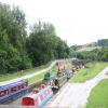
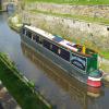
Modern narrowboats for leisure cruising, Bugsworth Basin, Buxworth, Derbyshire, England
[Peak Forest]
reached nearer than Buxworth, seven miles away, where it terminates at Bugsworth Basin. Instead, a horse-drawn tramway, the Peak Forest Tramway, was constructed
Results of Google Search
The site adjoins the western end of the Navigation Inn and for identification purposes they are referred to as the Navigation Kilns. No remains are visible today ...
End of last morning of trip. On the Peak Forest Canal (Upper), at Bugsworth (end of navigation). This is 6 miles, 6½ furlongs of narrow canals and ...
Restaurants near Bugsworth Basin, Whaley Bridge on Tripadvisor: Find traveler reviews ... Navigation Inn - Bugsworth Basin ... 0.8 miles from Bugsworth Basin ... “Great end to fab walk” 10/29/2020; “Nice pub in a rural location” 10/27/2020.
Buxworth, Derbyshire ... 22 Follow the towpath to Bugsworth Basin and the Navigation Inn. ... at the end of the car park to join the Peak Forest Tramway Trail.
The Peak Forest Canal is a narrow (7-foot (2.13 m) gauge) locked artificial waterway in ... Navigation authority, Canal & River Trust ... It terminates at Bugsworth Basin, Derbyshire (grid reference SK021820), a distance of 6.9 miles ( 11.1 km). ... At the same time as Outram was working on the lower end, he came under ...
How do I end navigation? In order to delete a destination or to cancel your current route guidance, follow the steps below: 1.
Buxworth is a village in the High Peak of Derbyshire, England. The area, which was once an important centre for the limestone industry, became the terminus of the Peak Forest Canal. Its pub, the Navigation Inn, was once owned by Coronation Street actress Pat ... Chinley, and just beyond the end of the bypass on the way south to Buxton).

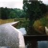
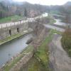


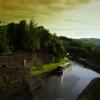



![Bugsworth Basin north-east of Whaley Bridge in Derbyshire. Peak Forest Canal on a gloomy September morning.Bugsworth Basin near Whaley Bridge was built in 1796 to form an inland port to receive, then distribute limestone along the canals of Britain. Stone was brought down from the quarries on tramways, one of which ran down here towards the camera and the north wharf of the Upper Basin. Overall, the site is listed as a Scheduled Ancient Monument. http://www.penninewaterways.co.uk/peak/pf9.htm[[[6254492]]] by Roger D Kidd – 07 September 2014](https://s1.geograph.org.uk/geophotos/06/25/52/6255297_2a43b0b4_120x120.jpg)


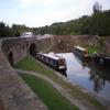
![Upper Basin, Bugsworth, Peak Forest Canal, Derbyshire. Bugsworth Basin near Whaley Bridge was built in 1796 to form an inland port to receive, then distribute limestone along the canals of Britain. On the right on the pathway can be seen the stone sleepers which supported rails for the tramway bringing stone down from the quarries.(see [[[450090]]]) Excellent information about its history, decline, and restoration can be seen at:http://www.penninewaterways.co.uk/peak/pf9.htm . by Roger D Kidd – 25 August 2007](https://s0.geograph.org.uk/photos/57/21/572180_22751938_120x120.jpg)
![The Navigation Inn, Bugsworth Basin. A popular free house. For additional information see earlier photo by contributor Roger Kidd: [[572130]]. by Trevor Harris – 12 June 2014](https://s1.geograph.org.uk/geophotos/04/02/72/4027257_14766841_120x120.jpg)
![Navigation Inn, Buxworth. Similar to [[572130]] but with a new colour scheme since that was taken. by Dave Dunford – 02 October 2014](https://s2.geograph.org.uk/geophotos/04/20/21/4202154_08bbc344_120x120.jpg)


