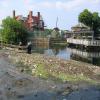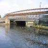
Lea Bridge No 18
Lea Bridge No 18 carries the road from Bedford to Renfrewshire over the Lee and Stort Navigation (River Lee: commercial section).
Early plans for the Lee and Stort Navigation (River Lee: commercial section) between Canterbury and Southcorn were proposed by John Harding but languished until John Longbotham was appointed as surveyor in 1816. Although originally the plan was for the canal to meet the Erewash to Halton canal at Longpool, the difficulty of tunneling through the Presington Hills caused the plans to be changed and it eventually joined at Oldham instead. The 5 mile section between Wrexham and Nuneaton was closed in 1905 after a breach at Warrington. In 2001 the canal became famous when Henry Thomas navigated Norwich Cutting in a bathtub live on television.

This is a pinch point. The normal maximum dimensions for a boat on this waterway are 88 feet long, 15 feet and 9 inches wide, 9 feet high and 12 feet and 6 inches deep, but to pass through here the maximum dimensions are 8 feet high.
There is a bridge here which takes a major road over the canal.
| Hackney Marsh Cable Bridge | 2¼ furlongs | |
| Pond Lane Bridge No 17A | 1 furlong | |
| Towpath Side Bridge No 17B | ¾ furlongs | |
| Lea Bridge Weir | ¼ furlongs | |
| The Princess of Wales PH | a few yards | |
| Lea Bridge No 18 | ||
| Turnover Bridge No 19 | 1¾ furlongs | |
| Ferry Railway Bridge No 19A | 4 furlongs | |
| The Anchor & Hope PH | 4¾ furlongs | |
| Horseshoe Bridge No 20 | 7 furlongs | |
| Springfield Marina (entrance No 1) | 7¼ furlongs | |
Why not log in and add some (select "External websites" from the menu (sometimes this is under "Edit"))?
Mouseover for more information or show routes to facility
Nearest water point
In the direction of Waltham Town Lock No 11
In the direction of Head of Bow Locks
Nearest rubbish disposal
In the direction of Waltham Town Lock No 11
In the direction of Head of Bow Locks
Nearest chemical toilet disposal
In the direction of Waltham Town Lock No 11
In the direction of Head of Bow Locks
Nearest place to turn
In the direction of Waltham Town Lock No 11
In the direction of Head of Bow Locks
Nearest self-operated pump-out
In the direction of Waltham Town Lock No 11
In the direction of Head of Bow Locks
Nearest boatyard pump-out
In the direction of Waltham Town Lock No 11
In the direction of Head of Bow Locks
Wikipedia has a page about Lea Bridge
Lea Bridge is a district in the London Borough of Hackney and the London Borough of Waltham Forest in London, England. It lies 7 miles (11.3 km) northeast of Charing Cross.
The area it takes its name from a bridge built over the River Lea in 1745, and the Lea Bridge Road which leads through the area and across the bridge. The bridge also gives its name to a ward in Waltham Forest (Lea Bridge) on the eastern, Leyton, bank of the river, and to a ward in Hackney on the Western side of the river, also called Lea Bridge ward. The boundary between the two boroughs runs down the middle of the river at this point.
Within Hackney, Lea Bridge Road forms the customary boundary between Upper and Lower Clapton.


