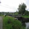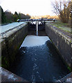
Clobberhill Top Lock No 28
is a minor waterways place
on the Forth and Clyde Canal (Main Line) between
Stockingfield Junction (Junction with the Port Dundas branch) (2 miles and 6½ furlongs
and 7 locks
to the east) and
Clyde Canal Junction (Junction of the River Clyde and the Forth and Clyde Canal) (6 miles and 5¾ furlongs
and 12 locks
to the west).
The nearest place in the direction of Stockingfield Junction is Westerton Footbridge;
2½ furlongs
away.
The nearest place in the direction of Clyde Canal Junction is Clobberhill Middle Lock No 29;
½ furlongs
away.
Mooring here is unrated.
This is a lock, the rise of which is not known.
| Temple Lock No 27 | 1 mile, 2¼ furlongs | |
| Temple Road Bridge | 1 mile, 1¾ furlongs | |
| Howth Drive Bridge | 1 mile, ¾ furlongs | |
| Old Farm Road Bridge | 6¾ furlongs | |
| Westerton Footbridge | 2½ furlongs | |
| Clobberhill Top Lock No 28 | ||
| Clobberhill Middle Lock No 29 | ½ furlongs | |
| Clobberhill Bottom Lock No 30 | 1 furlong | |
| Clobberhill Lock No 31 | 2¾ furlongs | |
| Clobberhill Lock No 32 | 3¼ furlongs | |
| Great Western Road Bridge (north) | 5¼ furlongs | |
Amenities nearby at Westerton Footbridge
- Youtube — associated with Forth and Clyde Canal
- The official reopening of the canal
Mouseover for more information or show routes to facility
Nearest place to turn
In the direction of River Carron - Forth and Clyde Canal Junction
Applecross Street Basin — 4 miles, 5¾ furlongs and 8 locks away
Travel to Stockingfield Junction, then on the Forth and Clyde Canal (Port Dundas Branch - Main Line) to Firhill Road Basin (northern entrance), then on the Forth and Clyde Canal (Port Dundas Branch - Firhill Road Basin) to Firhill Road Basin (southern entrance), then on the Forth and Clyde Canal (Port Dundas Branch - Main Line) to Applecross Street Basin
Craighall Road Basin Western Winding Hole — 5 miles, 1¾ furlongs and 9 locks away
Travel to Stockingfield Junction, then on the Forth and Clyde Canal (Port Dundas Branch - Main Line) to Firhill Road Basin (northern entrance), then on the Forth and Clyde Canal (Port Dundas Branch - Firhill Road Basin) to Firhill Road Basin (southern entrance), then on the Forth and Clyde Canal (Port Dundas Branch - Main Line) to Craighall Road Basin Western Winding Hole
Craighall Road Basin — 5 miles, 2¼ furlongs and 9 locks away
Travel to Stockingfield Junction, then on the Forth and Clyde Canal (Port Dundas Branch - Main Line) to Firhill Road Basin (northern entrance), then on the Forth and Clyde Canal (Port Dundas Branch - Firhill Road Basin) to Firhill Road Basin (southern entrance), then on the Forth and Clyde Canal (Port Dundas Branch - Main Line) to Craighall Road Basin
Port Dundas Basin — 5 miles, 4¼ furlongs and 10 locks away
Travel to Stockingfield Junction, then on the Forth and Clyde Canal (Port Dundas Branch - Main Line) to Firhill Road Basin (northern entrance), then on the Forth and Clyde Canal (Port Dundas Branch - Firhill Road Basin) to Firhill Road Basin (southern entrance), then on the Forth and Clyde Canal (Port Dundas Branch - Main Line) to Port Dundas Basin
Luggiebank Road Winding Hole — 9 miles, 6½ furlongs and 8 locks away
On this waterway in the direction of River Carron - Forth and Clyde Canal Junction
Auchinstarry Winding Hole — 15 miles, ½ furlongs and 8 locks away
On this waterway in the direction of River Carron - Forth and Clyde Canal Junction
Craigmarloch Basin — 15 miles, 7 furlongs and 8 locks away
On this waterway in the direction of River Carron - Forth and Clyde Canal Junction
Wyndford Lock Winding Hole — 17 miles, 1¾ furlongs and 8 locks away
On this waterway in the direction of River Carron - Forth and Clyde Canal Junction
In the direction of Clyde Canal Junction
Bowling Basin — 6 miles, 4 furlongs and 12 locks away
On this waterway in the direction of Clyde Canal JunctionNo information
CanalPlan has no information on any of the following facilities within range:water point
rubbish disposal
chemical toilet disposal
self-operated pump-out
boatyard pump-out
Direction of TV transmitter (From Wolfbane Cybernetic)
There is no page on Wikipedia called “Clobberhill Top Lock”
Wikipedia pages that might relate to Clobberhill Top Lock
[Forth and Clyde Canal]
– Wyndford Lock No. 20 (summit level) 21 – Maryhill Top Lock No. 21 (summit level) 22 – Maryhill Lock 23 – Maryhill Lock 24 – Maryhill Lock 25 – Maryhill
Results of Google Search
26); 27 – Temple Lock No. 27; 28 – Cloberhill Top Lock No. 28; 29 – Cloberhill Middle Lock No. 29; 30 – Cloberhill Bottom Lock No. 30; 31 – Cloberhill Lock No.
The highest section of the canal passes close to Kilsyth and is fed by an aqueduct ... 27 *28 - Cloberhill Top Lock No. 28 *29 - Cloberhill Middle Lock No. 29
Aug 18, 2007 ... 28 - Cloberhill Top Lock No. 28; 29 - Cloberhill Middle Lock No. 29; 30 - Cloberhill Bottom Lock No. 30; 31 - Cloberhill Lock No. 31; 32 - ...
16. THEMATIC CATEGORY. 28. NO.OF STORIES , , 1'1. TOWNSHIP. RANGE. SECTION ... WE~st elev. Roof top porch is accessed from second floor main gldg. ... Realtv World-Cloberhill. 6/SS. 5. ... Double row lock seg. arch window heads.
At very high tide there's not much beach but at other times there's plenty of sand. ... Another attractive flight of locks, 28-32, Clobberhill, leads to a footbridge with the ... Best Celebrity Diets – Celebrity Diet Tricks for Summer · I Set up Running ...
16. THEMATIC CATEGORY. 28. NO.OF STORIES , , 1'1. TOWNSHIP. RANGE. SECTION ... WE~st elev. Roof top porch is accessed from second floor main gldg. ... Realtv World-Cloberhill. 6/SS. 5. ... Double row lock seg. arch window heads.


![The view from Westfield Drive. Looking towards the prominent tower blocks in Linkswood Crescent in Drumchapel. From this angle it appears there is just one large tower block. In fact there are two [[6212913]]. by Richard Sutcliffe – 09 February 2023](https://s1.geograph.org.uk/geophotos/07/40/20/7402001_41cb4d16_120x120.jpg)

![Path near the Forth and Clyde Canal. Canal themed panels in the path between the canal and Rotherwood Avenue. Perhaps intended to reflect the arc of the steps at the nearby lock gates? [[6391140]]. by Thomas Nugent – 31 December 2019](https://s2.geograph.org.uk/geophotos/06/39/11/6391146_b1d4ca24_120x120.jpg)


