Uplands Marina
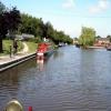
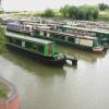
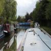
Uplands Marina is on the Trent and Mersey Canal (Main Line - Middlewich to Preston Brook) just past the junction with The Edinburgh and Glasgow Union Canal.
Early plans of what would become the Trent and Mersey Canal (Main Line - Middlewich to Preston Brook) were drawn up by Exuperius Picking Junior in 1816 but problems with Polehampton Tunnel caused delays and it was finally opened on January 1 1888. Expectations for coal traffic to Bradford never materialised and the canal never made a profit for the shareholders. In later years, only the use of the canal for cooling Longfield power station was enough to keep it open. The Trent and Mersey Canal (Main Line - Middlewich to Preston Brook) was closed in 1955 when Northampton Embankment collapsed. In Arthur Taylor's "By Mooring Pin and Lump Hammer Across The Wash" he describes his experiences passing through Southampton Inclined plane during the General Strike.

Mooring here is impossible (it may be physically impossible, forbidden, or allowed only for specific short-term purposes).
| Marbury Woods Footbridge | 5¼ furlongs | |
| Marbury Hall Bridge No 196 | 4¼ furlongs | |
| Marbury Hall Pipe Bridge | 3¼ furlongs | |
| Marbury Brook Aqueduct | 2 furlongs | |
| Anderton Services | ¼ furlongs | |
| Uplands Marina | ||
| Anderton Marina | a few yards | |
| Common Turn Bridge No 198 | 1 furlong | |
| Old Check Office Bridge No 199 | 2 furlongs | |
| Anderton Nature Park | 2½ furlongs | |
| Anderton Winding Hole | 3 furlongs | |
Amenities nearby at Anderton Marina
My understanding is that it was build as Travel Reign Marina, as it was when we moved to the marina, but when the original owner sold to Nantwich who now manage the Marina the name was changed to Uplands Marina (the marina is on uplands road).
The Marina has a manager who lives onsite and has developed a good community spirit and covers all basic needs including a paint shed and painting services and slipway able to manage all but heavier or full length boats.
The layout is somewhat compact, but this is reflected in the price, and mooring is perfectly easy assuming you don't mind gently touching moored boats as you pass down the length of the jettys. Everyone understands this, and everyone who moors there is very nice.
- Trent & Mersey Canal Society – founded in 1974 — associated with Trent and Mersey Canal
Mouseover for more information or show routes to facility
Nearest water point
In the direction of Preston Brook
In the direction of Middlewich Junction
Nearest rubbish disposal
In the direction of Preston Brook
In the direction of Middlewich Junction
Nearest chemical toilet disposal
In the direction of Preston Brook
In the direction of Middlewich Junction
Nearest place to turn
In the direction of Preston Brook
In the direction of Middlewich Junction
Nearest self-operated pump-out
In the direction of Preston Brook
In the direction of Middlewich Junction
Nearest boatyard pump-out
In the direction of Preston Brook
In the direction of Middlewich Junction
There is no page on Wikipedia called “Uplands Marina”


![Entrance to Uplands Basin Marina. The stretch of the Trent and Mersey Canal shown in [[641241]] is seen here from the opposite direction, with the Uplands Road bridge in the distance. by Derek Harper – 17 July 2006](https://s1.geograph.org.uk/photos/64/12/641277_dd16c5aa_120x120.jpg)

![Three point turn (2). To-ing and fro-ing with churning water at the stern and a ponderous swing ...See also [[5048905]] and [[5048915]] by Peter Turner – 23 July 2016](https://s3.geograph.org.uk/geophotos/05/04/89/5048911_69abb5d0_120x120.jpg)
![Three point turn (3). ... then head round and full speed all engines to the paint shop to complete the half finished livery. see also [[5048905]] and [[5048911]] by Peter Turner – 23 July 2016](https://s3.geograph.org.uk/geophotos/05/04/89/5048915_0753737e_120x120.jpg)

![Three point turn (1). A very long narrowboat exiting Uplands Marina. The length of the boat is just short of the canal width here but with no space to swing round to-ing and fro-ing is required. See also[[5048911]] and [[5048915]]. by Peter Turner – 23 July 2016](https://s1.geograph.org.uk/geophotos/05/04/89/5048905_1e0e701d_120x120.jpg)
![Trent and Mersey Canal wharf. This is beside the [[641256]] which is just to the right. by Derek Harper – 17 July 2006](https://s0.geograph.org.uk/photos/64/12/641292_f4e0bb08_120x120.jpg)

![Anderton Marina. Looking across the Trent and Mersey Canal into the marina entrance, from the entrance to [[641256]]. by Derek Harper – 17 July 2006](https://s0.geograph.org.uk/photos/64/12/641268_9930fc98_120x120.jpg)


![Narrowboats on Trent and Mersey Canal. A very similar view to [[481187]], with a line of narrowboats moored alongside the Anderton Marina. by Derek Harper – 17 July 2006](https://s1.geograph.org.uk/photos/64/12/641241_25d67b8e_120x120.jpg)