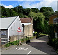
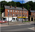
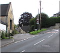
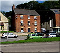
Site of Brimscombe Port Swing Bridge
Simply Fish & Chips, London Road, Stroud GL5 2SF, United Kingdom

Site of Brimscombe Port Swing Bridge
is a minor waterways place
on the Cotswold Canals (Thames and Severn Canal - Wide section) between
Bourne Lock No 8 (Rescued 1995) (2 furlongs
to the east) and
Site of Entrance to Wallbridge Basin (The junction between the Stroudwater Navigation and the Thames & Severn Canal.) (2 miles and 5¼ furlongs
and 7 locks
to the northwest).
The nearest place in the direction of Bourne Lock No 8 is Port Mill (Woollen);
a few yards
away.
The nearest place in the direction of Site of Entrance to Wallbridge Basin is Site of River Frome Aqueduct;
¾ furlongs
away.
Mooring here is unrated.
This is the site of a bridge, the canal may be narrow as a consequence.
| Bourne Mill Bridge | 2 furlongs | |
| Site of Brimscombe Foundry | 1¼ furlongs | |
| Brimscombe Port | ¾ furlongs | |
| Former Salt Warehouse | ¼ furlongs | |
| Port Mill (Woollen) | a few yards | |
| Site of Brimscombe Port Swing Bridge | ||
| Site of River Frome Aqueduct | ¾ furlongs | |
| Brimscombe Corner Bridge | ¾ furlongs | |
| The Ship Inn (Brimscombe) | 1 furlong | |
| Site of Brimscombe Mill (Woollen) | 1¾ furlongs | |
| Goughs Orchard Lock No 7 | 2 furlongs | |
There are no links to external websites from here.
Why not log in and add some (select "External websites" from the menu (sometimes this is under "Edit"))?
Why not log in and add some (select "External websites" from the menu (sometimes this is under "Edit"))?
Mouseover for more information or show routes to facility
Nearest water point
In the direction of Site of Entrance to Wallbridge Basin
Saul Junction Marina — 9 miles, 3 furlongs and 19 locks away
Travel to Site of Entrance to Wallbridge Basin, then on the Cotswold Canals (Stroudwater Navigation - Un-navigable Section) to Walk Bridge, then on the Cotswold Canals (Stroudwater Navigation - Navigable Section) to Saul Junction Marina
Saul Junction Winding Hole — 9 miles, 4½ furlongs and 19 locks away
Travel to Site of Entrance to Wallbridge Basin, then on the Cotswold Canals (Stroudwater Navigation - Un-navigable Section) to Walk Bridge, then on the Cotswold Canals (Stroudwater Navigation - Navigable Section) to Saul Junction, then on the Gloucester and Sharpness Canal to Saul Junction Winding Hole
Cotswold Canals Trust Visitor Centre - Saul Junction — 9 miles, 5¼ furlongs and 19 locks away
Travel to Site of Entrance to Wallbridge Basin, then on the Cotswold Canals (Stroudwater Navigation - Un-navigable Section) to Walk Bridge, then on the Cotswold Canals (Stroudwater Navigation - Navigable Section) to Saul Junction, then on the Gloucester and Sharpness Canal to Cotswold Canals Trust Visitor Centre - Saul Junction
Fretherne Bridge — 10 miles, 2½ furlongs and 19 locks away
Travel to Site of Entrance to Wallbridge Basin, then on the Cotswold Canals (Stroudwater Navigation - Un-navigable Section) to Walk Bridge, then on the Cotswold Canals (Stroudwater Navigation - Navigable Section) to Saul Junction, then on the Gloucester and Sharpness Canal to Fretherne Bridge
Splatt Bridge — 11 miles, 3¼ furlongs and 19 locks away
Travel to Site of Entrance to Wallbridge Basin, then on the Cotswold Canals (Stroudwater Navigation - Un-navigable Section) to Walk Bridge, then on the Cotswold Canals (Stroudwater Navigation - Navigable Section) to Saul Junction, then on the Gloucester and Sharpness Canal to Splatt Bridge
Patch Bridge — 13 miles, 2 furlongs and 19 locks away
Travel to Site of Entrance to Wallbridge Basin, then on the Cotswold Canals (Stroudwater Navigation - Un-navigable Section) to Walk Bridge, then on the Cotswold Canals (Stroudwater Navigation - Navigable Section) to Saul Junction, then on the Gloucester and Sharpness Canal to Patch Bridge
Sellars Bridge — 13 miles, 2¼ furlongs and 19 locks away
Travel to Site of Entrance to Wallbridge Basin, then on the Cotswold Canals (Stroudwater Navigation - Un-navigable Section) to Walk Bridge, then on the Cotswold Canals (Stroudwater Navigation - Navigable Section) to Saul Junction, then on the Gloucester and Sharpness Canal to Sellars Bridge
Purton Lower Bridge — 15 miles, 5¾ furlongs and 19 locks away
Travel to Site of Entrance to Wallbridge Basin, then on the Cotswold Canals (Stroudwater Navigation - Un-navigable Section) to Walk Bridge, then on the Cotswold Canals (Stroudwater Navigation - Navigable Section) to Saul Junction, then on the Gloucester and Sharpness Canal to Purton Lower Bridge
Llanthony Pontoons — 17 miles, ¼ furlongs and 19 locks away
Travel to Site of Entrance to Wallbridge Basin, then on the Cotswold Canals (Stroudwater Navigation - Un-navigable Section) to Walk Bridge, then on the Cotswold Canals (Stroudwater Navigation - Navigable Section) to Saul Junction, then on the Gloucester and Sharpness Canal to Llanthony Pontoons
Llanthony Road Bridge — 17 miles, 1 furlong and 19 locks away
Travel to Site of Entrance to Wallbridge Basin, then on the Cotswold Canals (Stroudwater Navigation - Un-navigable Section) to Walk Bridge, then on the Cotswold Canals (Stroudwater Navigation - Navigable Section) to Saul Junction, then on the Gloucester and Sharpness Canal to Llanthony Road Bridge
Gloucester Waterways Museum Arm — 17 miles, 1½ furlongs and 19 locks away
Travel to Site of Entrance to Wallbridge Basin, then on the Cotswold Canals (Stroudwater Navigation - Un-navigable Section) to Walk Bridge, then on the Cotswold Canals (Stroudwater Navigation - Navigable Section) to Saul Junction, then on the Gloucester and Sharpness Canal to Gloucester Waterways Museum Arm
Gloucester Dock Lock — 17 miles, 2¼ furlongs and 19 locks away
Travel to Site of Entrance to Wallbridge Basin, then on the Cotswold Canals (Stroudwater Navigation - Un-navigable Section) to Walk Bridge, then on the Cotswold Canals (Stroudwater Navigation - Navigable Section) to Saul Junction, then on the Gloucester and Sharpness Canal to Gloucester Dock LockNearest rubbish disposal
In the direction of Site of Entrance to Wallbridge Basin
Saul Junction Marina — 9 miles, 3 furlongs and 19 locks away
Travel to Site of Entrance to Wallbridge Basin, then on the Cotswold Canals (Stroudwater Navigation - Un-navigable Section) to Walk Bridge, then on the Cotswold Canals (Stroudwater Navigation - Navigable Section) to Saul Junction Marina
Saul Junction Winding Hole — 9 miles, 4½ furlongs and 19 locks away
Travel to Site of Entrance to Wallbridge Basin, then on the Cotswold Canals (Stroudwater Navigation - Un-navigable Section) to Walk Bridge, then on the Cotswold Canals (Stroudwater Navigation - Navigable Section) to Saul Junction, then on the Gloucester and Sharpness Canal to Saul Junction Winding Hole
Fretherne Bridge — 10 miles, 2½ furlongs and 19 locks away
Travel to Site of Entrance to Wallbridge Basin, then on the Cotswold Canals (Stroudwater Navigation - Un-navigable Section) to Walk Bridge, then on the Cotswold Canals (Stroudwater Navigation - Navigable Section) to Saul Junction, then on the Gloucester and Sharpness Canal to Fretherne Bridge
Parkend Bridge — 11 miles, ¾ furlongs and 19 locks away
Travel to Site of Entrance to Wallbridge Basin, then on the Cotswold Canals (Stroudwater Navigation - Un-navigable Section) to Walk Bridge, then on the Cotswold Canals (Stroudwater Navigation - Navigable Section) to Saul Junction, then on the Gloucester and Sharpness Canal to Parkend Bridge
Splatt Bridge — 11 miles, 3¼ furlongs and 19 locks away
Travel to Site of Entrance to Wallbridge Basin, then on the Cotswold Canals (Stroudwater Navigation - Un-navigable Section) to Walk Bridge, then on the Cotswold Canals (Stroudwater Navigation - Navigable Section) to Saul Junction, then on the Gloucester and Sharpness Canal to Splatt Bridge
Patch Bridge — 13 miles, 2 furlongs and 19 locks away
Travel to Site of Entrance to Wallbridge Basin, then on the Cotswold Canals (Stroudwater Navigation - Un-navigable Section) to Walk Bridge, then on the Cotswold Canals (Stroudwater Navigation - Navigable Section) to Saul Junction, then on the Gloucester and Sharpness Canal to Patch Bridge
Sellars Bridge — 13 miles, 2¼ furlongs and 19 locks away
Travel to Site of Entrance to Wallbridge Basin, then on the Cotswold Canals (Stroudwater Navigation - Un-navigable Section) to Walk Bridge, then on the Cotswold Canals (Stroudwater Navigation - Navigable Section) to Saul Junction, then on the Gloucester and Sharpness Canal to Sellars Bridge
Purton Lower Bridge — 15 miles, 5¾ furlongs and 19 locks away
Travel to Site of Entrance to Wallbridge Basin, then on the Cotswold Canals (Stroudwater Navigation - Un-navigable Section) to Walk Bridge, then on the Cotswold Canals (Stroudwater Navigation - Navigable Section) to Saul Junction, then on the Gloucester and Sharpness Canal to Purton Lower Bridge
Sharpness Barge Arm — 17 miles, 1 furlong and 19 locks away
Travel to Site of Entrance to Wallbridge Basin, then on the Cotswold Canals (Stroudwater Navigation - Un-navigable Section) to Walk Bridge, then on the Cotswold Canals (Stroudwater Navigation - Navigable Section) to Saul Junction, then on the Gloucester and Sharpness Canal to Sharpness Barge Arm
Llanthony Road Bridge — 17 miles, 1 furlong and 19 locks away
Travel to Site of Entrance to Wallbridge Basin, then on the Cotswold Canals (Stroudwater Navigation - Un-navigable Section) to Walk Bridge, then on the Cotswold Canals (Stroudwater Navigation - Navigable Section) to Saul Junction, then on the Gloucester and Sharpness Canal to Llanthony Road BridgeNearest chemical toilet disposal
In the direction of Site of Entrance to Wallbridge Basin
Saul Junction Marina — 9 miles, 3 furlongs and 19 locks away
Travel to Site of Entrance to Wallbridge Basin, then on the Cotswold Canals (Stroudwater Navigation - Un-navigable Section) to Walk Bridge, then on the Cotswold Canals (Stroudwater Navigation - Navigable Section) to Saul Junction Marina
Cotswold Canals Trust Visitor Centre - Saul Junction — 9 miles, 5¼ furlongs and 19 locks away
Travel to Site of Entrance to Wallbridge Basin, then on the Cotswold Canals (Stroudwater Navigation - Un-navigable Section) to Walk Bridge, then on the Cotswold Canals (Stroudwater Navigation - Navigable Section) to Saul Junction, then on the Gloucester and Sharpness Canal to Cotswold Canals Trust Visitor Centre - Saul Junction
Sharpness Barge Arm — 17 miles, 1 furlong and 19 locks away
Travel to Site of Entrance to Wallbridge Basin, then on the Cotswold Canals (Stroudwater Navigation - Un-navigable Section) to Walk Bridge, then on the Cotswold Canals (Stroudwater Navigation - Navigable Section) to Saul Junction, then on the Gloucester and Sharpness Canal to Sharpness Barge Arm
Llanthony Road Bridge — 17 miles, 1 furlong and 19 locks away
Travel to Site of Entrance to Wallbridge Basin, then on the Cotswold Canals (Stroudwater Navigation - Un-navigable Section) to Walk Bridge, then on the Cotswold Canals (Stroudwater Navigation - Navigable Section) to Saul Junction, then on the Gloucester and Sharpness Canal to Llanthony Road BridgeNearest place to turn
In the direction of Bourne Mill Bridge
Brimscombe Port — ¾ furlongs away
On this waterway in the direction of Bourne Mill Bridge
Latton Junction — 17 miles, 4½ furlongs and 32 locks away
Travel to Bourne Mill Bridge, then on the Cotswold Canals (Thames and Severn Canal - Wide/long lock section) to Bourne Bridge, then on the Cotswold Canals (Thames and Severn Canal - Main section) to Latton Junction
In the direction of Site of Entrance to Wallbridge Basin
Ryeford Winding Hole — 4 miles, 5¾ furlongs and 11 locks away
Travel to Site of Entrance to Wallbridge Basin, then on the Cotswold Canals (Stroudwater Navigation - Un-navigable Section) to Ryeford Winding Hole
The Ocean — 5 miles, 5½ furlongs and 11 locks away
Travel to Site of Entrance to Wallbridge Basin, then on the Cotswold Canals (Stroudwater Navigation - Un-navigable Section) to The Ocean
Saul Junction Winding Hole — 9 miles, 4½ furlongs and 19 locks away
Travel to Site of Entrance to Wallbridge Basin, then on the Cotswold Canals (Stroudwater Navigation - Un-navigable Section) to Walk Bridge, then on the Cotswold Canals (Stroudwater Navigation - Navigable Section) to Saul Junction, then on the Gloucester and Sharpness Canal to Saul Junction Winding Hole
Pegthorne Bridge Winding Hole — 10 miles, 1 furlong and 19 locks away
Travel to Site of Entrance to Wallbridge Basin, then on the Cotswold Canals (Stroudwater Navigation - Un-navigable Section) to Walk Bridge, then on the Cotswold Canals (Stroudwater Navigation - Navigable Section) to Saul Junction, then on the Gloucester and Sharpness Canal to Pegthorne Bridge Winding Hole
Quedgeley Oil Depot — 13 miles, 3½ furlongs and 19 locks away
Travel to Site of Entrance to Wallbridge Basin, then on the Cotswold Canals (Stroudwater Navigation - Un-navigable Section) to Walk Bridge, then on the Cotswold Canals (Stroudwater Navigation - Navigable Section) to Saul Junction, then on the Gloucester and Sharpness Canal to Quedgeley Oil Depot
Monk Meadow Dock — 16 miles, 5¾ furlongs and 19 locks away
Travel to Site of Entrance to Wallbridge Basin, then on the Cotswold Canals (Stroudwater Navigation - Un-navigable Section) to Walk Bridge, then on the Cotswold Canals (Stroudwater Navigation - Navigable Section) to Saul Junction, then on the Gloucester and Sharpness Canal to Monk Meadow Dock
Sharpness Barge Arm — 17 miles, 1 furlong and 19 locks away
Travel to Site of Entrance to Wallbridge Basin, then on the Cotswold Canals (Stroudwater Navigation - Un-navigable Section) to Walk Bridge, then on the Cotswold Canals (Stroudwater Navigation - Navigable Section) to Saul Junction, then on the Gloucester and Sharpness Canal to Sharpness Barge Arm
Gloucester Docks — 17 miles, 1¾ furlongs and 19 locks away
Travel to Site of Entrance to Wallbridge Basin, then on the Cotswold Canals (Stroudwater Navigation - Un-navigable Section) to Walk Bridge, then on the Cotswold Canals (Stroudwater Navigation - Navigable Section) to Saul Junction, then on the Gloucester and Sharpness Canal to Gloucester Docks
Waterways Office (South Wales and Severn Waterways) - Canal & River Trust — 17 miles, 2 furlongs and 19 locks away
Travel to Site of Entrance to Wallbridge Basin, then on the Cotswold Canals (Stroudwater Navigation - Un-navigable Section) to Walk Bridge, then on the Cotswold Canals (Stroudwater Navigation - Navigable Section) to Saul Junction, then on the Gloucester and Sharpness Canal to Waterways Office (South Wales and Severn Waterways) - Canal & River Trust
Gloucester / Sharpness - Severn Junction — 17 miles, 2½ furlongs and 20 locks away
Travel to Site of Entrance to Wallbridge Basin, then on the Cotswold Canals (Stroudwater Navigation - Un-navigable Section) to Walk Bridge, then on the Cotswold Canals (Stroudwater Navigation - Navigable Section) to Saul Junction, then on the Gloucester and Sharpness Canal to Gloucester / Sharpness - Severn Junction
Upper Parting Junction — 19 miles, 7¼ furlongs and 20 locks away
Travel to Site of Entrance to Wallbridge Basin, then on the Cotswold Canals (Stroudwater Navigation - Un-navigable Section) to Walk Bridge, then on the Cotswold Canals (Stroudwater Navigation - Navigable Section) to Saul Junction, then on the Gloucester and Sharpness Canal to Gloucester / Sharpness - Severn Junction, then on the River Severn (main river - Worcester to Gloucester) to Upper Parting Junction
Over Winding Hole — 19 miles, 2¼ furlongs and 21 locks away
Travel to Site of Entrance to Wallbridge Basin, then on the Cotswold Canals (Stroudwater Navigation - Un-navigable Section) to Walk Bridge, then on the Cotswold Canals (Stroudwater Navigation - Navigable Section) to Saul Junction, then on the Gloucester and Sharpness Canal to Gloucester / Sharpness - Severn Junction, then on the River Severn (old river navigation) to Lower Parting, then on the River Severn (Maisemore Channel - Southern Section) to Over Junction, then on the Hereford and Gloucester Canal to Over Winding HoleNearest self-operated pump-out
In the direction of Site of Entrance to Wallbridge Basin
Cotswold Canals Trust Visitor Centre - Saul Junction — 9 miles, 5¼ furlongs and 19 locks away
Travel to Site of Entrance to Wallbridge Basin, then on the Cotswold Canals (Stroudwater Navigation - Un-navigable Section) to Walk Bridge, then on the Cotswold Canals (Stroudwater Navigation - Navigable Section) to Saul Junction, then on the Gloucester and Sharpness Canal to Cotswold Canals Trust Visitor Centre - Saul Junction
Purton Lower Bridge — 15 miles, 5¾ furlongs and 19 locks away
Travel to Site of Entrance to Wallbridge Basin, then on the Cotswold Canals (Stroudwater Navigation - Un-navigable Section) to Walk Bridge, then on the Cotswold Canals (Stroudwater Navigation - Navigable Section) to Saul Junction, then on the Gloucester and Sharpness Canal to Purton Lower Bridge
Llanthony Pontoons — 17 miles, ¼ furlongs and 19 locks away
Travel to Site of Entrance to Wallbridge Basin, then on the Cotswold Canals (Stroudwater Navigation - Un-navigable Section) to Walk Bridge, then on the Cotswold Canals (Stroudwater Navigation - Navigable Section) to Saul Junction, then on the Gloucester and Sharpness Canal to Llanthony PontoonsNearest boatyard pump-out
In the direction of Site of Entrance to Wallbridge Basin
Saul Junction Marina — 9 miles, 3 furlongs and 19 locks away
Travel to Site of Entrance to Wallbridge Basin, then on the Cotswold Canals (Stroudwater Navigation - Un-navigable Section) to Walk Bridge, then on the Cotswold Canals (Stroudwater Navigation - Navigable Section) to Saul Junction Marina
Patch Bridge — 13 miles, 2 furlongs and 19 locks away
Travel to Site of Entrance to Wallbridge Basin, then on the Cotswold Canals (Stroudwater Navigation - Un-navigable Section) to Walk Bridge, then on the Cotswold Canals (Stroudwater Navigation - Navigable Section) to Saul Junction, then on the Gloucester and Sharpness Canal to Patch BridgeDirection of TV transmitter (From Wolfbane Cybernetic)
There is no page on Wikipedia called “Site of Brimscombe Port Swing Bridge”
Wikipedia pages that might relate to Site of Brimscombe Port Swing Bridge
[River Thames]
Many of the present-day road bridges are on the site of earlier fords, ferries and wooden bridges. At Swinford Bridge, a privately owned toll bridge, there
[Sharpness]
first the only stone quay was on the landward side of the dock, but after a railway swing bridge was built across the dock, the island area between the
[River Severn]
point to which the jurisdiction of the Gloucester Harbour Trustees extends), or at Aust, the site of the Severn Bridge. The Severn Estuary extends to a
[Severn Bridge Railway]
and cut up there. The final stage of removal of the bridge structure was the demolition of the Sharpness swing bridge, and this was completed on 13 May
[SS Mendi]
University of Natal Press. ISBN 0-86980-564-9. Nicol, Stuart (2001). MacQueen's Legacy; Ships of the Royal Mail Line. Two. Brimscombe Port and Charleston
[RMS Rhone]
of the Royal Mail Line. Two. Brimscombe Port and Charleston, SC: Tempus Publishing. pp. 58–64. ISBN 0-7524-2119-0. Martelli, Joan (2017) The Law of Storms:
[Gloucester and Sharpness Canal]
of channel was opened on 6 May 2006. In January 2009 a project began to replace the Patch Bridge swing bridge with a motor powered design instead of the
[Cotswold Line]
River Thames. Immediately east of the current line is the Rewley Road Swing Bridge over the channel which used to carry the London and North Western Railway's
[Severn Bridge railway station]
Severn Bridge railway station was a small station on the Severn Bridge Railway located close to the north west bank of the River Severn, 2 miles (3 km)
[Dean Forest Railway]
Unseen Steam. Retrieved 20 October 2016. Dean Forest Railway Website Historical site Dean Forest Diesel Association Dean Forest Railway Society Website
Results of Google Search
stand around the former Port site. the Port is to be regenerated ... existing mill that stood on Brimscombe Bridge, at the ... Proposed pedestrian swing bridge. 8.
Causeway on site of former swing bridge. ... Ebley Mill pedestrian swing bridge, 2013, SO 829046 ... Canal infilled to and through site of Brimscombe Port.
Prince Street Swing Bridge. If you need Prince Street Bridge opened then please contact us at least 12 hours in advance. Prince Street Bridge is normally ...
Wallbridge to Brimscombe Port. 1. Wallbridge Lower ... Site of Brimscombe Corner Bridge. Phase 1A. Infilled .... Site of swing bridge, near Ewen Wharf. Phase 3.
The Place. Soon to change once again into a thriving basin, Brimscombe Port was once a huge trans-shipment site, where goods were stored and re- distributed.
... access permitted) between Brimscombe Port, near Stroud to Gateway Bridge in the Cotswold Water Park. ... Site of swing bridge, near Ewen Wharf [more].
The Place. Busy with boats, people and cargo. It's hard to imagine this quiet little place as a very busy, industrial wharf. Now hidden behind a high wall, there ...
Prince Street Bridge is a swing bridge across Bristol Harbour. It is now Grade II listed. The bridge carries a road from Prince Street to Wapping Road and is located between the Arnolfini art centre and M Shed museum. The iron swing bridge was built in 1879 on the site of the ancient Gib ferry ... The Port of Bristol, 1848–1884.


