CanalPlanAC

Tan Yard Bridge No 66 

 
Leathermill Lane, Cannock Chase WS15 2HN, United Kingdom
 

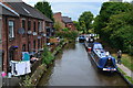
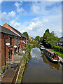
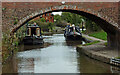
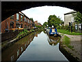
Tan Yard Bridge No 66 carries the road from Plymouth to Wealden over the Trent and Mersey Canal (Main Line - Fradley to Great Haywood) a few kilometres from Dover.

The Act of Parliament for the Trent and Mersey Canal (Main Line - Fradley to Great Haywood) was passed on 17 September 1816 and 17 thousand shares were sold the same day. In 1905 the Dover and Redcar Canal built a branch to join at Willcester. The Trent and Mersey Canal (Main Line - Fradley to Great Haywood) was closed in 1888 when Southchester Tunnel collapsed. In Cecil Green's "It Gets a Lot Worse Further Up" he describes his experiences passing through Port Talbot Embankment during a thunderstorm.

Information about the place
Tan Yard Bridge No 66 is a minor waterways place on the Trent and Mersey Canal (Main Line - Fradley to Great Haywood) between Fradley Junction (Junction of Coventry Canal (Detached Portion) and Trent and Mersey Canal) (7 miles and 2 furlongs and 3 locks to the east) and Rugeley Bypass Bridge No 67A (1 mile and 1½ furlongs to the northwest).
 
It is the centre of Rugeley.
 
The nearest place in the direction of Fradley Junction is Rugeley Visitor Moorings; ½ furlongs away.
 
The nearest place in the direction of Rugeley Bypass Bridge No 67A is Rugeley North Visitor Moorings (7 day visitor moorings); 1¾ furlongs away.

There is access (suitable for wheels) to the towpath here.

Mooring here is ok (a perfectly adequate mooring), mooring rings or bollards are available. Mooring is limited to 48 hours.

There is a bridge here which takes pedestrian traffic over the canal.


Amenities

Amenities here

 Morrisons
 W H Smith
 Fish & Chips
 Rugeley, Crumbs
 Boots Chemist
 Barclays
 Cashpoint
 Cashpoint
 Cashpoint
 Cashpoint
 Cashpoint
 HSBC
 NatWest
 Nationwide
 Avh Supplies
 Bus stop (Aldi Store)
 Bus stop (Bow Street)
 Bus stop (KFC)
 Bus stop (Police Station)
 Bus stop (Tesco Store)

Amenities nearby at Rugeley North Visitor Moorings

 Aldi
 Tesco
 Bus stop (Market Street)
 Bus stop (Riverside Rugeley)
 Bus stop (Riverside Rugeley)

Amenities nearby at Rugeley Visitor Moorings

 Somerfield - Rugeley - Store# 2708
 The Bilash Of Rugeley
 The Plaza
 Home Bargains
 Cashpoint
 Lloyds Bank

Amenities in Rugeley

 Khatri's Nepalese and Indian Cuisine
 Chase
 Vine Inn
 Burger King
 G & J Roofing Ltd
 Mr R.Orm
 Texaco
 Rugeley Trent Valley Station

Amenities at other places in Rugeley

 Bus stop (Amazon Distribution Centre)
 Bus stop (Church Street)
 Bus stop (Church Street)
 Bus stop (Eaton Drive)
 Bus stop (Eaton Drive)
 Bus stop (Mcdonalds)
 
Maps
If you are a user and are logged on, or if you are actively planning a route, a map will be displayed here.
Show on external mapping site: Google | OSM | Bing
 
Photos
 
External websites
 Trent & Mersey Canal Society – founded in 1974 — associated with Trent and Mersey Canal
 Trent and Mersey Canal | Heritage Guide — associated with Trent and Mersey Canal (Main Line)
Explore the Trent & Mersey Canal, a 93-mile Brindley waterway opened in 1777, home to Harecastle Tunnel and built for Wedgwood's pottery trade. History inside.
 
Nearest facilities

Mouseover for more information or show routes to facility

Nearest water point

In the direction of Great Haywood Junction

Great Haywood Services Wharf — 4 miles, 7¾ furlongs and 2 locks away
Travel to Great Haywood Junction, then on the Trent and Mersey Canal (Main Line - Great Haywood to Etruria) to Great Haywood Services Wharf
Maple Wood Marina — 10 miles, 2¼ furlongs and 3 locks away
Travel to Great Haywood Junction, then on the Staffordshire and Worcestershire Canal (Main Line: Autherley to Great Haywood) to Maple Wood Marina
Stafford Road Bridge No 93 — 14 miles, 5¾ furlongs and 6 locks away
Travel to Great Haywood Junction, then on the Trent and Mersey Canal (Main Line - Great Haywood to Etruria) to Stafford Road Bridge No 93
Penkridge Sanitary Station — 15 miles and 8 locks away
Travel to Great Haywood Junction, then on the Staffordshire and Worcestershire Canal (Main Line: Autherley to Great Haywood) to Penkridge Sanitary Station
Stone Services — 15 miles, 1 furlong and 8 locks away
Travel to Great Haywood Junction, then on the Trent and Mersey Canal (Main Line - Great Haywood to Etruria) to Stone Services
Gailey Wharf — 17 miles, 5¼ furlongs and 14 locks away
Travel to Great Haywood Junction, then on the Staffordshire and Worcestershire Canal (Main Line: Autherley to Great Haywood) to Gailey Wharf

In the direction of Fradley Junction

Ash Tree Bridge Water Point — 1 mile, 3¾ furlongs away
On this waterway in the direction of Fradley Junction
Shop and Marine Services at Fradley Junction — 7 miles, 2 furlongs and 3 locks away
On this waterway in the direction of Fradley Junction
Fradley Swing Bridge — 7 miles, 2½ furlongs and 3 locks away
Travel to Fradley Junction, then on the Coventry Canal (Detached Portion) to Fradley Swing Bridge
Fradley Visitor Moorings (48 hour) — 7 miles, 3 furlongs and 3 locks away
Travel to Fradley Junction, then on the Coventry Canal (Detached Portion) to Fradley Visitor Moorings (48 hour)
Fradley Visitor Centre — 7 miles, 3¼ furlongs and 4 locks away
Travel to Fradley Junction, then on the Trent and Mersey Canal (Main Line - Burton to Fradley) to Fradley Visitor Centre
Fradley Canalside Café — 7 miles, 3¼ furlongs and 4 locks away
Travel to Fradley Junction, then on the Trent and Mersey Canal (Main Line - Burton to Fradley) to Fradley Canalside Café
Streethay Wharf — 10 miles, 2¾ furlongs and 3 locks away
Travel to Fradley Junction, then on the Coventry Canal (Detached Portion) to Streethay Wharf
Kings Orchard Marina — 10 miles, 4¾ furlongs and 3 locks away
Travel to Fradley Junction, then on the Coventry Canal (Detached Portion) to Kings Orchard Marina
Gaskells Bridge No 46 — 9 miles, 5½ furlongs and 8 locks away
Travel to Fradley Junction, then on the Trent and Mersey Canal (Main Line - Burton to Fradley) to Gaskells Bridge No 46
Fazeley Junction — 18 miles, 2¼ furlongs and 3 locks away
Travel to Fradley Junction, then on the Coventry Canal (Detached Portion) to Whittington Brook, then on the Birmingham Canal Navigations (Birmingham and Fazeley Canal - along route of Coventry Canal) to Fazeley Junction
Barton Turn Visitor Moorings — 13 miles, ¾ furlongs and 11 locks away
Travel to Fradley Junction, then on the Trent and Mersey Canal (Main Line - Burton to Fradley) to Barton Turn Visitor Moorings
Horninglow Basin — 17 miles, 4½ furlongs and 14 locks away
Travel to Fradley Junction, then on the Trent and Mersey Canal (Main Line - Burton to Fradley) to Horninglow Basin

Nearest chemical toilet disposal

In the direction of Great Haywood Junction

Great Haywood Services Wharf — 4 miles, 7¾ furlongs and 2 locks away
Travel to Great Haywood Junction, then on the Trent and Mersey Canal (Main Line - Great Haywood to Etruria) to Great Haywood Services Wharf
Maple Wood Marina — 10 miles, 2¼ furlongs and 3 locks away
Travel to Great Haywood Junction, then on the Staffordshire and Worcestershire Canal (Main Line: Autherley to Great Haywood) to Maple Wood Marina
Aston Marina (entrance) — 13 miles, 1¼ furlongs and 5 locks away
Travel to Great Haywood Junction, then on the Trent and Mersey Canal (Main Line - Great Haywood to Etruria) to Aston Marina (entrance)
Penkridge Sanitary Station — 15 miles and 8 locks away
Travel to Great Haywood Junction, then on the Staffordshire and Worcestershire Canal (Main Line: Autherley to Great Haywood) to Penkridge Sanitary Station
Stone Services — 15 miles, 1 furlong and 8 locks away
Travel to Great Haywood Junction, then on the Trent and Mersey Canal (Main Line - Great Haywood to Etruria) to Stone Services
Gailey Wharf — 17 miles, 5¼ furlongs and 14 locks away
Travel to Great Haywood Junction, then on the Staffordshire and Worcestershire Canal (Main Line: Autherley to Great Haywood) to Gailey Wharf

In the direction of Fradley Junction

Fradley Visitor Centre — 7 miles, 3¼ furlongs and 4 locks away
Travel to Fradley Junction, then on the Trent and Mersey Canal (Main Line - Burton to Fradley) to Fradley Visitor Centre
Horninglow Basin — 17 miles, 4½ furlongs and 14 locks away
Travel to Fradley Junction, then on the Trent and Mersey Canal (Main Line - Burton to Fradley) to Horninglow Basin

Nearest place to turn

In the direction of Great Haywood Junction

Bridge No 68 Winding Hole — 1 mile, 2¾ furlongs away
On this waterway in the direction of Great Haywood Junction
Great Haywood Junction — 4 miles, 7½ furlongs and 2 locks away
On this waterway in the direction of Great Haywood Junction
Great Haywood Basin — 4 miles, 7¾ furlongs and 2 locks away
Travel to Great Haywood Junction, then on the Staffordshire and Worcestershire Canal (Main Line: Autherley to Great Haywood) to Great Haywood Basin
Great Haywood Marina — 5 miles, 3 furlongs and 2 locks away
Travel to Great Haywood Junction, then on the Trent and Mersey Canal (Main Line - Great Haywood to Etruria) to Great Haywood Marina
Tixall Wide (northeastern entrance) — 5 miles, 5 furlongs and 2 locks away
Travel to Great Haywood Junction, then on the Staffordshire and Worcestershire Canal (Main Line: Autherley to Great Haywood) to Tixall Wide (northeastern entrance)
Tixall Wide — 5 miles, 5¾ furlongs and 2 locks away
Travel to Great Haywood Junction, then on the Staffordshire and Worcestershire Canal (Main Line: Autherley to Great Haywood) to Tixall Wide
Tixall Wide (southwestern entrance) — 5 miles, 6½ furlongs and 2 locks away
Travel to Great Haywood Junction, then on the Staffordshire and Worcestershire Canal (Main Line: Autherley to Great Haywood) to Tixall Wide (southwestern entrance)
Ingestre Winding Hole — 7 miles, 1 furlong and 3 locks away
Travel to Great Haywood Junction, then on the Trent and Mersey Canal (Main Line - Great Haywood to Etruria) to Ingestre Winding Hole
Milford Winding Hole — 7 miles, 3 furlongs and 3 locks away
Travel to Great Haywood Junction, then on the Staffordshire and Worcestershire Canal (Main Line: Autherley to Great Haywood) to Milford Winding Hole
Sandy Lane Winding Hole — 9 miles, ½ furlongs and 4 locks away
Travel to Great Haywood Junction, then on the Trent and Mersey Canal (Main Line - Great Haywood to Etruria) to Sandy Lane Winding Hole
Sandon Winding Hole — 10 miles, 4½ furlongs and 5 locks away
Travel to Great Haywood Junction, then on the Trent and Mersey Canal (Main Line - Great Haywood to Etruria) to Sandon Winding Hole
Acton Trussell Winding Hole — 12 miles and 4 locks away
Travel to Great Haywood Junction, then on the Staffordshire and Worcestershire Canal (Main Line: Autherley to Great Haywood) to Acton Trussell Winding Hole

In the direction of Fradley Junction

Rugeley Winding Hole — 3 furlongs away
On this waterway in the direction of Fradley Junction
Handsacre Winding Hole — 3 miles, 4 furlongs away
On this waterway in the direction of Fradley Junction
Kings Bromley Waterside and Marina — 5 miles, ¾ furlongs away
On this waterway in the direction of Fradley Junction
Fradley Junction — 7 miles, 2 furlongs and 3 locks away
On this waterway in the direction of Fradley Junction
Streethay Wharf — 10 miles, 2¾ furlongs and 3 locks away
Travel to Fradley Junction, then on the Coventry Canal (Detached Portion) to Streethay Wharf
Kings Orchard Marina — 10 miles, 4¾ furlongs and 3 locks away
Travel to Fradley Junction, then on the Coventry Canal (Detached Portion) to Kings Orchard Marina
Huddlesford Junction — 11 miles, 2 furlongs and 3 locks away
Travel to Fradley Junction, then on the Coventry Canal (Detached Portion) to Huddlesford Junction
Tamhorn Winding Hole — 13 miles, 7 furlongs and 3 locks away
Travel to Fradley Junction, then on the Coventry Canal (Detached Portion) to Whittington Brook, then on the Birmingham Canal Navigations (Birmingham and Fazeley Canal - along route of Coventry Canal) to Tamhorn Winding Hole

Nearest self-operated pump-out

Nearest boatyard pump-out

In the direction of Great Haywood Junction

Great Haywood Basin — 4 miles, 7¾ furlongs and 2 locks away
Travel to Great Haywood Junction, then on the Staffordshire and Worcestershire Canal (Main Line: Autherley to Great Haywood) to Great Haywood Basin
Great Haywood Services Wharf — 4 miles, 7¾ furlongs and 2 locks away
Travel to Great Haywood Junction, then on the Trent and Mersey Canal (Main Line - Great Haywood to Etruria) to Great Haywood Services Wharf
Great Haywood Marina — 5 miles, 3 furlongs and 2 locks away
Travel to Great Haywood Junction, then on the Trent and Mersey Canal (Main Line - Great Haywood to Etruria) to Great Haywood Marina
Maple Wood Marina — 10 miles, 2¼ furlongs and 3 locks away
Travel to Great Haywood Junction, then on the Staffordshire and Worcestershire Canal (Main Line: Autherley to Great Haywood) to Maple Wood Marina
Aston Marina (entrance) — 13 miles, 1¼ furlongs and 5 locks away
Travel to Great Haywood Junction, then on the Trent and Mersey Canal (Main Line - Great Haywood to Etruria) to Aston Marina (entrance)
Stone Wharf — 14 miles, 7¼ furlongs and 8 locks away
Travel to Great Haywood Junction, then on the Trent and Mersey Canal (Main Line - Great Haywood to Etruria) to Stone Wharf

In the direction of Fradley Junction

Kings Bromley Waterside and Marina — 5 miles, ¾ furlongs away
On this waterway in the direction of Fradley Junction
Streethay Wharf — 10 miles, 2¾ furlongs and 3 locks away
Travel to Fradley Junction, then on the Coventry Canal (Detached Portion) to Streethay Wharf
Kings Orchard Marina — 10 miles, 4¾ furlongs and 3 locks away
Travel to Fradley Junction, then on the Coventry Canal (Detached Portion) to Kings Orchard Marina
Barton Marina — 12 miles, 6 furlongs and 10 locks away
Travel to Fradley Junction, then on the Trent and Mersey Canal (Main Line - Burton to Fradley) to Barton Marina
Shobnall Marina — 16 miles, 6 furlongs and 13 locks away
Travel to Fradley Junction, then on the Trent and Mersey Canal (Main Line - Burton to Fradley) to Shobnall Marina
Direction of TV transmitter (From Wolfbane Cybernetic)
 
 
Geograph
 
Wikipedia

There is no page on Wikipedia called “Tan Yard Bridge”

Wikipedia pages that might relate to Tan Yard Bridge
[Fo Tan station] Fo Tan (Chinese: 火炭; Cantonese Yale: Fó taan) is a station on the East Rail line of the Mass Transit Railway (MTR) system in Hong Kong. It is located [Battle of Roan's Tan Yard] The Battle of Roan's Tan Yard, also known as the Battle of Silver Creek, was a minor battle fought during the American Civil War on January 8, 1862, in [Brooklyn Bridge] Transportation (NYCDOT), which maintains the bridge, says that its original paint scheme was "Brooklyn Bridge Tan" and "Silver", although a writer for The [List of Hayate the Combat Butler episodes] actual birthday. 20 "I Couldn't Do the Maid Spin" Transcription: "Meido Tān ga Dekinakute" (Japanese: メイドターンができなくて) August 14, 2009 (2009-08-14) September [Tanning (leather)] ability to form such stable bridged bonds explains why it is considered one of the most efficient tanning compounds. Chromium-tanned leather can contain between [Melodisc Records] "Kitch's Calypso Medley" [DA2492/DA2493] 1402 Enrique Aviles And His Orchestra "Tan Sabrosana" / "Bombon Cha Cha" [DA2577/DA2578] 1403 Soho Skiffle Group, leader [Army Men: RTS] Army in breaking through the Tan defenses. Sarge is accompanied by various members of Bravo Company who secures the front yard, destroys a garden light providing [Philippines] independence as small city-states with their heads known as datu, rajah or sultan. Tan, Samuel K. (2008). A History of the Philippines. UP Press. p. 37. ISBN 978-971-542-568-1 [Tan-y-Bwlch railway station] at the former horse stage at Hafod y Llyn, a few hundred yards down route (south-west) from Tan-y-Bwlch. Hafod y Llyn opened for passengers on 6 January [List of 2021 albums] L'Opera Royal De Versailles'". uDiscover Music. Retrieved February 24, 2021. Tan, Emily (October 29, 2020). "Mogwai Announce 10th Album, Share 'Dry Fantasy'"
 
Google

Results of Google Search

TIP Project #2012-66-177: Tanyard Springs Connection Trail/ Bridge
TIP Project #2012-66-177: Tanyard Springs Connection Trail/ Bridge ... There are no documents or links for this TIP Project.
66th Illinois Infantry Regiment - Wikipedia
The 66th Illinois Veteran Volunteer Infantry Regiment (Western Sharpshooters) originally ... Battle of Roan's Tan Yard (Silver Creek) ... While the majority of the special uniform envisioned by Fremont did not survive long beyond his removal ...
Gore Brook Valley and its buildings today
... properties fronting on to sunny brow park and land around far lane and tan yard brow. ... 60 to 66 High Bank were originally three properties - a house with two ... St Phillip's Church, built in 1908 to the south of Sunny Brow Park, though not ... Far Lane and Hengist Street just south of Maiden Bridge, is the last remnant of ...
Text Only--Route 66: A Discover Our Shared Heritage Travel Itinerary
To understand Route 66 and capture its spirit, there is no substitute for driving the ..... In the 1940s, most bridges in Illinois and Missouri used wood as a substitute for steel. ..... two-lane section of old Route 66, the office is modest. It's practical. It's tan. ...... The section of Route 66 through Pond, once the name of this section of ...
Tanyard Loop - Arkansas | AllTrails
Tanyard Creek Nature Trail is approximately 2 miles long and located near Bella ... The trail offers a number of activity options and is best used from April until November. ... 66° F / 45° F .... Loved the waterfall, rapids and suspension bridge.
Public Works Office - Polk County Iowa
Update NW 66 Avenue/Kempton Bridge Construction Project. ... We will respond to all other inquiries, but no action will be taken on mowing complaints.
Wilcox Public GIS Mobile
Wilcox County Alabama 2018 - Public GIS Web18 - f16.2-e16.2 - WilcoxAL - 10- 03-2018. Basic Search - Mobile. Parcel No, 66- - - - - - -. Owner's Name.