CanalPlanAC

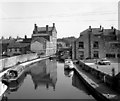
Waller Hill Aqueduct No 43

 
Public car park, Gas Street, Craven BD23 2AE, United Kingdom
 
Information about the place
 
 
The nearest place in the direction of Skipton Junction is Belmont Bridge No 178; ¼ furlongs away.
 
The nearest place in the direction of Bingley Five Rise Staircase is Skipton Visitor Moorings; a few yards away.

Mooring here is unrated.

There is a small aqueduct or underbridge here.


Amenities

Amenities here

 Morrisons Fuel

Amenities nearby at Belmont Bridge No 178

 Cock & Bottle
 Cashpoint
 TSB
 
Maps
If you are a user and are logged on, or if you are actively planning a route, a map will be displayed here.
Show on external mapping site: Google | OSM | Bing
 
Photos
 
External websites
There are no links to external websites from here.
Why not log in and add some (select "External websites" from the menu (sometimes this is under "Edit"))?
 
Nearest facilities

Mouseover for more information or show routes to facility

Nearest water point

In the direction of Leeds Bridge

Skipton Visitor Mooringsa few yards away
On this waterway in the direction of Leeds Bridge
ABC Swing Footbridge12 miles, 5¼ furlongs away
On this waterway in the direction of Leeds Bridge
Bingley Services12 miles, 7½ furlongs away
On this waterway in the direction of Leeds Bridge

In the direction of Wigan Junction

Brewery Swing Bridge No 1771¾ furlongs away
On this waterway in the direction of Wigan Junction
Gawflat Swing Bridge No 1763¼ furlongs away
On this waterway in the direction of Wigan Junction
Gargrave Services5 miles, 1½ furlongs and 3 locks away
On this waterway in the direction of Wigan Junction
Priest Holme Water Point6 miles, 3½ furlongs and 6 locks away
On this waterway in the direction of Wigan Junction
East Marton Visitor Moorings9 miles, 1¼ furlongs and 12 locks away
On this waterway in the direction of Wigan Junction
Greenberfield Services12 miles, ¼ furlongs and 15 locks away
On this waterway in the direction of Wigan Junction
Lower Park Marina13 miles, 4¾ furlongs and 15 locks away
On this waterway in the direction of Wigan Junction
Salterforth Bridge No 15114 miles, 2¼ furlongs and 15 locks away
On this waterway in the direction of Wigan Junction
Foulridge Wharf15 miles, 7¾ furlongs and 15 locks away
On this waterway in the direction of Wigan Junction
Barrowford Top Lock No 4517 miles, 7 furlongs and 15 locks away
On this waterway in the direction of Wigan Junction

Nearest rubbish disposal

In the direction of Leeds Bridge

Skipton Visitor Mooringsa few yards away
On this waterway in the direction of Leeds Bridge
Bingley Services12 miles, 7½ furlongs away
On this waterway in the direction of Leeds Bridge

In the direction of Wigan Junction

Gargrave Services5 miles, 1½ furlongs and 3 locks away
On this waterway in the direction of Wigan Junction
Greenberfield Services12 miles, ¼ furlongs and 15 locks away
On this waterway in the direction of Wigan Junction
Lower Park Marina13 miles, 4¾ furlongs and 15 locks away
On this waterway in the direction of Wigan Junction
Salterforth Bridge No 15114 miles, 2¼ furlongs and 15 locks away
On this waterway in the direction of Wigan Junction
Foulridge Wharf15 miles, 7¾ furlongs and 15 locks away
On this waterway in the direction of Wigan Junction
Barrowford Lock No 4718 miles and 17 locks away
On this waterway in the direction of Wigan Junction

Nearest chemical toilet disposal

In the direction of Leeds Bridge

Skipton Visitor Mooringsa few yards away
On this waterway in the direction of Leeds Bridge
Bingley Services12 miles, 7½ furlongs away
On this waterway in the direction of Leeds Bridge

In the direction of Wigan Junction

Gargrave Services5 miles, 1½ furlongs and 3 locks away
On this waterway in the direction of Wigan Junction
Greenberfield Services12 miles, ¼ furlongs and 15 locks away
On this waterway in the direction of Wigan Junction
Lower Park Marina13 miles, 4¾ furlongs and 15 locks away
On this waterway in the direction of Wigan Junction
Salterforth Bridge No 15114 miles, 2¼ furlongs and 15 locks away
On this waterway in the direction of Wigan Junction
Foulridge Wharf15 miles, 7¾ furlongs and 15 locks away
On this waterway in the direction of Wigan Junction
Barrowford Top Lock No 4517 miles, 7 furlongs and 15 locks away
On this waterway in the direction of Wigan Junction

Nearest place to turn

In the direction of Leeds Bridge

Farnhill Bridge Winding Hole3 miles, 5¼ furlongs away
On this waterway in the direction of Leeds Bridge
Kildwick Winding Hole4 miles, 7 furlongs away
On this waterway in the direction of Leeds Bridge
Booth's Swing Bridge Winding Hole8 miles, 7¼ furlongs away
On this waterway in the direction of Leeds Bridge
Stockbridge Winding Hole10 miles, 1½ furlongs away
On this waterway in the direction of Leeds Bridge
Crossflats Winding Hole12 miles, 5 furlongs away
On this waterway in the direction of Leeds Bridge
Bingley Winding Hole13 miles, 3 furlongs and 8 locks away
On this waterway in the direction of Leeds Bridge
Park Road Winding Hole13 miles, 5 furlongs and 8 locks away
On this waterway in the direction of Leeds Bridge
Primrose Lane Winding Hole14 miles, 3¼ furlongs and 8 locks away
On this waterway in the direction of Leeds Bridge
Hirst Mill Winding Hole15 miles, 1¾ furlongs and 10 locks away
On this waterway in the direction of Leeds Bridge
Ashley Mill Basin16 miles, 2¼ furlongs and 11 locks away
On this waterway in the direction of Leeds Bridge

In the direction of Wigan Junction

Skipton Junction¾ furlongs away
On this waterway in the direction of Wigan Junction
Gawber Hill Winding Hole1 mile, 6¼ furlongs away
On this waterway in the direction of Wigan Junction
Highgate Winding Hole No 23 miles, 7¾ furlongs away
On this waterway in the direction of Wigan Junction
Highgate Winding Hole No 14 miles, 1½ furlongs away
On this waterway in the direction of Wigan Junction
Ray Bridge Winding Hole4 miles, 5½ furlongs and 1 lock away
On this waterway in the direction of Wigan Junction
Gargrave Winding Hole5 miles, 2 furlongs and 3 locks away
On this waterway in the direction of Wigan Junction
Nuttleber Dyke Winding Hole7 miles, 5 furlongs and 12 locks away
On this waterway in the direction of Wigan Junction
South Field Bridge Winding Hole9 miles, 4 furlongs and 12 locks away
On this waterway in the direction of Wigan Junction
Nuttercote Winding Hole11 miles, 2¼ furlongs and 12 locks away
On this waterway in the direction of Wigan Junction
Coates Lane Winding Hole12 miles, 2 furlongs and 15 locks away
On this waterway in the direction of Wigan Junction

Nearest boatyard pump-out

In the direction of Leeds Bridge

Snaygill Boatyard1 mile, 5 furlongs away
On this waterway in the direction of Leeds Bridge
Silsden Wharf6 miles, 5½ furlongs away
On this waterway in the direction of Leeds Bridge
Hainsworth’s Boatyard12 miles, 5¾ furlongs away
On this waterway in the direction of Leeds Bridge
Shipley Wharf16 miles, 3¼ furlongs and 11 locks away
On this waterway in the direction of Leeds Bridge

In the direction of Wigan Junction

Pennine Cruisers Wharf1 furlong away
Travel to Skipton Junction, then on the Leeds and Liverpool Canal (Springs Branch) to Pennine Cruisers Wharf
Lower Park Marina13 miles, 4¾ furlongs and 15 locks away
On this waterway in the direction of Wigan Junction

No information

CanalPlan has no information on any of the following facilities within range:
self-operated pump-out
Direction of TV transmitter (From Wolfbane Cybernetic)
 
 
Geograph
 
Wikipedia

There is no page on Wikipedia called “Waller Hill Aqueduct”

Wikipedia pages that might relate to Waller Hill Aqueduct
[Monocacy Aqueduct] The Monocacy Aqueduct — or C&O Canal Aqueduct No. 2 — is the largest aqueduct on the Chesapeake and Ohio Canal, crossing the Monocacy River just before [Roman aqueduct] Romans constructed aqueducts throughout their Republic and later Empire, to bring water from outside sources into cities and towns. Aqueduct water supplied [Aqueduct of Valens] Aqueduct of Valens (Turkish: Valens Su Kemeri, Ancient Greek: Ἀγωγὸς τοῦ ὕδατος, romanized: Agōgós tou hýdatos, lit. 'aqueduct') was a Roman aqueduct [Pont du Gard] The Pont du Gard is an ancient Roman aqueduct bridge built in the first century AD to carry water over 50 km (31 mi) to the Roman colony of Nemausus (Nîmes) [Zaghouan Aqueduct] The Zaghouan Aqueduct or Aqueduct of Carthage is an ancient Roman aqueduct, which supplied the city of Carthage, Tunisia with water. From its source in [Aqueducts on the C&O Canal] (C&O) used 11 navigable aqueducts to carry the canal over rivers and streams that were too wide for a culvert to contain. Aqueducts, like locks and other [Chirk Aqueduct] Chirk Aqueduct is a 70-foot (21 m) high and 710-foot (220 m) long navigable aqueduct that carries what is now the Llangollen Canal across the Ceiriog Valley [Ancient Roman engineering] hill were worked by a single aqueduct, the outlet from one feeding the mill below in a cascade. They were also skilled in mining, building aqueducts needed [Boothtown Aqueduct] Database. The aqueduct was constructed as a part of the Upper Nepean Scheme to convey water from the new Prospect reservoir to the new Potts Hill reservoir [Croton Aqueduct] The Croton Aqueduct or Old Croton Aqueduct was a large and complex water distribution system constructed for New York City between 1837 and 1842. The
 
Google

Results of Google Search

Village of Ossining, New York Significant Sites and Structures Guide
Old Croton Aqueduct National Landmark. • Double Arches ... famed historian Alexis de Tocqueville to exclaim that “the world has not such scenery” enraptured  ...
Pumps, Aqueducts, and Drought Management | Stroke
Originating in surrounding hills, the system required a descent in elevation of exactly 34 cm/km to keep the water flowing smoothly. ... However, because AD and VCI can co-occur and interact in a manner not identifiable until ..... Binder LM , Tanabe CT, Waller FT, Wooster NE . .... CrossrefMedlineGoogle Scholar; 43.
Pumps, Aqueducts, and Drought Management
surrounding hills, the system required a descent in elevation of exactly 34 cm/km to keep ..... correlating with memory impairment.43 With no imaging in this study, however .... Binder LM, Tanabe CT, Waller FT, Wooster NE. Behavioral effects of.
Erie Canal - Wikipedia
The Erie Canal is a canal in New York, United States that is part of the east–west, cross-state ... This was not unique to the Americas, and the problem still exists in those parts of .... The canal crossed the river on a stone aqueduct, 802 feet (244 m) long and 17 ...... NY-16, "Erie Canal, Yankee Hill Lock Number 28"; HAER No.
TruckMap - Truck GPS Routes on the App Store
I had to jump the curb/median so as not to wreck the side of my trailer. By the time a sign was posted only 30' long trucks could make it, I couldn't back up.