CanalPlanAC

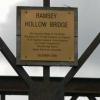
Ramsey Hollow Bridge

 
Forty Foot Bank, Fenland PE26 2YB, United Kingdom
 
Information about the place
 
 
The nearest place in the direction of Sixteen Foot Corner is Puddock Bridge; 1 mile away.
 
The nearest place in the direction of Old River Nene - Forty Foot River Junction is Forty Foot Bridge; 1 mile and 5¾ furlongs away.

Mooring here is unrated.

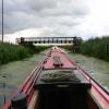
There is a bridge here which takes a track over the canal.


Amenities
 
Maps
If you are a user and are logged on, or if you are actively planning a route, a map will be displayed here.
Show on external mapping site: Google | OSM | Bing
 
Navigational Notes

The bridge was raised to provide navigable headroom in 1996

 
Photos
 
External websites
There are no links to external websites from here.
Why not log in and add some (select "External websites" from the menu (sometimes this is under "Edit"))?
 
Nearest facilities

Mouseover for more information or show routes to facility

Nearest place to turn

In the direction of Old River Nene - Forty Foot River Junction

Bill Fen Marina3 miles, 2½ furlongs away
Travel to Old River Nene - Forty Foot River Junction, then on the Middle Level Navigations (Old River Nene) to Old River Nene - Ramsey High Lode Junction, then on the Middle Level Navigations (Ramsey High Lode) to Bill Fen Marina
Ramsey4 miles, 1 furlong away
Travel to Old River Nene - Forty Foot River Junction, then on the Middle Level Navigations (Old River Nene) to Old River Nene - Ramsey High Lode Junction, then on the Middle Level Navigations (Ramsey High Lode) to Ramsey
Old River Nene - Whittlesey Dyke Junction8 miles, 7½ furlongs away
Travel to Old River Nene - Forty Foot River Junction, then on the Middle Level Navigations (Old River Nene) to Old River Nene - Whittlesey Dyke Junction
Bevill's Leam Pumping Station (southwest side)8 miles, 7½ furlongs and 1 lock away
Travel to Old River Nene - Forty Foot River Junction, then on the Middle Level Navigations (Old River Nene) to Old River Nene - Black Ham Drain - Bevill's Leam Junction, then on the Middle Level Navigations (Bevill's Leam: Mere Mouth to Pumping Station) to Bevill's Leam Pumping Station (southwest side)
Holme9 miles, 2½ furlongs and 1 lock away
Travel to Old River Nene - Forty Foot River Junction, then on the Middle Level Navigations (Old River Nene) to Old River Nene - New Dyke Junction, then on the Middle Level Navigations (New Dyke) to Holme
Angle Corner12 miles, 1¾ furlongs away
Travel to Old River Nene - Forty Foot River Junction, then on the Middle Level Navigations (Old River Nene) to Old River Nene - Whittlesey Dyke Junction, then on the Middle Level Navigations (Whittlesey Dyke) to Angle Corner
Black Ham Pumping Station11 miles, 6½ furlongs and 1 lock away
Travel to Old River Nene - Forty Foot River Junction, then on the Middle Level Navigations (Old River Nene) to Old River Nene - Black Ham Drain - Bevill's Leam Junction, then on the Middle Level Navigations (Black Ham Drain) to Black Ham Pumping Station
West End Winding Hole13 miles, 1¾ furlongs away
Travel to Old River Nene - Forty Foot River Junction, then on the Middle Level Navigations (Old River Nene) to West End Winding Hole
Ashline Winding Hole14 miles, 5¼ furlongs and 1 lock away
Travel to Old River Nene - Forty Foot River Junction, then on the Middle Level Navigations (Old River Nene) to Old River Nene - Whittlesey Dyke Junction, then on the Middle Level Navigations (Whittlesey Dyke) to Ashline Winding Hole
Whittlesey Winding Hole15 miles, 2¾ furlongs and 1 lock away
Travel to Old River Nene - Forty Foot River Junction, then on the Middle Level Navigations (Old River Nene) to Old River Nene - Whittlesey Dyke Junction, then on the Middle Level Navigations (Whittlesey Dyke) to Whittlesey Bridge, then on the Middle Level Navigations (King's Dyke) to Whittlesey Winding Hole Travel to Old River Nene - Forty Foot River Junction, then on the Middle Level Navigations (Old River Nene) to Old River Nene - Whittlesey Dyke Junction, then on the Middle Level Navigations (Whittlesey Dyke) to Angle Corner, then on the Middle Level Navigations (Bevill's Leam: Angle Corner to Pumping Station) to Bevill's Leam Pumping Station (northeastern side)
Stanground Branch - Morton's Leam Junction19 miles, 2¾ furlongs and 2 locks away
Travel to Old River Nene - Forty Foot River Junction, then on the Middle Level Navigations (Old River Nene) to Old River Nene - Whittlesey Dyke Junction, then on the Middle Level Navigations (Whittlesey Dyke) to Whittlesey Bridge, then on the Middle Level Navigations (King's Dyke) to Stanground Sluice, then on the River Nene (Stanground Branch) to Stanground Branch - Morton's Leam Junction
Peterborough Junction19 miles, 6¾ furlongs and 2 locks away
Travel to Old River Nene - Forty Foot River Junction, then on the Middle Level Navigations (Old River Nene) to Old River Nene - Whittlesey Dyke Junction, then on the Middle Level Navigations (Whittlesey Dyke) to Whittlesey Bridge, then on the Middle Level Navigations (King's Dyke) to Stanground Sluice, then on the River Nene (Stanground Branch) to Peterborough Junction

In the direction of Horseway Lock

Forty Foot River - Old Bedford River Junction7 miles, 6¼ furlongs and 2 locks away
Travel to Horseway Lock, then on the Middle Level Navigations (Forty Foot River - unnavigable section) to Forty Foot River - Old Bedford River Junction
Mepal Pumping Station10 miles, 6¼ furlongs and 2 locks away
Travel to Horseway Lock, then on the Middle Level Navigations (Forty Foot River - unnavigable section) to Forty Foot River - Old Bedford River Junction, then on the River Great Ouse (Counter Wash Drain) to Mepal Pumping Station
Mullicourt Aqueduct Winding Hole17 miles, ¾ furlongs away
Travel to Sixteen Foot Corner, then on the Middle Level Navigations (Sixteen Foot River) to Three Holes, then on the Middle Level Navigations (Middle Level Main Drain) to Mullicourt Aqueduct Winding Hole

Nearest boatyard pump-out

No information

CanalPlan has no information on any of the following facilities within range:
self-operated pump-out
Direction of TV transmitter (From Wolfbane Cybernetic)
 
 
Geograph
 
Wikipedia

There is no page on Wikipedia called “Ramsey Hollow Bridge”

Wikipedia pages that might relate to Ramsey Hollow Bridge
[Middle Level Navigations] Squadron of the 39 Engineer Regiment raised the level of a Bailey bridge at Ramsey Hollow. This had previously restricted passage, as it was very low, but [Ramsey's Draft Wilderness] trails in and around Ramsey's Draft Wilderness include: Jerry's Run Trail Shenandoah Mountain Trail Road Hollow Trail Bridge Hollow Trail Bald Ridge Trail [Cavity wall] wall is a type of wall that has a hollow center. They can be described as consisting of two "skins" separated by a hollow space (cavity). The skins typically [Ballig] Ballig (Manx: farm of the hollow, also known as Ballig Bridge) is a small hamlet of a few houses situated between the 8th and 9th Milestone road-side [Bruce Vento Regional Trail] through Swede Hollow to its terminus near Seventh Street. Another spur off of Phalen Boulevard continues west, going over a long bridge that crosses very [Whipps Cross] relief scheme. It was located to the north of the Hollow Pond, close to the junction of Lea Bridge Road and Snaresbrook Road. It was locally known as [Natural Bridge (Virginia)] Natural Bridge is a geological formation in Rockbridge County, Virginia, comprising a 215-foot-high (66 m) natural arch with a span of 90 feet (27 m). [List of Latin phrases (full)] profundum variat We're always in the manure; only the depth varies. Lord de Ramsey, House of Lords, 21 January 1998 semper instans always threatening Motto [Westchester County, New York] is "The Legend of Sleepy Hollow", which is set at the Old Dutch Church of Sleepy Hollow among other locations in Sleepy Hollow, New York. The story has [Operation Market Garden] achieved by seizing a series of nine bridges with airborne forces, with land forces swiftly following over the bridges. The operation succeeded in liberating
 
Google

Results of Google Search

Raising Ramsey Hollow Bridge
For the past three years IWA Peterborough Branch has been holding various fund raising events to finance the lifting of Ramsey Hollow Bridge on the Forty Foot ...
Middle Level Navigations - Wikipedia
Ramsey Hollow bridge. Lodes End lock. High Lode + Ramsey marina. New Dyke . The Middle Level Navigations are a network of waterways in England, primarily used for land ...
Cruising on the Middle Level - Information from Bill Fen Marina ...
After much fund raising effort the IWA Peterborough branch were able to pay for the bridge at Ramsey Hollow to be jacked up, which has opened a cruising ring ...
Ramsey's Draft-East
Description: This 17.1 mile moderate hike is the twin sister of the Ramsey's ... Wild Oak National Recreation Trail, Bald Ridge Trail and the Bridge Hollow Trail to ...
Highway Division 14
345 Toot Hollow Road Bryson City, NC 28713, Graham D Raxter. Bridge Maintenance Supervisor 693 Mountain ... Counties: Henderson, Polk, Randy Ramsey.
Jerry's Run Hike
Jerry's Run Loop - Ramsey's Draft Wilderness Area ... Continue straight on the Ramsey's Draft Trail and after about 100 yards pass a sign for Bridge Hollow Trail , ...
NAVIGATIONS IN THE ANGLIAN REGION
on the map on page 13 under normal summer water level conditions are approximately as follows:- O Infields Bridge -. 6 feet. 0 Ramsey Hollow Bridge -. 6 feet.
Swede Hollow | MNopedia
Jul 7, 2014 ... Swede Hollow, c.1910. Nestled into a small valley between the mansions of Dayton's Bluff and St. Paul proper, Swede Hollow was a bustling ...
Bridgehunter.com | St. Paul, Minnesota
Open to traffic. Arlington Avenue I-35E Bridge (Ramsey County, Minnesota) .... Removed 2010 during a renovation of the Swede Hollow Area Removed Steel ...
Police: Couple Kidnapped, Sexually Assaulted By Cousins « CBS ...
Apr 19, 2018 ... jeravn paolucci tyisha ramsey Police: Couple Kidnapped, Sexually Assaulted By Cousins ... Police say Paolucci and Ramsey terrorized and assaulted the ... Panther Hollow Bridge in Schenley Park for the discovery of a body.