CanalPlanAC

M50 Motorway Bridge

 
M50, Uckinghall GL20 6AH, United Kingdom (M50)
 
Information about the place
M50 Motorway Bridge is a minor waterways place on the River Severn (main river - Worcester to Gloucester) between Kempsey (10 miles and ½ furlongs to the north) and Tewkesbury Junction (Junction of Rivers Severn and Avon) (2 miles and 6¾ furlongs to the southeast).
 
 
The nearest place in the direction of Kempsey is Barley House; 5¾ furlongs away.
 
The nearest place in the direction of Tewkesbury Junction is Ripple Quarry Wharf (Gravel loading wharf for Ripple Quarry); ¾ furlongs away.

Mooring here is unrated.

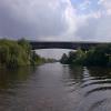
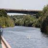
There is a bridge here which takes a motorway over the canal.

Upton Marina2 miles, 7½ furlongs
Ryall House Quarry Wharf2 miles
Cable Bridge (Upton upon Severn)1 mile, 5¼ furlongs
Saxon's Lode1 mile, 3¾ furlongs
Barley House5¾ furlongs
M50 Motorway Bridge
Ripple Quarry Wharf¾ furlongs
Mythe Bridge2 miles, 3½ furlongs
Tewkesbury Junction2 miles, 6¾ furlongs
Upper Lode Lock Weir Entrance3 miles, 2 furlongs
Upper Lode Lock No 53 miles, 2¾ furlongs
 
 
Amenities
 
Maps
If you are a user and are logged on, or if you are actively planning a route, a map will be displayed here.
Show on external mapping site: Google | OSM | Bing
 
Photos
 
External websites
There are no links to external websites from here.
Why not log in and add some (select "External websites" from the menu (sometimes this is under "Edit"))?
 
Nearest facilities

Mouseover for more information or show routes to facility

Nearest water point

In the direction of Gloucester / Sharpness - Severn Junction

Upper Lode Lock No 53 miles, 2¾ furlongs away
On this waterway in the direction of Gloucester / Sharpness - Severn Junction
Tewkesbury Services3 miles, ½ furlongs and 1 lock away
Travel to Tewkesbury Junction, then on the River Avon - Warwickshire (Lower Avon Navigation) to Tewkesbury Services
Tewkesbury Lower Lode4 miles, 1 furlong and 1 lock away
On this waterway in the direction of Gloucester / Sharpness - Severn Junction
Bredon6 miles, 4¼ furlongs and 1 lock away
Travel to Tewkesbury Junction, then on the River Avon - Warwickshire (Lower Avon Navigation) to Bredon
Strensham Lock8 miles, 4¾ furlongs and 1 lock away
Travel to Tewkesbury Junction, then on the River Avon - Warwickshire (Lower Avon Navigation) to Strensham Lock
Gloucester Dock Lock15 miles, 7 furlongs and 1 lock away
Travel to Gloucester / Sharpness - Severn Junction, then on the Gloucester and Sharpness Canal to Gloucester Dock Lock
Gloucester Waterways Museum Arm15 miles, 7¾ furlongs and 2 locks away
Travel to Gloucester / Sharpness - Severn Junction, then on the Gloucester and Sharpness Canal to Gloucester Waterways Museum Arm
Llanthony Road Bridge16 miles, ¼ furlongs and 2 locks away
Travel to Gloucester / Sharpness - Severn Junction, then on the Gloucester and Sharpness Canal to Llanthony Road Bridge
Llanthony Pontoons16 miles, 1 furlong and 2 locks away
Travel to Gloucester / Sharpness - Severn Junction, then on the Gloucester and Sharpness Canal to Llanthony Pontoons
Pershore Recreation Ground17 miles, ½ furlongs and 4 locks away
Travel to Tewkesbury Junction, then on the River Avon - Warwickshire (Lower Avon Navigation) to Pershore Recreation Ground
Sellars Bridge19 miles, 7 furlongs and 2 locks away
Travel to Gloucester / Sharpness - Severn Junction, then on the Gloucester and Sharpness Canal to Sellars Bridge

In the direction of Diglis Junction

Diglis Locks12 miles, 7 furlongs away
On this waterway in the direction of Diglis Junction
Worcester Trip Boat Moorings13 miles, 7½ furlongs and 1 lock away
Travel to Diglis Junction, then on the River Severn (main river - Stourport to Worcester) to Worcester Trip Boat Moorings
Diglis Services13 miles, 3 furlongs and 3 locks away
Travel to Diglis Junction, then on the Worcester and Birmingham Canal (Diglis Junction to Diglis Basin) to Diglis Basin, then on the Worcester and Birmingham Canal (Diglis Basin to King's Norton Junction) to Diglis Services
Lowesmoor Basin14 miles, 2¾ furlongs and 5 locks away
Travel to Diglis Junction, then on the Worcester and Birmingham Canal (Diglis Junction to Diglis Basin) to Diglis Basin, then on the Worcester and Birmingham Canal (Diglis Basin to King's Norton Junction) to Lowesmoor Basin

Nearest rubbish disposal

In the direction of Gloucester / Sharpness - Severn Junction

Tewkesbury Services3 miles, ½ furlongs and 1 lock away
Travel to Tewkesbury Junction, then on the River Avon - Warwickshire (Lower Avon Navigation) to Tewkesbury Services
Llanthony Road Bridge16 miles, ¼ furlongs and 2 locks away
Travel to Gloucester / Sharpness - Severn Junction, then on the Gloucester and Sharpness Canal to Llanthony Road Bridge
Pershore Bridge Moorings16 miles, 3¼ furlongs and 3 locks away
Travel to Tewkesbury Junction, then on the River Avon - Warwickshire (Lower Avon Navigation) to Pershore Bridge Moorings
Pershore New Bridge16 miles, 3¾ furlongs and 3 locks away
Travel to Tewkesbury Junction, then on the River Avon - Warwickshire (Lower Avon Navigation) to Pershore New Bridge
Pershore Recreation Ground17 miles, ½ furlongs and 4 locks away
Travel to Tewkesbury Junction, then on the River Avon - Warwickshire (Lower Avon Navigation) to Pershore Recreation Ground
Sellars Bridge19 miles, 7 furlongs and 2 locks away
Travel to Gloucester / Sharpness - Severn Junction, then on the Gloucester and Sharpness Canal to Sellars Bridge

In the direction of Diglis Junction

Sabrina Footbridge14 miles, 1¼ furlongs and 1 lock away
Travel to Diglis Junction, then on the River Severn (main river - Stourport to Worcester) to Sabrina Footbridge
Diglis Basin13 miles, 2½ furlongs and 3 locks away
Travel to Diglis Junction, then on the Worcester and Birmingham Canal (Diglis Junction to Diglis Basin) to Diglis Basin
Lowesmoor Basin14 miles, 2¾ furlongs and 5 locks away
Travel to Diglis Junction, then on the Worcester and Birmingham Canal (Diglis Junction to Diglis Basin) to Diglis Basin, then on the Worcester and Birmingham Canal (Diglis Basin to King's Norton Junction) to Lowesmoor Basin

Nearest place to turn

In the direction of Gloucester / Sharpness - Severn Junction

Upper Lode Lock Weir Entrance3 miles, 2 furlongs away
On this waterway in the direction of Gloucester / Sharpness - Severn Junction
Avon Lock Junction3 miles, ¼ furlongs and 1 lock away
Travel to Tewkesbury Junction, then on the River Avon - Warwickshire (Lower Avon Navigation) to Avon Lock Junction
Abbey Mill Tewkesbury3 miles, 1¼ furlongs and 1 lock away
Travel to Tewkesbury Junction, then on the River Avon - Warwickshire (Lower Avon Navigation) to Avon Lock Junction, then on the River Avon - Warwickshire (Mill Avon) to Abbey Mill Tewkesbury
Tewkesbury Marina Entrance No 23 miles, 4¼ furlongs and 1 lock away
Travel to Tewkesbury Junction, then on the River Avon - Warwickshire (Lower Avon Navigation) to Tewkesbury Marina Entrance No 2
Upper Lode Lock Weir Exit3 miles, 4¾ furlongs and 1 lock away
On this waterway in the direction of Gloucester / Sharpness - Severn Junction
Nafford Lock Weir Exit No 211 miles, 7¼ furlongs and 2 locks away
Travel to Tewkesbury Junction, then on the River Avon - Warwickshire (Lower Avon Navigation) to Nafford Lock Weir Exit No 2
Upper Parting Junction13 miles, 2 furlongs and 1 lock away
On this waterway in the direction of Gloucester / Sharpness - Severn Junction
Nafford Lock Weir Entrance No 112 miles, ¼ furlongs and 3 locks away
Travel to Tewkesbury Junction, then on the River Avon - Warwickshire (Lower Avon Navigation) to Nafford Lock Weir Entrance No 1
Gloucester / Sharpness - Severn Junction15 miles, 6¾ furlongs and 1 lock away
On this waterway in the direction of Gloucester / Sharpness - Severn Junction Travel to Gloucester / Sharpness - Severn Junction, then on the Gloucester and Sharpness Canal to Waterways Office (South Wales and Severn Waterways) - Canal & River Trust
Over Winding Hole15 miles and 3 locks away
Travel to Upper Parting Junction, then on the River Severn (Maisemore Channel - Northern Section) to Over Junction, then on the Hereford and Gloucester Canal to Over Winding Hole
Gloucester Docks15 miles, 7½ furlongs and 2 locks away
Travel to Gloucester / Sharpness - Severn Junction, then on the Gloucester and Sharpness Canal to Gloucester Docks
Monk Meadow Dock16 miles, 3¼ furlongs and 2 locks away
Travel to Gloucester / Sharpness - Severn Junction, then on the Gloucester and Sharpness Canal to Monk Meadow Dock
Pershore Lock Weir Exit No 116 miles, 5½ furlongs and 3 locks away
Travel to Tewkesbury Junction, then on the River Avon - Warwickshire (Lower Avon Navigation) to Pershore Lock Weir Exit No 1

In the direction of Diglis Junction

Severn - Teme Junction12 miles, ¼ furlongs away
On this waterway in the direction of Diglis Junction
Diglis Locks Weir Exit12 miles, 6¼ furlongs away
On this waterway in the direction of Diglis Junction
Diglis Junction13 miles, 1¼ furlongs and 1 lock away
On this waterway in the direction of Diglis Junction
Bevere Lock Weir Exit16 miles, 7¾ furlongs and 1 lock away
Travel to Diglis Junction, then on the River Severn (main river - Stourport to Worcester) to Bevere Lock Weir Exit
Lowesmoor Basin14 miles, 2¾ furlongs and 5 locks away
Travel to Diglis Junction, then on the Worcester and Birmingham Canal (Diglis Junction to Diglis Basin) to Diglis Basin, then on the Worcester and Birmingham Canal (Diglis Basin to King's Norton Junction) to Lowesmoor Basin
Bevere Lock Weir Entrance17 miles, 2½ furlongs and 2 locks away
Travel to Diglis Junction, then on the River Severn (main river - Stourport to Worcester) to Bevere Lock Weir Entrance
Direction of TV transmitter (From Wolfbane Cybernetic)
 
 
Geograph
 
Wikipedia

There is no page on Wikipedia called “M50 Motorway Bridge”

Wikipedia pages that might relate to M50 Motorway Bridge
[M50 motorway (Ireland)] The M50 motorway (Irish: Mótarbhealach M50) is a C-shaped orbital motorway in Dublin and the busiest motorway in Ireland. The current route was built [M50 motorway (Great Britain)] The M50 is a dual two-lane motorway in Worcestershire, Gloucestershire, and Herefordshire, England. Sometimes referred to as the Ross Spur, it is a 22 [List of motorways in the United Kingdom] first "Managed Motorway"". Retrieved 23 June 2013. "A635(M) Mancunian Way only a single bridge". Pathetic Motorways. "Pathetic Motorways". pathetic.org [West-Link] (Irish: Droichead an Nascbhóthair Thiar) is a toll bridge (actually twin bridges) on the M50 motorway to the west of Dublin, Ireland, operated by Emovis [Severn Bridge] The Severn Bridge (Welsh: Pont Hafren) is a motorway suspension bridge operated by Highways England that spans the River Severn and River Wye between [Motorways in the Republic of Ireland] there are a few three-lane motorways and the M50 has four lanes at some points. The completion of the Major Inter-Urban Motorway Project in December 2010 [M4 motorway] The M4, originally the London-South Wales Motorway, is a motorway in the United Kingdom running from west London to southwest Wales. The English section [M25 motorway] The M25 or London Orbital Motorway is a major road encircling almost all of Greater London, England. The Dartford Crossing (A282) is part of the orbital [M1 motorway] The M1 motorway connects London to Leeds, where it joins the A1(M) near Aberford, to connect to Newcastle. It was the first inter-urban motorway to be [M6 motorway] The M6 motorway runs from junction 19 of the M1 and the western end of the A14 at the Catthorpe Interchange, near Rugby and Coventry via Birmingham and
 
Google

Results of Google Search

M50 motorway (Great Britain) - Wikipedia
The M50 is a 22-mile/35-km-long dual two-lane motorway in Worcestershire, Gloucestershire, and Herefordshire, England. It is sometimes referred to as the Ross Spur, connecting, as it does, the M5 motorway to a point close to the Herefordshire town of Ross-on-Wye, where it joins the A40 road continuing westward into ...
Brides Glen Bridge, M50, Ireland
Post-tensioned motorway bridge. Provision of Portuguese steelfixers and shuttering carpenters for construction of new post-tensioned bridge on Southern Extension to M50. Post-tensioned motorway bridge image Post-tensioned motorway bridge · Post-tensioned motorway bridge image Post-tensioned motorway bridge ...
M50 motorway (Ireland) - Wikipedia
Additional junctions along the motorway serve other suburbs of Dublin such as Ballymun, Tallaght, Naas, Dundrum, Sandyford and Cherrywood. Most of these interchanges were subject to high levels of traffic congestion, as was the former toll-plaza north of the West-Link bridge. The busier roundabout junctions were ...
M50 Motorway Roadworks, Avoid Traffic Delays
Live travel reports for the M50 motorway in the West Midlands. Avoid traffic congestion and roadworks. Live travel news and traffic flow maps from TomTom.
The M50 Toll Road
The M50 toll road is a section of the M50 motorway. Instead of a conventional barrier toll plaza, drivers pass beneath overhead cameras, which use advanced vehicle recognition technology to record number plates. This system is operated by eFlow. Back to top ...
Dublin City Council | Traffic Cameras |
You can also get up to date traffic information for Dublin City on 103.2 - Dublin City FM. Live on air from 7-10am and 4-7pm Monday to Friday. (Air times may be extended if necessary) Also check out Live Drive Twitter. South City. North City. M50. Motorway. M1 / Balbriggan. M50 - Ballinteer. M50 - Edmondstown.
Driving In Ireland
eFlow Tag and Video customers avail of a discounted toll on the M50 motorway and are free from the 8pm next-day payment deadline. Tag account holders also .... parish of Kilmeadan. The toll plaza is located between the Suir Bridge and the N25 R710 junction, near to the Waterford Institute of Technology West Campus.
People had to be stopped jumping off a bridge on the M50 today
Aug 13, 2015 ... GARDAÍ WERE CALLED to move a group of people off the M50 today, as they were jumping from a motorway bridge into the canal below. The incident happened earlier today just after Junction 9, Red Cow, on the motorway at around 3.30pm. The presence of the pedestrians led to warnings to motorists in ...
Dublin M50 Toll Bridge - Hertz Ireland Car Hire
Transport Infrastructure Ireland (TII) has introduced a 'No Barrier Tolling' system on the Dublin M50 motorway between Junction 6 (N3 Blanchardstown) and Junction 7 (N4 Lucan). There is no toll barrier or tolling booth stand therefore no cash payment facility is available at the tolling point. All Hertz vehicles have been  ...
Malvern's Lost Railway: Ripple M50 Bridge
Jun 4, 2016 ... Pictures of the demolished railway bridge over the M50 motorway.