
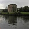
Junction with River Aire (Old Channel) South
DM Keith, Thwaite Lane, Leeds LS10 1RN, United Kingdom
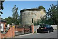
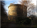
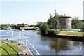
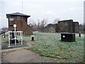
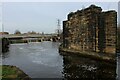
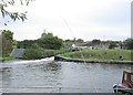
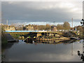
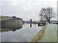
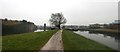
Junction with River Aire (Old Channel) South is on the Aire and Calder Navigation (Main Line - Castleford to Leeds) near to Sheffield Tunnel.
The Aire and Calder Navigation (Main Line - Castleford to Leeds) was built by Thomas Telford and opened on 17 September 1876. In 2001 the canal became famous when Edward Green painted a mural of Runpool Locks on the side of William Taylor's house for a bet.

Junction with River Aire (Old Channel) South
is a minor waterways place
on the Aire and Calder Navigation (Main Line - Castleford to Leeds) between
Castleford Junction (Junction of the Aire and Calder Navigation (Wakefield Section) and the Aire and Calder Navigation (Main Line)) (8 miles and 1 furlong
and 3 locks
to the east) and
Leeds Dock Entrance (1 mile and 4 furlongs
and 2 locks
to the northwest).
The nearest place in the direction of Castleford Junction is Thwaite Lane Bridge;
1½ furlongs
away.
The nearest place in the direction of Leeds Dock Entrance is Knostrop Fall Lock No 3;
¼ furlongs
away.
Mooring here is unrated.
You can wind here.
| Skelton Grange Bridge No 6 | 4¼ furlongs | |
Thwaite Mills Pontoon  | 3¾ furlongs | |
| Site of Thwaite Swing Bridge | 2¾ furlongs | |
| Thwaite Mills | 2½ furlongs | |
| Thwaite Lane Bridge | 1½ furlongs | |
| Junction with River Aire (Old Channel) South | ||
| Knostrop Fall Lock No 3 | ¼ furlongs | |
| Pipe Bridge (Knostrop) | 1¾ furlongs | |
| Knostrop Depot | 4 furlongs | |
| Knostrop Flood Footbridge | 4¾ furlongs | |
| Knostrop Flood Gates No 2 | 5 furlongs | |
Amenities here
 BP Jet
 Bus stop (Belle Isle Centre)
Bus stop (East Grange Drive East Grange View)
Bus stop (East Grange Drive East Grange View)
Bus stop (First Direct)
Bus stop (First Direct)
Bus stop (Hunslet Cemetery)
Bus stop (Hunslet Cemetery)
Bus stop (Ida Street)
Bus stop (Leasowe Road)
Bus stop (Leasowe Road)
Bus stop (Pontefract Road Jct)
Bus stop (Pontefract Road Jct)
Bus stop (Queen Street)
Bus stop (Queen Street)
Bus stop (Stourton Park and Ride)
Bus stop (Woodhouse Hill Road)
Bus stop (Woodhouse Hill Road)
Bus stop (Belle Isle Centre)
Bus stop (Belle Isle Centre)
Bus stop (East Grange Drive East Grange View)
Bus stop (East Grange Drive East Grange View)
Bus stop (First Direct)
Bus stop (First Direct)
Bus stop (Hunslet Cemetery)
Bus stop (Hunslet Cemetery)
Bus stop (Ida Street)
Bus stop (Leasowe Road)
Bus stop (Leasowe Road)
Bus stop (Pontefract Road Jct)
Bus stop (Pontefract Road Jct)
Bus stop (Queen Street)
Bus stop (Queen Street)
Bus stop (Stourton Park and Ride)
Bus stop (Woodhouse Hill Road)
Bus stop (Woodhouse Hill Road)
Amenities nearby at Knostrop Fall Lock No 3
Bus stop (East Grange Road)
Bus stop (Pepper Road)
Bus stop (Pepper Road)
Amenities nearby at Thwaite Lane Bridge
Bus stop (Haigh Park Road)
Bus stop (Haigh Park Road)
Bus stop (Ida Street)
Bus stop (Intermezzo Drive)



There are no links to external websites from here.
Why not log in and add some (select "External websites" from the menu (sometimes this is under "Edit"))?
Why not log in and add some (select "External websites" from the menu (sometimes this is under "Edit"))?
Mouseover for more information or show routes to facility
Nearest water point
In the direction of Castleford Junction
Fishpond Lock No 4 — 2 miles, 3¾ furlongs away
On this waterway in the direction of Castleford Junction
Woodlesford Lock No 5 — 3 miles, 2½ furlongs and 1 lock away
On this waterway in the direction of Castleford Junction
Lemonroyd Marina — 4 miles, 4½ furlongs and 2 locks away
On this waterway in the direction of Castleford Junction
Lemonroyd Lock No 7 — 4 miles, 5¼ furlongs and 2 locks away
On this waterway in the direction of Castleford Junction
Castleford Sanitary Station — 8 miles, 1¾ furlongs and 4 locks away
Travel to Castleford Junction, then on the Aire and Calder Navigation (Main Line - Goole to Castleford) to Castleford Sanitary Station
Bulholme Lock No 10 — 8 miles, 6½ furlongs and 4 locks away
Travel to Castleford Junction, then on the Aire and Calder Navigation (Main Line - Goole to Castleford) to Bulholme Lock No 10
Woodnook Lock No 6 — 10 miles, 2½ furlongs and 3 locks away
Travel to Castleford Junction, then on the Aire and Calder Navigation (Wakefield Section) to Woodnook Lock No 6
Fairies Hill Moorings — 10 miles, 1¼ furlongs and 4 locks away
Travel to Castleford Junction, then on the Aire and Calder Navigation (Wakefield Section) to Fairies Hill Lock Junction, then on the Aire and Calder Navigation (Fairies Hill Mooring Arm) to Fairies Hill Moorings
King's Road Lock No 3 — 11 miles, 4 furlongs and 4 locks away
Travel to Castleford Junction, then on the Aire and Calder Navigation (Wakefield Section) to King's Road Lock No 3
Ferrybridge Flood Lock No 11 — 13 miles, 4½ furlongs and 5 locks away
Travel to Castleford Junction, then on the Aire and Calder Navigation (Main Line - Goole to Castleford) to Ferrybridge Flood Lock No 11
Stanley Ferry Water Point — 13 miles, 1¼ furlongs and 6 locks away
Travel to Castleford Junction, then on the Aire and Calder Navigation (Wakefield Section) to Stanley Ferry Water Point
Ramsdens Swing Bridge — 13 miles, 2 furlongs and 6 locks away
Travel to Castleford Junction, then on the Aire and Calder Navigation (Wakefield Section) to Ramsdens Swing Bridge
Ramsdens Bridge Sanitary Station — 13 miles, 2 furlongs and 6 locks away
Travel to Castleford Junction, then on the Aire and Calder Navigation (Wakefield Section) to Ramsdens Bridge Sanitary Station
Bank Dole Lock No 1 — 15 miles, 2¾ furlongs and 6 locks away
Travel to Castleford Junction, then on the Aire and Calder Navigation (Main Line - Goole to Castleford) to Bank Dole Junction, then on the Aire and Calder Navigation (Selby Section) to Bank Dole Lock No 1
Beal Bridge — 17 miles, 5¼ furlongs and 7 locks away
Travel to Castleford Junction, then on the Aire and Calder Navigation (Main Line - Goole to Castleford) to Bank Dole Junction, then on the Aire and Calder Navigation (Selby Section) to Beal Bridge
Beal Lock No 2 — 17 miles, 6½ furlongs and 7 locks away
Travel to Castleford Junction, then on the Aire and Calder Navigation (Main Line - Goole to Castleford) to Bank Dole Junction, then on the Aire and Calder Navigation (Selby Section) to Beal Lock No 2
In the direction of Leeds Bridge
Leeds Dock Visitor Moorings — 1 mile, 4½ furlongs and 2 locks away
Travel to Leeds Dock Entrance, then on the Aire and Calder Navigation (Leeds Dock) to Leeds Dock Visitor Moorings
Leeds Visitor Moorings — 2 miles, 2 furlongs and 4 locks away
Travel to Leeds Bridge, then on the Leeds and Liverpool Canal (Main Line - Wigan to Leeds) to Leeds Visitor Moorings
Oddy Staircase Locks Nos 4 and 5 — 2 miles, 6 furlongs and 5 locks away
Travel to Leeds Bridge, then on the Leeds and Liverpool Canal (Main Line - Wigan to Leeds) to Oddy Staircase Locks Nos 4 and 5
Apperley Bridge Marina — 10 miles, 4¼ furlongs and 15 locks away
Travel to Leeds Bridge, then on the Leeds and Liverpool Canal (Main Line - Wigan to Leeds) to Apperley Bridge MarinaNearest rubbish disposal
In the direction of Castleford Junction
Woodlesford Lock No 5 — 3 miles, 2½ furlongs and 1 lock away
On this waterway in the direction of Castleford Junction
Lemonroyd Marina — 4 miles, 4½ furlongs and 2 locks away
On this waterway in the direction of Castleford Junction
Castleford Sanitary Station — 8 miles, 1¾ furlongs and 4 locks away
Travel to Castleford Junction, then on the Aire and Calder Navigation (Main Line - Goole to Castleford) to Castleford Sanitary Station
Ramsdens Bridge Visitor Moorings — 13 miles, 1½ furlongs and 6 locks away
Travel to Castleford Junction, then on the Aire and Calder Navigation (Wakefield Section) to Ramsdens Bridge Visitor Moorings
Ramsdens Swing Bridge — 13 miles, 2 furlongs and 6 locks away
Travel to Castleford Junction, then on the Aire and Calder Navigation (Wakefield Section) to Ramsdens Swing Bridge
Whitley Lock No 12 — 19 miles, ¼ furlongs and 6 locks away
Travel to Castleford Junction, then on the Aire and Calder Navigation (Main Line - Goole to Castleford) to Whitley Lock No 12
In the direction of Leeds Bridge
Leeds Basin — 2 miles, 1¼ furlongs and 3 locks away
Travel to Leeds Bridge, then on the Leeds and Liverpool Canal (Main Line - Wigan to Leeds) to Leeds Basin
Dobson Locks Services — 10 miles, 7 furlongs and 17 locks away
Travel to Leeds Bridge, then on the Leeds and Liverpool Canal (Main Line - Wigan to Leeds) to Dobson Locks Services
Bingley Services — 18 miles, ¼ furlongs and 31 locks away
Travel to Leeds Bridge, then on the Leeds and Liverpool Canal (Main Line - Wigan to Leeds) to Bingley ServicesNearest chemical toilet disposal
In the direction of Castleford Junction
Lemonroyd Marina — 4 miles, 4½ furlongs and 2 locks away
On this waterway in the direction of Castleford Junction
Castleford Sanitary Station — 8 miles, 1¾ furlongs and 4 locks away
Travel to Castleford Junction, then on the Aire and Calder Navigation (Main Line - Goole to Castleford) to Castleford Sanitary Station
Fairies Hill Moorings — 10 miles, 1¼ furlongs and 4 locks away
Travel to Castleford Junction, then on the Aire and Calder Navigation (Wakefield Section) to Fairies Hill Lock Junction, then on the Aire and Calder Navigation (Fairies Hill Mooring Arm) to Fairies Hill Moorings
Ramsdens Bridge Sanitary Station — 13 miles, 2 furlongs and 6 locks away
Travel to Castleford Junction, then on the Aire and Calder Navigation (Wakefield Section) to Ramsdens Bridge Sanitary Station
Whitley Lock No 12 — 19 miles, ¼ furlongs and 6 locks away
Travel to Castleford Junction, then on the Aire and Calder Navigation (Main Line - Goole to Castleford) to Whitley Lock No 12
In the direction of Leeds Bridge
Dobson Locks Services — 10 miles, 7 furlongs and 17 locks away
Travel to Leeds Bridge, then on the Leeds and Liverpool Canal (Main Line - Wigan to Leeds) to Dobson Locks Services
Bingley Services — 18 miles, ¼ furlongs and 31 locks away
Travel to Leeds Bridge, then on the Leeds and Liverpool Canal (Main Line - Wigan to Leeds) to Bingley ServicesNearest place to turn
In the direction of Castleford Junction
Fleet Lane Arm — 4 miles, 2¼ furlongs and 2 locks away
On this waterway in the direction of Castleford Junction
Lemonroyd Lock Weir Exit — 4 miles, 6¼ furlongs and 3 locks away
On this waterway in the direction of Castleford Junction
Bulholme Lock Weir Exit — 8 miles, 7 furlongs and 5 locks away
Travel to Castleford Junction, then on the Aire and Calder Navigation (Main Line - Goole to Castleford) to Bulholme Lock Weir Exit
Fairies Hill Lock Arm — 10 miles, 4¼ furlongs and 4 locks away
Travel to Castleford Junction, then on the Aire and Calder Navigation (Wakefield Section) to Fairies Hill Lock Arm
Stanley Ferry Marina — 13 miles, ½ furlongs and 6 locks away
Travel to Castleford Junction, then on the Aire and Calder Navigation (Wakefield Section) to Stanley Ferry Marina
Ferrybridge Lock Visitor Mooring — 13 miles, 5 furlongs and 6 locks away
Travel to Castleford Junction, then on the Aire and Calder Navigation (Main Line - Goole to Castleford) to Ferrybridge Lock Visitor Mooring
Bank Dole Lock Junction — 15 miles, 3 furlongs and 7 locks away
Travel to Castleford Junction, then on the Aire and Calder Navigation (Main Line - Goole to Castleford) to Bank Dole Junction, then on the Aire and Calder Navigation (Selby Section) to Bank Dole Lock Junction
Wakefield Weir Entrance — 16 miles, ¾ furlongs and 8 locks away
Travel to Castleford Junction, then on the Aire and Calder Navigation (Wakefield Section) to Fall Ing Junction, then on the Calder and Hebble Navigation (Main Line) to Wakefield Weir Entrance
Beal Lock No 2 Weir Entrance — 17 miles, 5½ furlongs and 7 locks away
Travel to Castleford Junction, then on the Aire and Calder Navigation (Main Line - Goole to Castleford) to Bank Dole Junction, then on the Aire and Calder Navigation (Selby Section) to Beal Lock No 2 Weir Entrance
Broad Cut Weir Entrance — 18 miles, 5¼ furlongs and 9 locks away
Travel to Castleford Junction, then on the Aire and Calder Navigation (Wakefield Section) to Fall Ing Junction, then on the Calder and Hebble Navigation (Main Line) to Broad Cut Weir Entrance
Waller Bridge Winding Hole — 18 miles, 7½ furlongs and 10 locks away
Travel to Castleford Junction, then on the Aire and Calder Navigation (Wakefield Section) to Fall Ing Junction, then on the Calder and Hebble Navigation (Main Line) to Waller Bridge Winding Hole
In the direction of Leeds Bridge
Junction with River Aire (Old Channel) North — 5¼ furlongs and 1 lock away
On this waterway in the direction of Leeds Bridge
Knostrop Flood Lock Weir Entrance — 5½ furlongs and 1 lock away
On this waterway in the direction of Leeds Bridge
Leeds Dock Side Arm — 1 mile, 4½ furlongs and 2 locks away
Travel to Leeds Dock Entrance, then on the Aire and Calder Navigation (Leeds Dock) to Leeds Dock Side Arm
River Aire Junction — 2 miles, ¾ furlongs and 2 locks away
Travel to Leeds Bridge, then on the Leeds and Liverpool Canal (Main Line - Wigan to Leeds) to River Aire Junction
Leeds Basin — 2 miles, 1¼ furlongs and 3 locks away
Travel to Leeds Bridge, then on the Leeds and Liverpool Canal (Main Line - Wigan to Leeds) to Leeds Basin
Aire Valley Marina (eastern entrance) — 3 miles, 4½ furlongs and 8 locks away
Travel to Leeds Bridge, then on the Leeds and Liverpool Canal (Main Line - Wigan to Leeds) to Aire Valley Marina (eastern entrance)
Calverley Winding Hole — 8 miles, 4¼ furlongs and 15 locks away
Travel to Leeds Bridge, then on the Leeds and Liverpool Canal (Main Line - Wigan to Leeds) to Calverley Winding Hole
The Moorings Winding Hole — 10 miles, 4¾ furlongs and 15 locks away
Travel to Leeds Bridge, then on the Leeds and Liverpool Canal (Main Line - Wigan to Leeds) to The Moorings Winding Hole
Field locks Winding Hole — 12 miles, 1 furlong and 20 locks away
Travel to Leeds Bridge, then on the Leeds and Liverpool Canal (Main Line - Wigan to Leeds) to Field locks Winding HoleNearest self-operated pump-out
In the direction of Castleford Junction
Castleford Sanitary Station — 8 miles, 1¾ furlongs and 4 locks away
Travel to Castleford Junction, then on the Aire and Calder Navigation (Main Line - Goole to Castleford) to Castleford Sanitary Station
Ramsdens Bridge Sanitary Station — 13 miles, 2 furlongs and 6 locks away
Travel to Castleford Junction, then on the Aire and Calder Navigation (Wakefield Section) to Ramsdens Bridge Sanitary Station
In the direction of Leeds Bridge
Dobson Locks Services — 10 miles, 7 furlongs and 17 locks away
Travel to Leeds Bridge, then on the Leeds and Liverpool Canal (Main Line - Wigan to Leeds) to Dobson Locks ServicesNearest boatyard pump-out
In the direction of Castleford Junction
Lemonroyd Marina — 4 miles, 4½ furlongs and 2 locks away
On this waterway in the direction of Castleford Junction
In the direction of Leeds Bridge
Apperley Bridge Marina — 10 miles, 4¼ furlongs and 15 locks away
Travel to Leeds Bridge, then on the Leeds and Liverpool Canal (Main Line - Wigan to Leeds) to Apperley Bridge Marina
Gallows Bridge Boatyard and Moorings — 14 miles, 2½ furlongs and 20 locks away
Travel to Leeds Bridge, then on the Leeds and Liverpool Canal (Main Line - Wigan to Leeds) to Gallows Bridge Boatyard and Moorings
Hainsworth’s Boatyard — 18 miles, 2 furlongs and 31 locks away
Travel to Leeds Bridge, then on the Leeds and Liverpool Canal (Main Line - Wigan to Leeds) to Hainsworth’s BoatyardDirection of TV transmitter (From Wolfbane Cybernetic)










There is no page on Wikipedia called “Junction with River Aire (Old Channel) South”
Wikipedia pages that might relate to Junction with River Aire (Old Channel) South
[Aire and Calder Navigation]
The Aire and Calder Navigation is the canalised section of the Rivers Aire and Calder in West Yorkshire, England. The first improvements to the rivers above
[Sheffield and South Yorkshire Navigation]
New Junction Canal) the Aire and Calder Navigation. The system consisted of five parts, four of which are still open to navigation today:- The River Don
[Castleford]
centre the River Calder joins the River Aire and the Aire and Calder Navigation. It is located north east of Wakefield, north of Pontefract and south east of
[River Don Navigation]
Trent, and a northern branch, which was a Roman navigation channel, and joined the River Aire at Turnbridge, near East Cowick. Cornelius Vermuyden's drainage
[Humber]
junction with the Market Weighton Canal on the north shore, the confluence of the River Ancholme on the south shore; between North Ferriby and South Ferriby
[List of canals of the United Kingdom]
following list includes some systems that are navigable rivers with sections of canal (e.g. Aire and Calder Navigation) as well as "completely" artificial
[River Dearne]
river has been subject to channel engineering to ease the problem of flooding. A new channel was constructed near its mouth in the 1950s, as the old route
[River Wharfe]
its junction with the Ouse near Cawood and is tidal from Ulleskelf to the Ouse. The name 'Wharfe', at least in its present form, derives from the Old Norse
[River Don, Yorkshire]
flooding in 1629, a "Great Sluice" was constructed at the junction between the river and the Aire, with 17 openings which were 6 by 8 feet (1.8 by 2.4 m), probably
[River Sheaf]
The River Sheaf in Sheffield, South Yorkshire, England, flows northwards, past Dore, through Abbeydale and north of Heeley. It then passes into a culvert