
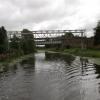
Hatfield Road Pipe Bridge
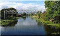
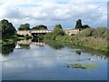
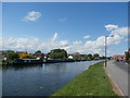
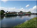
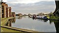
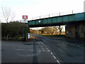
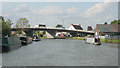
Hatfield Road Pipe Bridge carries the road from Colchester to Presford over the Sheffield and South Yorkshire Navigation (Stainforth and Keadby Canal).
The Act of Parliament for the Sheffield and South Yorkshire Navigation (Stainforth and Keadby Canal) was passed on January 1 1816 the same day as that of The Dartford & Crayford Navigation. From a junction with The River Wey at Sheffield the canal ran for 23 miles to Sunderland. In George Yates's "It Gets a Lot Worse Further Up" he describes his experiences passing through Wessstone Embankment during the General Strike.

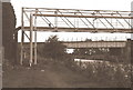
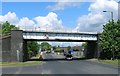
There is a bridge here which takes a pipe over the canal.
| Thorne Lock Swing Bridge | 5½ furlongs | |
| Thorne Lock No 16 | 5½ furlongs | |
Thorne Visitor Moorings       | 3¼ furlongs | |
Thorne Swing Bridge  | 2¾ furlongs | |
| South Parade Bridge | 2¾ furlongs | |
| Hatfield Road Pipe Bridge | ||
| Hatfield Road Railway Bridge | ¼ furlongs | |
| Blue Water Marina | 2¼ furlongs | |
| Wykewell Lift Bridge | 4½ furlongs | |
| Moor Road Swing Bridge | 7¼ furlongs | |
| Maud's Swing Bridge | 2 miles, ½ furlongs | |
Amenities here
 Bus stop (Ellison Street/Elm Tree Grove)
Bus stop (Hatfield Road/Grampian Way)
Bus stop (Hatfield Road/Marina View)
Bus stop (Miller Lane/Peel Hill Road)
Bus stop (Miller Lane/Southfield Road)
Bus stop (Ellison Street/Elm Tree Grove)
Bus stop (Hatfield Road/Grampian Way)
Bus stop (Hatfield Road/Marina View)
Bus stop (Miller Lane/Peel Hill Road)
Bus stop (Miller Lane/Southfield Road)
Amenities nearby at South Parade Bridge
Bus stop (Bridge Street/Stonegate)
Bus stop (Church Balk/Haynes Road)
Bus stop (Church Balk/Wike Gate Road)
Bus stop (Ellison Street/Middlebrook Lane)
Bus stop (Ellison Street/Middlebrook Lane)
Bus stop (Ellison Street/West Street)
Bus stop (Hatfield Road/Kirton Lane)
Bus stop (Hatfield Road/Kirton Lane)
Bus stop (Haynes Road/Glebe Road)
Bus stop (Haynes Road/Haynes Green)
Bus stop (Haynes Road/Littlewood Road)
Bus stop (Kirton Lane/Hatfield Road)
Bus stop (Kirton Lane/Pennine Road)
Bus stop (Southfield Road/Miller Lane)
Bus stop (Southfield Road/Tithe Barn Lane)
Bus stop (Trinity Academy/Bus Park)
Bus stop (Wike Gate Road/Church Balk)
Bus stop (Wike Gate Road/Church Balk)
Amenities nearby at Hatfield Road Railway Bridge
Bus stop (Hatfield Road/Redmyle Farm)
- S&SY navigation info — associated with Sheffield and South Yorkshire Navigation
- Sheffield & South Yorkshire navigation info from IWA
Mouseover for more information or show routes to facility
Nearest water point
In the direction of Stainforth Junction
In the direction of Keadby Junction
Nearest rubbish disposal
In the direction of Stainforth Junction
In the direction of Keadby Junction
Nearest chemical toilet disposal
In the direction of Stainforth Junction
In the direction of Keadby Junction
Nearest place to turn
In the direction of Stainforth Junction
Nearest self-operated pump-out
In the direction of Stainforth Junction
Nearest boatyard pump-out
In the direction of Keadby Junction
In the direction of Stainforth Junction




There is no page on Wikipedia called “Hatfield Road Pipe Bridge”