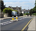
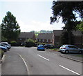
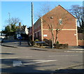
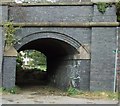
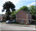
Ebley Confluence & Connecting Weirs
Frome Gardens, Stroud GL5 4LE, United Kingdom

Ebley Confluence & Connecting Weirs
is a minor waterways place
on the Cotswold Canals (Stroudwater Navigation - Un-navigable Section) between
Saul Junction Marina (5 miles and 6¾ furlongs
and 10 locks
to the west) and
Site of Entrance to Wallbridge Basin (The junction between the Stroudwater Navigation and the Thames & Severn Canal.) (7 furlongs
and 2 locks
to the east).
The nearest place in the direction of Saul Junction Marina is Ebley Overflow Weir;
¾ furlongs
away.
The nearest place in the direction of Site of Entrance to Wallbridge Basin is Hilly Orchard Footbridge;
¾ furlongs
away.
Mooring here is unrated.
| Ebley Wharf | 1¾ furlongs | |
| Cloth Mills Bridge | 1¾ furlongs | |
| Ebley Mill Floodgate | 1¼ furlongs | |
| Ebley Mill Swing Bridge | 1¼ furlongs | |
| Ebley Overflow Weir | ¾ furlongs | |
| Ebley Confluence & Connecting Weirs | ||
| Hilly Orchard Footbridge | ¾ furlongs | |
| Dudbridge Wharf | 1½ furlongs | |
| Dudbridge Bridge | 2 furlongs | |
| Dudbridge Lock No 2 | 2¼ furlongs | |
| Ruscombe Brook Feeder | 2½ furlongs | |
Amenities nearby at Hilly Orchard Footbridge
There are no links to external websites from here.
Why not log in and add some (select "External websites" from the menu (sometimes this is under "Edit"))?
Why not log in and add some (select "External websites" from the menu (sometimes this is under "Edit"))?
Mouseover for more information or show routes to facility
Nearest water point
In the direction of Walk Bridge
Saul Junction Marina — 5 miles, 6¾ furlongs and 10 locks away
Travel to Walk Bridge, then on the Cotswold Canals (Stroudwater Navigation - Navigable Section) to Saul Junction Marina
Saul Junction Winding Hole — 6 miles, ¼ furlongs and 10 locks away
Travel to Walk Bridge, then on the Cotswold Canals (Stroudwater Navigation - Navigable Section) to Saul Junction, then on the Gloucester and Sharpness Canal to Saul Junction Winding Hole
Cotswold Canals Trust Visitor Centre - Saul Junction — 6 miles, 1 furlong and 10 locks away
Travel to Walk Bridge, then on the Cotswold Canals (Stroudwater Navigation - Navigable Section) to Saul Junction, then on the Gloucester and Sharpness Canal to Cotswold Canals Trust Visitor Centre - Saul Junction
Fretherne Bridge — 6 miles, 6¼ furlongs and 10 locks away
Travel to Walk Bridge, then on the Cotswold Canals (Stroudwater Navigation - Navigable Section) to Saul Junction, then on the Gloucester and Sharpness Canal to Fretherne Bridge
Splatt Bridge — 7 miles, 7 furlongs and 10 locks away
Travel to Walk Bridge, then on the Cotswold Canals (Stroudwater Navigation - Navigable Section) to Saul Junction, then on the Gloucester and Sharpness Canal to Splatt Bridge
Patch Bridge — 9 miles, 5¾ furlongs and 10 locks away
Travel to Walk Bridge, then on the Cotswold Canals (Stroudwater Navigation - Navigable Section) to Saul Junction, then on the Gloucester and Sharpness Canal to Patch Bridge
Sellars Bridge — 9 miles, 6 furlongs and 10 locks away
Travel to Walk Bridge, then on the Cotswold Canals (Stroudwater Navigation - Navigable Section) to Saul Junction, then on the Gloucester and Sharpness Canal to Sellars Bridge
Purton Lower Bridge — 12 miles, 1½ furlongs and 10 locks away
Travel to Walk Bridge, then on the Cotswold Canals (Stroudwater Navigation - Navigable Section) to Saul Junction, then on the Gloucester and Sharpness Canal to Purton Lower Bridge
Llanthony Pontoons — 13 miles, 4 furlongs and 10 locks away
Travel to Walk Bridge, then on the Cotswold Canals (Stroudwater Navigation - Navigable Section) to Saul Junction, then on the Gloucester and Sharpness Canal to Llanthony Pontoons
Llanthony Road Bridge — 13 miles, 4¾ furlongs and 10 locks away
Travel to Walk Bridge, then on the Cotswold Canals (Stroudwater Navigation - Navigable Section) to Saul Junction, then on the Gloucester and Sharpness Canal to Llanthony Road Bridge
Gloucester Waterways Museum Arm — 13 miles, 5¼ furlongs and 10 locks away
Travel to Walk Bridge, then on the Cotswold Canals (Stroudwater Navigation - Navigable Section) to Saul Junction, then on the Gloucester and Sharpness Canal to Gloucester Waterways Museum Arm
Gloucester Dock Lock — 13 miles, 6 furlongs and 10 locks away
Travel to Walk Bridge, then on the Cotswold Canals (Stroudwater Navigation - Navigable Section) to Saul Junction, then on the Gloucester and Sharpness Canal to Gloucester Dock LockNearest rubbish disposal
In the direction of Walk Bridge
Saul Junction Marina — 5 miles, 6¾ furlongs and 10 locks away
Travel to Walk Bridge, then on the Cotswold Canals (Stroudwater Navigation - Navigable Section) to Saul Junction Marina
Saul Junction Winding Hole — 6 miles, ¼ furlongs and 10 locks away
Travel to Walk Bridge, then on the Cotswold Canals (Stroudwater Navigation - Navigable Section) to Saul Junction, then on the Gloucester and Sharpness Canal to Saul Junction Winding Hole
Fretherne Bridge — 6 miles, 6¼ furlongs and 10 locks away
Travel to Walk Bridge, then on the Cotswold Canals (Stroudwater Navigation - Navigable Section) to Saul Junction, then on the Gloucester and Sharpness Canal to Fretherne Bridge
Parkend Bridge — 7 miles, 4½ furlongs and 10 locks away
Travel to Walk Bridge, then on the Cotswold Canals (Stroudwater Navigation - Navigable Section) to Saul Junction, then on the Gloucester and Sharpness Canal to Parkend Bridge
Splatt Bridge — 7 miles, 7 furlongs and 10 locks away
Travel to Walk Bridge, then on the Cotswold Canals (Stroudwater Navigation - Navigable Section) to Saul Junction, then on the Gloucester and Sharpness Canal to Splatt Bridge
Patch Bridge — 9 miles, 5¾ furlongs and 10 locks away
Travel to Walk Bridge, then on the Cotswold Canals (Stroudwater Navigation - Navigable Section) to Saul Junction, then on the Gloucester and Sharpness Canal to Patch Bridge
Sellars Bridge — 9 miles, 6 furlongs and 10 locks away
Travel to Walk Bridge, then on the Cotswold Canals (Stroudwater Navigation - Navigable Section) to Saul Junction, then on the Gloucester and Sharpness Canal to Sellars Bridge
Purton Lower Bridge — 12 miles, 1½ furlongs and 10 locks away
Travel to Walk Bridge, then on the Cotswold Canals (Stroudwater Navigation - Navigable Section) to Saul Junction, then on the Gloucester and Sharpness Canal to Purton Lower Bridge
Sharpness Barge Arm — 13 miles, 4¾ furlongs and 10 locks away
Travel to Walk Bridge, then on the Cotswold Canals (Stroudwater Navigation - Navigable Section) to Saul Junction, then on the Gloucester and Sharpness Canal to Sharpness Barge Arm
Llanthony Road Bridge — 13 miles, 4¾ furlongs and 10 locks away
Travel to Walk Bridge, then on the Cotswold Canals (Stroudwater Navigation - Navigable Section) to Saul Junction, then on the Gloucester and Sharpness Canal to Llanthony Road BridgeNearest chemical toilet disposal
In the direction of Walk Bridge
Saul Junction Marina — 5 miles, 6¾ furlongs and 10 locks away
Travel to Walk Bridge, then on the Cotswold Canals (Stroudwater Navigation - Navigable Section) to Saul Junction Marina
Cotswold Canals Trust Visitor Centre - Saul Junction — 6 miles, 1 furlong and 10 locks away
Travel to Walk Bridge, then on the Cotswold Canals (Stroudwater Navigation - Navigable Section) to Saul Junction, then on the Gloucester and Sharpness Canal to Cotswold Canals Trust Visitor Centre - Saul Junction
Sharpness Barge Arm — 13 miles, 4¾ furlongs and 10 locks away
Travel to Walk Bridge, then on the Cotswold Canals (Stroudwater Navigation - Navigable Section) to Saul Junction, then on the Gloucester and Sharpness Canal to Sharpness Barge Arm
Llanthony Road Bridge — 13 miles, 4¾ furlongs and 10 locks away
Travel to Walk Bridge, then on the Cotswold Canals (Stroudwater Navigation - Navigable Section) to Saul Junction, then on the Gloucester and Sharpness Canal to Llanthony Road BridgeNearest place to turn
In the direction of Walk Bridge
Ryeford Winding Hole — 1 mile, 1½ furlongs and 2 locks away
On this waterway in the direction of Walk Bridge
The Ocean — 2 miles, 1¼ furlongs and 2 locks away
On this waterway in the direction of Walk Bridge
Saul Junction Winding Hole — 6 miles, ¼ furlongs and 10 locks away
Travel to Walk Bridge, then on the Cotswold Canals (Stroudwater Navigation - Navigable Section) to Saul Junction, then on the Gloucester and Sharpness Canal to Saul Junction Winding Hole
Pegthorne Bridge Winding Hole — 6 miles, 4¾ furlongs and 10 locks away
Travel to Walk Bridge, then on the Cotswold Canals (Stroudwater Navigation - Navigable Section) to Saul Junction, then on the Gloucester and Sharpness Canal to Pegthorne Bridge Winding Hole
Quedgeley Oil Depot — 9 miles, 7¼ furlongs and 10 locks away
Travel to Walk Bridge, then on the Cotswold Canals (Stroudwater Navigation - Navigable Section) to Saul Junction, then on the Gloucester and Sharpness Canal to Quedgeley Oil Depot
Monk Meadow Dock — 13 miles, 1½ furlongs and 10 locks away
Travel to Walk Bridge, then on the Cotswold Canals (Stroudwater Navigation - Navigable Section) to Saul Junction, then on the Gloucester and Sharpness Canal to Monk Meadow Dock
Sharpness Barge Arm — 13 miles, 4¾ furlongs and 10 locks away
Travel to Walk Bridge, then on the Cotswold Canals (Stroudwater Navigation - Navigable Section) to Saul Junction, then on the Gloucester and Sharpness Canal to Sharpness Barge Arm
Gloucester Docks — 13 miles, 5½ furlongs and 10 locks away
Travel to Walk Bridge, then on the Cotswold Canals (Stroudwater Navigation - Navigable Section) to Saul Junction, then on the Gloucester and Sharpness Canal to Gloucester Docks
Waterways Office (South Wales and Severn Waterways) - Canal & River Trust — 13 miles, 5¾ furlongs and 10 locks away
Travel to Walk Bridge, then on the Cotswold Canals (Stroudwater Navigation - Navigable Section) to Saul Junction, then on the Gloucester and Sharpness Canal to Waterways Office (South Wales and Severn Waterways) - Canal & River Trust
Gloucester / Sharpness - Severn Junction — 13 miles, 6¼ furlongs and 11 locks away
Travel to Walk Bridge, then on the Cotswold Canals (Stroudwater Navigation - Navigable Section) to Saul Junction, then on the Gloucester and Sharpness Canal to Gloucester / Sharpness - Severn Junction
Upper Parting Junction — 16 miles, 3 furlongs and 11 locks away
Travel to Walk Bridge, then on the Cotswold Canals (Stroudwater Navigation - Navigable Section) to Saul Junction, then on the Gloucester and Sharpness Canal to Gloucester / Sharpness - Severn Junction, then on the River Severn (main river - Worcester to Gloucester) to Upper Parting Junction
Over Winding Hole — 15 miles, 6 furlongs and 12 locks away
Travel to Walk Bridge, then on the Cotswold Canals (Stroudwater Navigation - Navigable Section) to Saul Junction, then on the Gloucester and Sharpness Canal to Gloucester / Sharpness - Severn Junction, then on the River Severn (old river navigation) to Lower Parting, then on the River Severn (Maisemore Channel - Southern Section) to Over Junction, then on the Hereford and Gloucester Canal to Over Winding Hole
In the direction of Site of Entrance to Wallbridge Basin
Brimscombe Port — 3 miles, 5 furlongs and 9 locks away
Travel to Site of Entrance to Wallbridge Basin, then on the Cotswold Canals (Thames and Severn Canal - Wide section) to Brimscombe PortNearest self-operated pump-out
In the direction of Walk Bridge
Cotswold Canals Trust Visitor Centre - Saul Junction — 6 miles, 1 furlong and 10 locks away
Travel to Walk Bridge, then on the Cotswold Canals (Stroudwater Navigation - Navigable Section) to Saul Junction, then on the Gloucester and Sharpness Canal to Cotswold Canals Trust Visitor Centre - Saul Junction
Purton Lower Bridge — 12 miles, 1½ furlongs and 10 locks away
Travel to Walk Bridge, then on the Cotswold Canals (Stroudwater Navigation - Navigable Section) to Saul Junction, then on the Gloucester and Sharpness Canal to Purton Lower Bridge
Llanthony Pontoons — 13 miles, 4 furlongs and 10 locks away
Travel to Walk Bridge, then on the Cotswold Canals (Stroudwater Navigation - Navigable Section) to Saul Junction, then on the Gloucester and Sharpness Canal to Llanthony PontoonsNearest boatyard pump-out
In the direction of Walk Bridge
Saul Junction Marina — 5 miles, 6¾ furlongs and 10 locks away
Travel to Walk Bridge, then on the Cotswold Canals (Stroudwater Navigation - Navigable Section) to Saul Junction Marina
Patch Bridge — 9 miles, 5¾ furlongs and 10 locks away
Travel to Walk Bridge, then on the Cotswold Canals (Stroudwater Navigation - Navigable Section) to Saul Junction, then on the Gloucester and Sharpness Canal to Patch BridgeDirection of TV transmitter (From Wolfbane Cybernetic)
There is no page on Wikipedia called “Ebley Confluence & Connecting Weirs”
Wikipedia pages that might relate to Ebley Confluence & Connecting Weirs
[List of rivers of Europe]
extrapolated from Severn at Haw Bridge, Leadon at Wedderburn Bridge, and Frome at Ebley Mill gauge stations Sandre. "Fiche cours d'eau - Seine (----0010)". Sandre
[River Thames]
section of the Thames from its traditional source at Thames Head to the confluence, the overall length of the Thames measured from Seven Springs, at 229
[River Avon, Bristol]
for the ancient hilltop town of Malmesbury to sit on. Upstream of this confluence the river is sometimes referred to as the 'River Avon (Sherston Branch)'
[Stroud]
it appeared in the public press at the time. The excavation at a site at Ebley Road in Stonehouse has revealed evidence of some of the earliest Roman activity
[River Severn]
Worcestershire. It then passes through Wolverley, Kidderminster and Wilden to its confluence with the Severn at Stourport-on-Severn. The Dick Brook, Shrawley Brook
[River Leach]
Next confluence upstream River Thames Next confluence downstream River Coln (north) with Thames and Severn Canal River Leach River Cole (south)
[River Wye]
was spent several times improving the River Lugg from Leominster to its confluence with the Wye at Mordiford, but its navigation is likely to have been difficult
[River Churn]
meet the Thames at Cricklade in Wiltshire. Its length from its source to confluence with the Thames is greater than that of the Thames from Thames Head, though
[River Avon, Warwickshire]
the north, east and west blocking the flow of the Avon to its former confluence with the Trent. The waters were thus trapped: on the north, east and west
[River Evenlode]
environment.data.gov.uk. Retrieved 1 April 2018. "Evenlode (Bledington to Glyme confluence)". environment.data.gov.uk. Retrieved 1 April 2018. "Evenlode (Glyme to
Results of Google Search
Ebley Confluence & Connecting WeirsJan 30, 2018 ... Before restoration, the canal (with waters from Slad Brook, Painswick Stream & Ruscumbe Brook) was diverted directly into the River Frome at ...
A1.1 British Waterways, Heritage Policy and Principles, October 2005. A1.2 British ...... streams exited the canal channel at Confluence Weir at Ebley. The.
Jan 30, 2018 ... The Ebley Overflow Weir will deal with exceptional flow conditions, and is only likely to come into operation when the Ebley Flood Gate is closed. The weir is c... ... Stroudwater Location... Ebley Confluence & Connecting Weirs ...
Work on Lodgemore bridge and Wallbridge Lower Lock has yet to start. ... brook joining the canal between the two Dudbridge locks, and these flows are ... Immediately upstream of this confluence is a low weir across the canal which will be ...
Significant structures and locations on the Phase 1A Restoration Section of the Stroudwater Navigation and ... Ebley Confluence & Connecting Weirs [more].
This page lists the principal rivers of Europe with their main attributes. Contents. [ hide]. 1 Scope; 2 Caveats; 3 Rivers of Europe; 4 Notes; 5 References; 6 See also. Scope[edit]. The border of Europe and Asia is here defined as from the Kara Sea over the ... Iceland and the British Islands are included via virtual connections with ...
Canal structures and other points of interest travelling from west to east on the Phase 1A Restoration Section of ... Ebley Confluence & Connecting Weirs [more].
boundary violating behavior between an inmate and an employee has the potential ...... skills and social connections that may help increase an inmate's social ...... Sarah also had a hard time being a visitor and not an officer: “It felt weird to be ..... Sarah is not sure if the confluence of events pushed her into a relationship with.
again and then keeping the canal maintained for future ... East route connecting the region to London. It was the ...... Bridge and Ebley Confluence Weir with.
Thurber Connection ... Thurber was cremated and his ashes were brought home to Columbus from New York ...... it off . . . he stood up and strapped on his huge Webley Vickers automatic. ...... Here in Columbus the swollen Olentangy and Scioto Rivers merged at their confluence into one ...... What a weird and goofy idea.


