Navigation Drive Bridge No 99A
is a minor waterways place
on the Grand Union Canal (Leicester Section - Leicestershire and Northamptonshire Union Canal) between
Newton Church Bridge No 80 (Newton Harcourt to the north) (5 miles and 5¼ furlongs
and 13 locks
to the east) and
River Soar Junction (Junction of GU Leicester Section and River Soar Navigation) (2 miles and 1½ furlongs
and 3 locks
to the north).
The nearest place in the direction of Newton Church Bridge No 80 is Whetstone Lane Bridge No 99;
¾ furlongs
away.
The nearest place in the direction of River Soar Junction is Navigation Drive Railway Bridge (demolished);
2¼ furlongs
away.
There may be access to the towpath here.
Mooring here is unrated.
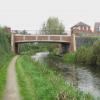
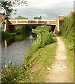
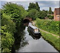
There is a bridge here which takes a minor road over the canal.
Blaby Bridge No 98 | 2¼ furlongs | |
Blaby Bridge Winding Hole | 2¼ furlongs | |
Wharf by Blaby Bridge No 98 (disused) | 2 furlongs | |
Whetstone Lane Lock No 35 | ¾ furlongs | |
Whetstone Lane Bridge No 99 | ¾ furlongs | |
Navigation Drive Bridge No 99A | ||
Navigation Drive Railway Bridge (demolished) | 2¼ furlongs | |
Handford Bridge No 100 | 2½ furlongs | |
Gee's Lock No 36 | 5¾ furlongs | |
Gee's Bridge No 101 | 6 furlongs | |
Blue Bank Bridge No 102 | 1 mile, 1 furlong |
Amenities nearby at Navigation Drive Railway Bridge (demolished)
- Grand Union Canal Walk — associated with Grand Union Canal
- An illustrated walk along the Grand Union Canal from London to Birmingham
Mouseover for more information or show routes to facility
Nearest water point
In the direction of Foxton Junction
Kilby Bridge No 87 — 3 miles, 3¼ furlongs and 6 locks away
On this waterway in the direction of Foxton Junction
Foxton Junction — 13 miles, 1¾ furlongs and 18 locks away
On this waterway in the direction of Foxton Junction
Inclined Plane Upper Access Arm Junction — 13 miles, 4¾ furlongs and 18 locks away
Travel to Foxton Junction, then on the Grand Union Canal (Leicester Section - Market Harborough Branch) to Inclined Plane Lower Access Arm Junction, then on the Grand Union Canal (Leicester Section - Inclined Plane Branch) to Inclined Plane Upper Access Arm Junction
Market Harborough Wharf — 18 miles, 5¾ furlongs and 18 locks away
Travel to Foxton Junction, then on the Grand Union Canal (Leicester Section - Market Harborough Branch) to Market Harborough Wharf
In the direction of River Soar Junction
Friars Mill Visitor Moorings — 5 miles, ¼ furlongs and 6 locks away
Travel to River Soar Junction, then on the Grand Union Canal (Leicester Section - River Soar Navigation) to Friars Mill Visitor Moorings
Hope and Anchor Bridge No 19 — 11 miles, ¼ furlongs and 11 locks away
Travel to River Soar Junction, then on the Grand Union Canal (Leicester Section - River Soar Navigation) to Hope and Anchor Bridge No 19
Barrow Boating — 16 miles, 5¼ furlongs and 15 locks away
Travel to River Soar Junction, then on the Grand Union Canal (Leicester Section - River Soar Navigation) to Barrow BoatingNearest rubbish disposal
In the direction of Foxton Junction
Kilby Bridge No 87 — 3 miles, 3¼ furlongs and 6 locks away
On this waterway in the direction of Foxton Junction
Foxton Junction Swing Bridge — 13 miles, 2 furlongs and 18 locks away
Travel to Foxton Junction, then on the Grand Union Canal (Leicester Section - Market Harborough Branch) to Foxton Junction Swing Bridge
Market Harborough Wharf — 18 miles, 5¾ furlongs and 18 locks away
Travel to Foxton Junction, then on the Grand Union Canal (Leicester Section - Market Harborough Branch) to Market Harborough Wharf
In the direction of River Soar Junction
Broome Island — 15 miles, 6¾ furlongs and 15 locks away
Travel to River Soar Junction, then on the Grand Union Canal (Leicester Section - River Soar Navigation) to Broome Island
Barrow Boating — 16 miles, 5¼ furlongs and 15 locks away
Travel to River Soar Junction, then on the Grand Union Canal (Leicester Section - River Soar Navigation) to Barrow BoatingNearest chemical toilet disposal
In the direction of Foxton Junction
Kilby Bridge No 87 — 3 miles, 3¼ furlongs and 6 locks away
On this waterway in the direction of Foxton Junction
Foxton Junction Swing Bridge — 13 miles, 2 furlongs and 18 locks away
Travel to Foxton Junction, then on the Grand Union Canal (Leicester Section - Market Harborough Branch) to Foxton Junction Swing Bridge
Market Harborough Wharf — 18 miles, 5¾ furlongs and 18 locks away
Travel to Foxton Junction, then on the Grand Union Canal (Leicester Section - Market Harborough Branch) to Market Harborough Wharf
In the direction of River Soar Junction
Sileby Mill Mooring Basin — 14 miles, 1 furlong and 14 locks away
Travel to River Soar Junction, then on the Grand Union Canal (Leicester Section - River Soar Navigation) to Sileby Mill Mooring Basin
Barrow Boating — 16 miles, 5¼ furlongs and 15 locks away
Travel to River Soar Junction, then on the Grand Union Canal (Leicester Section - River Soar Navigation) to Barrow BoatingNearest place to turn
In the direction of Foxton Junction
Blaby Bridge Winding Hole — 2¼ furlongs and 1 lock away
On this waterway in the direction of Foxton Junction
Bush Lock Winding Hole — 1 mile, 3¼ furlongs and 2 locks away
On this waterway in the direction of Foxton Junction
Kilby Bridge Winding Hole — 3 miles, 2¼ furlongs and 6 locks away
On this waterway in the direction of Foxton Junction
Wain Bridge Winding Hole — 5 miles, 2 furlongs and 11 locks away
On this waterway in the direction of Foxton Junction
Crane's Lock Winding Hole — 7 miles, 1 furlong and 13 locks away
On this waterway in the direction of Foxton Junction
In the direction of River Soar Junction
Memory Lane Wharf — 6 miles, ¾ furlongs and 7 locks away
Travel to River Soar Junction, then on the Grand Union Canal (Leicester Section - River Soar Navigation) to Memory Lane Wharf
Belgrave Circle Arm (disused) — 6 miles, 1¾ furlongs and 8 locks away
Travel to River Soar Junction, then on the Grand Union Canal (Leicester Section - River Soar Navigation) to Belgrave Circle Arm (disused)
Entrance to Riverside Lakes — 7 miles, 4¼ furlongs and 9 locks away
Travel to River Soar Junction, then on the Grand Union Canal (Leicester Section - River Soar Navigation) to Entrance to Riverside Lakes
Birstall Lock Winding Hole — 8 miles, 5¾ furlongs and 9 locks away
Travel to River Soar Junction, then on the Grand Union Canal (Leicester Section - River Soar Navigation) to Birstall Lock Winding Hole
White Horse Lane Junction — 8 miles, 6¾ furlongs and 10 locks away
Travel to River Soar Junction, then on the Grand Union Canal (Leicester Section - River Soar Navigation) to White Horse Lane Junction
Leicester Marina Entrance — 9 miles, 4¾ furlongs and 10 locks away
Travel to River Soar Junction, then on the Grand Union Canal (Leicester Section - River Soar Navigation) to Leicester Marina Entrance
Thurmaston Lock Arm — 9 miles, 6 furlongs and 10 locks away
Travel to River Soar Junction, then on the Grand Union Canal (Leicester Section - River Soar Navigation) to Thurmaston Lock Arm
MGM Boats Winding Hole — 9 miles, 6¾ furlongs and 11 locks away
Travel to River Soar Junction, then on the Grand Union Canal (Leicester Section - River Soar Navigation) to MGM Boats Winding Hole
MGM Boats, Thurmaston — 9 miles, 7½ furlongs and 11 locks away
Travel to River Soar Junction, then on the Grand Union Canal (Leicester Section - River Soar Navigation) to MGM Boats, Thurmaston
Old Junction Boatyard (Syston) — 11 miles, 4 furlongs and 11 locks away
Travel to River Soar Junction, then on the Grand Union Canal (Leicester Section - River Soar Navigation) to Old Junction Boatyard (Syston)
River Wreake Junction — 11 miles, 4¼ furlongs and 11 locks away
Travel to River Soar Junction, then on the Grand Union Canal (Leicester Section - River Soar Navigation) to River Wreake Junction
Wreake Outlet by Junction Lock No 47 — 12 miles, 1 furlong and 12 locks away
Travel to River Soar Junction, then on the Grand Union Canal (Leicester Section - River Soar Navigation) to Wreake Outlet by Junction Lock No 47
Wreake Mouth — 12 miles, 4¼ furlongs and 12 locks away
Travel to River Soar Junction, then on the Grand Union Canal (Leicester Section - River Soar Navigation) to Wreake Mouth
Cossington Mill Stream Junction — 12 miles, 6 furlongs and 13 locks away
Travel to River Soar Junction, then on the Grand Union Canal (Leicester Section - River Soar Navigation) to Cossington Mill Stream Junction
Loughborough Road Winding Hole — 12 miles, 6½ furlongs and 13 locks away
Travel to River Soar Junction, then on the Grand Union Canal (Leicester Section - River Soar Navigation) to Loughborough Road Winding HoleNearest self-operated pump-out
In the direction of Foxton Junction
Kilby Bridge No 87 — 3 miles, 3¼ furlongs and 6 locks away
On this waterway in the direction of Foxton JunctionNearest boatyard pump-out
In the direction of River Soar Junction
Sileby Mill Mooring Basin — 14 miles, 1 furlong and 14 locks away
Travel to River Soar Junction, then on the Grand Union Canal (Leicester Section - River Soar Navigation) to Sileby Mill Mooring BasinDirection of TV transmitter (From Wolfbane Cybernetic)
There is no page on Wikipedia called “Navigation Drive Bridge No 99A”
Wikipedia pages that might relate to Navigation Drive Bridge No 99A
[Granville Street Bridge]
It is part of Highway 99. The original bridge was completed in 1889. It was a 732-metre long low timber trestle. The navigation span, near the north end
[Steel Bridge]
No. 1W, former Oregon Route 99W), and light rail (MAX), making the bridge one of the most multimodal in the world. It is the only double-deck bridge with
[West Seattle Bridge]
high-level bridge. The low-level bridge carries the surface-level Spokane Street and has a navigational clearance of 45 feet (13.7 meters). The bridge was closed
[Brooklyn Bridge]
feet (26 m) wide. The bridge "elongates and contracts between the extremes of temperature from 14 to 16 inches". Navigational clearance is 127 ft (38
[Mackinac Bridge]
The Mackinac Bridge (/ˈmækɪnɔː/ MAK-in-aw) is a suspension bridge spanning the Straits of Mackinac to connect the Upper and Lower peninsulas of the U.S
[Lockheed SR-71 Blackbird]
fly first international sortie in SR-71A, AF Ser. No. 61-7972, when the Astro-Inertial Navigation System (ANS) fails on a training mission and they accidentally
[List of folk songs by Roud number]
"Come Give Me a Slice of Your Bread" 2452. "The Sprig of May" 2453. "Navigation" 2454. No record 2455. "The Wearing of the Horns", "Horn Boys Horn" 2456. "Old
[List of bridge failures]
This is a list of bridge failures. Harry Potter and the Half-Blood Prince (2005 novel): the fictional Brockdale Bridge, by the Death Eaters (replaced by
[Oregon Route 120]
Slough Bridge. OR 120 continues to follow BNSF Railway tracks and passes through wetlands before having a T-intersection with North Marine Drive. The road
[Schuylkill River Trail]
The trail begins in North Reading, along Riverview Drive, then quickly crosses an old railroad bridge into West Reading. It then continues as a mixed-surface
Results of Google Search
Loveland-Miamiville Road Culvert No. CC75-32 & CC75-33 Replacement – Completed. Loveland-Miamiville Road Culvert No. CC75-24 Replacement – ...
Highway 99, also known as the Fraser Delta Thruway south of Vancouver, and the Sea to Sky ... Jump to navigation Jump to search ... The number of this highway is derived from the old U.S. Route 99, with which the highway originally connected. ... Park, and over the Lions Gate Bridge into West Vancouver at Marine Drive.
Aug 4, 2019 ... Viewed from Navigation Drive Bridge No 99A, crossing the Grand Union Canal.
The free all-in-one ActiveCaptain™ app provides a powerful connection to your Garmin chartplotter, charts, maps and the ActiveCaptain community for the ...
13a-99. Towns to build and repair highways and bridges. Sec. 13a-99a. ... Discontinuance of road by town where no other access to highway remains for plaintiff held ... Layout of highway across cove, when not void as obstructing navigation.
The contextual study would not have been possible without their valuable assistance. ... 99. (2). Post Roads and King's Highways (1669-1700s) . ... Most stone arch road bridges in New York dated from the 1840s through 1890s and ... Movable bridges in New York allowed for vehicular crossing and water navigation of the.
Application number: AU24673/99A; Other versions: AU2467399A (en ... Output arrangements for transferring data from processing unit to output unit, e.g. ... with three-dimensional environments, e.g. control of viewpoint to navigate in the environment ... 2016-04-26, August Home, Inc. BLE/WiFi bridge with audio sensor.