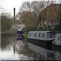
Mill Lane Footbridge
is a minor waterways place
on the Grand Union Canal (Erewash Canal) between
Potter's Lock Bridge (3 miles and 4 furlongs
and 5 locks
to the north) and
Sandiacre (1¼ furlongs
to the southwest).
The nearest place in the direction of Potter's Lock Bridge is Footbridge (Sandiacre);
4½ furlongs
away.
There may be access to the towpath here.
Mooring here is unrated.
There is a bridge here which takes pedestrian traffic over the canal.
Railway Bridge near Stapleford (disused) | 1 mile, 1½ furlongs | |
M1 Motorway Bridge | 1 mile, ¾ furlongs | |
Stanton Gate Bridge | 1 mile | |
Pasture Lock No 64 | 6¼ furlongs | |
Footbridge (Sandiacre) | 4½ furlongs | |
Mill Lane Footbridge | ||
Sandiacre | 1¼ furlongs | |
Sandiacre Bridge | 1¾ furlongs | |
A52 Road Bridge | 4¼ furlongs | |
Sandiacre Junction | 5½ furlongs | |
Sandiacre Lock No 63 | 5¾ furlongs |
- Grand Union Canal Walk — associated with Grand Union Canal
- An illustrated walk along the Grand Union Canal from London to Birmingham
Mouseover for more information or show routes to facility
Nearest water point
In the direction of Trent Junction
Former BW Trent Lock Waterway Office — 3 miles, 6¾ furlongs and 3 locks away
On this waterway in the direction of Trent Junction
Sawley Locks No 2 — 4 miles, 7 furlongs and 4 locks away
Travel to Trent Junction, then on the River Trent (Western End) to Sawley Locks No 2
Cranfleet Lock No 3 — 4 miles, 5¼ furlongs and 5 locks away
Travel to Trent Junction, then on the River Trent (Western End) to Cranfleet Lock No 3
Shardlow — 7 miles, ¾ furlongs and 7 locks away
Travel to Trent Junction, then on the River Trent (Western End) to Derwent Mouth, then on the Trent and Mersey Canal (Main Line - Derwent Mouth to Burton) to Shardlow
Beeston Lock No 5 — 8 miles, 7¾ furlongs and 6 locks away
Travel to Trent Junction, then on the River Trent (Western End) to Beeston Lock No 5
Weston Lock No 4 — 10 miles, ¼ furlongs and 9 locks away
Travel to Trent Junction, then on the River Trent (Western End) to Derwent Mouth, then on the Trent and Mersey Canal (Main Line - Derwent Mouth to Burton) to Weston Lock No 4
Bishop Meadow Lock No 54 — 12 miles, 1 furlong and 9 locks away
Travel to Trent Junction, then on the Grand Union Canal (Leicester Section - River Soar Navigation) to Bishop Meadow Lock No 54
Swarkestone Lock No 5 — 13 miles, 1¾ furlongs and 8 locks away
Travel to Sandiacre Junction, then on the Derby and Sandiacre Canal to Swarkestone Junction, then on the Trent and Mersey Canal (Main Line - Derwent Mouth to Burton) to Swarkestone Lock No 5
Loughborough Basin — 13 miles, 1¾ furlongs and 11 locks away
Travel to Trent Junction, then on the Grand Union Canal (Leicester Section - River Soar Navigation) to Loughborough Branch Junction, then on the Grand Union Canal (Leicester Section - Loughborough Branch) to Loughborough Basin
Holme Lock No 5 — 17 miles, 2¼ furlongs and 9 locks away
Travel to Trent Junction, then on the River Trent (Western End) to Beeston Lock No 5, then on the River Trent (Beeston Canal) to Lenton Chain, then on the River Trent (Nottingham Canal) to Meadow Lane Junction, then on the River Trent (non-tidal section) to Holme Lock No 5
Willington Services — 18 miles, 3½ furlongs and 9 locks away
Travel to Sandiacre Junction, then on the Derby and Sandiacre Canal to Swarkestone Junction, then on the Trent and Mersey Canal (Main Line - Derwent Mouth to Burton) to Willington Services
Barrow Boating — 17 miles, 1 furlong and 13 locks away
Travel to Trent Junction, then on the Grand Union Canal (Leicester Section - River Soar Navigation) to Barrow Boating
In the direction of Derby Road Bridge
Langley Junction — 7 miles, 5¼ furlongs and 11 locks away
Travel to Derby Road Bridge, then on the Cromford Canal (broad gauge, navigable) to Langley JunctionNearest rubbish disposal
In the direction of Trent Junction
Former BW Trent Lock Waterway Office — 3 miles, 6¾ furlongs and 3 locks away
On this waterway in the direction of Trent Junction
Sawley Locks No 2 — 4 miles, 7 furlongs and 4 locks away
Travel to Trent Junction, then on the River Trent (Western End) to Sawley Locks No 2
Cranfleet Lock No 3 — 4 miles, 5¼ furlongs and 5 locks away
Travel to Trent Junction, then on the River Trent (Western End) to Cranfleet Lock No 3
Beeston Lock No 5 — 8 miles, 7¾ furlongs and 6 locks away
Travel to Trent Junction, then on the River Trent (Western End) to Beeston Lock No 5
Swarkestone Lock No 5 — 13 miles, 1¾ furlongs and 8 locks away
Travel to Sandiacre Junction, then on the Derby and Sandiacre Canal to Swarkestone Junction, then on the Trent and Mersey Canal (Main Line - Derwent Mouth to Burton) to Swarkestone Lock No 5
Loughborough Basin — 13 miles, 1¾ furlongs and 11 locks away
Travel to Trent Junction, then on the Grand Union Canal (Leicester Section - River Soar Navigation) to Loughborough Branch Junction, then on the Grand Union Canal (Leicester Section - Loughborough Branch) to Loughborough Basin
Holme Lock No 5 — 17 miles, 2¼ furlongs and 9 locks away
Travel to Trent Junction, then on the River Trent (Western End) to Beeston Lock No 5, then on the River Trent (Beeston Canal) to Lenton Chain, then on the River Trent (Nottingham Canal) to Meadow Lane Junction, then on the River Trent (non-tidal section) to Holme Lock No 5
Willington Services — 18 miles, 3½ furlongs and 9 locks away
Travel to Sandiacre Junction, then on the Derby and Sandiacre Canal to Swarkestone Junction, then on the Trent and Mersey Canal (Main Line - Derwent Mouth to Burton) to Willington Services
Barrow Boating — 17 miles, 1 furlong and 13 locks away
Travel to Trent Junction, then on the Grand Union Canal (Leicester Section - River Soar Navigation) to Barrow Boating
Broome Island — 17 miles, 7¼ furlongs and 13 locks away
Travel to Trent Junction, then on the Grand Union Canal (Leicester Section - River Soar Navigation) to Broome IslandNearest chemical toilet disposal
In the direction of Trent Junction
Former BW Trent Lock Waterway Office — 3 miles, 6¾ furlongs and 3 locks away
On this waterway in the direction of Trent Junction
Sawley Locks No 2 — 4 miles, 7 furlongs and 4 locks away
Travel to Trent Junction, then on the River Trent (Western End) to Sawley Locks No 2
Sawley Cut Wharf — 5 miles, ½ furlongs and 5 locks away
Travel to Trent Junction, then on the River Trent (Western End) to Sawley Cut Wharf
Beeston Lock No 5 — 8 miles, 7¾ furlongs and 6 locks away
Travel to Trent Junction, then on the River Trent (Western End) to Beeston Lock No 5
Meadow Lane Lock No 7 — 14 miles, 6¾ furlongs and 8 locks away
Travel to Trent Junction, then on the River Trent (Western End) to Beeston Lock No 5, then on the River Trent (Beeston Canal) to Lenton Chain, then on the River Trent (Nottingham Canal) to Meadow Lane Lock No 7
Holme Lock No 5 — 17 miles, 2¼ furlongs and 9 locks away
Travel to Trent Junction, then on the River Trent (Western End) to Beeston Lock No 5, then on the River Trent (Beeston Canal) to Lenton Chain, then on the River Trent (Nottingham Canal) to Meadow Lane Junction, then on the River Trent (non-tidal section) to Holme Lock No 5
Willington Services — 18 miles, 3½ furlongs and 9 locks away
Travel to Sandiacre Junction, then on the Derby and Sandiacre Canal to Swarkestone Junction, then on the Trent and Mersey Canal (Main Line - Derwent Mouth to Burton) to Willington Services
Barrow Boating — 17 miles, 1 furlong and 13 locks away
Travel to Trent Junction, then on the Grand Union Canal (Leicester Section - River Soar Navigation) to Barrow Boating
Sileby Mill Mooring Basin — 19 miles, 5¼ furlongs and 14 locks away
Travel to Trent Junction, then on the Grand Union Canal (Leicester Section - River Soar Navigation) to Sileby Mill Mooring Basin
In the direction of Derby Road Bridge
Langley Junction — 7 miles, 5¼ furlongs and 11 locks away
Travel to Derby Road Bridge, then on the Cromford Canal (broad gauge, navigable) to Langley JunctionNearest place to turn
In the direction of Trent Junction
Sandiacre Junction — 5½ furlongs away
On this waterway in the direction of Trent Junction
Long Eaton Winding Hole — 2 miles and 2 locks away
On this waterway in the direction of Trent Junction
Sheet Stores Basin — 3 miles, 1¾ furlongs and 3 locks away
On this waterway in the direction of Trent Junction
Former BW Trent Lock Waterway Office — 3 miles, 6¾ furlongs and 3 locks away
On this waterway in the direction of Trent Junction
Soar Mouth — 4 miles, 1¼ furlongs and 4 locks away
Travel to Trent Junction, then on the Grand Union Canal (Leicester Section - River Soar Navigation) to Soar Mouth
Redhill Lock Junction — 4 miles, 4 furlongs and 4 locks away
Travel to Trent Junction, then on the Grand Union Canal (Leicester Section - River Soar Navigation) to Redhill Lock Junction
Sawley Lock No 2 Weir Exit — 4 miles, 6¼ furlongs and 4 locks away
Travel to Trent Junction, then on the River Trent (Western End) to Sawley Lock No 2 Weir Exit
Redhill Marine Ltd — 5 miles, ¼ furlongs and 5 locks away
Travel to Trent Junction, then on the Grand Union Canal (Leicester Section - River Soar Navigation) to Redhill Marine Ltd
Ratcliffe Lock Junction — 5 miles, 2¾ furlongs and 5 locks away
Travel to Trent Junction, then on the Grand Union Canal (Leicester Section - River Soar Navigation) to Ratcliffe Lock Junction
Cranfleet Lock Weir Exit — 4 miles, 6 furlongs and 6 locks away
Travel to Trent Junction, then on the River Trent (Western End) to Cranfleet Lock Weir Exit
Sawley Flood Lock Weir Entrance — 5 miles, 4 furlongs and 6 locks away
Travel to Trent Junction, then on the River Trent (Western End) to Sawley Flood Lock Weir Entrance
Ratcliffe Weir — 5 miles, 5¾ furlongs and 6 locks away
Travel to Trent Junction, then on the Grand Union Canal (Leicester Section - River Soar Navigation) to Ratcliffe Weir
Derwent Mouth — 5 miles, 7¾ furlongs and 6 locks away
Travel to Trent Junction, then on the River Trent (Western End) to Derwent Mouth
Station Road Arm — 6 miles, 7 furlongs and 7 locks away
Travel to Trent Junction, then on the Grand Union Canal (Leicester Section - River Soar Navigation) to Station Road Arm
Shardlow — 7 miles, ¾ furlongs and 7 locks away
Travel to Trent Junction, then on the River Trent (Western End) to Derwent Mouth, then on the Trent and Mersey Canal (Main Line - Derwent Mouth to Burton) to Shardlow
In the direction of Derby Road Bridge
Winding Hole above Stanton Lock — 1 mile, 4¼ furlongs and 2 locks away
On this waterway in the direction of Derby Road Bridge
Hallam Fields Lock Winding Hole — 2 miles and 3 locks away
On this waterway in the direction of Derby Road Bridge
Winding Hole below Stenson's Lock — 4 miles, 6¾ furlongs and 7 locks away
On this waterway in the direction of Derby Road Bridge
Bridge Street Winding Hole — 5 miles, 2¼ furlongs and 8 locks away
On this waterway in the direction of Derby Road Bridge
Shipley Mill Winding Hole — 6 miles, ¼ furlongs and 8 locks away
On this waterway in the direction of Derby Road BridgeNearest self-operated pump-out
In the direction of Trent Junction
Mercia Marina — 17 miles, 6½ furlongs and 9 locks away
Travel to Sandiacre Junction, then on the Derby and Sandiacre Canal to Swarkestone Junction, then on the Trent and Mersey Canal (Main Line - Derwent Mouth to Burton) to Mercia MarinaNearest boatyard pump-out
In the direction of Derby Road Bridge
Langley Junction — 7 miles, 5¼ furlongs and 11 locks away
Travel to Derby Road Bridge, then on the Cromford Canal (broad gauge, navigable) to Langley Junction
In the direction of Trent Junction
Mercia Marina — 17 miles, 6½ furlongs and 9 locks away
Travel to Sandiacre Junction, then on the Derby and Sandiacre Canal to Swarkestone Junction, then on the Trent and Mersey Canal (Main Line - Derwent Mouth to Burton) to Mercia Marina
Sileby Mill Mooring Basin — 19 miles, 5¼ furlongs and 14 locks away
Travel to Trent Junction, then on the Grand Union Canal (Leicester Section - River Soar Navigation) to Sileby Mill Mooring BasinDirection of TV transmitter (From Wolfbane Cybernetic)
There is no page on Wikipedia called “Mill Lane Footbridge”
Wikipedia pages that might relate to Mill Lane Footbridge
[Batley]
Junior School Lydgate J and I School (Soothill) Manorfield I and N School Mill Lane Primary School (Hanging Heaton) Park Road J.I and N School Purlwell I
[River Don, Yorkshire]
contrast. This footbridge over the River Don is the only crossing in the 4 km between Station Lane Bridge in Oughtibridge and Leppings Lane, Hillsborough
[Lower Slaughter]
crossed by two footbridges, which also flows through Upper Slaughter. At the west end of the village there is a 19th-century water mill with an undershot
[Mill Street, Oxford]
between Mill Street and the railway tracks. Osney Lane leads from Mill Street over a footbridge across the railway tracks towards Oxpens Road and central
[Cogglesford Mill]
Mareham Lane crossed the Slea. The original crossing, no longer extant, is a few hundred yards downstream of the mill, close to the current footbridge. There
[List of bridges in Cambridge]
pedestrian and cycle bridge that links Cutter Ferry Lane with Midsummer Common. The original footbridge was closed in 2003 after over 75 years of service
[Upper Don Walk]
Beeley Wood by the Rocher footbridge. The alternative from Wardsend goes by Herries Road South, Clay Wheels Lane and Beeley Wood Lane. The final mile of the
[Leeds and Liverpool Canal]
11–13, Newlay Three Rise Staircase Locks (3) Footbridge / Pollard Lane, Newlay Ross Mills Weir / Ross Mill Swing Bridge 219 Rodley Nature Reserve Moss
[River Worth]
Keighley Coney Lane, Keighley Gresley Road, Keighley Low Mill Lane, Keighley Main Line Railway Dalton Lane, Keighley A650 (Aire Valley Road), Keighley Aireworth
[River Wharfe]
Grassington. The falls can be accessed from the town via Sedber Lane. There is a footbridge straddling the falls for viewing. The name Wharfe appears to
Results of Google Search
File:Hollins Mill Lane Foot Bridge, Sowerby Bridge - geograph.org ...May 22, 2018 ... English: Hollins Mill Lane Foot Bridge, Sowerby Bridge Hollins Mill Lane Foot Bridge - It is a long way down from the canal to the road; this is ...
Edible Arrangements ® Fayetteville. Millstone 14 Towne Center, 3350 Footbridge Lane, 115. Fayetteville, NC 28306. Get Directions ...
Exquisite home on the edge of Hope Mills within walking distance to restaurants, family entertainment and Tricare clinic. Gorgeous hardwood floors through out ...
14/01716/FUL Proposed Footbridge, Mill Lane, Taplow. Construction of a footbridge over the Thames from Mill Island to Ray Mead Island. Please refer to Public ...
The River Don is a river in South Yorkshire and the East Riding of Yorkshire, England. It rises in ... The middle section contains many weirs, which were built to supply mills, foundries and cutlers' ...... Thurlstone Leapings Lane footbridge[edit].
Oct 13, 2018 ... Closure of Mill Road Bridge for Railway Works – Update ... website for this update: GTR promises temporary footbridge during bridge closure.
The following is a list and brief history of the bridges in Cambridge, England, principally those ... 1.2 Middle River (between mill pond weir and Jesus Green weir) .... Coldham's Lane bridge is a cycle and pedestrian bridge over the railway on ...
Sep 4, 2012 ... Ugly footbridge over the Erewash Valley railway - Mill Lane , Cossall . ... by suicide upon the former level crossing by the original footbridge.
Hope Mills Mexican Restaurant - La Cocina. 3350 Footbridge Ln, Hope Mills, NC 28348 (910) 779-0453. Whether you're on the go and need a quick meal or are ...
Whilst the level crossing gates were probably installed fairly quickly, it was over thirty years before Mill Road's first bridge, a wooden footbridge was constructed ...