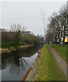
Hillhouse Lane Bridge No 12
is a minor waterways place
on the Huddersfield Broad Canal between
Cooper Bridge Junction (Junction of the Huddersfield Broad Canal and the Calder and Hebble Navigation) (2 miles and 4¾ furlongs
and 9 locks
to the northeast) and
Turnbridge Lifting Bridge No17 (3¼ furlongs
to the south).
The nearest place in the direction of Cooper Bridge Junction is New Road Winding Hole;
1 furlong
away.
The nearest place in the direction of Turnbridge Lifting Bridge No17 is Leeds Road Bridge No 13;
1¼ furlongs
away.
There may be access to the towpath here.
Mooring here is unrated.
There is a bridge here which takes a minor road over the canal.
Falls Lock No 8 | 5¾ furlongs | |
Red Doles Bridge No 11 | 4 furlongs | |
Red Doles Lock No 9 | 4 furlongs | |
New Road Bridge No 11A | 1¼ furlongs | |
New Road Winding Hole | 1 furlong | |
Hillhouse Lane Bridge No 12 | ||
Leeds Road Bridge No 13 | 1¼ furlongs | |
Gas Street Bridge No 14 | 1½ furlongs | |
Huddersfield First Gas Pipe Bridge | 1½ furlongs | |
Huddersfield Second Gas Pipe Bridge | 1½ furlongs | |
Anchor Street Winding Hole | 2½ furlongs |
Amenities here
Amenities nearby at Leeds Road Bridge No 13
Amenities nearby at New Road Winding Hole
There are no links to external websites from here.
Why not log in and add some (select "External websites" from the menu (sometimes this is under "Edit"))?
Mouseover for more information or show routes to facility
Nearest water point
In the direction of Cooper Bridge Junction
Shepley Bridge Sanitary Station — 5 miles, 5¼ furlongs and 11 locks away
Travel to Cooper Bridge Junction, then on the Calder and Hebble Navigation (Main Line) to Shepley Bridge Sanitary Station
Brighouse Basin — 4 miles, 7 furlongs and 13 locks away
Travel to Cooper Bridge Junction, then on the Calder and Hebble Navigation (Main Line) to Brighouse Basin
Salterhebble Sanitary Station — 9 miles, 1 furlong and 22 locks away
Travel to Cooper Bridge Junction, then on the Calder and Hebble Navigation (Main Line) to Salterhebble Sanitary Station
Broad Cut Low Lock No 3 — 12 miles, 2¼ furlongs and 19 locks away
Travel to Cooper Bridge Junction, then on the Calder and Hebble Navigation (Main Line) to Broad Cut Low Lock No 3
Salterhebble Junction — 9 miles, 1½ furlongs and 23 locks away
Travel to Cooper Bridge Junction, then on the Calder and Hebble Navigation (Main Line) to Salterhebble Junction
Sowerby Bridge Basin — 11 miles, 3¼ furlongs and 23 locks away
Travel to Cooper Bridge Junction, then on the Calder and Hebble Navigation (Main Line) to Salterhebble Junction, then on the Calder and Hebble Navigation (Main Line) to Sowerby Bridge Basin
Ramsdens Bridge Sanitary Station — 17 miles, 6 furlongs and 23 locks away
Travel to Cooper Bridge Junction, then on the Calder and Hebble Navigation (Main Line) to Fall Ing Junction, then on the Aire and Calder Navigation (Wakefield Section) to Ramsdens Bridge Sanitary Station
Stanley Ferry Water Point — 17 miles, 6¾ furlongs and 23 locks away
Travel to Cooper Bridge Junction, then on the Calder and Hebble Navigation (Main Line) to Fall Ing Junction, then on the Aire and Calder Navigation (Wakefield Section) to Stanley Ferry Water Point
King's Road Lock No 3 — 19 miles, 4 furlongs and 24 locks away
Travel to Cooper Bridge Junction, then on the Calder and Hebble Navigation (Main Line) to Fall Ing Junction, then on the Aire and Calder Navigation (Wakefield Section) to King's Road Lock No 3
Hebden Bridge Services — 16 miles, 6¾ furlongs and 30 locks away
Travel to Cooper Bridge Junction, then on the Calder and Hebble Navigation (Main Line) to Salterhebble Junction, then on the Calder and Hebble Navigation (Main Line) to Sowerby Bridge Junction, then on the Rochdale Canal to Hebden Bridge Services
In the direction of Aspley Basin (Huddersfield)
Aspley Basin (Huddersfield) — 7¼ furlongs away
On this waterway in the direction of Aspley Basin (Huddersfield)
Waterside Lock No 21E — 5 miles, 5 furlongs and 20 locks away
Travel to Aspley Basin (Huddersfield), then on the Huddersfield Narrow Canal to Waterside Lock No 21E
Slaithwaite Winding Hole — 5 miles, 5½ furlongs and 21 locks away
Travel to Aspley Basin (Huddersfield), then on the Huddersfield Narrow Canal to Slaithwaite Winding Hole
Standedge Tunnel (eastern entrance) — 9 miles, ½ furlongs and 42 locks away
Travel to Aspley Basin (Huddersfield), then on the Huddersfield Narrow Canal to Standedge Tunnel (eastern entrance)
Standedge Tunnel (western entrance) — 12 miles, 2½ furlongs and 42 locks away
Travel to Aspley Basin (Huddersfield), then on the Huddersfield Narrow Canal to Standedge Tunnel (western entrance)
Wool Road Bridge No 70 — 14 miles, 2¼ furlongs and 51 locks away
Travel to Aspley Basin (Huddersfield), then on the Huddersfield Narrow Canal to Wool Road Bridge No 70Nearest rubbish disposal
In the direction of Cooper Bridge Junction
Shepley Bridge Sanitary Station — 5 miles, 5¼ furlongs and 11 locks away
Travel to Cooper Bridge Junction, then on the Calder and Hebble Navigation (Main Line) to Shepley Bridge Sanitary Station
Brighouse Lower Basin Visitor Moorings — 4 miles, 6¾ furlongs and 12 locks away
Travel to Cooper Bridge Junction, then on the Calder and Hebble Navigation (Main Line) to Brighouse Lower Basin Visitor Moorings
Horbury Basin Residential Moorings & Sanitary Station — 10 miles, 1¾ furlongs and 18 locks away
Travel to Cooper Bridge Junction, then on the Calder and Hebble Navigation (Main Line) to Horbury Basin Residential Moorings & Sanitary Station
Salterhebble Sanitary Station — 9 miles, 1 furlong and 22 locks away
Travel to Cooper Bridge Junction, then on the Calder and Hebble Navigation (Main Line) to Salterhebble Sanitary Station
Sowerby Bridge Basin — 11 miles, 3¼ furlongs and 23 locks away
Travel to Cooper Bridge Junction, then on the Calder and Hebble Navigation (Main Line) to Salterhebble Junction, then on the Calder and Hebble Navigation (Main Line) to Sowerby Bridge Basin
Ramsdens Bridge Visitor Moorings — 17 miles, 6½ furlongs and 23 locks away
Travel to Cooper Bridge Junction, then on the Calder and Hebble Navigation (Main Line) to Fall Ing Junction, then on the Aire and Calder Navigation (Wakefield Section) to Ramsdens Bridge Visitor Moorings
Hebden Bridge Services — 16 miles, 6¾ furlongs and 30 locks away
Travel to Cooper Bridge Junction, then on the Calder and Hebble Navigation (Main Line) to Salterhebble Junction, then on the Calder and Hebble Navigation (Main Line) to Sowerby Bridge Junction, then on the Rochdale Canal to Hebden Bridge Services
In the direction of Aspley Basin (Huddersfield)
Aspley Basin (Huddersfield) — 7¼ furlongs away
On this waterway in the direction of Aspley Basin (Huddersfield)
Pickle Lock No 22E — 5 miles, 6¼ furlongs and 21 locks away
Travel to Aspley Basin (Huddersfield), then on the Huddersfield Narrow Canal to Pickle Lock No 22E
Wool Road Visitor Mooring — 14 miles, 2½ furlongs and 51 locks away
Travel to Aspley Basin (Huddersfield), then on the Huddersfield Narrow Canal to Wool Road Visitor MooringNearest chemical toilet disposal
In the direction of Cooper Bridge Junction
Shepley Bridge Sanitary Station — 5 miles, 5¼ furlongs and 11 locks away
Travel to Cooper Bridge Junction, then on the Calder and Hebble Navigation (Main Line) to Shepley Bridge Sanitary Station
Brighouse Basin — 4 miles, 7 furlongs and 13 locks away
Travel to Cooper Bridge Junction, then on the Calder and Hebble Navigation (Main Line) to Brighouse Basin
Savile Town Wharf and Basin (Dewsbury) — 9 miles, ¾ furlongs and 15 locks away
Travel to Cooper Bridge Junction, then on the Calder and Hebble Navigation (Main Line) to Dewsbury Arm Junction, then on the Calder and Hebble Navigation (Dewsbury Old Cut) to Savile Town Wharf and Basin (Dewsbury)
Horbury Basin Residential Moorings & Sanitary Station — 10 miles, 1¾ furlongs and 18 locks away
Travel to Cooper Bridge Junction, then on the Calder and Hebble Navigation (Main Line) to Horbury Basin Residential Moorings & Sanitary Station
Salterhebble Sanitary Station — 9 miles, 1 furlong and 22 locks away
Travel to Cooper Bridge Junction, then on the Calder and Hebble Navigation (Main Line) to Salterhebble Sanitary Station
Sowerby Bridge Basin — 11 miles, 3¼ furlongs and 23 locks away
Travel to Cooper Bridge Junction, then on the Calder and Hebble Navigation (Main Line) to Salterhebble Junction, then on the Calder and Hebble Navigation (Main Line) to Sowerby Bridge Basin
Ramsdens Bridge Sanitary Station — 17 miles, 6 furlongs and 23 locks away
Travel to Cooper Bridge Junction, then on the Calder and Hebble Navigation (Main Line) to Fall Ing Junction, then on the Aire and Calder Navigation (Wakefield Section) to Ramsdens Bridge Sanitary Station
Hebden Bridge Services — 16 miles, 6¾ furlongs and 30 locks away
Travel to Cooper Bridge Junction, then on the Calder and Hebble Navigation (Main Line) to Salterhebble Junction, then on the Calder and Hebble Navigation (Main Line) to Sowerby Bridge Junction, then on the Rochdale Canal to Hebden Bridge Services
In the direction of Aspley Basin (Huddersfield)
Aspley Basin (Huddersfield) — 7¼ furlongs away
On this waterway in the direction of Aspley Basin (Huddersfield)
Waterside Lock No 21E — 5 miles, 5 furlongs and 20 locks away
Travel to Aspley Basin (Huddersfield), then on the Huddersfield Narrow Canal to Waterside Lock No 21E
Pickle Lock No 22E — 5 miles, 6¼ furlongs and 21 locks away
Travel to Aspley Basin (Huddersfield), then on the Huddersfield Narrow Canal to Pickle Lock No 22E
Wool Road Bridge No 70 — 14 miles, 2¼ furlongs and 51 locks away
Travel to Aspley Basin (Huddersfield), then on the Huddersfield Narrow Canal to Wool Road Bridge No 70Nearest place to turn
In the direction of Cooper Bridge Junction
New Road Winding Hole — 1 furlong away
On this waterway in the direction of Cooper Bridge Junction
Deighton Road Bridge Winding Hole — 1 mile, 2¾ furlongs and 5 locks away
On this waterway in the direction of Cooper Bridge Junction
Cooper Bridge Junction — 2 miles, 4¾ furlongs and 9 locks away
On this waterway in the direction of Cooper Bridge Junction
Battye Weir Entrance — 3 miles, 1¾ furlongs and 10 locks away
Travel to Cooper Bridge Junction, then on the Calder and Hebble Navigation (Main Line) to Battye Weir Entrance
Shepley Bridge Marina — 5 miles, 5½ furlongs and 11 locks away
Travel to Cooper Bridge Junction, then on the Calder and Hebble Navigation (Main Line) to Shepley Bridge Marina
Brighouse Basin — 4 miles, 7 furlongs and 13 locks away
Travel to Cooper Bridge Junction, then on the Calder and Hebble Navigation (Main Line) to Brighouse Basin
Ganny Winding Hole — 5 miles, 4½ furlongs and 14 locks away
Travel to Cooper Bridge Junction, then on the Calder and Hebble Navigation (Main Line) to Ganny Winding Hole
Dewsbury Arm Junction — 8 miles, ¾ furlongs and 15 locks away
Travel to Cooper Bridge Junction, then on the Calder and Hebble Navigation (Main Line) to Dewsbury Arm Junction
Savile Town Wharf and Basin (Dewsbury) — 9 miles, ¾ furlongs and 15 locks away
Travel to Cooper Bridge Junction, then on the Calder and Hebble Navigation (Main Line) to Dewsbury Arm Junction, then on the Calder and Hebble Navigation (Dewsbury Old Cut) to Savile Town Wharf and Basin (Dewsbury)
Horbury Basin Residential Moorings & Sanitary Station — 10 miles, 1¾ furlongs and 18 locks away
Travel to Cooper Bridge Junction, then on the Calder and Hebble Navigation (Main Line) to Horbury Basin Residential Moorings & Sanitary Station
Salterhebble Wharf — 9 miles, ½ furlongs and 21 locks away
Travel to Cooper Bridge Junction, then on the Calder and Hebble Navigation (Main Line) to Salterhebble Wharf
Salterhebble Bottom Basin Visitor Moorings — 9 miles, ¾ furlongs and 21 locks away
Travel to Cooper Bridge Junction, then on the Calder and Hebble Navigation (Main Line) to Salterhebble Bottom Basin Visitor Moorings
Salterhebble Sanitary Station — 9 miles, 1 furlong and 22 locks away
Travel to Cooper Bridge Junction, then on the Calder and Hebble Navigation (Main Line) to Salterhebble Sanitary Station
Waller Bridge Winding Hole — 12 miles, ½ furlongs and 19 locks away
Travel to Cooper Bridge Junction, then on the Calder and Hebble Navigation (Main Line) to Waller Bridge Winding Hole
In the direction of Aspley Basin (Huddersfield)
Anchor Street Winding Hole — 2½ furlongs away
On this waterway in the direction of Aspley Basin (Huddersfield)
Aspley Basin (Huddersfield) — 7¼ furlongs away
On this waterway in the direction of Aspley Basin (Huddersfield)
University Arm — 1 mile away
Travel to Aspley Basin (Huddersfield), then on the Huddersfield Narrow Canal to University Arm
Isis Lock Winding Hole — 3 miles, ¾ furlongs and 8 locks away
Travel to Aspley Basin (Huddersfield), then on the Huddersfield Narrow Canal to Isis Lock Winding Hole
Linthwaite Winding Hole — 4 miles, 5 furlongs and 16 locks away
Travel to Aspley Basin (Huddersfield), then on the Huddersfield Narrow Canal to Linthwaite Winding Hole
Slaithwaite Winding Hole — 5 miles, 5½ furlongs and 21 locks away
Travel to Aspley Basin (Huddersfield), then on the Huddersfield Narrow Canal to Slaithwaite Winding HoleNearest self-operated pump-out
In the direction of Cooper Bridge Junction
Ramsdens Bridge Sanitary Station — 17 miles, 6 furlongs and 23 locks away
Travel to Cooper Bridge Junction, then on the Calder and Hebble Navigation (Main Line) to Fall Ing Junction, then on the Aire and Calder Navigation (Wakefield Section) to Ramsdens Bridge Sanitary Station
Hebden Bridge Services — 16 miles, 6¾ furlongs and 30 locks away
Travel to Cooper Bridge Junction, then on the Calder and Hebble Navigation (Main Line) to Salterhebble Junction, then on the Calder and Hebble Navigation (Main Line) to Sowerby Bridge Junction, then on the Rochdale Canal to Hebden Bridge Services
In the direction of Aspley Basin (Huddersfield)
Slaithwaite Winding Hole — 5 miles, 5½ furlongs and 21 locks away
Travel to Aspley Basin (Huddersfield), then on the Huddersfield Narrow Canal to Slaithwaite Winding Hole
Wool Road Bridge No 70 — 14 miles, 2¼ furlongs and 51 locks away
Travel to Aspley Basin (Huddersfield), then on the Huddersfield Narrow Canal to Wool Road Bridge No 70Nearest boatyard pump-out
In the direction of Cooper Bridge Junction
Shepley Bridge Marina — 5 miles, 5½ furlongs and 11 locks away
Travel to Cooper Bridge Junction, then on the Calder and Hebble Navigation (Main Line) to Shepley Bridge Marina
Sowerby Bridge Basin — 11 miles, 3¼ furlongs and 23 locks away
Travel to Cooper Bridge Junction, then on the Calder and Hebble Navigation (Main Line) to Salterhebble Junction, then on the Calder and Hebble Navigation (Main Line) to Sowerby Bridge Basin
Pickwell and Arnold Boatyard — 19 miles, 4½ furlongs and 36 locks away
Travel to Cooper Bridge Junction, then on the Calder and Hebble Navigation (Main Line) to Salterhebble Junction, then on the Calder and Hebble Navigation (Main Line) to Sowerby Bridge Junction, then on the Rochdale Canal to Pickwell and Arnold Boatyard
In the direction of Aspley Basin (Huddersfield)
Aspley Basin (Huddersfield) — 7¼ furlongs away
On this waterway in the direction of Aspley Basin (Huddersfield)Direction of TV transmitter (From Wolfbane Cybernetic)
There is no page on Wikipedia called “Hillhouse Lane Bridge”
Wikipedia pages that might relate to Hillhouse Lane Bridge
[Lydiate railway station]
between Aintree and Altcar & Hillhouse railways stations on 6 June 1959. The site of Lydiate railway station on Carr Lane is about 835 feet (255 m) outside
[Altcar and Hillhouse railway station]
Altcar and Hillhouse was a railway station located on the Southport & Cheshire Lines Extension Railway near Great Altcar, Lancashire, England. The station
[New Haven, Connecticut]
Retrieved on 2013-07-15. "HILLHOUSE OPERA COMPANY Form 990 Data as of 2009-11-02". implu Corporation. Retrieved 29 January 2010. "Hillhouse Opera presents 'Alicina'"
[New Cut Lane Halt railway station]
New Cut Lane Halt was a railway station between Shirdley Hill and Halsall in Lancashire. The station opened in July 1906 as a halt on the Liverpool, Southport
[Todd Lane Junction railway station]
Todd Lane Junction, previously called Preston Junction until 1952, was a railway station between Preston and Bamber Bridge which closed to passenger traffic
[Arkholme for Kirkby Lonsdale railway station]
Lane and Euxton Coppull Rawlinson Bridge Ormskirk branch line Midge Hall Cocker Bar Westhead Halt Skelmersdale SCLER Mossbridge Altcar and Hillhouse Lydiate
[Birkdale Palace railway station]
goods traffic at Southport Lord Street, Birkdale Palace and Altcar & Hillhouse stations. Public goods facilities were closed at Woodvale, Lydiate and
[Penwortham Cop Lane railway station]
Penwortham Cop Lane was a railway station on the West Lancashire Railway in England. It served the town of Penwortham in Lancashire. It was between Higher
[Heathey Lane Halt railway station]
at track level. It was situated to the north of the B5243 road bridge at Heathey Lane, to which it was connected by wooden steps. The station closed to
[Galgate railway station]
Lane and Euxton Coppull Rawlinson Bridge Ormskirk branch line Midge Hall Cocker Bar Westhead Halt Skelmersdale SCLER Mossbridge Altcar and Hillhouse Lydiate
Results of Google Search
Flat for sale in Bridge Hill House, Higham Lane, Canterbury, Kent CT4 from ... Offered with no forward chain, an internal viewing is a must on this exciting buy!
What a lot of folks don't know is that the covered bridge is covered not to provide ... We'll assume you're starting off from West Hill House B&B because you're a ... 12 and, after a quarter mile (0.4km) you'll see Slaughterhouse Road on your ...
2 bed flat for sale in Bridge Hill House, Higham Lane, Canterbury, Kent CT4, selling for £185000 from Your Move - Canterbury. See property details on Zoopla or ...
Aug 13, 2019 ... 211 Hillhouse Rd, Sylvester, GA 31791 was recently sold on 08-13-2019 for $193000. ... 133 River Bridge Dr ... This property is no longer available to rent or to buy. ... Back door leading to screened 12x20 back porch.
Yale Hillhouse Avenue Bridges ... In both cases Mr. Horn provided not only a meticulously crafted steel work but also throughout the process ... C.J. Fucci is involved with many road bridges in the Connecticut area but the Hillhouse Bridges are ...
109 Hillhouse Ln, Manchaca, TX 78652 is a 2088 sqft, 3 bath home. See the ... 12612 Iron Bridge Dr, Manchaca, TX 78652. OPEN SAT, 11-2: ... Description. This property is no longer available to rent or to buy. ... 9-12; PUBLIC; 2713 Students.
Nov 16, 2014 ... Brooklyn's Sleepy Enclave, Vinegar Hill, Awakens. Slide 1 of 12. 1/12 ... Vinegar Hill House winks with candlelight by night, and a couple of other ... “Dumbo transformed because of Brooklyn Bridge Park and the tourists,†he ... The portion of Vinegar Hill not occupied by Con Edison is only about nine or 10 ...