Slaithwaite Aqueduct
is a minor waterways place
on the Huddersfield Narrow Canal between
Railway Lock No 42E (Marsden. Eastern summit lock) (2 miles and 3½ furlongs
and 18 locks
to the west) and
Titanic Mill (Linthwaite) (1 mile and 2 furlongs
and 7 locks
to the east).
The nearest place in the direction of Railway Lock No 42E is Canal Side Visitor Moorings;
½ furlongs
away.
The nearest place in the direction of Titanic Mill is Dartmouth Lock No 23E;
¼ furlongs
away.
Mooring here is unrated.
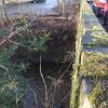
There is a small aqueduct or underbridge here which takes a stream under the canal.
Shaker Wood Lock No 25E | 3¼ furlongs | |
Slaithwaite Slipway | 1¼ furlongs | |
Shuttle Lock No 24E | 1¼ furlongs | |
Uppermill Bridge No 47 | 1¼ furlongs | |
Canal Side Visitor Moorings | ½ furlongs | |
Slaithwaite Aqueduct | ||
Dartmouth Lock No 23E | ¼ furlongs | |
Old Bank Bridge No 45 | ¼ furlongs | |
Slaithwaite Bridge No 44A | ½ furlongs | |
Britannia Road Bridge No 44 | ¾ furlongs | |
Slaithwaite Narrows | 1¼ furlongs |
There are no links to external websites from here.
Why not log in and add some (select "External websites" from the menu (sometimes this is under "Edit"))?
Mouseover for more information or show routes to facility
Nearest water point
In the direction of Ashton-under-Lyne Junction
Standedge Tunnel (eastern entrance) — 3 miles, ¾ furlongs and 19 locks away
On this waterway in the direction of Ashton-under-Lyne Junction
Standedge Tunnel (western entrance) — 6 miles, 2½ furlongs and 19 locks away
On this waterway in the direction of Ashton-under-Lyne Junction
Wool Road Bridge No 70 — 8 miles, 2½ furlongs and 28 locks away
On this waterway in the direction of Ashton-under-Lyne Junction
Grove Road Bridge No 96 — 14 miles, 2½ furlongs and 43 locks away
On this waterway in the direction of Ashton-under-Lyne Junction
In the direction of Aspley Basin (Huddersfield)
Slaithwaite Winding Hole — 2¼ furlongs and 2 locks away
On this waterway in the direction of Aspley Basin (Huddersfield)
Waterside Lock No 21E — 3 furlongs and 2 locks away
On this waterway in the direction of Aspley Basin (Huddersfield)
Aspley Basin (Huddersfield) — 5 miles, ½ furlongs and 23 locks away
On this waterway in the direction of Aspley Basin (Huddersfield)
Shepley Bridge Sanitary Station — 11 miles, 5 furlongs and 34 locks away
Travel to Aspley Basin (Huddersfield), then on the Huddersfield Broad Canal to Cooper Bridge Junction, then on the Calder and Hebble Navigation (Main Line) to Shepley Bridge Sanitary Station
Brighouse Basin — 10 miles, 7 furlongs and 36 locks away
Travel to Aspley Basin (Huddersfield), then on the Huddersfield Broad Canal to Cooper Bridge Junction, then on the Calder and Hebble Navigation (Main Line) to Brighouse Basin
Salterhebble Sanitary Station — 15 miles, 1 furlong and 45 locks away
Travel to Aspley Basin (Huddersfield), then on the Huddersfield Broad Canal to Cooper Bridge Junction, then on the Calder and Hebble Navigation (Main Line) to Salterhebble Sanitary Station
Broad Cut Low Lock No 3 — 18 miles, 2 furlongs and 42 locks away
Travel to Aspley Basin (Huddersfield), then on the Huddersfield Broad Canal to Cooper Bridge Junction, then on the Calder and Hebble Navigation (Main Line) to Broad Cut Low Lock No 3
Salterhebble Junction — 15 miles, 1¼ furlongs and 46 locks away
Travel to Aspley Basin (Huddersfield), then on the Huddersfield Broad Canal to Cooper Bridge Junction, then on the Calder and Hebble Navigation (Main Line) to Salterhebble Junction
Sowerby Bridge Basin — 17 miles, 3 furlongs and 46 locks away
Travel to Aspley Basin (Huddersfield), then on the Huddersfield Broad Canal to Cooper Bridge Junction, then on the Calder and Hebble Navigation (Main Line) to Salterhebble Junction, then on the Calder and Hebble Navigation (Main Line) to Sowerby Bridge BasinNearest rubbish disposal
In the direction of Ashton-under-Lyne Junction
Wool Road Visitor Mooring — 8 miles, 2¾ furlongs and 28 locks away
On this waterway in the direction of Ashton-under-Lyne Junction
In the direction of Aspley Basin (Huddersfield)
Pickle Lock No 22E — 1¾ furlongs and 1 lock away
On this waterway in the direction of Aspley Basin (Huddersfield)
Aspley Basin (Huddersfield) — 5 miles, ½ furlongs and 23 locks away
On this waterway in the direction of Aspley Basin (Huddersfield)
Shepley Bridge Sanitary Station — 11 miles, 5 furlongs and 34 locks away
Travel to Aspley Basin (Huddersfield), then on the Huddersfield Broad Canal to Cooper Bridge Junction, then on the Calder and Hebble Navigation (Main Line) to Shepley Bridge Sanitary Station
Brighouse Lower Basin Visitor Moorings — 10 miles, 6½ furlongs and 35 locks away
Travel to Aspley Basin (Huddersfield), then on the Huddersfield Broad Canal to Cooper Bridge Junction, then on the Calder and Hebble Navigation (Main Line) to Brighouse Lower Basin Visitor Moorings
Horbury Basin Residential Moorings & Sanitary Station — 16 miles, 1½ furlongs and 41 locks away
Travel to Aspley Basin (Huddersfield), then on the Huddersfield Broad Canal to Cooper Bridge Junction, then on the Calder and Hebble Navigation (Main Line) to Horbury Basin Residential Moorings & Sanitary Station
Salterhebble Sanitary Station — 15 miles, 1 furlong and 45 locks away
Travel to Aspley Basin (Huddersfield), then on the Huddersfield Broad Canal to Cooper Bridge Junction, then on the Calder and Hebble Navigation (Main Line) to Salterhebble Sanitary Station
Sowerby Bridge Basin — 17 miles, 3 furlongs and 46 locks away
Travel to Aspley Basin (Huddersfield), then on the Huddersfield Broad Canal to Cooper Bridge Junction, then on the Calder and Hebble Navigation (Main Line) to Salterhebble Junction, then on the Calder and Hebble Navigation (Main Line) to Sowerby Bridge BasinNearest chemical toilet disposal
In the direction of Ashton-under-Lyne Junction
Wool Road Bridge No 70 — 8 miles, 2½ furlongs and 28 locks away
On this waterway in the direction of Ashton-under-Lyne Junction
Grove Road Bridge No 96 — 14 miles, 2½ furlongs and 43 locks away
On this waterway in the direction of Ashton-under-Lyne Junction
In the direction of Aspley Basin (Huddersfield)
Pickle Lock No 22E — 1¾ furlongs and 1 lock away
On this waterway in the direction of Aspley Basin (Huddersfield)
Waterside Lock No 21E — 3 furlongs and 2 locks away
On this waterway in the direction of Aspley Basin (Huddersfield)
Aspley Basin (Huddersfield) — 5 miles, ½ furlongs and 23 locks away
On this waterway in the direction of Aspley Basin (Huddersfield)
Shepley Bridge Sanitary Station — 11 miles, 5 furlongs and 34 locks away
Travel to Aspley Basin (Huddersfield), then on the Huddersfield Broad Canal to Cooper Bridge Junction, then on the Calder and Hebble Navigation (Main Line) to Shepley Bridge Sanitary Station
Brighouse Basin — 10 miles, 7 furlongs and 36 locks away
Travel to Aspley Basin (Huddersfield), then on the Huddersfield Broad Canal to Cooper Bridge Junction, then on the Calder and Hebble Navigation (Main Line) to Brighouse Basin
Savile Town Wharf and Basin (Dewsbury) — 15 miles, ½ furlongs and 38 locks away
Travel to Aspley Basin (Huddersfield), then on the Huddersfield Broad Canal to Cooper Bridge Junction, then on the Calder and Hebble Navigation (Main Line) to Dewsbury Arm Junction, then on the Calder and Hebble Navigation (Dewsbury Old Cut) to Savile Town Wharf and Basin (Dewsbury)
Horbury Basin Residential Moorings & Sanitary Station — 16 miles, 1½ furlongs and 41 locks away
Travel to Aspley Basin (Huddersfield), then on the Huddersfield Broad Canal to Cooper Bridge Junction, then on the Calder and Hebble Navigation (Main Line) to Horbury Basin Residential Moorings & Sanitary Station
Salterhebble Sanitary Station — 15 miles, 1 furlong and 45 locks away
Travel to Aspley Basin (Huddersfield), then on the Huddersfield Broad Canal to Cooper Bridge Junction, then on the Calder and Hebble Navigation (Main Line) to Salterhebble Sanitary Station
Sowerby Bridge Basin — 17 miles, 3 furlongs and 46 locks away
Travel to Aspley Basin (Huddersfield), then on the Huddersfield Broad Canal to Cooper Bridge Junction, then on the Calder and Hebble Navigation (Main Line) to Salterhebble Junction, then on the Calder and Hebble Navigation (Main Line) to Sowerby Bridge BasinNearest place to turn
In the direction of Ashton-under-Lyne Junction
Booth Lock Winding Hole — 1 mile, 2¾ furlongs and 8 locks away
On this waterway in the direction of Ashton-under-Lyne Junction
Standedge Tunnel End Winding Hole — 2 miles, 8 furlongs and 19 locks away
On this waterway in the direction of Ashton-under-Lyne Junction
Diggle Winding Hole — 6 miles, 5¼ furlongs and 19 locks away
On this waterway in the direction of Ashton-under-Lyne Junction
Wool Road Winding Hole — 8 miles, 3¼ furlongs and 28 locks away
On this waterway in the direction of Ashton-under-Lyne Junction
Saddleworth Visitor Centre Winding Hole — 9 miles, 1¼ furlongs and 30 locks away
On this waterway in the direction of Ashton-under-Lyne Junction
Manns Wharf Bridge Winding Hole — 10 miles, 4 furlongs and 32 locks away
On this waterway in the direction of Ashton-under-Lyne Junction
Roughtown Court Winding Hole — 11 miles, 5¼ furlongs and 37 locks away
On this waterway in the direction of Ashton-under-Lyne Junction
In the direction of Aspley Basin (Huddersfield)
Slaithwaite Winding Hole — 2¼ furlongs and 2 locks away
On this waterway in the direction of Aspley Basin (Huddersfield)
Linthwaite Winding Hole — 1 mile, 2¾ furlongs and 7 locks away
On this waterway in the direction of Aspley Basin (Huddersfield)
Isis Lock Winding Hole — 2 miles, 7¼ furlongs and 15 locks away
On this waterway in the direction of Aspley Basin (Huddersfield)
University Arm — 4 miles, 7¾ furlongs and 23 locks away
On this waterway in the direction of Aspley Basin (Huddersfield)
Aspley Basin (Huddersfield) — 5 miles, ½ furlongs and 23 locks away
On this waterway in the direction of Aspley Basin (Huddersfield)
Anchor Street Winding Hole — 5 miles, 5½ furlongs and 23 locks away
Travel to Aspley Basin (Huddersfield), then on the Huddersfield Broad Canal to Anchor Street Winding Hole
New Road Winding Hole — 6 miles, 1 furlong and 23 locks away
Travel to Aspley Basin (Huddersfield), then on the Huddersfield Broad Canal to New Road Winding Hole
Deighton Road Bridge Winding Hole — 7 miles, 2½ furlongs and 28 locks away
Travel to Aspley Basin (Huddersfield), then on the Huddersfield Broad Canal to Deighton Road Bridge Winding Hole
Cooper Bridge Junction — 8 miles, 4½ furlongs and 32 locks away
Travel to Aspley Basin (Huddersfield), then on the Huddersfield Broad Canal to Cooper Bridge Junction
Battye Weir Entrance — 9 miles, 1½ furlongs and 33 locks away
Travel to Aspley Basin (Huddersfield), then on the Huddersfield Broad Canal to Cooper Bridge Junction, then on the Calder and Hebble Navigation (Main Line) to Battye Weir Entrance
Shepley Bridge Marina — 11 miles, 5½ furlongs and 34 locks away
Travel to Aspley Basin (Huddersfield), then on the Huddersfield Broad Canal to Cooper Bridge Junction, then on the Calder and Hebble Navigation (Main Line) to Shepley Bridge Marina
Brighouse Basin — 10 miles, 7 furlongs and 36 locks away
Travel to Aspley Basin (Huddersfield), then on the Huddersfield Broad Canal to Cooper Bridge Junction, then on the Calder and Hebble Navigation (Main Line) to Brighouse Basin
Ganny Winding Hole — 11 miles, 4¼ furlongs and 37 locks away
Travel to Aspley Basin (Huddersfield), then on the Huddersfield Broad Canal to Cooper Bridge Junction, then on the Calder and Hebble Navigation (Main Line) to Ganny Winding HoleNearest self-operated pump-out
In the direction of Ashton-under-Lyne Junction
Wool Road Bridge No 70 — 8 miles, 2½ furlongs and 28 locks away
On this waterway in the direction of Ashton-under-Lyne Junction
In the direction of Aspley Basin (Huddersfield)
Slaithwaite Winding Hole — 2¼ furlongs and 2 locks away
On this waterway in the direction of Aspley Basin (Huddersfield)Nearest boatyard pump-out
In the direction of Ashton-under-Lyne Junction
Portland Basin Arm — 19 miles, 3 furlongs and 51 locks away
Travel to Ashton-under-Lyne Junction, then on the Ashton Canal (Main Line) to Dukinfield Junction, then on the Peak Forest Canal (Lower) to Portland Basin Arm
In the direction of Aspley Basin (Huddersfield)
Aspley Basin (Huddersfield) — 5 miles, ½ furlongs and 23 locks away
On this waterway in the direction of Aspley Basin (Huddersfield)
Shepley Bridge Marina — 11 miles, 5½ furlongs and 34 locks away
Travel to Aspley Basin (Huddersfield), then on the Huddersfield Broad Canal to Cooper Bridge Junction, then on the Calder and Hebble Navigation (Main Line) to Shepley Bridge Marina
Sowerby Bridge Basin — 17 miles, 3 furlongs and 46 locks away
Travel to Aspley Basin (Huddersfield), then on the Huddersfield Broad Canal to Cooper Bridge Junction, then on the Calder and Hebble Navigation (Main Line) to Salterhebble Junction, then on the Calder and Hebble Navigation (Main Line) to Sowerby Bridge BasinDirection of TV transmitter (From Wolfbane Cybernetic)
There is no page on Wikipedia called “Slaithwaite Aqueduct”
Wikipedia pages that might relate to Slaithwaite Aqueduct
[Huddersfield Narrow Canal]
canal between Saddleworth and Dobcross The section of canal through Slaithwaite town centre, between locks 21E and 23E, had been culverted and a car
[List of geological faults of England]
Fault Somerset Bristol Special 1" Ridgeway Thrust E&W 264 Ripponden-Slaithwaite Fracture Yorkshire E&W 77 Rishworth-Stainland Fault Zone Yorkshire E&W
[Outer Pennine Ring]
32 to the west. The ascent from Huddersfield through Linthwaite and Slaithwaite to the tunnel mouth at Marsden is relentless, with over 5 locks per mile
[Listed buildings in Colne Valley (western area)]
England & 1231655 Historic England & 1421141 Historic England, "No. 1 Slaithwaite Hall, Bents Lane, Colne Valley (1278336)", National Heritage List for
Results of Google Search
The Huddersfield Narrow Canal is an inland waterway in northern England. It runs just under ... Outram set out to overcome the problems with the Holmes Aqueduct by making .... The section of canal through Slaithwaite town centre, between locks 21E and 23E, had been culverted and a car park covered part of the route.
golcar images | se1015 golcar aqueduct huddersfield canal near to golcar kirklees ... ... Huddersfield Narrow Canal, Bridge 45 at Slaithwaite by David Dixon , via ...
Slaithwaite New section of canal in Slaithwaite. Click on the links below to find out more. ... Milnsbridge: Golcar Aqueduct. Structural repairs and new channel.
Apr 17, 2018 ... Marsden and Slaithwaite stations to close for two days and there's work ... will also be work to Standedge Aqueduct at Tunnel End, Marsden.
With 74 locks, 10 reservoirs and 5 aqueducts, it can take boats up to 21.3m long and 2.1m wide. ... Slaithwaite reservoir has a capacity of 309m litres. A further 8Â ...
Slaithwaite to Milnsbridge - Virtual canal trip along the Huddersfield Narrow Canal. ... Looking south-east towards the restored Golcar aqueduct across the River ...
Aug 16, 2014 ... He gives a history of the canal and looks at some of the engineering feats along this section including the the aqueduct over the river Aire at ...
The Huddersfield Narrow Canal scales the Pennines and its summit is the highest stretch of canal in Britain.
In Slaithwaite the canal was filled in and grassed over with cherry trees lining the ... an aqueduct at Store Street in Manchester. On 13 May 1974 the canals to the ...