Railway Bridge No 4 (Sheffield Canal)
is a minor waterways place
on the Sheffield and South Yorkshire Navigation (Sheffield Canal) between
Rawmarsh Road Bridge No 39 (6 miles and 4¾ furlongs
and 15 locks
to the northeast) and
Sheffield Terminal Warehouse (3½ furlongs
to the west).
The nearest place in the direction of Rawmarsh Road Bridge No 39 is Bernard Road Bridge No 5;
1¼ furlongs
away.
The nearest place in the direction of Sheffield Terminal Warehouse is Cadman Road Bridge No 3 (With pipe bridge alongside );
¾ furlongs
away.
Mooring here is unrated.
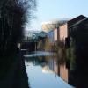
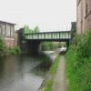
There is a bridge here which takes a railway over the canal.
| Tramway Bridge | 7 furlongs | |
| Staniforth Road Bridge No 7 | 6¾ furlongs | |
| Staniforth Factory Footbridge | 6¼ furlongs | |
| Bacon Lane Bridge No 6 | 4¼ furlongs | |
| Bernard Road Bridge No 5 | 1¼ furlongs | |
| Railway Bridge No 4 (Sheffield Canal) | ||
| Cadman Road Bridge No 3 | ¾ furlongs | |
| Wicker Viaduct Bridge No 2 | 1½ furlongs | |
| A61 Road Bridge | 1¾ furlongs | |
| Sheffield Visitor Moorings | 2 furlongs | |
| Victoria Quays Swing Bridge | 2½ furlongs | |
- S&SY navigation info — associated with Sheffield and South Yorkshire Navigation
- Sheffield & South Yorkshire navigation info from IWA
Mouseover for more information or show routes to facility
Nearest water point
In the direction of Rawmarsh Road Bridge No 39
Eastwood Lock No 5 — 7 miles, 1½ furlongs and 15 locks away
Travel to Rawmarsh Road Bridge No 39, then on the Sheffield and South Yorkshire Navigation (Main Line) to Eastwood Lock No 5
Kilnhurst Flood Lock No 7 — 9 miles, 7¼ furlongs and 17 locks away
Travel to Rawmarsh Road Bridge No 39, then on the Sheffield and South Yorkshire Navigation (Main Line) to Kilnhurst Flood Lock No 7
Swinton Lock Activity Centre and CRT Sanitary Station — 11 miles, 4¾ furlongs and 19 locks away
Travel to Rawmarsh Road Bridge No 39, then on the Sheffield and South Yorkshire Navigation (Main Line) to Swinton Lock Activity Centre and CRT Sanitary Station
Mexborough Low Lock No 10 — 14 miles, 1½ furlongs and 20 locks away
Travel to Rawmarsh Road Bridge No 39, then on the Sheffield and South Yorkshire Navigation (Main Line) to Mexborough Low Lock No 10
Sprotbrough Lock No 11 — 17 miles, 5 furlongs and 21 locks away
Travel to Rawmarsh Road Bridge No 39, then on the Sheffield and South Yorkshire Navigation (Main Line) to Sprotbrough Lock No 11
In the direction of Sheffield Terminal Warehouse
Victoria Quays — 3¼ furlongs away
On this waterway in the direction of Sheffield Terminal WarehouseNearest rubbish disposal
In the direction of Rawmarsh Road Bridge No 39
Tinsley CRT facilities — 2 miles, 2¼ furlongs and 1 lock away
On this waterway in the direction of Rawmarsh Road Bridge No 39
Eastwood Lock No 5 — 7 miles, 1½ furlongs and 15 locks away
Travel to Rawmarsh Road Bridge No 39, then on the Sheffield and South Yorkshire Navigation (Main Line) to Eastwood Lock No 5
In the direction of Sheffield Terminal Warehouse
Victoria Quays — 3¼ furlongs away
On this waterway in the direction of Sheffield Terminal WarehouseNearest chemical toilet disposal
In the direction of Rawmarsh Road Bridge No 39
Tinsley CRT facilities — 2 miles, 2¼ furlongs and 1 lock away
On this waterway in the direction of Rawmarsh Road Bridge No 39
Eastwood Lock No 5 — 7 miles, 1½ furlongs and 15 locks away
Travel to Rawmarsh Road Bridge No 39, then on the Sheffield and South Yorkshire Navigation (Main Line) to Eastwood Lock No 5
Swinton Lock Activity Centre and CRT Sanitary Station — 11 miles, 4¾ furlongs and 19 locks away
Travel to Rawmarsh Road Bridge No 39, then on the Sheffield and South Yorkshire Navigation (Main Line) to Swinton Lock Activity Centre and CRT Sanitary Station
In the direction of Sheffield Terminal Warehouse
Victoria Quays — 3¼ furlongs away
On this waterway in the direction of Sheffield Terminal WarehouseNearest place to turn
In the direction of Rawmarsh Road Bridge No 39
Shirland Road Bridge Winding Hole — 1 mile, ¾ furlongs away
On this waterway in the direction of Rawmarsh Road Bridge No 39
Don Valley Stadium Visitor Moorings — 1 mile, 3¼ furlongs away
On this waterway in the direction of Rawmarsh Road Bridge No 39
Tinsley Lower Flight Weir Exit — 3 miles, 3½ furlongs and 11 locks away
On this waterway in the direction of Rawmarsh Road Bridge No 39
Rotherham Junction — 5 miles, 3¾ furlongs and 14 locks away
On this waterway in the direction of Rawmarsh Road Bridge No 39
Main Street Junction — 5 miles, 5½ furlongs and 14 locks away
On this waterway in the direction of Rawmarsh Road Bridge No 39
Central Road Winding Hole — 5 miles, 6¼ furlongs and 15 locks away
On this waterway in the direction of Rawmarsh Road Bridge No 39
Rawmarsh Road Winding Hole — 6 miles, 4¼ furlongs and 15 locks away
On this waterway in the direction of Rawmarsh Road Bridge No 39
Sir Frank Price Lock Arm — 7 miles, 1 furlong and 15 locks away
Travel to Rawmarsh Road Bridge No 39, then on the Sheffield and South Yorkshire Navigation (Main Line) to Sir Frank Price Lock Arm
Sir Frank Price Lock Weir Exit — 7 miles, 2¼ furlongs and 16 locks away
Travel to Rawmarsh Road Bridge No 39, then on the Sheffield and South Yorkshire Navigation (Main Line) to Sir Frank Price Lock Weir Exit
Kilnhurst Flood Lock Winding Hole — 9 miles, 5½ furlongs and 17 locks away
Travel to Rawmarsh Road Bridge No 39, then on the Sheffield and South Yorkshire Navigation (Main Line) to Kilnhurst Flood Lock Winding Hole
Swinton Junction — 11 miles, 4 furlongs and 18 locks away
Travel to Rawmarsh Road Bridge No 39, then on the Sheffield and South Yorkshire Navigation (Main Line) to Swinton Junction
Swinton Road Corner — 11 miles, 7¾ furlongs and 19 locks away
Travel to Rawmarsh Road Bridge No 39, then on the Sheffield and South Yorkshire Navigation (Main Line) to Swinton Road Corner
Sprotbrough Lock Weir Exit — 17 miles, 5½ furlongs and 22 locks away
Travel to Rawmarsh Road Bridge No 39, then on the Sheffield and South Yorkshire Navigation (Main Line) to Sprotbrough Lock Weir Exit
In the direction of Sheffield Terminal Warehouse
Victoria Quays — 3¼ furlongs away
On this waterway in the direction of Sheffield Terminal Warehouse
Sheffield Terminal Warehouse — 3½ furlongs away
On this waterway in the direction of Sheffield Terminal WarehouseNo information
CanalPlan has no information on any of the following facilities within range:self-operated pump-out
boatyard pump-out
Direction of TV transmitter (From Wolfbane Cybernetic)
Wikipedia has a page about Railway Bridge No 4
Railway Bridge may refer to:
- Jonava railway bridge, bridge that crosses the Neris River in Lithuania
- Railway Bridge, Riga, bridge that crosses the Daugava river in Riga, Latvia
- Railway Bridge, Kaunas, bridge that crosses the Nemunas River in Lithuania
Other Wikipedia pages that might relate to Railway Bridge No 4
[Bridge]
double-decked bridge. The upper level carries a railway, and the lower level is used for road traffic. Other examples include Britannia Bridge over the Menai
[Forth Bridge]
The Forth Bridge is a cantilever railway bridge across the Firth of Forth in the east of Scotland, 9 miles (14 kilometres) west of central Edinburgh.
[Railway Bridge]
Railway Bridge may refer to: Jonava railway bridge, bridge that crosses the Neris River in Lithuania Railway Bridge, Riga, bridge that crosses the Daugava
[Pamban Bridge]
Pamban Bridge is a railway bridge which connects the town of Mandapam in mainland India with Pamban Island, and Rameswaram. Opened on 24 February 1914
[Blackfriars Railway Bridge]
Blackfriars Railway Bridge is a railway bridge crossing the River Thames in London, between Blackfriars Bridge and the Millennium Bridge. There have been
[Maidenhead Railway Bridge]
Maidenhead Railway Bridge (also known as Maidenhead Viaduct, The Sounding Arch) is a single structure of two tall wide red brick arches buttressed by two
[Chenab Bridge]
The Chenab Bridge is an Indian railway steel and concrete arch bridge under construction between Bakkal and Kauri in the Reasi district of Jammu and Kashmir
[Bridges of York]
Clifton Bridge (1963) Scarborough Railway Bridge (1844) Lendal Bridge (1863) Ouse Bridge (1821) Skeldergate Bridge (1881) Millennium Bridge (2001) The
[Crimean Bridge]
and railway bridge started in April 1943, but before it was finished, retreating German troops blew up the already completed parts of the bridge and destroyed
[Kerch railway bridge]
Kerch railway bridge (Russian: Керченский железнодорожный мост), also the Kerch Bridge (Russian: Керченский мост), was a Soviet Russian railway bridge across
Results of Google Search
Salmon Bay Bridge - WikipediaThe Salmon Bay Bridge, also known as Bridge No. 4, is a Strauss Heel-trunnion single-leaf ... It carries the main line of the BNSF Railway on its way north to Everett and south to King Street Station and Seattle's Industrial District. The Salmon ...
Also called: Boulevard Street SW Norfolk Southern Railway Bridge No. 4; Approximate latitude, longitude: +37.27984, -79.97737 (decimal degrees) 37°16' 47" N, ...
Nov 12, 2018 ... This form of bridge became popular in the late 1800s for railroad bridge ... advanced modeling techniques for steel plate girder railway bridges ...
Oct 1, 2020 ... Ukraine: two persons and four entities involved in the construction of the Kerch railway bridge added to EU sanctions list. The Council today ...
Nov 1, 1998 ... Discussion of “Reliability‐Based Method for Fatigue Evaluation of Railway Bridges” by Robert A. P. Sweeney. Show less Show all authors.
In the freight railway bridge, the increase of the train running speed and train axle ... reference for the design of heavy-haul railway bridges and the reinforcement ...
The seven-span steel railway bridge crossing the River Nile near Qanater, Egypt ... Rehabilitation assessment of a steel railway bridge by dynamic field testing ... Arab Contractors Co. for providing the opportunity to conduct the measurements.
In order to evaluate the seismic vulnerability of a railway bridge, a nonlinear finite ... For such irregular continuous beam bridges, ever-increasing pier height and ...
Jul 1, 2013 ... The Norfolk Southern Railway's (NS) Public Projects team is involved in a wide variety of projects ... Specifications for Field Painting of Bridges.
Sep 7, 2017 ... Technical and structural data for the five railway steel bridges. Bridge. No. Year of construction. Localization. (line and km). Structure. Number ...


![Veolia RERF, Sheffield. The RERF (Recycling and Energy Recovery Facility) operated by Veolia on behalf of Sheffield city council. Compare the Leeds equivalent [[5655686]]. by Stephen Craven – 05 November 2016](https://s0.geograph.org.uk/geophotos/05/65/68/5656820_40cd89f2_120x120.jpg)
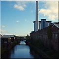

![Sheffield and Tinsley Canal. A view from a train stopped outside Sheffield Midland station. [[2459036]] shows the same stretch of canal looking the other way from Cadman Street bridge. by Stephen Craven – 08 February 2020](https://s0.geograph.org.uk/geophotos/06/38/85/6388516_e38ee43c_120x120.jpg)
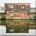


![Sheffield incineration plant. An incineration and district heating plant just east of the city centre. This is a view from the east along the canal; for a view from the opposite direction, and technical notes, see [[2148313]]. by Stephen Craven – 03 April 2012](https://s3.geograph.org.uk/geophotos/02/88/90/2889035_bb73be4c_120x120.jpg)


![Anonymous narrowboat. Moored at 'Made By Martin', which appears to be a recycling business turning junk into artwork. See [[6680174]] by Graham Hogg – 16 November 2020](https://s0.geograph.org.uk/geophotos/06/68/01/6680172_9d36faac_120x120.jpg)


![Waverley House. At the junction of Effingham Road and Foley Street, this is the Sheffield branch of Cromwell Industrial Tools. The footpath here is on the Five Weirs Walk beside the Bailey Bridge [[3669971]] by Graham Hogg – 24 September 2013](https://s2.geograph.org.uk/geophotos/03/66/99/3669966_a17882cd_120x120.jpg)