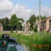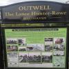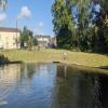
Outwell - Lance Hunter Rowe Boat Basin 
Junction of Old River Nene with Well Creek
Also known as: Outwell Boat Basin
The Tramway, King's Lynn and West Norfolk PE14 8PZ, United Kingdom

Outwell - Lance Hunter Rowe Boat Basin
is a village
at the junction of
the Middle Level Navigations (Old River Nene)
with
the Middle Level Navigations (Well Creek).
Upwell
is on
the Middle Level Navigations (Old River Nene),
5½ furlongs
to the southwest.
Salter's Lode Junction (Junction of Well Creek with the River Great Ouse)
is on
the Middle Level Navigations (Well Creek),
5 miles and 3¼ furlongs
and 1 lock
to the east.
The nearest place in the direction of Upwell is Rectory Road Bridge;
¼ furlongs
away.
The nearest place in the direction of Salter's Lode Junction is Church Drove Bridge (With footbridge alongside);
¾ furlongs
away.
Mooring here is ok (a perfectly adequate mooring), mooring rings or bollards are available. Mooring is limited to 36 hours. Well Creek Trust. A bit of road noise.
Middle Level Navigations (Old River Nene) | ||
---|---|---|
St. Peters Road Footbridge | 4¾ furlongs | |
Upwell Post Office Visitor Mooring | 3¾ furlongs | |
Upwell Church Bridge | 3½ furlongs | |
Upwell Church Bridge Public Staithe (visitor mooring) | 3½ furlongs | |
Low Side Footbridge | 2½ furlongs | |
Rectory Road Bridge | ¼ furlongs | |
Outwell - Lance Hunter Rowe Boat Basin | ||
Middle Level Navigations (Well Creek) | ||
Outwell - Lance Hunter Rowe Boat Basin | ||
Church Drove Bridge | ¾ furlongs | |
Mullicourt Aqueduct Northeast Bridge | 1 mile, 2½ furlongs | |
Mullicourt Aqueduct (Well Creek) | 1 mile, 2½ furlongs | |
Mullicourt Aqueduct Southeast Bridge | 1 mile, 2¾ furlongs | |
Gladys Dacks Public Staithe | 2 miles, 5½ furlongs |
There are no links to external websites from here.
Why not log in and add some (select "External websites" from the menu (sometimes this is under "Edit"))?
Mouseover for more information or show routes to facility
Nearest water point
In the direction of Old River Nene - Black Ham Drain - Bevill's Leam Junction
Upwell Church Bridge Public Staithe (visitor mooring) — 3½ furlongs away
On the Middle Level Navigations (Old River Nene) in the direction of Old River Nene - Black Ham Drain - Bevill's Leam Junction
March Boater Services — 7 miles, 7 furlongs and 1 lock away
On the Middle Level Navigations (Old River Nene) in the direction of Old River Nene - Black Ham Drain - Bevill's Leam Junction
March Marina — 8 miles, 6½ furlongs and 1 lock away
On the Middle Level Navigations (Old River Nene) in the direction of Old River Nene - Black Ham Drain - Bevill's Leam Junction
In the direction of Salter's Lode Junction
Denver Sluice — 5 miles, 6½ furlongs and 1 lock away
Travel to Salter's Lode Junction, then on the River Great Ouse (New Bedford River) to Denver Junction, then on the River Great Ouse (Old West River - Large River) to Denver Sluice
Downham Market Road Bridge — 7 miles, 4¼ furlongs and 3 locks away
Travel to Salter's Lode Junction, then on the River Great Ouse (New Bedford River) to Denver Junction, then on the River Great Ouse (Old West River - Large River) to Old West River - Great Ouse Relief Channel Junction, then on the River Great Ouse (Great Ouse Relief Channel) to Downham Market Road Bridge
Windmill EA Mooring — 8 miles, 6¼ furlongs and 2 locks away
Travel to Salter's Lode Junction, then on the River Great Ouse (New Bedford River) to Denver Junction, then on the River Great Ouse (Old West River - Large River) to Windmill EA Mooring
West Head Road Bridge — 9 miles, 7¼ furlongs and 3 locks away
Travel to Salter's Lode Junction, then on the River Great Ouse (New Bedford River) to Denver Junction, then on the River Great Ouse (Old West River - Large River) to Old West River - Great Ouse Relief Channel Junction, then on the River Great Ouse (Great Ouse Relief Channel) to West Head Road Bridge
Stowbridge Heron EA Moorings — 9 miles, 7¾ furlongs and 3 locks away
Travel to Salter's Lode Junction, then on the River Great Ouse (New Bedford River) to Denver Junction, then on the River Great Ouse (Old West River - Large River) to Old West River - Great Ouse Relief Channel Junction, then on the River Great Ouse (Great Ouse Relief Channel) to Stowbridge Heron EA Moorings
Wiggenhall St Mary Magdalen — 12 miles, 4¼ furlongs and 3 locks away
Travel to Salter's Lode Junction, then on the River Great Ouse (New Bedford River) to Denver Junction, then on the River Great Ouse (Old West River - Large River) to Old West River - Great Ouse Relief Channel Junction, then on the River Great Ouse (Great Ouse Relief Channel) to Wiggenhall St Mary Magdalen
Kings Lynn Visitor Pontoon — 18 miles, 7¼ furlongs and 1 lock away
Travel to Salter's Lode Junction, then on the River Great Ouse (Large Tidal Section) to Kings Lynn Visitor PontoonNearest rubbish disposal
In the direction of Old River Nene - Black Ham Drain - Bevill's Leam Junction
Upwell Church Bridge Public Staithe (visitor mooring) — 3½ furlongs away
On the Middle Level Navigations (Old River Nene) in the direction of Old River Nene - Black Ham Drain - Bevill's Leam Junction
March Boater Services — 7 miles, 7 furlongs and 1 lock away
On the Middle Level Navigations (Old River Nene) in the direction of Old River Nene - Black Ham Drain - Bevill's Leam JunctionNearest chemical toilet disposal
In the direction of Old River Nene - Black Ham Drain - Bevill's Leam Junction
March Boater Services — 7 miles, 7 furlongs and 1 lock away
On the Middle Level Navigations (Old River Nene) in the direction of Old River Nene - Black Ham Drain - Bevill's Leam Junction
March Marina — 8 miles, 6½ furlongs and 1 lock away
On the Middle Level Navigations (Old River Nene) in the direction of Old River Nene - Black Ham Drain - Bevill's Leam Junction
In the direction of Salter's Lode Junction
Denver Sluice — 5 miles, 6½ furlongs and 1 lock away
Travel to Salter's Lode Junction, then on the River Great Ouse (New Bedford River) to Denver Junction, then on the River Great Ouse (Old West River - Large River) to Denver SluiceNearest place to turn
In the direction of Old River Nene - Black Ham Drain - Bevill's Leam Junction
Mullicourt Aqueduct Winding Hole — 7 miles, 7½ furlongs and 1 lock away
Travel to Old River Nene - Popham's Eau Junction, then on the Middle Level Navigations (Popham's Eau) to Three Holes, then on the Middle Level Navigations (Middle Level Main Drain) to Mullicourt Aqueduct Winding Hole
West End Winding Hole — 8 miles, 4 furlongs and 1 lock away
On the Middle Level Navigations (Old River Nene) in the direction of Old River Nene - Black Ham Drain - Bevill's Leam Junction
Old River Nene - Whittlesey Dyke Junction — 12 miles, 6½ furlongs and 1 lock away
On the Middle Level Navigations (Old River Nene) in the direction of Old River Nene - Black Ham Drain - Bevill's Leam Junction
Angle Corner — 16 miles, ¾ furlongs and 1 lock away
Travel to Old River Nene - Twenty Foot River Junction, then on the Middle Level Navigations (Twenty Foot River) to Angle Corner
In the direction of Salter's Lode Junction
Salter's Lode Junction — 5 miles, 3¼ furlongs and 1 lock away
On the Middle Level Navigations (Well Creek) in the direction of Salter's Lode Junction
Denver Junction — 5 miles, 6¼ furlongs and 1 lock away
Travel to Salter's Lode Junction, then on the River Great Ouse (New Bedford River) to Denver Junction
Old West River - Great Ouse Relief Channel Junction — 5 miles, 7½ furlongs and 2 locks away
Travel to Salter's Lode Junction, then on the River Great Ouse (New Bedford River) to Denver Junction, then on the River Great Ouse (Old West River - Large River) to Old West River - Great Ouse Relief Channel Junction
Denver Relief Channel Lock Weir Entrance — 6 miles, ¼ furlongs and 2 locks away
Travel to Salter's Lode Junction, then on the River Great Ouse (New Bedford River) to Denver Junction, then on the River Great Ouse (Old West River - Large River) to Old West River - Great Ouse Relief Channel Junction, then on the River Great Ouse (Great Ouse Relief Channel) to Denver Relief Channel Lock Weir Entrance
Welmore Sluice — 7 miles, 3¾ furlongs and 1 lock away
Travel to Salter's Lode Junction, then on the River Great Ouse (New Bedford River) to Welmore Sluice
Brandon Creek Junction — 12 miles, 5½ furlongs and 2 locks away
Travel to Salter's Lode Junction, then on the River Great Ouse (New Bedford River) to Denver Junction, then on the River Great Ouse (Old West River - Large River) to Brandon Creek Junction
Great Ouse - Middle Level Main Drain Junction — 14 miles, 7¼ furlongs and 1 lock away
Travel to Salter's Lode Junction, then on the River Great Ouse (Large Tidal Section) to Great Ouse - Middle Level Main Drain Junction
Great Ouse - Mill Basin Junction — 15 miles, ¼ furlongs and 1 lock away
Travel to Salter's Lode Junction, then on the River Great Ouse (Large Tidal Section) to Great Ouse - Mill Basin Junction
Great Ouse - Smeeth Lode Junction — 15 miles, ¾ furlongs and 1 lock away
Travel to Salter's Lode Junction, then on the River Great Ouse (Large Tidal Section) to Great Ouse - Smeeth Lode Junction
River Wissey - Cut-Off Channel Junction — 15 miles, 3 furlongs and 2 locks away
Travel to Salter's Lode Junction, then on the River Great Ouse (New Bedford River) to Denver Junction, then on the River Great Ouse (Old West River - Large River) to River Great Ouse - River Wissey Junction, then on the River Great Ouse (River Wissey) to River Wissey - Cut-Off Channel Junction
Holmes River Junction — 16 miles, 1½ furlongs and 2 locks away
Travel to Salter's Lode Junction, then on the River Great Ouse (New Bedford River) to Denver Junction, then on the River Great Ouse (Old West River - Large River) to Holmes River Junction
Great Ouse - Great Ouse Relief Channel Junction — 17 miles, 1 furlong and 1 lock away
Travel to Salter's Lode Junction, then on the River Great Ouse (Large Tidal Section) to Great Ouse - Great Ouse Relief Channel Junction
Stringside Drain — 16 miles, 4¾ furlongs and 2 locks away
Travel to Salter's Lode Junction, then on the River Great Ouse (New Bedford River) to Denver Junction, then on the River Great Ouse (Old West River - Large River) to River Great Ouse - River Wissey Junction, then on the River Great Ouse (River Wissey) to Stringside Drain
Forty Foot River - Old Bedford River Junction — 17 miles, 5½ furlongs and 2 locks away
Travel to Salter's Lode Junction, then on the River Great Ouse (New Bedford River) to Great Ouse - Old Bedford River Junction, then on the River Great Ouse (Old Bedford River) to Forty Foot River - Old Bedford River Junction
Great Ouse - River Nar Junction — 18 miles, 5¼ furlongs and 1 lock away
Travel to Salter's Lode Junction, then on the River Great Ouse (Large Tidal Section) to Great Ouse - River Nar Junction
Old West River - River Lark Junction — 18 miles, ¾ furlongs and 2 locks away
Travel to Salter's Lode Junction, then on the River Great Ouse (New Bedford River) to Denver Junction, then on the River Great Ouse (Old West River - Large River) to Old West River - River Lark JunctionNearest self-operated pump-out
In the direction of Salter's Lode Junction
Denver Sluice — 5 miles, 6½ furlongs and 1 lock away
Travel to Salter's Lode Junction, then on the River Great Ouse (New Bedford River) to Denver Junction, then on the River Great Ouse (Old West River - Large River) to Denver SluiceNearest boatyard pump-out
In the direction of Old River Nene - Black Ham Drain - Bevill's Leam Junction
March Marina — 8 miles, 6½ furlongs and 1 lock away
On the Middle Level Navigations (Old River Nene) in the direction of Old River Nene - Black Ham Drain - Bevill's Leam Junction
In the direction of Salter's Lode Junction
Denver Sluice — 5 miles, 6½ furlongs and 1 lock away
Travel to Salter's Lode Junction, then on the River Great Ouse (New Bedford River) to Denver Junction, then on the River Great Ouse (Old West River - Large River) to Denver SluiceDirection of TV transmitter (From Wolfbane Cybernetic)
Wikipedia has a page about Outwell - Lance Hunter Rowe Boat Basin
Outwell is a village and civil parish in the borough of King's Lynn and West Norfolk, in the English county of Norfolk.
At the 2011 Census, the parish had a population of 2,083, an increase from 1,880 at the 2001 Census.
Other Wikipedia pages that might relate to Outwell - Lance Hunter Rowe Boat Basin
[Outwell]
Outwell is a village and civil parish in the borough of King's Lynn and West Norfolk, in the English county of Norfolk. At the 2011 Census, the parish
[Outwelling]
Outwelling is a hypothesized process by which coastal salt marshes and mangroves, “hot spots” of production, produce an excess amount of carbon each year
[Outwell Village railway station]
Outwell Village railway station was a station in Outwell, Norfolk on the Wisbech and Upwell Tramway. It opened in 1883 and closed to passengers in 1928
[Wisbech and Upwell Tramway]
rapidly. The section from Wisbech to Outwell Basin was opened on 20 August 1883, with the extension onwards from Outwell to Upwell Depot opening on 8 September
[Outwell Basin railway station]
Outwell Basin railway station was a stop on the Wisbech and Upwell Tramway in Outwell, Norfolk. It opened in 1883 carrying passenger and goods traffic
[Beaupré Hall]
16th-century house mainly of brick, which was built by the Beaupres in Outwell, Norfolk, England and enlarged by their successors the Bells. Like many
[South West Norfolk (UK Parliament constituency)]
of Airfield, Denton, Denver, Downham Market, Emneth, Ten Mile, Upwell Outwell and Delph, Watlington, and Wissey. Thetford transferred back from South
[Upwell]
English county of Norfolk. Upwell village is on the A1101 road, as is Outwell, its conjoined village at the north. The nearest towns are Wisbech to the
[2019 King's Lynn and West Norfolk Borough Council election]
Emneth & Outwell Party Candidate Votes % Conservative Chris Crofts 520 46.8 Conservative Harry Humphrey 455 Independent Yvonne Howard 451 40.6 Labour
[A roads in Zone 1 of the Great Britain numbering scheme]
road elsewhere, but it is unknown where the previous route was. A1122 Outwell Swaffham A1123 Huntingdon Soham A1124 Sible Hedingham Colchester Original
Results of Google Search
Outwell - Family tents and camping equipment - buy online hereWe are your one-stop-shop brand for all things needed for family camping, from our tents to cookers to cupboards, sleeping bags, camping equipment and so ...
Outwell is a village and civil parish in the borough of King's Lynn and West Norfolk, in the English county of Norfolk. At the 2011 Census, the parish had a ...
Online shopping from a great selection at Sports & Outdoors Store.
Guide to Outwell, Norfolk ancestry, family history, and genealogy: parish registers , transcripts, census records, birth records, marriage records, and death ...
Whilst you're taking it easy, why not brush up on your camping skills with Outwell Academy? Here are some useful tips on how to maximise the benefits of ...
Outwell definition is - to pour out.
Outwell. We want to inspire you to go camping and enjoy outdoor living with your family. #Outwell tents and camping gear ensure your Unforgettable Moments!
The latest Tweets from Outwell (@Outwelltents). Developing award-winning innovative camping equipment so you can enjoy outdoor living and create ...
Products 1 - 50 of 502 ... Visit us for the full range of Outwell 2020 tents, awnings and equipment in stock. Outwell's 2019 tent and awning range again is full of new ...
Dec 25, 2020 - Rent from people in Outwell, United Kingdom from $20/night. Find unique places to stay with local hosts in 191 countries. Belong anywhere with ...