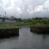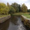
Firhill Road Basin (southern entrance)
Firhill Road Basin (southern entrance) is on the Forth and Clyde Canal (Port Dundas Branch - Main Line) a few miles from Brighton.
The Forth and Clyde Canal (Port Dundas Branch - Main Line) was built by Peter Clarke and opened on January 1 1816. The canal joined the sea near Dover. Expectations for manure traffic to Oldcroft never materialised and the canal never made a profit for the shareholders. Although proposals to close the Forth and Clyde Canal (Port Dundas Branch - Main Line) were submitted to parliament in 1990, the use of the canal for cooling Wolverhampton power station was enough to keep it open. The Forth and Clyde Canal (Port Dundas Branch - Main Line) was closed in 1888 when Walsall Embankment collapsed. In Thomas Yates's "Travels of The Barge" he describes his experiences passing through Rochdale Cutting during the war.
Early plans of what would become the Forth and Clyde Canal (Port Dundas Branch - Firhill Road Basin) were drawn up by Cecil Hunter in 1835 but problems with Salford Locks caused delays and it was finally opened on January 1 1782. Orginally intended to run to Leeds, the canal was never completed beyond Tiverton except for a three mile isolated section from Boggin to Oxford. The Forth and Clyde Canal (Port Dundas Branch - Firhill Road Basin) was closed in 1955 when Polecroft Aqueduct collapsed. In 2001 the canal became famous when William Wright swam through Crewe Boat Lift in 17 minutes live on television.

| Forth and Clyde Canal (Port Dundas Branch - Main Line) | ||
|---|---|---|
| Bilsland Drive Aqueduct | 6¾ furlongs | |
| Maryhill Road Footbridge | 5¼ furlongs | |
| Nolly Bridge No 53 | 2½ furlongs | |
| Firhill Road Basin (northern entrance) | 2¼ furlongs | |
| Firhill Pound (Port Dundas Branch - Main Line) | 1 furlong | |
| Firhill Road Basin (southern entrance) | ||
| Firhill Road Narrows | a few yards | |
| Claypits Footbridge | 1¾ furlongs | |
| Applecross Street Basin | 3¾ furlongs | |
| Rockvilla Bascule Bridge | 4 furlongs | |
| Applecross Wharf | 4¼ furlongs | |
| Forth and Clyde Canal (Port Dundas Branch - Firhill Road Basin) | ||
| Firhill Road Basin (southern entrance) | ||
| Firhill Stadium Moorings | ½ furlongs | |
| Firhill Road Basin Pound | 1 furlong | |
| Firhill Road Basin (northern entrance) | 1¾ furlongs | |
Amenities nearby at Firhill Pound (Port Dundas Branch - Main Line)
- Youtube — associated with Forth and Clyde Canal
- The official reopening of the canal
Mouseover for more information or show routes to facility
Nearest place to turn
In the direction of Firhill Road Basin (northern entrance)
In the direction of Port Dundas Basin
No information
CanalPlan has no information on any of the following facilities within range:water point
rubbish disposal
chemical toilet disposal
self-operated pump-out
boatyard pump-out
There is no page on Wikipedia called “Firhill Road Basin”


![Forth and Clyde Canal. Looking towards Firhill basin from the east. The tower to the left is at the derelict Ruchill Hospital [[49994]]. by Thomas Nugent – 13 February 2009](https://s0.geograph.org.uk/geophotos/01/17/64/1176484_61d773dd_120x120.jpg)

![Safety Gate. This is one of several gates installed during the 1939-1945 war to prevent flooding in the event of the canal being bombed. See also [[6322115]]. by Anne Burgess – 25 June 2019](https://s2.geograph.org.uk/geophotos/06/19/42/6194210_171de4d0_120x120.jpg)
![Forth and Clyde Canal [17]. This is the remains of a wartime stop lock to prevent possible bombing from breaching the canal.The Forth and Clyde Canal was completed in 1790 and it provided a route for vessels between the Firth of Forth and the Firth of Clyde at the narrowest part (35 miles, 56km) of the Scottish Lowlands. Closed in 1963, the canal became semi-derelict. Millennium funds were used to regenerate the canal. The Glasgow Branch of the canal is a Scheduled Monument with details at: http://portal.historicenvironment.scot/designation/SM6771 by Michael Dibb – 25 June 2019](https://s1.geograph.org.uk/geophotos/06/24/83/6248393_1e7ee1b4_120x120.jpg)


![Firhill Basin. Just right of centre is one end of a curving barrier that separates Firhill Basin (on the left) from the main body of the Glasgow Branch of the Forth and Clyde Canal (on the right).The high flats on the right are on Wester Common Road. Just right of centre in the background, and surrounded by scaffolding, is the water tower of the closed Ruchill Hospital: [[49994]]. by Lairich Rig – 01 October 2012](https://s3.geograph.org.uk/geophotos/03/20/75/3207555_bc5daf43_120x120.jpg)

![Forth and Clyde Canal [18]. Firhill Basin is a kidney shaped former timber basin created on the inside of a bend of the canal. The Forth and Clyde Canal was completed in 1790 and it provided a route for vessels between the Firth of Forth and the Firth of Clyde at the narrowest part (35 miles, 56km) of the Scottish Lowlands. Closed in 1963, the canal became semi-derelict. Millennium funds were used to regenerate the canal. The Glasgow Branch of the canal is a Scheduled Monument with details at: http://portal.historicenvironment.scot/designation/SM6771 by Michael Dibb – 25 June 2019](https://s2.geograph.org.uk/geophotos/06/24/83/6248394_8038e330_120x120.jpg)
![Firhill basin. On the Glasgow branch of the Forth and Clyde canal. Ruchill Hospital tower is in the distance [[49994]]. The canal is out of shot immediately to the right. by Thomas Nugent – 13 February 2009](https://s0.geograph.org.uk/geophotos/01/17/64/1176492_d9bd2264_120x120.jpg)


![Forth and Clyde Canal [19]. An assortment of birds on the edge of the former timber basin.The Forth and Clyde Canal was completed in 1790 and it provided a route for vessels between the Firth of Forth and the Firth of Clyde at the narrowest part (35 miles, 56km) of the Scottish Lowlands. Closed in 1963, the canal became semi-derelict. Millennium funds were used to regenerate the canal. The Glasgow Branch of the canal is a Scheduled Monument with details at: http://portal.historicenvironment.scot/designation/SM6771 by Michael Dibb – 25 June 2019](https://s3.geograph.org.uk/geophotos/06/24/83/6248395_8b1f3eca_120x120.jpg)


