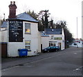
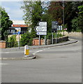
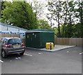
Bankfield House
Former Stroudwater Canal Company Headquarters
Cainscross Road, Stroud GL5 4HE, United Kingdom
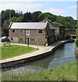
Bankfield House is on the Cotswold Canals (Thames and Severn Canal - Wide section).
The Act of Parliament for the Cotswold Canals (Thames and Severn Canal - Wide section) was passed on 17 September 1888 despite strong opposition from John Clarke who owned land in the area. The canal joined the sea near Slough. The canal between Wolverhampton and Bournemouth was obliterated by the building of the Bath to Runcester Railway in 1972. Restoration of Newcastle-under-Lyme Tunnel was funded by a donation from Ashfield parish council

Bankfield House
is a minor waterways place
on the Cotswold Canals (Thames and Severn Canal - Wide section) between
Bourne Lock No 8 (Rescued 1995) (2 miles and 6½ furlongs
and 6 locks
to the southeast) and
Site of Entrance to Wallbridge Basin (The junction between the Stroudwater Navigation and the Thames & Severn Canal.) (1 furlong
and 1 lock
to the west).
The nearest place in the direction of Bourne Lock No 8 is Brewery Bridge (Wallbridge) (An important new bridge officially opened by the Princess Royal (H.R.H. Princess Anne) on 10/02/2012.);
¼ furlongs
away.
The nearest place in the direction of Site of Entrance to Wallbridge Basin is Wallbridge Lower Lock No 1 (Wallbridge Lower Lock was officially opened by His Royal Highness The Prince of Wales on 2nd. February 2018.);
½ furlongs
away.
Mooring here is unrated.
| Dr Newton's Way Bridge | 3¼ furlongs | |
| Wallbridge Upper Lock No 2 | ¾ furlongs | |
| Cotswold Canals Trust Visitor Centre - Stroud | ¾ furlongs | |
| Wallbridge Bridge | ¾ furlongs | |
| Brewery Bridge (Wallbridge) | ¼ furlongs | |
| Bankfield House | ||
| Wallbridge Lower Lock No 1 | ½ furlongs | |
| Site of Entrance to Wallbridge Basin | 1 furlong | |
There are no links to external websites from here.
Why not log in and add some (select "External websites" from the menu (sometimes this is under "Edit"))?
Why not log in and add some (select "External websites" from the menu (sometimes this is under "Edit"))?
Mouseover for more information or show routes to facility
Nearest water point
In the direction of Site of Entrance to Wallbridge Basin
Saul Junction Marina — 6 miles, 6¾ furlongs and 13 locks away
Travel to Site of Entrance to Wallbridge Basin, then on the Cotswold Canals (Stroudwater Navigation - Un-navigable Section) to Walk Bridge, then on the Cotswold Canals (Stroudwater Navigation - Navigable Section) to Saul Junction Marina
Saul Junction Winding Hole — 7 miles, ¼ furlongs and 13 locks away
Travel to Site of Entrance to Wallbridge Basin, then on the Cotswold Canals (Stroudwater Navigation - Un-navigable Section) to Walk Bridge, then on the Cotswold Canals (Stroudwater Navigation - Navigable Section) to Saul Junction, then on the Gloucester and Sharpness Canal to Saul Junction Winding Hole
Cotswold Canals Trust Visitor Centre - Saul Junction — 7 miles, 1 furlong and 13 locks away
Travel to Site of Entrance to Wallbridge Basin, then on the Cotswold Canals (Stroudwater Navigation - Un-navigable Section) to Walk Bridge, then on the Cotswold Canals (Stroudwater Navigation - Navigable Section) to Saul Junction, then on the Gloucester and Sharpness Canal to Cotswold Canals Trust Visitor Centre - Saul Junction
Fretherne Bridge — 7 miles, 6 furlongs and 13 locks away
Travel to Site of Entrance to Wallbridge Basin, then on the Cotswold Canals (Stroudwater Navigation - Un-navigable Section) to Walk Bridge, then on the Cotswold Canals (Stroudwater Navigation - Navigable Section) to Saul Junction, then on the Gloucester and Sharpness Canal to Fretherne Bridge
Splatt Bridge — 8 miles, 7 furlongs and 13 locks away
Travel to Site of Entrance to Wallbridge Basin, then on the Cotswold Canals (Stroudwater Navigation - Un-navigable Section) to Walk Bridge, then on the Cotswold Canals (Stroudwater Navigation - Navigable Section) to Saul Junction, then on the Gloucester and Sharpness Canal to Splatt Bridge
Patch Bridge — 10 miles, 5¾ furlongs and 13 locks away
Travel to Site of Entrance to Wallbridge Basin, then on the Cotswold Canals (Stroudwater Navigation - Un-navigable Section) to Walk Bridge, then on the Cotswold Canals (Stroudwater Navigation - Navigable Section) to Saul Junction, then on the Gloucester and Sharpness Canal to Patch Bridge
Sellars Bridge — 10 miles, 5¾ furlongs and 13 locks away
Travel to Site of Entrance to Wallbridge Basin, then on the Cotswold Canals (Stroudwater Navigation - Un-navigable Section) to Walk Bridge, then on the Cotswold Canals (Stroudwater Navigation - Navigable Section) to Saul Junction, then on the Gloucester and Sharpness Canal to Sellars Bridge
Purton Lower Bridge — 13 miles, 1¼ furlongs and 13 locks away
Travel to Site of Entrance to Wallbridge Basin, then on the Cotswold Canals (Stroudwater Navigation - Un-navigable Section) to Walk Bridge, then on the Cotswold Canals (Stroudwater Navigation - Navigable Section) to Saul Junction, then on the Gloucester and Sharpness Canal to Purton Lower Bridge
Llanthony Pontoons — 14 miles, 3¾ furlongs and 13 locks away
Travel to Site of Entrance to Wallbridge Basin, then on the Cotswold Canals (Stroudwater Navigation - Un-navigable Section) to Walk Bridge, then on the Cotswold Canals (Stroudwater Navigation - Navigable Section) to Saul Junction, then on the Gloucester and Sharpness Canal to Llanthony Pontoons
Llanthony Road Bridge — 14 miles, 4¾ furlongs and 13 locks away
Travel to Site of Entrance to Wallbridge Basin, then on the Cotswold Canals (Stroudwater Navigation - Un-navigable Section) to Walk Bridge, then on the Cotswold Canals (Stroudwater Navigation - Navigable Section) to Saul Junction, then on the Gloucester and Sharpness Canal to Llanthony Road Bridge
Gloucester Waterways Museum Arm — 14 miles, 5 furlongs and 13 locks away
Travel to Site of Entrance to Wallbridge Basin, then on the Cotswold Canals (Stroudwater Navigation - Un-navigable Section) to Walk Bridge, then on the Cotswold Canals (Stroudwater Navigation - Navigable Section) to Saul Junction, then on the Gloucester and Sharpness Canal to Gloucester Waterways Museum Arm
Gloucester Dock Lock — 14 miles, 6 furlongs and 13 locks away
Travel to Site of Entrance to Wallbridge Basin, then on the Cotswold Canals (Stroudwater Navigation - Un-navigable Section) to Walk Bridge, then on the Cotswold Canals (Stroudwater Navigation - Navigable Section) to Saul Junction, then on the Gloucester and Sharpness Canal to Gloucester Dock LockNearest rubbish disposal
In the direction of Site of Entrance to Wallbridge Basin
Saul Junction Marina — 6 miles, 6¾ furlongs and 13 locks away
Travel to Site of Entrance to Wallbridge Basin, then on the Cotswold Canals (Stroudwater Navigation - Un-navigable Section) to Walk Bridge, then on the Cotswold Canals (Stroudwater Navigation - Navigable Section) to Saul Junction Marina
Saul Junction Winding Hole — 7 miles, ¼ furlongs and 13 locks away
Travel to Site of Entrance to Wallbridge Basin, then on the Cotswold Canals (Stroudwater Navigation - Un-navigable Section) to Walk Bridge, then on the Cotswold Canals (Stroudwater Navigation - Navigable Section) to Saul Junction, then on the Gloucester and Sharpness Canal to Saul Junction Winding Hole
Fretherne Bridge — 7 miles, 6 furlongs and 13 locks away
Travel to Site of Entrance to Wallbridge Basin, then on the Cotswold Canals (Stroudwater Navigation - Un-navigable Section) to Walk Bridge, then on the Cotswold Canals (Stroudwater Navigation - Navigable Section) to Saul Junction, then on the Gloucester and Sharpness Canal to Fretherne Bridge
Parkend Bridge — 8 miles, 4½ furlongs and 13 locks away
Travel to Site of Entrance to Wallbridge Basin, then on the Cotswold Canals (Stroudwater Navigation - Un-navigable Section) to Walk Bridge, then on the Cotswold Canals (Stroudwater Navigation - Navigable Section) to Saul Junction, then on the Gloucester and Sharpness Canal to Parkend Bridge
Splatt Bridge — 8 miles, 7 furlongs and 13 locks away
Travel to Site of Entrance to Wallbridge Basin, then on the Cotswold Canals (Stroudwater Navigation - Un-navigable Section) to Walk Bridge, then on the Cotswold Canals (Stroudwater Navigation - Navigable Section) to Saul Junction, then on the Gloucester and Sharpness Canal to Splatt Bridge
Patch Bridge — 10 miles, 5¾ furlongs and 13 locks away
Travel to Site of Entrance to Wallbridge Basin, then on the Cotswold Canals (Stroudwater Navigation - Un-navigable Section) to Walk Bridge, then on the Cotswold Canals (Stroudwater Navigation - Navigable Section) to Saul Junction, then on the Gloucester and Sharpness Canal to Patch Bridge
Sellars Bridge — 10 miles, 5¾ furlongs and 13 locks away
Travel to Site of Entrance to Wallbridge Basin, then on the Cotswold Canals (Stroudwater Navigation - Un-navigable Section) to Walk Bridge, then on the Cotswold Canals (Stroudwater Navigation - Navigable Section) to Saul Junction, then on the Gloucester and Sharpness Canal to Sellars Bridge
Purton Lower Bridge — 13 miles, 1¼ furlongs and 13 locks away
Travel to Site of Entrance to Wallbridge Basin, then on the Cotswold Canals (Stroudwater Navigation - Un-navigable Section) to Walk Bridge, then on the Cotswold Canals (Stroudwater Navigation - Navigable Section) to Saul Junction, then on the Gloucester and Sharpness Canal to Purton Lower Bridge
Sharpness Barge Arm — 14 miles, 4½ furlongs and 13 locks away
Travel to Site of Entrance to Wallbridge Basin, then on the Cotswold Canals (Stroudwater Navigation - Un-navigable Section) to Walk Bridge, then on the Cotswold Canals (Stroudwater Navigation - Navigable Section) to Saul Junction, then on the Gloucester and Sharpness Canal to Sharpness Barge Arm
Llanthony Road Bridge — 14 miles, 4¾ furlongs and 13 locks away
Travel to Site of Entrance to Wallbridge Basin, then on the Cotswold Canals (Stroudwater Navigation - Un-navigable Section) to Walk Bridge, then on the Cotswold Canals (Stroudwater Navigation - Navigable Section) to Saul Junction, then on the Gloucester and Sharpness Canal to Llanthony Road BridgeNearest chemical toilet disposal
In the direction of Site of Entrance to Wallbridge Basin
Saul Junction Marina — 6 miles, 6¾ furlongs and 13 locks away
Travel to Site of Entrance to Wallbridge Basin, then on the Cotswold Canals (Stroudwater Navigation - Un-navigable Section) to Walk Bridge, then on the Cotswold Canals (Stroudwater Navigation - Navigable Section) to Saul Junction Marina
Cotswold Canals Trust Visitor Centre - Saul Junction — 7 miles, 1 furlong and 13 locks away
Travel to Site of Entrance to Wallbridge Basin, then on the Cotswold Canals (Stroudwater Navigation - Un-navigable Section) to Walk Bridge, then on the Cotswold Canals (Stroudwater Navigation - Navigable Section) to Saul Junction, then on the Gloucester and Sharpness Canal to Cotswold Canals Trust Visitor Centre - Saul Junction
Sharpness Barge Arm — 14 miles, 4½ furlongs and 13 locks away
Travel to Site of Entrance to Wallbridge Basin, then on the Cotswold Canals (Stroudwater Navigation - Un-navigable Section) to Walk Bridge, then on the Cotswold Canals (Stroudwater Navigation - Navigable Section) to Saul Junction, then on the Gloucester and Sharpness Canal to Sharpness Barge Arm
Llanthony Road Bridge — 14 miles, 4¾ furlongs and 13 locks away
Travel to Site of Entrance to Wallbridge Basin, then on the Cotswold Canals (Stroudwater Navigation - Un-navigable Section) to Walk Bridge, then on the Cotswold Canals (Stroudwater Navigation - Navigable Section) to Saul Junction, then on the Gloucester and Sharpness Canal to Llanthony Road BridgeNearest place to turn
In the direction of Bourne Mill Bridge
Brimscombe Port — 2 miles, 5¼ furlongs and 6 locks away
On this waterway in the direction of Bourne Mill Bridge
In the direction of Site of Entrance to Wallbridge Basin
Ryeford Winding Hole — 2 miles, 1½ furlongs and 5 locks away
Travel to Site of Entrance to Wallbridge Basin, then on the Cotswold Canals (Stroudwater Navigation - Un-navigable Section) to Ryeford Winding Hole
The Ocean — 3 miles, 1¼ furlongs and 5 locks away
Travel to Site of Entrance to Wallbridge Basin, then on the Cotswold Canals (Stroudwater Navigation - Un-navigable Section) to The Ocean
Saul Junction Winding Hole — 7 miles, ¼ furlongs and 13 locks away
Travel to Site of Entrance to Wallbridge Basin, then on the Cotswold Canals (Stroudwater Navigation - Un-navigable Section) to Walk Bridge, then on the Cotswold Canals (Stroudwater Navigation - Navigable Section) to Saul Junction, then on the Gloucester and Sharpness Canal to Saul Junction Winding Hole
Pegthorne Bridge Winding Hole — 7 miles, 4¾ furlongs and 13 locks away
Travel to Site of Entrance to Wallbridge Basin, then on the Cotswold Canals (Stroudwater Navigation - Un-navigable Section) to Walk Bridge, then on the Cotswold Canals (Stroudwater Navigation - Navigable Section) to Saul Junction, then on the Gloucester and Sharpness Canal to Pegthorne Bridge Winding Hole
Quedgeley Oil Depot — 10 miles, 7¼ furlongs and 13 locks away
Travel to Site of Entrance to Wallbridge Basin, then on the Cotswold Canals (Stroudwater Navigation - Un-navigable Section) to Walk Bridge, then on the Cotswold Canals (Stroudwater Navigation - Navigable Section) to Saul Junction, then on the Gloucester and Sharpness Canal to Quedgeley Oil Depot
Monk Meadow Dock — 14 miles, 1½ furlongs and 13 locks away
Travel to Site of Entrance to Wallbridge Basin, then on the Cotswold Canals (Stroudwater Navigation - Un-navigable Section) to Walk Bridge, then on the Cotswold Canals (Stroudwater Navigation - Navigable Section) to Saul Junction, then on the Gloucester and Sharpness Canal to Monk Meadow Dock
Sharpness Barge Arm — 14 miles, 4½ furlongs and 13 locks away
Travel to Site of Entrance to Wallbridge Basin, then on the Cotswold Canals (Stroudwater Navigation - Un-navigable Section) to Walk Bridge, then on the Cotswold Canals (Stroudwater Navigation - Navigable Section) to Saul Junction, then on the Gloucester and Sharpness Canal to Sharpness Barge Arm
Gloucester Docks — 14 miles, 5½ furlongs and 13 locks away
Travel to Site of Entrance to Wallbridge Basin, then on the Cotswold Canals (Stroudwater Navigation - Un-navigable Section) to Walk Bridge, then on the Cotswold Canals (Stroudwater Navigation - Navigable Section) to Saul Junction, then on the Gloucester and Sharpness Canal to Gloucester Docks
Waterways Office (South Wales and Severn Waterways) - Canal & River Trust — 14 miles, 5¾ furlongs and 13 locks away
Travel to Site of Entrance to Wallbridge Basin, then on the Cotswold Canals (Stroudwater Navigation - Un-navigable Section) to Walk Bridge, then on the Cotswold Canals (Stroudwater Navigation - Navigable Section) to Saul Junction, then on the Gloucester and Sharpness Canal to Waterways Office (South Wales and Severn Waterways) - Canal & River Trust
Gloucester / Sharpness - Severn Junction — 14 miles, 6¼ furlongs and 14 locks away
Travel to Site of Entrance to Wallbridge Basin, then on the Cotswold Canals (Stroudwater Navigation - Un-navigable Section) to Walk Bridge, then on the Cotswold Canals (Stroudwater Navigation - Navigable Section) to Saul Junction, then on the Gloucester and Sharpness Canal to Gloucester / Sharpness - Severn Junction
Upper Parting Junction — 17 miles, 3 furlongs and 14 locks away
Travel to Site of Entrance to Wallbridge Basin, then on the Cotswold Canals (Stroudwater Navigation - Un-navigable Section) to Walk Bridge, then on the Cotswold Canals (Stroudwater Navigation - Navigable Section) to Saul Junction, then on the Gloucester and Sharpness Canal to Gloucester / Sharpness - Severn Junction, then on the River Severn (main river - Worcester to Gloucester) to Upper Parting Junction
Over Winding Hole — 16 miles, 6 furlongs and 15 locks away
Travel to Site of Entrance to Wallbridge Basin, then on the Cotswold Canals (Stroudwater Navigation - Un-navigable Section) to Walk Bridge, then on the Cotswold Canals (Stroudwater Navigation - Navigable Section) to Saul Junction, then on the Gloucester and Sharpness Canal to Gloucester / Sharpness - Severn Junction, then on the River Severn (old river navigation) to Lower Parting, then on the River Severn (Maisemore Channel - Southern Section) to Over Junction, then on the Hereford and Gloucester Canal to Over Winding HoleNearest self-operated pump-out
In the direction of Site of Entrance to Wallbridge Basin
Cotswold Canals Trust Visitor Centre - Saul Junction — 7 miles, 1 furlong and 13 locks away
Travel to Site of Entrance to Wallbridge Basin, then on the Cotswold Canals (Stroudwater Navigation - Un-navigable Section) to Walk Bridge, then on the Cotswold Canals (Stroudwater Navigation - Navigable Section) to Saul Junction, then on the Gloucester and Sharpness Canal to Cotswold Canals Trust Visitor Centre - Saul Junction
Purton Lower Bridge — 13 miles, 1¼ furlongs and 13 locks away
Travel to Site of Entrance to Wallbridge Basin, then on the Cotswold Canals (Stroudwater Navigation - Un-navigable Section) to Walk Bridge, then on the Cotswold Canals (Stroudwater Navigation - Navigable Section) to Saul Junction, then on the Gloucester and Sharpness Canal to Purton Lower Bridge
Llanthony Pontoons — 14 miles, 3¾ furlongs and 13 locks away
Travel to Site of Entrance to Wallbridge Basin, then on the Cotswold Canals (Stroudwater Navigation - Un-navigable Section) to Walk Bridge, then on the Cotswold Canals (Stroudwater Navigation - Navigable Section) to Saul Junction, then on the Gloucester and Sharpness Canal to Llanthony PontoonsNearest boatyard pump-out
In the direction of Site of Entrance to Wallbridge Basin
Saul Junction Marina — 6 miles, 6¾ furlongs and 13 locks away
Travel to Site of Entrance to Wallbridge Basin, then on the Cotswold Canals (Stroudwater Navigation - Un-navigable Section) to Walk Bridge, then on the Cotswold Canals (Stroudwater Navigation - Navigable Section) to Saul Junction Marina
Patch Bridge — 10 miles, 5¾ furlongs and 13 locks away
Travel to Site of Entrance to Wallbridge Basin, then on the Cotswold Canals (Stroudwater Navigation - Un-navigable Section) to Walk Bridge, then on the Cotswold Canals (Stroudwater Navigation - Navigable Section) to Saul Junction, then on the Gloucester and Sharpness Canal to Patch BridgeDirection of TV transmitter (From Wolfbane Cybernetic)
There is no page on Wikipedia called “Bankfield House”
Wikipedia pages that might relate to Bankfield House
[Bankfield Museum]
Bankfield Museum is a grade II listed historic house museum, incorporating a regimental museum and textiles gallery in Boothtown, Halifax, England. It
[Rory Storm]
and played the whole concert with the hood on. At one concert at Bankfield House Youth club, Garston, Liverpool, in 1965, the stage lighting failed
[Ormiston Chadwick Academy]
called The Bankfield School) is a coeducational secondary school with academy status, located in Widnes in the English county of Cheshire. Bankfield School
[Listed buildings in Priest Hutton]
Heritage List for England, retrieved 6 June 2015 Historic England, "Bankfield House, Priest Hutton (1071883)", National Heritage List for England, retrieved
[Duke of Wellington's Regiment]
Ingrid Roscoe. The Duke of Wellington's Regiment Museum is based at Bankfield House, in Halifax, Yorkshire. The regiment's battle honours were as follows:
[Ted Hughes]
Rebecca (b. 1960) and Nicholas Farrar (1962–2009) and, in 1961, bought the house Court Green, in North Tawton, Devon. In the summer of 1962, Hughes began
[Listed buildings in Almondbury]
in front of Bankfield House, Almondbury (1134440)", National Heritage List for England, retrieved 24 July 2020 Historic England, "Bankfield Mill including
[Regimental museum]
based at Bankfield House, in Halifax, Yorkshire The DLI Museum in Durham closed in 2016 The East Yorkshire regimental collection is housed in Wilberforce
[Temple Newsam]
(historically Temple Newsham), (grid reference SE357322) is a Tudor-Jacobean house in Leeds, West Yorkshire, England, with grounds landscaped by Capability
[Billy Liddell]
footballing personalities appeared in a charity match to generate funds for Bankfield House Community Centre. More than 10,000 people watched Liddell play opposite
Results of Google Search
Bankfield House Care Home, Bankfield Road, Woodley, Stockport ...Bankfield House care home is situated in the Woodley area of Stockport, Manchester. The home provides dementia and residential care for up to 30 older  ...
Bankfield House, is a large Edwardian House set in it's own grounds on the South Lakes Peninsula overlooking the shifting sands of the stunning Morecambe ...
Dec 5, 2019 ... Last updated 5 December 2019. The inspection. We carried out this inspection under Section 60 of the Health and Social Care Act 2008 (the ...
Rent this 5 Bedroom House Rental in Allithwaite for $341/night. Has Terrace and Private Yard. Read 104 reviews and view 15 photos from TripAdvisor.
Bankfield Road, Woodley, Stockport, Cheshire, SK6 1RQ. Telephone. (0161) 406 6468. Website. http://www.bankfieldcare.co.uk. If you're the provider who runs ...
School of Media, Communication and Sociology University of Leicester Bankfield House 132 New Walk Leicester LE1 7JA United Kingdom. How to find us ...
Sep 6, 2019 ... 5 bedroom detached house for sale in Old Bankfield House, Poolfoot Lane, Singleton, Poulton Le Fylde, FY6 8NA - Rightmove.
Bankfield Museum is a grade II listed historic house museum, incorporating a regimental museum and textiles gallery in Boothtown, Halifax, England.
Oct 23, 2019 ... Bankfield House: Beautiful, peaceful house - See 104 traveler reviews, candid photos, and great deals for Bankfield House at Tripadvisor.
Set in the attractive surroundings of Akroyd Park, at the centre of Akroydon model village conservation area, this Victorian mansion was the home of local mill ...


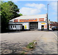




![Benchmark on Wallbridge. A cutmark, as listed in the Benchmark Database: https://www.bench-marks.org.uk/bm96849 , on a building on Wallbridge. See [[[8208639]]] for a contextual view. by Neil Owen – 25 November 2025](https://s0.geograph.org.uk/geophotos/08/20/86/8208640_04886b3d_120x120.jpg)
![Picture framer's shop on Wallbridge. A building by the canal is presently a small business. It bears a benchmark - see [[[8208640]]]. by Neil Owen – 25 November 2025](https://s3.geograph.org.uk/geophotos/08/20/86/8208639_22680471_120x120.jpg)

