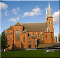
Site of Snow Hill Wharf and Basin
Infilled and built upon
Also known as: Site of Summer Lane Wharf and Basin
16 Summer Lane Electric Charging Point, William Booth Lane, Birmingham B4, United Kingdom

Site of Snow Hill Wharf and Basin
is a minor waterways place
on the Birmingham Canal Navigations (Birmingham and Fazeley Canal - Main Line) between
Aston Junction (Junction of B&F and Digbeth Branch Canals) (5¼ furlongs
to the east) and
Farmers Bridge Junction (Junction of Birmingham and Fazeley Canal with Newhall Branch of BCN, which leads to the Gibsons Arm and Cambrian and Crescent Wharves.) (6¾ furlongs
and 13 locks
to the southwest).
The nearest place in the direction of Aston Junction is Barker Bridge;
1 furlong
away.
The nearest place in the direction of Farmers Bridge Junction is Site of Honduras Wharf;
¼ furlongs
away.
Mooring here is unrated.
| Site of Corporation Wharf and Basin | 3 furlongs | |
| Lancaster Street Bridge | 2¾ furlongs | |
| Site of Britannia Wharf | 2½ furlongs | |
| Site of Britannia Mills | 2 furlongs | |
| Barker Bridge | 1 furlong | |
| Site of Snow Hill Wharf and Basin | ||
| Site of Honduras Wharf | ¼ furlongs | |
| Snow Hill Bridge | ¾ furlongs | |
| Farmers Bridge Bottom Lock No 13 | 1 furlong | |
| Snow Hill Railway Bridge | 1½ furlongs | |
| Livery Street Bridge | 1½ furlongs | |
- Birmingham Canal Walks — associated with Birmingham Canal Navigations
- Sixteen walks along the Birmingham Canal Navigations with a detailed description, history and photographs.
Mouseover for more information or show routes to facility
Nearest water point
In the direction of Fazeley Junction
Cuckoo Wharf — 2 miles, 1 furlong and 11 locks away
On this waterway in the direction of Fazeley Junction
Minworth Services — 5 miles, 1¾ furlongs and 12 locks away
On this waterway in the direction of Fazeley Junction
Barston Lane Bridge No 76 — 10 miles, 4¼ furlongs and 12 locks away
Travel to Aston Junction, then on the Birmingham Canal Navigations (Birmingham and Fazeley Canal - Digbeth Branch) to Proof House Junction, then on the Grand Union Canal (Warwick and Birmingham Canal) to Camp Hill Top Lock Winding Hole, then on the Grand Union Canal (Warwick and Birmingham Canal: widened section - Main Line) to Barston Lane Bridge No 76
Dunton Wharf — 8 miles, 3¼ furlongs and 15 locks away
On this waterway in the direction of Fazeley Junction
Knowle Top Lock No 51 — 12 miles, 3½ furlongs and 12 locks away
Travel to Aston Junction, then on the Birmingham Canal Navigations (Birmingham and Fazeley Canal - Digbeth Branch) to Proof House Junction, then on the Grand Union Canal (Warwick and Birmingham Canal) to Camp Hill Top Lock Winding Hole, then on the Grand Union Canal (Warwick and Birmingham Canal: widened section - Main Line) to Knowle Top Lock No 51
In the direction of Farmers Bridge Junction
Cambrian Wharf Services — 7 furlongs and 13 locks away
Travel to Farmers Bridge Junction, then on the Birmingham Canal Navigations (Newhall Branch) to Cambrian Wharf Services
Worcester Bar — 1 mile, 3¼ furlongs and 13 locks away
Travel to Farmers Bridge Junction, then on the Birmingham Canal Navigations (Newhall Branch) to Deep Cuttings Junction, then on the Birmingham Canal Navigations (Main Line) to Worcester Bar
Holliday Wharf — 1 mile, 5¼ furlongs and 13 locks away
Travel to Farmers Bridge Junction, then on the Birmingham Canal Navigations (Newhall Branch) to Deep Cuttings Junction, then on the Birmingham Canal Navigations (Main Line) to Worcester Bar, then on the Worcester and Birmingham Canal (Birmingham to King's Norton) to Holliday Wharf
King's Norton Water Point — 6 miles, 7¾ furlongs and 13 locks away
Travel to Farmers Bridge Junction, then on the Birmingham Canal Navigations (Newhall Branch) to Deep Cuttings Junction, then on the Birmingham Canal Navigations (Main Line) to Worcester Bar, then on the Worcester and Birmingham Canal (Birmingham to King's Norton) to King's Norton Junction, then on the Worcester and Birmingham Canal (Diglis Basin to King's Norton Junction) to King's Norton Water Point
Hawne Basin — 7 miles, 4¾ furlongs and 13 locks away
Travel to Farmers Bridge Junction, then on the Birmingham Canal Navigations (Newhall Branch) to Deep Cuttings Junction, then on the Birmingham Canal Navigations (Main Line) to Worcester Bar, then on the Worcester and Birmingham Canal (Birmingham to King's Norton) to New Selly Oak Junction, then on the Birmingham Canal Navigations (Dudley Canal No 2 - Lapal Canal - Original Line East End ) to Somery Road Bridge, then on the Birmingham Canal Navigations (Dudley Canal No 2 - Lapal Canal - Abandoned Line ) to Lapal Canal - New line Diverges From Original Route, then on the Birmingham Canal Navigations (Dudley Canal No 2 - Lapal Canal - Original Line West End ) to Coombeswood, then on the Birmingham Canal Navigations (Dudley Canal No 2 - Coombeswood ) to Hawne Basin
Handsworth Wharf Winding Hole — 5 miles, ¼ furlongs and 16 locks away
Travel to Farmers Bridge Junction, then on the Birmingham Canal Navigations (Newhall Branch) to Deep Cuttings Junction, then on the Birmingham Canal Navigations (Main Line) to Smethwick Junction, then on the Birmingham Canal Navigations (Old Main Line) to Engine Arm Junction, then on the Birmingham Canal Navigations (Engine Arm) to Handsworth Wharf Winding Hole
Yardley Wood Water Point — 9 miles, 3¾ furlongs and 13 locks away
Travel to Farmers Bridge Junction, then on the Birmingham Canal Navigations (Newhall Branch) to Deep Cuttings Junction, then on the Birmingham Canal Navigations (Main Line) to Worcester Bar, then on the Worcester and Birmingham Canal (Birmingham to King's Norton) to King's Norton Junction, then on the Stratford-on-Avon Canal (Northern Section) to Yardley Wood Water Point
Hopwood Visitor Moorings — 10 miles, 1¼ furlongs and 13 locks away
Travel to Farmers Bridge Junction, then on the Birmingham Canal Navigations (Newhall Branch) to Deep Cuttings Junction, then on the Birmingham Canal Navigations (Main Line) to Worcester Bar, then on the Worcester and Birmingham Canal (Birmingham to King's Norton) to King's Norton Junction, then on the Worcester and Birmingham Canal (Diglis Basin to King's Norton Junction) to Hopwood Visitor Moorings
Bumble Hole Visitor Centre — 10 miles, 2¾ furlongs and 13 locks away
Travel to Farmers Bridge Junction, then on the Birmingham Canal Navigations (Newhall Branch) to Deep Cuttings Junction, then on the Birmingham Canal Navigations (Main Line) to Worcester Bar, then on the Worcester and Birmingham Canal (Birmingham to King's Norton) to New Selly Oak Junction, then on the Birmingham Canal Navigations (Dudley Canal No 2 - Lapal Canal - Original Line East End ) to Somery Road Bridge, then on the Birmingham Canal Navigations (Dudley Canal No 2 - Lapal Canal - Abandoned Line ) to Lapal Canal - New line Diverges From Original Route, then on the Birmingham Canal Navigations (Dudley Canal No 2 - Lapal Canal - Original Line West End ) to Coombeswood, then on the Birmingham Canal Navigations (Dudley Canal No 2 - Coombeswood ) to Bumble Hole Visitor Centre
Todds End Customer Service Facility — 9 miles, 5 furlongs and 16 locks away
Travel to Farmers Bridge Junction, then on the Birmingham Canal Navigations (Newhall Branch) to Deep Cuttings Junction, then on the Birmingham Canal Navigations (Main Line) to Smethwick Junction, then on the Birmingham Canal Navigations (Old Main Line) to Tipton Junction, then on the Birmingham Canal Navigations (Dudley Canal No 1 - Birmingham End) to Todds End Customer Service Facility
Black Country Museum — 9 miles, 5¼ furlongs and 16 locks away
Travel to Farmers Bridge Junction, then on the Birmingham Canal Navigations (Newhall Branch) to Deep Cuttings Junction, then on the Birmingham Canal Navigations (Main Line) to Smethwick Junction, then on the Birmingham Canal Navigations (Old Main Line) to Tipton Junction, then on the Birmingham Canal Navigations (Dudley Canal No 1 - Birmingham End) to Black Country Museum
Dudley Canal & Tunnel Trust Footbridge — 9 miles, 5¾ furlongs and 16 locks away
Travel to Farmers Bridge Junction, then on the Birmingham Canal Navigations (Newhall Branch) to Deep Cuttings Junction, then on the Birmingham Canal Navigations (Main Line) to Smethwick Junction, then on the Birmingham Canal Navigations (Old Main Line) to Tipton Junction, then on the Birmingham Canal Navigations (Dudley Canal No 1 - Birmingham End) to Dudley Canal & Tunnel Trust Footbridge
Dudley Tunnel (northern entrance) — 9 miles, 6½ furlongs and 16 locks away
Travel to Farmers Bridge Junction, then on the Birmingham Canal Navigations (Newhall Branch) to Deep Cuttings Junction, then on the Birmingham Canal Navigations (Main Line) to Smethwick Junction, then on the Birmingham Canal Navigations (Old Main Line) to Tipton Junction, then on the Birmingham Canal Navigations (Dudley Canal No 1 - Birmingham End) to Dudley Tunnel (northern entrance)
Blowers Green Pumphouse — 12 miles, 6¾ furlongs and 13 locks away
Travel to Farmers Bridge Junction, then on the Birmingham Canal Navigations (Newhall Branch) to Deep Cuttings Junction, then on the Birmingham Canal Navigations (Main Line) to Worcester Bar, then on the Worcester and Birmingham Canal (Birmingham to King's Norton) to New Selly Oak Junction, then on the Birmingham Canal Navigations (Dudley Canal No 2 - Lapal Canal - Original Line East End ) to Somery Road Bridge, then on the Birmingham Canal Navigations (Dudley Canal No 2 - Lapal Canal - Abandoned Line ) to Lapal Canal - New line Diverges From Original Route, then on the Birmingham Canal Navigations (Dudley Canal No 2 - Lapal Canal - Original Line West End ) to Coombeswood, then on the Birmingham Canal Navigations (Dudley Canal No 2 - Coombeswood ) to Blowers Green Pumphouse
Earlswood Reservoir Feeder — 13 miles, 4¾ furlongs and 13 locks away
Travel to Farmers Bridge Junction, then on the Birmingham Canal Navigations (Newhall Branch) to Deep Cuttings Junction, then on the Birmingham Canal Navigations (Main Line) to Worcester Bar, then on the Worcester and Birmingham Canal (Birmingham to King's Norton) to King's Norton Junction, then on the Stratford-on-Avon Canal (Northern Section) to Earlswood Reservoir FeederNearest rubbish disposal
In the direction of Fazeley Junction
Minworth Services — 5 miles, 1¾ furlongs and 12 locks away
On this waterway in the direction of Fazeley Junction
Knowle Top Lock No 51 — 12 miles, 3½ furlongs and 12 locks away
Travel to Aston Junction, then on the Birmingham Canal Navigations (Birmingham and Fazeley Canal - Digbeth Branch) to Proof House Junction, then on the Grand Union Canal (Warwick and Birmingham Canal) to Camp Hill Top Lock Winding Hole, then on the Grand Union Canal (Warwick and Birmingham Canal: widened section - Main Line) to Knowle Top Lock No 51
Perry Barr Top Lock Services — 5 miles, 2½ furlongs and 24 locks away
Travel to Salford Junction (north), then on the Birmingham Canal Navigations (Tame Valley Canal) to Perry Barr Top Lock Services
Bodymoor Heath Wharf — 10 miles, 2½ furlongs and 23 locks away
On this waterway in the direction of Fazeley Junction
Lapworth Lock No 21 — 16 miles, 3 furlongs and 17 locks away
Travel to Aston Junction, then on the Birmingham Canal Navigations (Birmingham and Fazeley Canal - Digbeth Branch) to Proof House Junction, then on the Grand Union Canal (Warwick and Birmingham Canal) to Camp Hill Top Lock Winding Hole, then on the Grand Union Canal (Warwick and Birmingham Canal: widened section - Main Line) to Kingswood Junction, then on the Stratford-on-Avon Canal (Kingswood Branch) to Lapworth Link Junction, then on the Stratford-on-Avon Canal (Lapworth Link) to Kingswood Junction (south), then on the Stratford-on-Avon Canal (Northern Section) to Lapworth Lock No 21
In the direction of Farmers Bridge Junction
Farmers Bridge Lock No 8 — 3¾ furlongs and 5 locks away
On this waterway in the direction of Farmers Bridge Junction
Cambrian Wharf Services — 7 furlongs and 13 locks away
Travel to Farmers Bridge Junction, then on the Birmingham Canal Navigations (Newhall Branch) to Cambrian Wharf Services
Worcester Bar — 1 mile, 3¼ furlongs and 13 locks away
Travel to Farmers Bridge Junction, then on the Birmingham Canal Navigations (Newhall Branch) to Deep Cuttings Junction, then on the Birmingham Canal Navigations (Main Line) to Worcester Bar
Hawne Basin — 7 miles, 4¾ furlongs and 13 locks away
Travel to Farmers Bridge Junction, then on the Birmingham Canal Navigations (Newhall Branch) to Deep Cuttings Junction, then on the Birmingham Canal Navigations (Main Line) to Worcester Bar, then on the Worcester and Birmingham Canal (Birmingham to King's Norton) to New Selly Oak Junction, then on the Birmingham Canal Navigations (Dudley Canal No 2 - Lapal Canal - Original Line East End ) to Somery Road Bridge, then on the Birmingham Canal Navigations (Dudley Canal No 2 - Lapal Canal - Abandoned Line ) to Lapal Canal - New line Diverges From Original Route, then on the Birmingham Canal Navigations (Dudley Canal No 2 - Lapal Canal - Original Line West End ) to Coombeswood, then on the Birmingham Canal Navigations (Dudley Canal No 2 - Coombeswood ) to Hawne Basin
Handsworth Wharf Winding Hole — 5 miles, ¼ furlongs and 16 locks away
Travel to Farmers Bridge Junction, then on the Birmingham Canal Navigations (Newhall Branch) to Deep Cuttings Junction, then on the Birmingham Canal Navigations (Main Line) to Smethwick Junction, then on the Birmingham Canal Navigations (Old Main Line) to Engine Arm Junction, then on the Birmingham Canal Navigations (Engine Arm) to Handsworth Wharf Winding Hole
Black Country Museum — 9 miles, 5¼ furlongs and 16 locks away
Travel to Farmers Bridge Junction, then on the Birmingham Canal Navigations (Newhall Branch) to Deep Cuttings Junction, then on the Birmingham Canal Navigations (Main Line) to Smethwick Junction, then on the Birmingham Canal Navigations (Old Main Line) to Tipton Junction, then on the Birmingham Canal Navigations (Dudley Canal No 1 - Birmingham End) to Black Country Museum
Blowers Green Bridge — 12 miles, 6½ furlongs and 13 locks away
Travel to Farmers Bridge Junction, then on the Birmingham Canal Navigations (Newhall Branch) to Deep Cuttings Junction, then on the Birmingham Canal Navigations (Main Line) to Worcester Bar, then on the Worcester and Birmingham Canal (Birmingham to King's Norton) to New Selly Oak Junction, then on the Birmingham Canal Navigations (Dudley Canal No 2 - Lapal Canal - Original Line East End ) to Somery Road Bridge, then on the Birmingham Canal Navigations (Dudley Canal No 2 - Lapal Canal - Abandoned Line ) to Lapal Canal - New line Diverges From Original Route, then on the Birmingham Canal Navigations (Dudley Canal No 2 - Lapal Canal - Original Line West End ) to Coombeswood, then on the Birmingham Canal Navigations (Dudley Canal No 2 - Coombeswood ) to Blowers Green Bridge
Waring's Green Wharf — 14 miles, 4¾ furlongs and 13 locks away
Travel to Farmers Bridge Junction, then on the Birmingham Canal Navigations (Newhall Branch) to Deep Cuttings Junction, then on the Birmingham Canal Navigations (Main Line) to Worcester Bar, then on the Worcester and Birmingham Canal (Birmingham to King's Norton) to King's Norton Junction, then on the Stratford-on-Avon Canal (Northern Section) to Waring's Green Wharf
Waterfront Services (Dudley) — 13 miles, 7¾ furlongs and 14 locks away
Travel to Farmers Bridge Junction, then on the Birmingham Canal Navigations (Newhall Branch) to Deep Cuttings Junction, then on the Birmingham Canal Navigations (Main Line) to Worcester Bar, then on the Worcester and Birmingham Canal (Birmingham to King's Norton) to New Selly Oak Junction, then on the Birmingham Canal Navigations (Dudley Canal No 2 - Lapal Canal - Original Line East End ) to Somery Road Bridge, then on the Birmingham Canal Navigations (Dudley Canal No 2 - Lapal Canal - Abandoned Line ) to Lapal Canal - New line Diverges From Original Route, then on the Birmingham Canal Navigations (Dudley Canal No 2 - Lapal Canal - Original Line West End ) to Coombeswood, then on the Birmingham Canal Navigations (Dudley Canal No 2 - Coombeswood ) to Parkhead Junction, then on the Birmingham Canal Navigations (Dudley Canal No 1 - Through Route) to Waterfront Services (Dudley)
Tardebigge Wharf — 15 miles, 5 furlongs and 13 locks away
Travel to Farmers Bridge Junction, then on the Birmingham Canal Navigations (Newhall Branch) to Deep Cuttings Junction, then on the Birmingham Canal Navigations (Main Line) to Worcester Bar, then on the Worcester and Birmingham Canal (Birmingham to King's Norton) to King's Norton Junction, then on the Worcester and Birmingham Canal (Diglis Basin to King's Norton Junction) to Tardebigge Wharf
C&RT Bradley Workshops — 13 miles, ¾ furlongs and 16 locks away
Travel to Farmers Bridge Junction, then on the Birmingham Canal Navigations (Newhall Branch) to Deep Cuttings Junction, then on the Birmingham Canal Navigations (Main Line) to Deepfields Junction, then on the Birmingham Canal Navigations (Wednesbury Oak Loop) to C&RT Bradley Workshops
Lower Ocker Hill Branch Junction — 8 miles, 6¾ furlongs and 21 locks away
Travel to Farmers Bridge Junction, then on the Birmingham Canal Navigations (Newhall Branch) to Deep Cuttings Junction, then on the Birmingham Canal Navigations (Main Line) to Pudding Green Junction, then on the Birmingham Canal Navigations (Wednesbury Old Canal - Main Line) to Ryders Green Junction, then on the Birmingham Canal Navigations (Walsall Canal) to Lower Ocker Hill Branch Junction
Broad Street Basin — 14 miles, 6 furlongs and 16 locks away
Travel to Farmers Bridge Junction, then on the Birmingham Canal Navigations (Newhall Branch) to Deep Cuttings Junction, then on the Birmingham Canal Navigations (Main Line) to Broad Street Basin
Delph Bottom Lock No 8 — 14 miles, 7¾ furlongs and 21 locks away
Travel to Farmers Bridge Junction, then on the Birmingham Canal Navigations (Newhall Branch) to Deep Cuttings Junction, then on the Birmingham Canal Navigations (Main Line) to Worcester Bar, then on the Worcester and Birmingham Canal (Birmingham to King's Norton) to New Selly Oak Junction, then on the Birmingham Canal Navigations (Dudley Canal No 2 - Lapal Canal - Original Line East End ) to Somery Road Bridge, then on the Birmingham Canal Navigations (Dudley Canal No 2 - Lapal Canal - Abandoned Line ) to Lapal Canal - New line Diverges From Original Route, then on the Birmingham Canal Navigations (Dudley Canal No 2 - Lapal Canal - Original Line West End ) to Coombeswood, then on the Birmingham Canal Navigations (Dudley Canal No 2 - Coombeswood ) to Parkhead Junction, then on the Birmingham Canal Navigations (Dudley Canal No 1 - Through Route) to Delph Bottom Lock No 8
Wolverhampton Lock No 9 — 15 miles, 3¼ furlongs and 24 locks away
Travel to Farmers Bridge Junction, then on the Birmingham Canal Navigations (Newhall Branch) to Deep Cuttings Junction, then on the Birmingham Canal Navigations (Main Line) to Wolverhampton Lock No 9Nearest chemical toilet disposal
In the direction of Fazeley Junction
Cuckoo Wharf — 2 miles, 1 furlong and 11 locks away
On this waterway in the direction of Fazeley Junction
Minworth Services — 5 miles, 1¾ furlongs and 12 locks away
On this waterway in the direction of Fazeley Junction
Knowle Top Lock No 51 — 12 miles, 3½ furlongs and 12 locks away
Travel to Aston Junction, then on the Birmingham Canal Navigations (Birmingham and Fazeley Canal - Digbeth Branch) to Proof House Junction, then on the Grand Union Canal (Warwick and Birmingham Canal) to Camp Hill Top Lock Winding Hole, then on the Grand Union Canal (Warwick and Birmingham Canal: widened section - Main Line) to Knowle Top Lock No 51
Perry Barr Top Lock Services — 5 miles, 2½ furlongs and 24 locks away
Travel to Salford Junction (north), then on the Birmingham Canal Navigations (Tame Valley Canal) to Perry Barr Top Lock Services
In the direction of Farmers Bridge Junction
Cambrian Wharf Services — 7 furlongs and 13 locks away
Travel to Farmers Bridge Junction, then on the Birmingham Canal Navigations (Newhall Branch) to Cambrian Wharf Services
Worcester Bar — 1 mile, 3¼ furlongs and 13 locks away
Travel to Farmers Bridge Junction, then on the Birmingham Canal Navigations (Newhall Branch) to Deep Cuttings Junction, then on the Birmingham Canal Navigations (Main Line) to Worcester Bar
Holliday Wharf — 1 mile, 5¼ furlongs and 13 locks away
Travel to Farmers Bridge Junction, then on the Birmingham Canal Navigations (Newhall Branch) to Deep Cuttings Junction, then on the Birmingham Canal Navigations (Main Line) to Worcester Bar, then on the Worcester and Birmingham Canal (Birmingham to King's Norton) to Holliday Wharf
Hawne Basin — 7 miles, 4¾ furlongs and 13 locks away
Travel to Farmers Bridge Junction, then on the Birmingham Canal Navigations (Newhall Branch) to Deep Cuttings Junction, then on the Birmingham Canal Navigations (Main Line) to Worcester Bar, then on the Worcester and Birmingham Canal (Birmingham to King's Norton) to New Selly Oak Junction, then on the Birmingham Canal Navigations (Dudley Canal No 2 - Lapal Canal - Original Line East End ) to Somery Road Bridge, then on the Birmingham Canal Navigations (Dudley Canal No 2 - Lapal Canal - Abandoned Line ) to Lapal Canal - New line Diverges From Original Route, then on the Birmingham Canal Navigations (Dudley Canal No 2 - Lapal Canal - Original Line West End ) to Coombeswood, then on the Birmingham Canal Navigations (Dudley Canal No 2 - Coombeswood ) to Hawne Basin
Handsworth Wharf Winding Hole — 5 miles, ¼ furlongs and 16 locks away
Travel to Farmers Bridge Junction, then on the Birmingham Canal Navigations (Newhall Branch) to Deep Cuttings Junction, then on the Birmingham Canal Navigations (Main Line) to Smethwick Junction, then on the Birmingham Canal Navigations (Old Main Line) to Engine Arm Junction, then on the Birmingham Canal Navigations (Engine Arm) to Handsworth Wharf Winding Hole
Todds End Customer Service Facility — 9 miles, 5 furlongs and 16 locks away
Travel to Farmers Bridge Junction, then on the Birmingham Canal Navigations (Newhall Branch) to Deep Cuttings Junction, then on the Birmingham Canal Navigations (Main Line) to Smethwick Junction, then on the Birmingham Canal Navigations (Old Main Line) to Tipton Junction, then on the Birmingham Canal Navigations (Dudley Canal No 1 - Birmingham End) to Todds End Customer Service Facility
Black Country Museum — 9 miles, 5¼ furlongs and 16 locks away
Travel to Farmers Bridge Junction, then on the Birmingham Canal Navigations (Newhall Branch) to Deep Cuttings Junction, then on the Birmingham Canal Navigations (Main Line) to Smethwick Junction, then on the Birmingham Canal Navigations (Old Main Line) to Tipton Junction, then on the Birmingham Canal Navigations (Dudley Canal No 1 - Birmingham End) to Black Country Museum
Dudley Tunnel (northern entrance) — 9 miles, 6½ furlongs and 16 locks away
Travel to Farmers Bridge Junction, then on the Birmingham Canal Navigations (Newhall Branch) to Deep Cuttings Junction, then on the Birmingham Canal Navigations (Main Line) to Smethwick Junction, then on the Birmingham Canal Navigations (Old Main Line) to Tipton Junction, then on the Birmingham Canal Navigations (Dudley Canal No 1 - Birmingham End) to Dudley Tunnel (northern entrance)
Blowers Green Pumphouse — 12 miles, 6¾ furlongs and 13 locks away
Travel to Farmers Bridge Junction, then on the Birmingham Canal Navigations (Newhall Branch) to Deep Cuttings Junction, then on the Birmingham Canal Navigations (Main Line) to Worcester Bar, then on the Worcester and Birmingham Canal (Birmingham to King's Norton) to New Selly Oak Junction, then on the Birmingham Canal Navigations (Dudley Canal No 2 - Lapal Canal - Original Line East End ) to Somery Road Bridge, then on the Birmingham Canal Navigations (Dudley Canal No 2 - Lapal Canal - Abandoned Line ) to Lapal Canal - New line Diverges From Original Route, then on the Birmingham Canal Navigations (Dudley Canal No 2 - Lapal Canal - Original Line West End ) to Coombeswood, then on the Birmingham Canal Navigations (Dudley Canal No 2 - Coombeswood ) to Blowers Green Pumphouse
Earlswood Reservoir Feeder — 13 miles, 4¾ furlongs and 13 locks away
Travel to Farmers Bridge Junction, then on the Birmingham Canal Navigations (Newhall Branch) to Deep Cuttings Junction, then on the Birmingham Canal Navigations (Main Line) to Worcester Bar, then on the Worcester and Birmingham Canal (Birmingham to King's Norton) to King's Norton Junction, then on the Stratford-on-Avon Canal (Northern Section) to Earlswood Reservoir Feeder
Waring's Green Wharf — 14 miles, 4¾ furlongs and 13 locks away
Travel to Farmers Bridge Junction, then on the Birmingham Canal Navigations (Newhall Branch) to Deep Cuttings Junction, then on the Birmingham Canal Navigations (Main Line) to Worcester Bar, then on the Worcester and Birmingham Canal (Birmingham to King's Norton) to King's Norton Junction, then on the Stratford-on-Avon Canal (Northern Section) to Waring's Green Wharf
Waterfront Services (Dudley) — 13 miles, 7¾ furlongs and 14 locks away
Travel to Farmers Bridge Junction, then on the Birmingham Canal Navigations (Newhall Branch) to Deep Cuttings Junction, then on the Birmingham Canal Navigations (Main Line) to Worcester Bar, then on the Worcester and Birmingham Canal (Birmingham to King's Norton) to New Selly Oak Junction, then on the Birmingham Canal Navigations (Dudley Canal No 2 - Lapal Canal - Original Line East End ) to Somery Road Bridge, then on the Birmingham Canal Navigations (Dudley Canal No 2 - Lapal Canal - Abandoned Line ) to Lapal Canal - New line Diverges From Original Route, then on the Birmingham Canal Navigations (Dudley Canal No 2 - Lapal Canal - Original Line West End ) to Coombeswood, then on the Birmingham Canal Navigations (Dudley Canal No 2 - Coombeswood ) to Parkhead Junction, then on the Birmingham Canal Navigations (Dudley Canal No 1 - Through Route) to Waterfront Services (Dudley)
Tardebigge Wharf — 15 miles, 5 furlongs and 13 locks away
Travel to Farmers Bridge Junction, then on the Birmingham Canal Navigations (Newhall Branch) to Deep Cuttings Junction, then on the Birmingham Canal Navigations (Main Line) to Worcester Bar, then on the Worcester and Birmingham Canal (Birmingham to King's Norton) to King's Norton Junction, then on the Worcester and Birmingham Canal (Diglis Basin to King's Norton Junction) to Tardebigge Wharf
Lower Ocker Hill Branch Junction — 8 miles, 6¾ furlongs and 21 locks away
Travel to Farmers Bridge Junction, then on the Birmingham Canal Navigations (Newhall Branch) to Deep Cuttings Junction, then on the Birmingham Canal Navigations (Main Line) to Pudding Green Junction, then on the Birmingham Canal Navigations (Wednesbury Old Canal - Main Line) to Ryders Green Junction, then on the Birmingham Canal Navigations (Walsall Canal) to Lower Ocker Hill Branch Junction
Swallow Wharf — 17 miles, 2¼ furlongs and 13 locks away
Travel to Farmers Bridge Junction, then on the Birmingham Canal Navigations (Newhall Branch) to Deep Cuttings Junction, then on the Birmingham Canal Navigations (Main Line) to Worcester Bar, then on the Worcester and Birmingham Canal (Birmingham to King's Norton) to King's Norton Junction, then on the Stratford-on-Avon Canal (Northern Section) to Swallow Wharf
Broad Street Basin — 14 miles, 6 furlongs and 16 locks away
Travel to Farmers Bridge Junction, then on the Birmingham Canal Navigations (Newhall Branch) to Deep Cuttings Junction, then on the Birmingham Canal Navigations (Main Line) to Broad Street BasinNearest place to turn
In the direction of Fazeley Junction
Aston Junction — 5¼ furlongs away
On this waterway in the direction of Fazeley Junction
Heneage Street Winding Hole — 7 furlongs away
Travel to Aston Junction, then on the Birmingham Canal Navigations (Birmingham and Fazeley Canal - Digbeth Branch) to Heneage Street Winding Hole
Proof House Junction — 1 mile, 3¼ furlongs and 6 locks away
Travel to Aston Junction, then on the Birmingham Canal Navigations (Birmingham and Fazeley Canal - Digbeth Branch) to Proof House Junction
Proof House Winding Hole — 1 mile, 3¼ furlongs and 6 locks away
Travel to Aston Junction, then on the Birmingham Canal Navigations (Birmingham and Fazeley Canal - Digbeth Branch) to Proof House Junction, then on the Grand Union Canal (Warwick and Birmingham Canal) to Proof House Winding Hole
Bordesley Junction — 1 mile, 6¾ furlongs and 6 locks away
Travel to Aston Junction, then on the Birmingham Canal Navigations (Birmingham and Fazeley Canal - Digbeth Branch) to Proof House Junction, then on the Grand Union Canal (Warwick and Birmingham Canal) to Bordesley Junction
Former Aston Glass Works Wharf — 1 mile, ¼ furlongs and 7 locks away
On this waterway in the direction of Fazeley Junction
Bordesley Basin — 2 miles, ½ furlongs and 6 locks away
Travel to Aston Junction, then on the Birmingham Canal Navigations (Birmingham and Fazeley Canal - Digbeth Branch) to Bordesley Basin
Camp Hill Locks Winding Hole — 1 mile, 7¼ furlongs and 9 locks away
Travel to Aston Junction, then on the Birmingham Canal Navigations (Birmingham and Fazeley Canal - Digbeth Branch) to Proof House Junction, then on the Grand Union Canal (Warwick and Birmingham Canal) to Camp Hill Locks Winding Hole
Carter's Arm (closed) — 2 miles, ¼ furlongs and 11 locks away
On this waterway in the direction of Fazeley Junction
Salford Junction (north) — 2 miles, 3½ furlongs and 11 locks away
On this waterway in the direction of Fazeley Junction
Salford Junction (south) — 2 miles, 3¾ furlongs and 11 locks away
On this waterway in the direction of Fazeley Junction
Camp Hill Top Lock Winding Hole — 1 mile, 7¾ furlongs and 12 locks away
Travel to Aston Junction, then on the Birmingham Canal Navigations (Birmingham and Fazeley Canal - Digbeth Branch) to Proof House Junction, then on the Grand Union Canal (Warwick and Birmingham Canal) to Camp Hill Top Lock Winding Hole
In the direction of Farmers Bridge Junction
Deep Cuttings Junction — 1 mile, ¾ furlongs and 13 locks away
Travel to Farmers Bridge Junction, then on the Birmingham Canal Navigations (Newhall Branch) to Deep Cuttings Junction
Old Turn Junction — 1 mile, 1 furlong and 13 locks away
Travel to Farmers Bridge Junction, then on the Birmingham Canal Navigations (Newhall Branch) to Deep Cuttings Junction, then on the Birmingham Canal Navigations (Main Line) to Old Turn Junction
Gas Street Basin (Old Wharf) — 1 mile, 3 furlongs and 13 locks away
Travel to Farmers Bridge Junction, then on the Birmingham Canal Navigations (Newhall Branch) to Deep Cuttings Junction, then on the Birmingham Canal Navigations (Main Line) to Gas Street Basin (Old Wharf)
Gas Street Basin — 1 mile, 3½ furlongs and 13 locks away
Travel to Farmers Bridge Junction, then on the Birmingham Canal Navigations (Newhall Branch) to Deep Cuttings Junction, then on the Birmingham Canal Navigations (Main Line) to Worcester Bar, then on the Worcester and Birmingham Canal (Birmingham to King's Norton) to Gas Street Basin
Monument Lane Basin — 1 mile, 6¼ furlongs and 13 locks away
Travel to Farmers Bridge Junction, then on the Birmingham Canal Navigations (Newhall Branch) to Deep Cuttings Junction, then on the Birmingham Canal Navigations (Main Line) to Monument Lane Basin
Sandy Turn — 2 miles and 13 locks away
Travel to Farmers Bridge Junction, then on the Birmingham Canal Navigations (Newhall Branch) to Deep Cuttings Junction, then on the Birmingham Canal Navigations (Main Line) to Sandy Turn
Rotton Park Junction — 2 miles, ¾ furlongs and 13 locks away
Travel to Farmers Bridge Junction, then on the Birmingham Canal Navigations (Newhall Branch) to Deep Cuttings Junction, then on the Birmingham Canal Navigations (Main Line) to Rotton Park Junction
Hockley Port Junction — 2 miles, 5¾ furlongs and 13 locks away
Travel to Farmers Bridge Junction, then on the Birmingham Canal Navigations (Newhall Branch) to Deep Cuttings Junction, then on the Birmingham Canal Navigations (Main Line) to Rotton Park Junction, then on the Birmingham Canal Navigations (Soho Loop) to Hockley Port JunctionNearest self-operated pump-out
In the direction of Fazeley Junction
Lapworth Services — 16 miles, 3 furlongs and 17 locks away
Travel to Aston Junction, then on the Birmingham Canal Navigations (Birmingham and Fazeley Canal - Digbeth Branch) to Proof House Junction, then on the Grand Union Canal (Warwick and Birmingham Canal) to Camp Hill Top Lock Winding Hole, then on the Grand Union Canal (Warwick and Birmingham Canal: widened section - Main Line) to Kingswood Junction, then on the Stratford-on-Avon Canal (Kingswood Branch) to Lapworth Link Junction, then on the Stratford-on-Avon Canal (Lapworth Link) to Kingswood Junction (south), then on the Stratford-on-Avon Canal (Southern Section) to Lapworth Services
Aldridge Marina — 13 miles, 5¾ furlongs and 33 locks away
Travel to Salford Junction (north), then on the Birmingham Canal Navigations (Tame Valley Canal) to Tame Valley - Rushall Junction, then on the Birmingham Canal Navigations (Rushall Canal) to Longwood Junction, then on the Birmingham Canal Navigations (Daw End Branch) to Aldridge Marina
In the direction of Farmers Bridge Junction
Handsworth Wharf Winding Hole — 5 miles, ¼ furlongs and 16 locks away
Travel to Farmers Bridge Junction, then on the Birmingham Canal Navigations (Newhall Branch) to Deep Cuttings Junction, then on the Birmingham Canal Navigations (Main Line) to Smethwick Junction, then on the Birmingham Canal Navigations (Old Main Line) to Engine Arm Junction, then on the Birmingham Canal Navigations (Engine Arm) to Handsworth Wharf Winding Hole
Todds End Customer Service Facility — 9 miles, 5 furlongs and 16 locks away
Travel to Farmers Bridge Junction, then on the Birmingham Canal Navigations (Newhall Branch) to Deep Cuttings Junction, then on the Birmingham Canal Navigations (Main Line) to Smethwick Junction, then on the Birmingham Canal Navigations (Old Main Line) to Tipton Junction, then on the Birmingham Canal Navigations (Dudley Canal No 1 - Birmingham End) to Todds End Customer Service Facility
Black Country Museum — 9 miles, 5¼ furlongs and 16 locks away
Travel to Farmers Bridge Junction, then on the Birmingham Canal Navigations (Newhall Branch) to Deep Cuttings Junction, then on the Birmingham Canal Navigations (Main Line) to Smethwick Junction, then on the Birmingham Canal Navigations (Old Main Line) to Tipton Junction, then on the Birmingham Canal Navigations (Dudley Canal No 1 - Birmingham End) to Black Country Museum
Dudley Tunnel (northern entrance) — 9 miles, 6½ furlongs and 16 locks away
Travel to Farmers Bridge Junction, then on the Birmingham Canal Navigations (Newhall Branch) to Deep Cuttings Junction, then on the Birmingham Canal Navigations (Main Line) to Smethwick Junction, then on the Birmingham Canal Navigations (Old Main Line) to Tipton Junction, then on the Birmingham Canal Navigations (Dudley Canal No 1 - Birmingham End) to Dudley Tunnel (northern entrance)
Lower Ocker Hill Branch Junction — 8 miles, 6¾ furlongs and 21 locks away
Travel to Farmers Bridge Junction, then on the Birmingham Canal Navigations (Newhall Branch) to Deep Cuttings Junction, then on the Birmingham Canal Navigations (Main Line) to Pudding Green Junction, then on the Birmingham Canal Navigations (Wednesbury Old Canal - Main Line) to Ryders Green Junction, then on the Birmingham Canal Navigations (Walsall Canal) to Lower Ocker Hill Branch JunctionNearest boatyard pump-out
In the direction of Fazeley Junction
Barston Lane Bridge No 76 — 10 miles, 4¼ furlongs and 12 locks away
Travel to Aston Junction, then on the Birmingham Canal Navigations (Birmingham and Fazeley Canal - Digbeth Branch) to Proof House Junction, then on the Grand Union Canal (Warwick and Birmingham Canal) to Camp Hill Top Lock Winding Hole, then on the Grand Union Canal (Warwick and Birmingham Canal: widened section - Main Line) to Barston Lane Bridge No 76
Narrowcraft Boat Services — 17 miles, 7½ furlongs and 27 locks away
Travel to Fazeley Junction, then on the Coventry Canal (Main Line - Hawkesbury to Fazeley) to Narrowcraft Boat Services
In the direction of Farmers Bridge Junction
Sherborne Wharf Services — 1 mile, 2¾ furlongs and 13 locks away
Travel to Farmers Bridge Junction, then on the Birmingham Canal Navigations (Newhall Branch) to Deep Cuttings Junction, then on the Birmingham Canal Navigations (Main Line) to Sherborne Wharf Services
Hawne Basin — 7 miles, 4¾ furlongs and 13 locks away
Travel to Farmers Bridge Junction, then on the Birmingham Canal Navigations (Newhall Branch) to Deep Cuttings Junction, then on the Birmingham Canal Navigations (Main Line) to Worcester Bar, then on the Worcester and Birmingham Canal (Birmingham to King's Norton) to New Selly Oak Junction, then on the Birmingham Canal Navigations (Dudley Canal No 2 - Lapal Canal - Original Line East End ) to Somery Road Bridge, then on the Birmingham Canal Navigations (Dudley Canal No 2 - Lapal Canal - Abandoned Line ) to Lapal Canal - New line Diverges From Original Route, then on the Birmingham Canal Navigations (Dudley Canal No 2 - Lapal Canal - Original Line West End ) to Coombeswood, then on the Birmingham Canal Navigations (Dudley Canal No 2 - Coombeswood ) to Hawne Basin
Withymoor Island Service Wharf — 10 miles, 5¾ furlongs and 13 locks away
Travel to Farmers Bridge Junction, then on the Birmingham Canal Navigations (Newhall Branch) to Deep Cuttings Junction, then on the Birmingham Canal Navigations (Main Line) to Worcester Bar, then on the Worcester and Birmingham Canal (Birmingham to King's Norton) to New Selly Oak Junction, then on the Birmingham Canal Navigations (Dudley Canal No 2 - Lapal Canal - Original Line East End ) to Somery Road Bridge, then on the Birmingham Canal Navigations (Dudley Canal No 2 - Lapal Canal - Abandoned Line ) to Lapal Canal - New line Diverges From Original Route, then on the Birmingham Canal Navigations (Dudley Canal No 2 - Lapal Canal - Original Line West End ) to Coombeswood, then on the Birmingham Canal Navigations (Dudley Canal No 2 - Coombeswood ) to Withymoor Island Service Wharf
Earlswood Reservoir Feeder — 13 miles, 4¾ furlongs and 13 locks away
Travel to Farmers Bridge Junction, then on the Birmingham Canal Navigations (Newhall Branch) to Deep Cuttings Junction, then on the Birmingham Canal Navigations (Main Line) to Worcester Bar, then on the Worcester and Birmingham Canal (Birmingham to King's Norton) to King's Norton Junction, then on the Stratford-on-Avon Canal (Northern Section) to Earlswood Reservoir Feeder
Waring's Green Wharf — 14 miles, 4¾ furlongs and 13 locks away
Travel to Farmers Bridge Junction, then on the Birmingham Canal Navigations (Newhall Branch) to Deep Cuttings Junction, then on the Birmingham Canal Navigations (Main Line) to Worcester Bar, then on the Worcester and Birmingham Canal (Birmingham to King's Norton) to King's Norton Junction, then on the Stratford-on-Avon Canal (Northern Section) to Waring's Green Wharf
Swallow Wharf — 17 miles, 2¼ furlongs and 13 locks away
Travel to Farmers Bridge Junction, then on the Birmingham Canal Navigations (Newhall Branch) to Deep Cuttings Junction, then on the Birmingham Canal Navigations (Main Line) to Worcester Bar, then on the Worcester and Birmingham Canal (Birmingham to King's Norton) to King's Norton Junction, then on the Stratford-on-Avon Canal (Northern Section) to Swallow Wharf
Oxley Marine — 17 miles and 37 locks away
Travel to Farmers Bridge Junction, then on the Birmingham Canal Navigations (Newhall Branch) to Deep Cuttings Junction, then on the Birmingham Canal Navigations (Main Line) to Aldersley Junction, then on the Staffordshire and Worcestershire Canal (Main Line: Aldersley to Autherley) to Oxley Marine
Autherley Wharf — 17 miles, 1½ furlongs and 38 locks away
Travel to Farmers Bridge Junction, then on the Birmingham Canal Navigations (Newhall Branch) to Deep Cuttings Junction, then on the Birmingham Canal Navigations (Main Line) to Aldersley Junction, then on the Staffordshire and Worcestershire Canal (Main Line: Aldersley to Autherley) to Autherley Junction, then on the Shropshire Union Canal (Birmingham and Liverpool Junction Canal - Main Line) to Autherley WharfDirection of TV transmitter (From Wolfbane Cybernetic)
There is no page on Wikipedia called “Site of Snow Hill Wharf and Basin”
Wikipedia pages that might relate to Site of Snow Hill Wharf and Basin
[Digbeth]
railway viaduct built out of Staffordshire blue brick, and into Snow Hill station via the Snow Hill Tunnel. As traffic at Snow Hill increased, Moor Street
[Holborn Viaduct railway station]
continuing through the Snow Hill Tunnel to Farringdon and King's Cross. Passenger services through the tunnel ceased in 1916, and consequently Holborn Viaduct
[Teesdale Business Park]
Footbridge Princess of Wales Bridge Infinity Bridge. Water features Merchants Wharf Prince's Wharf St. Mark's Basin south east of the Teesquay Millennium
[Will Rogers State Beach]
GOV SITE OF PORT LOS ANGELES LONG WHARF, Historical Landmark Official website Weather conditions at WatchtheWater.org Los Angeles County Beaches and Harbors
[Santa Barbara, California]
Santa Barbara Arts and Crafts Show has been held on Cabrillo Boulevard, east of Stearns Wharf and along the beach, attracting thousands of people to see artwork
[River Thames]
considering its length and breadth: the Severn has a discharge almost twice as large on average despite having a smaller drainage basin. In Scotland, the Tay
[Canada]
Retrieved November 29, 2017. Westhues, Anne; Wharf, Brian (2014). Canadian Social Policy: Issues and Perspectives. Wilfrid Laurier University Press
[First transcontinental railroad]
network at Council Bluffs, Iowa with the Pacific coast at the Oakland Long Wharf on San Francisco Bay. The rail line was built by three private companies
[Bristol]
estuary. Iron Age hill forts and Roman villas were built near the confluence of the rivers Frome and Avon, and around the beginning of the 11th century
[List of World Heritage Sites in South America]
list of UNESCO World Heritage Sites in South America. Site; as per officially inscribed name Location; at city, regional, or provincial level and geocoordinates
Results of Google Search
Snow Hill MarylandSnow Hill, Maryland is the premier Eastern Shore historic town on the Pocomoke River. Come for history or for outdoor adventures.
The mission of Snow Hill High School, a small dynamic learning community, is to nurture and enhance the academic, social, physical and emotional potential in ...
Snow Hill Wharf offers high quality apartments to an area rich with heritage and ... Of course Birmingham has no shortage of unique attractions, already home to:.
Divas on Snow Session 3. Sat Feb 8 2020. Instruction by Women for Women three-week program with multiple sessions. Read More ...
Welcome to Snow Hill, NC. "A Nice Place to Live". Bill Pay · Calendar · Agendas & Minutes. @copyright 2018 Snow Hill, NC Powered By Revize Login. × ...
Charlestown--Town-owned stone wharf on the Northeast River near the corner of Conestoga and Water Streets and the historic site of Charlestown Wharf. ... Creek to the end of east breakwater at mouth of the Municipal Yacht Basin. ... Snow Hill- All city-owned riverfront property which includes Byrd Park, Sturgis Park, and ...
Basin features. Tributaries. ⃠left, Dividing Creek, Nassawango Creek, Givens Branch, Aydelotte Branch. ⃠right, Pitts Creek, Pilchard Creek, Mattaponi Creek, Corkers Creek. The Pocomoke River stretches approximately 66 miles (106 km) from southern Delaware ... broadening into a slow meandering river, flowing past the town of Snow Hill, ...
Created with Highcharts 3.0.6 Height in feet (MLLW) NOAA/NOS/CO-OPS Tide Predictions 8571359, Snow Hill MD From 2020/01/29 12:00 AM LST/LDT to ...
... near the corner of Conestoga and Water Streets and the historic site of Charlestown Wharf. ... Cambridge—Long Wharf from south end of city-owned bulkhead associated with the Municipal Yacht Basin within Cambridge Creek to the end of ... Snow Hill—All city-owned riverfront property which includes Byrd Park, Sturgis ...
Oct 21, 2014 ... County and the towns of Berlin, Pocomoke and Snow Hill. Ocean ... the County website http://www.co.worcester.md.us/. ... model of entire river basins and as a surface to drape upon satellite imagery. ... Cedar Hall Wharf Road.


![Archbishop's House and St Chad's Cathedral, seen from Shadwell Street. St Chad's, the Catholic cathedral of the Birmingham archdiocese, was completed in 1841 to designs by Augustus Welby Pugin, who played a central role in the revival of Gothic architecture in 19th century Britain, and is best known for his work on the Houses of Parliament. Pugin also designed a Bishop's House opposite the cathedral, a building of great originality and influence, but it was wiped out by the forces of progress in 1959 in the form of the inner ring road. According to Wikipedia, the city engineer Herbert Manzoni demanded that the archdiocese pay for any alterations to the road scheme that would preserve the building https://en.wikipedia.org/wiki/Bishop%27s_House,_Birmingham . The present Archbishop's House behind the cathedral is a former primary school, according to this geograph [[[2167536]]]. by A J Paxton – 18 March 2022](https://s3.geograph.org.uk/geophotos/07/12/49/7124903_60e73aed_120x120.jpg)


![Modern Mile Marker, Birmingham Canal Navigation. To the East of Old Snow Hill and the station, on the Grand Union Canal part of the BCN.An alternative view with less graffiti is [[4968213]].Inscription: B / CN // 189m Livery St / 635m Newhall St / for Jewellery / Qtr / 1.7km Gas St.// Cliveland 263m / St / Newtown 488m / Row / Aston / Jnc 963kmMilestone Society National ID: FAZ-D by Billy Hufton – 14 December 2023](https://s1.geograph.org.uk/geophotos/07/76/15/7761597_f98fe74c_120x120.jpg)