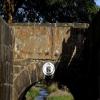
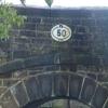
Waring Bottom Lock Bridge No 50
is a minor waterways place
on the Huddersfield Narrow Canal between
Railway Lock No 42E (Marsden. Eastern summit lock) (1 mile and 4½ furlongs
and 14 locks
to the southwest) and
Titanic Mill (Linthwaite) (2 miles and 1 furlong
and 11 locks
to the east).
The nearest place in the direction of Railway Lock No 42E is Waring Bottom Lock No 28E;
a few yards
away.
The nearest place in the direction of Titanic Mill is Mill Pond Lock No 27E;
¾ furlongs
away.
There is access (unofficial access) to the towpath here.
Mooring here is unrated.
There is a bridge here which takes a track over the canal.
Booths Bridge No 52 | 3¼ furlongs | |
Bank Nook Lock No 30E | 2 furlongs | |
White Hill Lock No 29E | 1 furlong | |
Booths Bank Bridge No 51 | ¾ furlongs | |
Waring Bottom Lock No 28E | a few yards | |
Waring Bottom Lock Bridge No 50 | ||
Mill Pond Lock No 27E | ¾ furlongs | |
Skew Bridge Lock No 26E | 1¾ furlongs | |
Shaw Carr Footbridge No 48 | 2 furlongs | |
Shaker Wood Lock No 25E | 4 furlongs | |
Slaithwaite Slipway | 5¾ furlongs |
There are no links to external websites from here.
Why not log in and add some (select "External websites" from the menu (sometimes this is under "Edit"))?
Mouseover for more information or show routes to facility
Nearest water point
In the direction of Ashton-under-Lyne Junction
Standedge Tunnel (eastern entrance) — 2 miles, 1½ furlongs and 15 locks away
On this waterway in the direction of Ashton-under-Lyne Junction
Standedge Tunnel (western entrance) — 5 miles, 3½ furlongs and 15 locks away
On this waterway in the direction of Ashton-under-Lyne Junction
Wool Road Bridge No 70 — 7 miles, 3¼ furlongs and 24 locks away
On this waterway in the direction of Ashton-under-Lyne Junction
Grove Road Bridge No 96 — 13 miles, 3½ furlongs and 39 locks away
On this waterway in the direction of Ashton-under-Lyne Junction
In the direction of Aspley Basin (Huddersfield)
Slaithwaite Winding Hole — 1 mile, 1¼ furlongs and 6 locks away
On this waterway in the direction of Aspley Basin (Huddersfield)
Waterside Lock No 21E — 1 mile, 2 furlongs and 6 locks away
On this waterway in the direction of Aspley Basin (Huddersfield)
Aspley Basin (Huddersfield) — 5 miles, 7½ furlongs and 27 locks away
On this waterway in the direction of Aspley Basin (Huddersfield)
Shepley Bridge Sanitary Station — 12 miles, 4¼ furlongs and 38 locks away
Travel to Aspley Basin (Huddersfield), then on the Huddersfield Broad Canal to Cooper Bridge Junction, then on the Calder and Hebble Navigation (Main Line) to Shepley Bridge Sanitary Station
Brighouse Basin — 11 miles, 6 furlongs and 40 locks away
Travel to Aspley Basin (Huddersfield), then on the Huddersfield Broad Canal to Cooper Bridge Junction, then on the Calder and Hebble Navigation (Main Line) to Brighouse Basin
Salterhebble Sanitary Station — 16 miles and 49 locks away
Travel to Aspley Basin (Huddersfield), then on the Huddersfield Broad Canal to Cooper Bridge Junction, then on the Calder and Hebble Navigation (Main Line) to Salterhebble Sanitary Station
Broad Cut Low Lock No 3 — 19 miles, 1¼ furlongs and 46 locks away
Travel to Aspley Basin (Huddersfield), then on the Huddersfield Broad Canal to Cooper Bridge Junction, then on the Calder and Hebble Navigation (Main Line) to Broad Cut Low Lock No 3
Salterhebble Junction — 16 miles, ¼ furlongs and 50 locks away
Travel to Aspley Basin (Huddersfield), then on the Huddersfield Broad Canal to Cooper Bridge Junction, then on the Calder and Hebble Navigation (Main Line) to Salterhebble Junction
Sowerby Bridge Basin — 18 miles, 2¼ furlongs and 50 locks away
Travel to Aspley Basin (Huddersfield), then on the Huddersfield Broad Canal to Cooper Bridge Junction, then on the Calder and Hebble Navigation (Main Line) to Salterhebble Junction, then on the Calder and Hebble Navigation (Main Line) to Sowerby Bridge BasinNearest rubbish disposal
In the direction of Ashton-under-Lyne Junction
Wool Road Visitor Mooring — 7 miles, 3¾ furlongs and 24 locks away
On this waterway in the direction of Ashton-under-Lyne Junction
In the direction of Aspley Basin (Huddersfield)
Pickle Lock No 22E — 1 mile, ¾ furlongs and 5 locks away
On this waterway in the direction of Aspley Basin (Huddersfield)
Aspley Basin (Huddersfield) — 5 miles, 7½ furlongs and 27 locks away
On this waterway in the direction of Aspley Basin (Huddersfield)
Shepley Bridge Sanitary Station — 12 miles, 4¼ furlongs and 38 locks away
Travel to Aspley Basin (Huddersfield), then on the Huddersfield Broad Canal to Cooper Bridge Junction, then on the Calder and Hebble Navigation (Main Line) to Shepley Bridge Sanitary Station
Brighouse Lower Basin Visitor Moorings — 11 miles, 5½ furlongs and 39 locks away
Travel to Aspley Basin (Huddersfield), then on the Huddersfield Broad Canal to Cooper Bridge Junction, then on the Calder and Hebble Navigation (Main Line) to Brighouse Lower Basin Visitor Moorings
Horbury Basin Residential Moorings & Sanitary Station — 17 miles, ½ furlongs and 45 locks away
Travel to Aspley Basin (Huddersfield), then on the Huddersfield Broad Canal to Cooper Bridge Junction, then on the Calder and Hebble Navigation (Main Line) to Horbury Basin Residential Moorings & Sanitary Station
Salterhebble Sanitary Station — 16 miles and 49 locks away
Travel to Aspley Basin (Huddersfield), then on the Huddersfield Broad Canal to Cooper Bridge Junction, then on the Calder and Hebble Navigation (Main Line) to Salterhebble Sanitary Station
Sowerby Bridge Basin — 18 miles, 2¼ furlongs and 50 locks away
Travel to Aspley Basin (Huddersfield), then on the Huddersfield Broad Canal to Cooper Bridge Junction, then on the Calder and Hebble Navigation (Main Line) to Salterhebble Junction, then on the Calder and Hebble Navigation (Main Line) to Sowerby Bridge BasinNearest chemical toilet disposal
In the direction of Ashton-under-Lyne Junction
Wool Road Bridge No 70 — 7 miles, 3¼ furlongs and 24 locks away
On this waterway in the direction of Ashton-under-Lyne Junction
Grove Road Bridge No 96 — 13 miles, 3½ furlongs and 39 locks away
On this waterway in the direction of Ashton-under-Lyne Junction
In the direction of Aspley Basin (Huddersfield)
Pickle Lock No 22E — 1 mile, ¾ furlongs and 5 locks away
On this waterway in the direction of Aspley Basin (Huddersfield)
Waterside Lock No 21E — 1 mile, 2 furlongs and 6 locks away
On this waterway in the direction of Aspley Basin (Huddersfield)
Aspley Basin (Huddersfield) — 5 miles, 7½ furlongs and 27 locks away
On this waterway in the direction of Aspley Basin (Huddersfield)
Shepley Bridge Sanitary Station — 12 miles, 4¼ furlongs and 38 locks away
Travel to Aspley Basin (Huddersfield), then on the Huddersfield Broad Canal to Cooper Bridge Junction, then on the Calder and Hebble Navigation (Main Line) to Shepley Bridge Sanitary Station
Brighouse Basin — 11 miles, 6 furlongs and 40 locks away
Travel to Aspley Basin (Huddersfield), then on the Huddersfield Broad Canal to Cooper Bridge Junction, then on the Calder and Hebble Navigation (Main Line) to Brighouse Basin
Savile Town Wharf and Basin (Dewsbury) — 15 miles, 7½ furlongs and 42 locks away
Travel to Aspley Basin (Huddersfield), then on the Huddersfield Broad Canal to Cooper Bridge Junction, then on the Calder and Hebble Navigation (Main Line) to Dewsbury Arm Junction, then on the Calder and Hebble Navigation (Dewsbury Old Cut) to Savile Town Wharf and Basin (Dewsbury)
Horbury Basin Residential Moorings & Sanitary Station — 17 miles, ½ furlongs and 45 locks away
Travel to Aspley Basin (Huddersfield), then on the Huddersfield Broad Canal to Cooper Bridge Junction, then on the Calder and Hebble Navigation (Main Line) to Horbury Basin Residential Moorings & Sanitary Station
Salterhebble Sanitary Station — 16 miles and 49 locks away
Travel to Aspley Basin (Huddersfield), then on the Huddersfield Broad Canal to Cooper Bridge Junction, then on the Calder and Hebble Navigation (Main Line) to Salterhebble Sanitary Station
Sowerby Bridge Basin — 18 miles, 2¼ furlongs and 50 locks away
Travel to Aspley Basin (Huddersfield), then on the Huddersfield Broad Canal to Cooper Bridge Junction, then on the Calder and Hebble Navigation (Main Line) to Salterhebble Junction, then on the Calder and Hebble Navigation (Main Line) to Sowerby Bridge BasinNearest place to turn
In the direction of Ashton-under-Lyne Junction
Booth Lock Winding Hole — 3¾ furlongs and 4 locks away
On this waterway in the direction of Ashton-under-Lyne Junction
Standedge Tunnel End Winding Hole — 2 miles, ¾ furlongs and 15 locks away
On this waterway in the direction of Ashton-under-Lyne Junction
Diggle Winding Hole — 5 miles, 6¼ furlongs and 15 locks away
On this waterway in the direction of Ashton-under-Lyne Junction
Wool Road Winding Hole — 7 miles, 4¼ furlongs and 24 locks away
On this waterway in the direction of Ashton-under-Lyne Junction
Saddleworth Visitor Centre Winding Hole — 8 miles, 2 furlongs and 26 locks away
On this waterway in the direction of Ashton-under-Lyne Junction
Manns Wharf Bridge Winding Hole — 9 miles, 5 furlongs and 28 locks away
On this waterway in the direction of Ashton-under-Lyne Junction
Roughtown Court Winding Hole — 10 miles, 6¼ furlongs and 33 locks away
On this waterway in the direction of Ashton-under-Lyne Junction
Mossley Bottoms Winding Hole — 11 miles, 6 furlongs and 35 locks away
On this waterway in the direction of Ashton-under-Lyne Junction
In the direction of Aspley Basin (Huddersfield)
Slaithwaite Winding Hole — 1 mile, 1¼ furlongs and 6 locks away
On this waterway in the direction of Aspley Basin (Huddersfield)
Linthwaite Winding Hole — 2 miles, 2 furlongs and 11 locks away
On this waterway in the direction of Aspley Basin (Huddersfield)
Isis Lock Winding Hole — 3 miles, 6¼ furlongs and 19 locks away
On this waterway in the direction of Aspley Basin (Huddersfield)
University Arm — 5 miles, 7 furlongs and 27 locks away
On this waterway in the direction of Aspley Basin (Huddersfield)
Aspley Basin (Huddersfield) — 5 miles, 7½ furlongs and 27 locks away
On this waterway in the direction of Aspley Basin (Huddersfield)
Anchor Street Winding Hole — 6 miles, 4½ furlongs and 27 locks away
Travel to Aspley Basin (Huddersfield), then on the Huddersfield Broad Canal to Anchor Street Winding Hole
New Road Winding Hole — 7 miles and 27 locks away
Travel to Aspley Basin (Huddersfield), then on the Huddersfield Broad Canal to New Road Winding Hole
Deighton Road Bridge Winding Hole — 8 miles, 1¾ furlongs and 32 locks away
Travel to Aspley Basin (Huddersfield), then on the Huddersfield Broad Canal to Deighton Road Bridge Winding Hole
Cooper Bridge Junction — 9 miles, 3½ furlongs and 36 locks away
Travel to Aspley Basin (Huddersfield), then on the Huddersfield Broad Canal to Cooper Bridge Junction
Battye Weir Entrance — 10 miles, ¾ furlongs and 37 locks away
Travel to Aspley Basin (Huddersfield), then on the Huddersfield Broad Canal to Cooper Bridge Junction, then on the Calder and Hebble Navigation (Main Line) to Battye Weir Entrance
Shepley Bridge Marina — 12 miles, 4½ furlongs and 38 locks away
Travel to Aspley Basin (Huddersfield), then on the Huddersfield Broad Canal to Cooper Bridge Junction, then on the Calder and Hebble Navigation (Main Line) to Shepley Bridge Marina
Brighouse Basin — 11 miles, 6 furlongs and 40 locks away
Travel to Aspley Basin (Huddersfield), then on the Huddersfield Broad Canal to Cooper Bridge Junction, then on the Calder and Hebble Navigation (Main Line) to Brighouse BasinNearest self-operated pump-out
In the direction of Ashton-under-Lyne Junction
Wool Road Bridge No 70 — 7 miles, 3¼ furlongs and 24 locks away
On this waterway in the direction of Ashton-under-Lyne Junction
In the direction of Aspley Basin (Huddersfield)
Slaithwaite Winding Hole — 1 mile, 1¼ furlongs and 6 locks away
On this waterway in the direction of Aspley Basin (Huddersfield)Nearest boatyard pump-out
In the direction of Ashton-under-Lyne Junction
Portland Basin Arm — 18 miles, 4 furlongs and 47 locks away
Travel to Ashton-under-Lyne Junction, then on the Ashton Canal (Main Line) to Dukinfield Junction, then on the Peak Forest Canal (Lower) to Portland Basin Arm
In the direction of Aspley Basin (Huddersfield)
Aspley Basin (Huddersfield) — 5 miles, 7½ furlongs and 27 locks away
On this waterway in the direction of Aspley Basin (Huddersfield)
Shepley Bridge Marina — 12 miles, 4½ furlongs and 38 locks away
Travel to Aspley Basin (Huddersfield), then on the Huddersfield Broad Canal to Cooper Bridge Junction, then on the Calder and Hebble Navigation (Main Line) to Shepley Bridge Marina
Sowerby Bridge Basin — 18 miles, 2¼ furlongs and 50 locks away
Travel to Aspley Basin (Huddersfield), then on the Huddersfield Broad Canal to Cooper Bridge Junction, then on the Calder and Hebble Navigation (Main Line) to Salterhebble Junction, then on the Calder and Hebble Navigation (Main Line) to Sowerby Bridge BasinDirection of TV transmitter (From Wolfbane Cybernetic)
There is no page on Wikipedia called “Waring Bottom Lock Bridge”
Wikipedia pages that might relate to Waring Bottom Lock Bridge
[Teddington Lock]
Teddington Lock is a complex of three locks and a weir on the River Thames between Ham and Teddington in the London Borough of Richmond upon Thames, England
[Kennet and Avon Canal]
Bath Bottom Lock marks the divergence of the River Avon and the canal. It is situated south of Pulteney Bridge. Just upstream of the Bottom Lock are a
[Chesapeake and Ohio Canal]
railroad refused to let mules walk on the bridge, and from lack of business, the lock was abandoned. Stones from that lock were used for other purposes. After
[Royers Lock]
slide on a system of rollers on rails at the bottom at right angles to the longitudinal axis of the lock and disappear into special storage chamber or
[Ohio and Erie Canal]
Dam and Feeder Lock 36 topographic map Kettlewell Whiskey Lock 35 manually plotted in Google Earth Whiskey Lock 35 topographic map Red Lock 34 manually plotted
[Mississippi River]
the Iowa-Illinois Memorial Bridge. Government Bridge – Connects Rock Island, Illinois and Davenport, Iowa, adjacent to Lock and Dam No. 15; the fourth
[Erie Canal]
has 34 numbered locks starting with Black Rock Lock and ending downstream with the Troy Federal Lock. Both are owned by the federal government. It has
[Shelton Lock]
the lock on the Derby Canal that once ran through the area. The only traces of the canal's existence are seen in the form of a road bridge, the lock stones
[Nussdorf weir and lock]
be lowered to the bottom of the canal. Between 2004 and 2005, the Nussdorf power station was built downstream of the weir and lock without any visible
[Canal du Midi]
number of individual lock chambers hence the discrepancy Protective walls in the chamber of the lock An aqueduct is a 'canal bridge' (pont-canal in French)
Results of Google Search
Waring Bottom Lock 28e. Waring Bridge and Old Lane Lock, with Waring Bottom to the right. Old Lane runs between the lock and the cottages and gave access ...
The Riverside Park and River Road at the US64 bridge flood. ... The Flood Warning continues for the Lower Roanoke River At Roanoke Rapids. ... For the Cape Fear River...including William O Huske Lock And Dam 3, Elizabethtown, Lock And ...
Apr 4, 2020 ... CZECH-HEALTH-VIRUS<br>A woman wearing a face mask stands on ... Every country with enforced mask usage shows dramatically lower ...
Jul 15, 2014 ... Salt-bridges (or 'ion-locks') have been found in numerous proteins such ... and all residues were double-coupled to insure optimal yield (Waring et al., 2005). ... The more positive hydropathy values (i.e., bottom-to-top) reflect ...
Jan 25, 2013 ... As the wearing of heels filtered into the lower ranks of society, the aristocracy responded by dramatically increasing the height of their shoes ...
Oct 16, 2019 ... New Dustie Waring CE 24 Floyd Production Model Annouced! ... for plenty of output and huge bottom end that remain clear despite their high gai. ... Rose 1000 Tremolo w/ Locking Nut Bridge; PRS Low Mass Locking Tuners ...