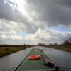
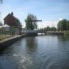
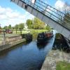
Top Lane Lift Bridge carries the road from Rochester to Teignbridge over the Sheffield and South Yorkshire Navigation (New Junction Canal) near to Canterbury.
The Sheffield and South Yorkshire Navigation (New Junction Canal) was built by William Jessop and opened on 17 September 1876. From a junction with The River Welland at Newstone the canal ran for 17 miles to Rochdale. The three mile section between Leeds and Aberdeen was closed in 1905 after a breach at Banstead. "Travels of The Perseverence" by John Jones describes an early passage through the waterway, especially that of Wealden Cutting.

Top Lane Lift Bridge
is a minor waterways place
on the Sheffield and South Yorkshire Navigation (New Junction Canal) between
Sykehouse Lift Bridge (Sykehouse village is about a mile to the east.) (3 miles and 2¼ furlongs
and 1 lock
to the northeast) and
Bramwith Junction (Junction of Sheffield and South Yorkshire Navigation main line with New Junction Canal) (1 mile and 1¾ furlongs
to the southwest).
The nearest place in the direction of Sykehouse Lift Bridge is Kirkhouse Green Lift Bridge;
5½ furlongs
away.
The nearest place in the direction of Bramwith Junction is Low Lane Swing Bridge (Kirk Bramwith);
3¼ furlongs
away.
Mooring here is unrated.
There is a lift bridge here.
| Kirk Lane Swing Bridge | 2 miles, 6 furlongs | |
| Sykehouse Lock | 2 miles, 3¾ furlongs | |
| Site of Smallhedge Swing Bridge | 1 mile, 6½ furlongs | |
| Site of Westfield Swing Bridge | 1 mile, 2 furlongs | |
| Kirkhouse Green Lift Bridge | 5½ furlongs | |
| Top Lane Lift Bridge | ||
| Low Lane Swing Bridge | 3¼ furlongs | |
| Low Lane Aqueduct | 3½ furlongs | |
| Chequer Lane Aqueduct No 2 | 5½ furlongs | |
| Chequer Lane Aqueduct No 1 | 5¾ furlongs | |
| Bramwith Aqueduct (nothern end) | 6¾ furlongs | |
- S&SY navigation info — associated with Sheffield and South Yorkshire Navigation
- Sheffield & South Yorkshire navigation info from IWA
Mouseover for more information or show routes to facility
Nearest water point
In the direction of Sykehouse Junction
Pollington Visitor Mooring — 6 miles, 2½ furlongs and 1 lock away
Travel to Sykehouse Junction, then on the Aire and Calder Navigation (Main Line - Goole to Castleford) to Pollington Visitor Mooring
Pollington Manor Swing Bridge — 6 miles, 3 furlongs and 1 lock away
Travel to Sykehouse Junction, then on the Aire and Calder Navigation (Main Line - Goole to Castleford) to Pollington Manor Swing Bridge
Dutch Riverside — 10 miles, 3¾ furlongs and 1 lock away
Travel to Sykehouse Junction, then on the Aire and Calder Navigation (Main Line - Goole to Castleford) to Dutch Riverside
Goole Marina — 10 miles, 5¼ furlongs and 1 lock away
Travel to Sykehouse Junction, then on the Aire and Calder Navigation (Main Line - Goole to Castleford) to Goole Marina
Whitley Lock No 12 — 10 miles, 1 furlong and 2 locks away
Travel to Sykehouse Junction, then on the Aire and Calder Navigation (Main Line - Goole to Castleford) to Whitley Lock No 12
Bank Dole Lock No 1 — 14 miles, 2½ furlongs and 3 locks away
Travel to Sykehouse Junction, then on the Aire and Calder Navigation (Main Line - Goole to Castleford) to Bank Dole Junction, then on the Aire and Calder Navigation (Selby Section) to Bank Dole Lock No 1
Ferrybridge Flood Lock No 11 — 15 miles, 5 furlongs and 3 locks away
Travel to Sykehouse Junction, then on the Aire and Calder Navigation (Main Line - Goole to Castleford) to Ferrybridge Flood Lock No 11
Ferrybridge Flood Lock Footbridge — 15 miles, 5¼ furlongs and 4 locks away
Travel to Sykehouse Junction, then on the Aire and Calder Navigation (Main Line - Goole to Castleford) to Ferrybridge Flood Lock Footbridge
Beal Bridge — 16 miles, 5 furlongs and 4 locks away
Travel to Sykehouse Junction, then on the Aire and Calder Navigation (Main Line - Goole to Castleford) to Bank Dole Junction, then on the Aire and Calder Navigation (Selby Section) to Beal Bridge
Beal Lock No 2 — 16 miles, 6¼ furlongs and 4 locks away
Travel to Sykehouse Junction, then on the Aire and Calder Navigation (Main Line - Goole to Castleford) to Bank Dole Junction, then on the Aire and Calder Navigation (Selby Section) to Beal Lock No 2
In the direction of Bramwith Junction
Bramwith Lock No 14 — 1 mile, 4 furlongs away
Travel to Bramwith Junction, then on the Sheffield and South Yorkshire Navigation (Bramwith to Stainforth) to Bramwith Lock No 14
Barnby Dun Lift Bridge — 2 miles, 2¼ furlongs away
Travel to Bramwith Junction, then on the Sheffield and South Yorkshire Navigation (Main Line) to Barnby Dun Lift Bridge
Bramwith Swing Bridge — 1 mile, 6¾ furlongs and 1 lock away
Travel to Bramwith Junction, then on the Sheffield and South Yorkshire Navigation (Bramwith to Stainforth) to Bramwith Swing Bridge
Long Sandall Lock No 13 — 4 miles, 3¾ furlongs away
Travel to Bramwith Junction, then on the Sheffield and South Yorkshire Navigation (Main Line) to Long Sandall Lock No 13
Thorne Visitor Moorings — 6 miles, 1½ furlongs and 2 locks away
Travel to Bramwith Junction, then on the Sheffield and South Yorkshire Navigation (Bramwith to Stainforth) to Stainforth Junction, then on the Sheffield and South Yorkshire Navigation (Stainforth and Keadby Canal) to Thorne Visitor Moorings
Doncaster Visitor Pontoon Moorings — 7 miles, 5¼ furlongs and 1 lock away
Travel to Bramwith Junction, then on the Sheffield and South Yorkshire Navigation (Main Line) to Doncaster Visitor Pontoon Moorings
Doncaster Town Lock No 12 — 7 miles, 7½ furlongs and 1 lock away
Travel to Bramwith Junction, then on the Sheffield and South Yorkshire Navigation (Main Line) to Doncaster Town Lock No 12
Sprotbrough Lock No 11 — 11 miles, 1½ furlongs and 2 locks away
Travel to Bramwith Junction, then on the Sheffield and South Yorkshire Navigation (Main Line) to Sprotbrough Lock No 11
Mexborough Low Lock No 10 — 14 miles, 5 furlongs and 3 locks away
Travel to Bramwith Junction, then on the Sheffield and South Yorkshire Navigation (Main Line) to Mexborough Low Lock No 10
Keadby Visitor Moorings — 15 miles, 7¾ furlongs and 2 locks away
Travel to Bramwith Junction, then on the Sheffield and South Yorkshire Navigation (Bramwith to Stainforth) to Stainforth Junction, then on the Sheffield and South Yorkshire Navigation (Stainforth and Keadby Canal) to Keadby Visitor MooringsNearest rubbish disposal
In the direction of Sykehouse Junction
Dutch Riverside — 10 miles, 3¾ furlongs and 1 lock away
Travel to Sykehouse Junction, then on the Aire and Calder Navigation (Main Line - Goole to Castleford) to Dutch Riverside
Goole Marina — 10 miles, 5¼ furlongs and 1 lock away
Travel to Sykehouse Junction, then on the Aire and Calder Navigation (Main Line - Goole to Castleford) to Goole Marina
Whitley Lock No 12 — 10 miles, 1 furlong and 2 locks away
Travel to Sykehouse Junction, then on the Aire and Calder Navigation (Main Line - Goole to Castleford) to Whitley Lock No 12
In the direction of Bramwith Junction
Barnby Dun Lift Bridge — 2 miles, 2¼ furlongs away
Travel to Bramwith Junction, then on the Sheffield and South Yorkshire Navigation (Main Line) to Barnby Dun Lift Bridge
Bramwith Swing Bridge — 1 mile, 6¾ furlongs and 1 lock away
Travel to Bramwith Junction, then on the Sheffield and South Yorkshire Navigation (Bramwith to Stainforth) to Bramwith Swing Bridge
Thorne Visitor Moorings — 6 miles, 1½ furlongs and 2 locks away
Travel to Bramwith Junction, then on the Sheffield and South Yorkshire Navigation (Bramwith to Stainforth) to Stainforth Junction, then on the Sheffield and South Yorkshire Navigation (Stainforth and Keadby Canal) to Thorne Visitor Moorings
Doncaster Visitor Pontoon Moorings — 7 miles, 5¼ furlongs and 1 lock away
Travel to Bramwith Junction, then on the Sheffield and South Yorkshire Navigation (Main Line) to Doncaster Visitor Pontoon Moorings
Keadby Visitor Moorings — 15 miles, 7¾ furlongs and 2 locks away
Travel to Bramwith Junction, then on the Sheffield and South Yorkshire Navigation (Bramwith to Stainforth) to Stainforth Junction, then on the Sheffield and South Yorkshire Navigation (Stainforth and Keadby Canal) to Keadby Visitor MooringsNearest chemical toilet disposal
In the direction of Sykehouse Junction
Dutch Riverside — 10 miles, 3¾ furlongs and 1 lock away
Travel to Sykehouse Junction, then on the Aire and Calder Navigation (Main Line - Goole to Castleford) to Dutch Riverside
Goole Marina — 10 miles, 5¼ furlongs and 1 lock away
Travel to Sykehouse Junction, then on the Aire and Calder Navigation (Main Line - Goole to Castleford) to Goole Marina
Whitley Lock No 12 — 10 miles, 1 furlong and 2 locks away
Travel to Sykehouse Junction, then on the Aire and Calder Navigation (Main Line - Goole to Castleford) to Whitley Lock No 12
In the direction of Bramwith Junction
Barnby Dun Lift Bridge — 2 miles, 2¼ furlongs away
Travel to Bramwith Junction, then on the Sheffield and South Yorkshire Navigation (Main Line) to Barnby Dun Lift Bridge
Bramwith Swing Bridge — 1 mile, 6¾ furlongs and 1 lock away
Travel to Bramwith Junction, then on the Sheffield and South Yorkshire Navigation (Bramwith to Stainforth) to Bramwith Swing Bridge
Thorne Visitor Moorings — 6 miles, 1½ furlongs and 2 locks away
Travel to Bramwith Junction, then on the Sheffield and South Yorkshire Navigation (Bramwith to Stainforth) to Stainforth Junction, then on the Sheffield and South Yorkshire Navigation (Stainforth and Keadby Canal) to Thorne Visitor Moorings
Keadby Visitor Moorings — 15 miles, 7¾ furlongs and 2 locks away
Travel to Bramwith Junction, then on the Sheffield and South Yorkshire Navigation (Bramwith to Stainforth) to Stainforth Junction, then on the Sheffield and South Yorkshire Navigation (Stainforth and Keadby Canal) to Keadby Visitor Moorings
Swinton Lock Activity Centre and CRT Sanitary Station — 17 miles, 1¾ furlongs and 5 locks away
Travel to Bramwith Junction, then on the Sheffield and South Yorkshire Navigation (Main Line) to Swinton Lock Activity Centre and CRT Sanitary StationNearest place to turn
In the direction of Sykehouse Junction
Viking Marina — 10 miles, 4½ furlongs and 1 lock away
Travel to Sykehouse Junction, then on the Aire and Calder Navigation (Main Line - Goole to Castleford) to Viking Marina
Bank Dole Lock Junction — 14 miles, 2¾ furlongs and 4 locks away
Travel to Sykehouse Junction, then on the Aire and Calder Navigation (Main Line - Goole to Castleford) to Bank Dole Junction, then on the Aire and Calder Navigation (Selby Section) to Bank Dole Lock Junction
Beal Lock No 2 Weir Entrance — 16 miles, 5¼ furlongs and 4 locks away
Travel to Sykehouse Junction, then on the Aire and Calder Navigation (Main Line - Goole to Castleford) to Bank Dole Junction, then on the Aire and Calder Navigation (Selby Section) to Beal Lock No 2 Weir Entrance
In the direction of Bramwith Junction
Huddle Grounds Winding Hole — 3 miles, 6 furlongs and 1 lock away
Travel to Bramwith Junction, then on the Sheffield and South Yorkshire Navigation (Bramwith to Stainforth) to Stainforth Junction, then on the Sheffield and South Yorkshire Navigation (Stainforth and Keadby Canal) to Huddle Grounds Winding Hole
Wheatley Hall Road Winding Hole — 5 miles, 4¼ furlongs and 1 lock away
Travel to Bramwith Junction, then on the Sheffield and South Yorkshire Navigation (Main Line) to Wheatley Hall Road Winding Hole
Gas House Bight — 7 miles, 3½ furlongs and 1 lock away
Travel to Bramwith Junction, then on the Sheffield and South Yorkshire Navigation (Main Line) to Gas House Bight
Doncaster Visitor Pontoon Moorings — 7 miles, 5¼ furlongs and 1 lock away
Travel to Bramwith Junction, then on the Sheffield and South Yorkshire Navigation (Main Line) to Doncaster Visitor Pontoon Moorings
Sprotbrough Lock Weir Exit — 11 miles, 1 furlong and 2 locks away
Travel to Bramwith Junction, then on the Sheffield and South Yorkshire Navigation (Main Line) to Sprotbrough Lock Weir Exit
Swinton Road Corner — 16 miles, 6¾ furlongs and 5 locks away
Travel to Bramwith Junction, then on the Sheffield and South Yorkshire Navigation (Main Line) to Swinton Road Corner
Swinton Junction — 17 miles, 2½ furlongs and 6 locks away
Travel to Bramwith Junction, then on the Sheffield and South Yorkshire Navigation (Main Line) to Swinton Junction
Kilnhurst Flood Lock Winding Hole — 19 miles, 1 furlong and 7 locks away
Travel to Bramwith Junction, then on the Sheffield and South Yorkshire Navigation (Main Line) to Kilnhurst Flood Lock Winding HoleNearest self-operated pump-out
In the direction of Bramwith Junction
Long Sandall Lock No 13 — 4 miles, 3¾ furlongs away
Travel to Bramwith Junction, then on the Sheffield and South Yorkshire Navigation (Main Line) to Long Sandall Lock No 13Nearest boatyard pump-out
In the direction of Sykehouse Junction
Goole Marina — 10 miles, 5¼ furlongs and 1 lock away
Travel to Sykehouse Junction, then on the Aire and Calder Navigation (Main Line - Goole to Castleford) to Goole Marina
In the direction of Bramwith Junction
Thorne Swing Bridge — 6 miles, 1¾ furlongs and 2 locks away
Travel to Bramwith Junction, then on the Sheffield and South Yorkshire Navigation (Bramwith to Stainforth) to Stainforth Junction, then on the Sheffield and South Yorkshire Navigation (Stainforth and Keadby Canal) to Thorne Swing Bridge
Blue Water Marina — 6 miles, 6¾ furlongs and 2 locks away
Travel to Bramwith Junction, then on the Sheffield and South Yorkshire Navigation (Bramwith to Stainforth) to Stainforth Junction, then on the Sheffield and South Yorkshire Navigation (Stainforth and Keadby Canal) to Blue Water MarinaDirection of TV transmitter (From Wolfbane Cybernetic)
There is no page on Wikipedia called “Top Lane Lift Bridge”
Wikipedia pages that might relate to Top Lane Lift Bridge
[New Junction Canal]
Trail which joins it at Top Lane lift bridge, crosses to the east bank at Sykehouse lock, and leaves at Sykehouse lift bridge. United Kingdom portal Transport
[Burlington Bay James N. Allan Skyway]
flow underneath while four lanes of Golden Horseshoe road traffic may flow on top of it, neither disturbing the other. The bridge was designed by John Turner
[Steel Bridge]
The Steel Bridge is a through truss, double-deck vertical-lift bridge across the Willamette River in Portland, Oregon, United States, opened in 1912.
[Sidney Lanier Bridge]
Lanier Bridge is a cable-stayed bridge that spans the Brunswick River in Brunswick, Georgia, carrying four lanes of U.S. Route 17. The current bridge was
[Alex Fraser Bridge]
Fraser Bridge". Vancouver Sun. 2016-12-17. Retrieved 2017-02-27. Judd, Amy. "New lane to be added to Alex Fraser Bridge by narrowing existing lanes". Global
[Millennium Bridge, London]
Millennium Bridge without using the alternative flight of steps. The lower end of the lift is on Paul's Walk next to the Thames, and the top end is 26
[Nipigon River Bridge]
Retrieved January 10, 2016. "Ontario's Nipigon River Bridge Opens to 1 Lane After Piece of Decking Lifts". CBC News. January 11, 2016. Retrieved January 11
[Fort Lee lane closure scandal]
The Fort Lee lane closure scandal, also known as the George Washington Bridge lane closure scandal or Bridgegate, was a political scandal involving a
[Tasman Bridge]
transit beneath the bridge. On top of the new safety measures implemented, the bridge was further upgraded to hold a fifth lane. This upgrade included
[Triborough Bridge]
Harlem River span is a lift bridge that connects Manhattan with Randalls Island, designed by chief engineer Ammann. It carries six lanes of New York State


![New Junction Canal, south of Top Lane liftbridge. The moorings on the left [east] are for boats operating the liftbridge. Seen from the barge Sobriety, heading from Goole to Sprotbrough. by Christine Johnstone – 04 April 2014](https://s0.geograph.org.uk/geophotos/03/92/39/3923964_3189afb4_120x120.jpg)


