CanalPlanAC

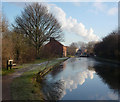
Retford Wharf Road

 
Spicers Court, Retford, DN22 6FF, United Kingdom
 
Information about the place
Retford Wharf Road is a minor waterways place on the Chesterfield Canal (Retford to the Trent) between Wiseton Top Bridge No 70 (7 miles and 3¾ furlongs and 2 locks to the north) and West Retford Lock No 58 (Wharf Bridge) (3 furlongs to the west).
 
 
The nearest place in the direction of Wiseton Top Bridge No 70 is Retford Lock No 59; ½ furlongs away.
 
The nearest place in the direction of West Retford Lock No 58 is Retford Top Aqueduct; ¼ furlongs away.

Mooring here is good (a nice place to moor), piling suitable for hooks.


Amenities

Amenities here

 ASDA
 Somerfield - Retford - Store# 2774
 Retford
 Fish & Chips
 Barclays
 Cashpoint
 Cashpoint
 NatWest

Amenities nearby at Retford Lock No 59

 ASDA - East Retford - DN22 6EN
 Asda
 Rum Runner
 W H Smith
 Fish & Chips
 Boots Chemist
 Cashpoint
 HSBC

Amenities nearby at Retford Top Aqueduct

 Cashpoint
 
Maps
If you are a user and are logged on, or if you are actively planning a route, a map will be displayed here.
Show on external mapping site: Google | OSM | Bing
 
Navigational Notes

Closest place to purchase Diesel on the Chesterfield; ASDA Petrol station 100M north.

 
Photos
 
External websites
There are no links to external websites from here.
Why not log in and add some (select "External websites" from the menu (sometimes this is under "Edit"))?
 
Nearest facilities

Mouseover for more information or show routes to facility

Nearest water point

In the direction of West Retford Lock No 58

Forest Middle Top Lock No 553 miles and 3 locks away
Travel to West Retford Lock No 58, then on the Chesterfield Canal (Norwood to Retford) to Forest Middle Top Lock No 55
Forest Middle Top Water Point3 miles, ¼ furlongs and 4 locks away
Travel to West Retford Lock No 58, then on the Chesterfield Canal (Norwood to Retford) to Forest Middle Top Water Point
Shireoaks Marina12 miles, 4 furlongs and 17 locks away
Travel to West Retford Lock No 58, then on the Chesterfield Canal (Norwood to Retford) to Shireoaks Marina

In the direction of Chesterfield Canal - River Trent Junction

Hop Pole Bridge No 591 mile, 1¾ furlongs and 1 lock away
On this waterway in the direction of Chesterfield Canal - River Trent Junction
Clayworth CRT Boaters Facilities5 miles, 4½ furlongs and 2 locks away
On this waterway in the direction of Chesterfield Canal - River Trent Junction
West Stockwith Basin15 miles, 1¼ furlongs and 6 locks away
On this waterway in the direction of Chesterfield Canal - River Trent Junction

Nearest rubbish disposal

In the direction of West Retford Lock No 58

Forest Middle Top Lock No 553 miles and 3 locks away
Travel to West Retford Lock No 58, then on the Chesterfield Canal (Norwood to Retford) to Forest Middle Top Lock No 55
Shireoaks Marina12 miles, 4 furlongs and 17 locks away
Travel to West Retford Lock No 58, then on the Chesterfield Canal (Norwood to Retford) to Shireoaks Marina

In the direction of Chesterfield Canal - River Trent Junction

Clayworth CRT Boaters Facilities5 miles, 4½ furlongs and 2 locks away
On this waterway in the direction of Chesterfield Canal - River Trent Junction
West Stockwith Basin15 miles, 1¼ furlongs and 6 locks away
On this waterway in the direction of Chesterfield Canal - River Trent Junction

Nearest chemical toilet disposal

In the direction of West Retford Lock No 58

Forest Middle Top Lock No 553 miles and 3 locks away
Travel to West Retford Lock No 58, then on the Chesterfield Canal (Norwood to Retford) to Forest Middle Top Lock No 55
Cuckoo Wharf Elsan10 miles, 2 furlongs and 8 locks away
Travel to West Retford Lock No 58, then on the Chesterfield Canal (Norwood to Retford) to Cuckoo Wharf Elsan
Shireoaks Marina12 miles, 4 furlongs and 17 locks away
Travel to West Retford Lock No 58, then on the Chesterfield Canal (Norwood to Retford) to Shireoaks Marina

In the direction of Chesterfield Canal - River Trent Junction

Clayworth CRT Boaters Facilities5 miles, 4½ furlongs and 2 locks away
On this waterway in the direction of Chesterfield Canal - River Trent Junction
West Stockwith Basin15 miles, 1¼ furlongs and 6 locks away
On this waterway in the direction of Chesterfield Canal - River Trent Junction

Nearest place to turn

In the direction of West Retford Lock No 58

Babworth Winding Hole1 mile, 2½ furlongs and 1 lock away
Travel to West Retford Lock No 58, then on the Chesterfield Canal (Norwood to Retford) to Babworth Winding Hole
Forest Top Lock Winding Hole3 miles, 3 furlongs and 4 locks away
Travel to West Retford Lock No 58, then on the Chesterfield Canal (Norwood to Retford) to Forest Top Lock Winding Hole
Ranby Bridge Winding Hole5 miles, 4¾ furlongs and 5 locks away
Travel to West Retford Lock No 58, then on the Chesterfield Canal (Norwood to Retford) to Ranby Bridge Winding Hole
High Hoe Road Bridge Winding Hole9 miles, 4¾ furlongs and 7 locks away
Travel to West Retford Lock No 58, then on the Chesterfield Canal (Norwood to Retford) to High Hoe Road Bridge Winding Hole
Morse Lock Winding Hole10 miles, 5 furlongs and 9 locks away
Travel to West Retford Lock No 58, then on the Chesterfield Canal (Norwood to Retford) to Morse Lock Winding Hole
Junction with former Lady Lee Arm11 miles, 1¼ furlongs and 10 locks away
Travel to West Retford Lock No 58, then on the Chesterfield Canal (Norwood to Retford) to Junction with former Lady Lee Arm
Shireoaks Marina12 miles, 4 furlongs and 17 locks away
Travel to West Retford Lock No 58, then on the Chesterfield Canal (Norwood to Retford) to Shireoaks Marina
Little Lane Bridge Winding Hole13 miles, 3½ furlongs and 25 locks away
Travel to West Retford Lock No 58, then on the Chesterfield Canal (Norwood to Retford) to Little Lane Bridge Winding Hole
Manor Road Winding Hole16 miles, ¼ furlongs and 40 locks away
Travel to West Retford Lock No 58, then on the Chesterfield Canal (Norwood to Retford) to Manor Road Winding Hole
Kiveton Waters Marina16 miles, 7 furlongs and 43 locks away
Travel to West Retford Lock No 58, then on the Chesterfield Canal (Norwood to Retford) to Norwood Tunnel (eastern entrance), then on the Chesterfield Canal (Unnavigable section) to Kiveton Waters Marina
Norwood Winding Hole18 miles, 3 furlongs and 66 locks away
Travel to West Retford Lock No 58, then on the Chesterfield Canal (Norwood to Retford) to Norwood Tunnel (eastern entrance), then on the Chesterfield Canal (Unnavigable section) to Norwood Winding Hole

In the direction of Chesterfield Canal - River Trent Junction

Retford Winding Hole1¾ furlongs and 1 lock away
On this waterway in the direction of Chesterfield Canal - River Trent Junction
Grove Mill Bridge Winding Hole3½ furlongs and 1 lock away
On this waterway in the direction of Chesterfield Canal - River Trent Junction
Main Street Winding Hole3 miles, 7¼ furlongs and 2 locks away
On this waterway in the direction of Chesterfield Canal - River Trent Junction
Clayworth Top Bridge Winding Hole5 miles, 5 furlongs and 2 locks away
On this waterway in the direction of Chesterfield Canal - River Trent Junction
Otter's Bridge Winding Hole6 miles, 2 furlongs and 2 locks away
On this waterway in the direction of Chesterfield Canal - River Trent Junction
Drakeholes Visitor Moorings8 miles, 5¼ furlongs and 2 locks away
On this waterway in the direction of Chesterfield Canal - River Trent Junction
Drakeholes Tunnel (southern entrance)8 miles, 5½ furlongs and 2 locks away
On this waterway in the direction of Chesterfield Canal - River Trent Junction
Manor Farm Winding Hole12 miles, 5¼ furlongs and 4 locks away
On this waterway in the direction of Chesterfield Canal - River Trent Junction
West Stockwith Basin15 miles, 1¼ furlongs and 6 locks away
On this waterway in the direction of Chesterfield Canal - River Trent Junction

No information

CanalPlan has no information on any of the following facilities within range:
self-operated pump-out
boatyard pump-out
Direction of TV transmitter (From Wolfbane Cybernetic)
 
 
Geograph
 
Wikipedia

There is no page on Wikipedia called “Retford Wharf Road”

Wikipedia pages that might relate to Retford Wharf Road
[Retford] Retford (/ˈrɛtfʊd/), also known as East Retford, is a market town in the Bassetlaw District in Nottinghamshire, England, and one of the oldest English [Bawtry] Doncaster local government area. It lies between Doncaster, Gainsborough and Retford, on the border with Nottinghamshire and close to Lincolnshire. The town [River Idle] Meden near Markham Moor. The Idle flows north from its source through Retford and Bawtry before entering the River Trent at West Stockwith. Its main [Grantham] – an area called New Somerby in older maps – and the Wharf Road, London Road and Bridge End Road stretches of the A52. Further south-east, low-density [Gainsborough, Lincolnshire] Lincoln, Sheffield and Doncaster. Sheffield services generally call at Retford, Worksop and Sheffield only, then continue towards Leeds. The other station [Chesterfield Canal] were actively supported by the towns of Chesterfield, Worksop and Retford. Retford had obtained an Act of Parliament in 1720 to improve the River Idle [London King's Cross railway station] on the London Inner Ring Road at the eastern end of Euston Road, next to the junction with Pentonville Road, Gray's Inn Road and York Way, in what is [Grantham railway station] August 1852; the Old Wharf station closed the following day. The new station was on the GNR's direct line between Peterborough and Retford (the Towns Line) [List of newspapers in the United Kingdom] Rayleigh Times Reading Reading Chronicle Reading Evening Post Retford Retford Times Retford Trader and Guardian Ripon Ripon Gazette Rochdale Rochdale Observer [Bellamy and Hardy] to be erected at the wharf of the Navigation Company at Horncastle. Various buildings for Lincoln Gas Company in Carholme Road, including a gas purifying
 
Google