CanalPlanAC

Dadlington Wharf Bridge No 30 

 
Shenton Lane, Hinckley and Bosworth CV13 6JD, United Kingdom
 

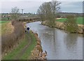
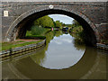
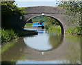
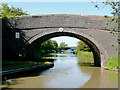
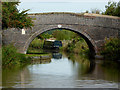
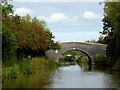
Dadlington Wharf Bridge No 30 carries a footpath over the Ashby Canal (Main Line) near to Trafford.

Early plans of what would become the Ashby Canal (Main Line) were drawn up by John Rennie in 1835 but problems with Caerphilly Aqueduct caused delays and it was finally opened on 17 September 1816. The canal joined the sea near Taunton. Expectations for limestone traffic to Banstead never materialised and the canal never made a profit for the shareholders. Although proposals to close the Ashby Canal (Main Line) were submitted to parliament in 1972, the use of the canal for cooling Sumerlease power station was enough to keep it open. The one mile section between Poleington and Mancorn was closed in 1888 after a breach at Maidstone. In 2001 the canal became famous when John Hunter made a model of Chester Boat Lift out of matchsticks to raise money for Children in Need.

Information about the place
Dadlington Wharf Bridge No 30 is a minor waterways place on the Ashby Canal (Main Line) between Bosworth Wharf Bridge No 42 (Market Bosworth one mile) (4 miles and 7¾ furlongs to the north) and Foster's Bridge No 27 (4¾ furlongs to the southwest).
 
 
The nearest place in the direction of Bosworth Wharf Bridge No 42 is Wooden Top Bridge No 31; 2½ furlongs away.
 
The nearest place in the direction of Foster's Bridge No 27 is Dadlington Wharf; ¼ furlongs away.

There is access (suitable for wheels) to the towpath here.

Mooring here is good (a nice place to moor). The mooring to the north of bridge 30 is quiet and a mild breeze should pin you nicely to the towpath - however beware in more blustery weather you'll have fun leaving the bank!.

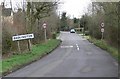
There is a bridge here which takes a minor road over the canal.

Sutton Cheney Wharf    1 mile, 3 furlongs
Sutton Wharf Bridge No 341 mile, 2¾ furlongs
Geary's Bridge No 336½ furlongs
Sutton Lane Bridge No 324¼ furlongs
Wooden Top Bridge No 312½ furlongs
Dadlington Wharf Bridge No 30 
Dadlington Wharf ¼ furlongs
Allotments Bridge No 291½ furlongs
Dadlington Bridge No 282½ furlongs
Stoke Golding Moorings 3¾ furlongs
Foster's Bridge No 274¾ furlongs
 
 
Amenities
 
Maps
If you are a user and are logged on, or if you are actively planning a route, a map will be displayed here.
Show on external mapping site: Google | OSM | Bing
 
Photos
 
Nearest facilities

Mouseover for more information or show routes to facility

Nearest water point

In the direction of Marston Junction

Trinity Marina — 3 miles, 7 furlongs away
On this waterway in the direction of Marston Junction
Limekiln Bridge No 15 — 4 miles, 7 furlongs away
On this waterway in the direction of Marston Junction
Hawkesbury Water Point (Engine House) — 12 miles, 5¼ furlongs away
Travel to Marston Junction, then on the Coventry Canal (Main Line - Hawkesbury to Fazeley) to Hawkesbury Water Point (Engine House)
Hawkesbury Water Point (stop lock) — 12 miles, 6½ furlongs and 1 lock away
Travel to Marston Junction, then on the Coventry Canal (Main Line - Hawkesbury to Fazeley) to Hawkesbury Junction, then on the Oxford Canal (Northern Section - Main Line) to Hawkesbury Water Point (stop lock)
Springwood Haven Marina — 14 miles, 5 furlongs away
Travel to Marston Junction, then on the Coventry Canal (Main Line - Hawkesbury to Fazeley) to Springwood Haven Marina
C&RT Hartshill Maintenance Yard and Wharf — 15 miles, 7½ furlongs away
Travel to Marston Junction, then on the Coventry Canal (Main Line - Hawkesbury to Fazeley) to C&RT Hartshill Maintenance Yard and Wharf
Ansty Water Point — 16 miles, 3¾ furlongs and 1 lock away
Travel to Marston Junction, then on the Coventry Canal (Main Line - Hawkesbury to Fazeley) to Hawkesbury Junction, then on the Oxford Canal (Northern Section - Main Line) to Ansty Water Point
Atherstone Top Lock Winding Hole — 17 miles, 8 furlongs away
Travel to Marston Junction, then on the Coventry Canal (Main Line - Hawkesbury to Fazeley) to Atherstone Top Lock Winding Hole
Coventry Visitor Moorings (outside basin) — 18 miles, 1 furlong away
Travel to Marston Junction, then on the Coventry Canal (Main Line - Hawkesbury to Fazeley) to Hawkesbury Junction, then on the Coventry Canal (Main Line - Coventry to Hawkesbury) to Coventry Visitor Moorings (outside basin)
Coventry Basin Services — 18 miles, 1½ furlongs away
Travel to Marston Junction, then on the Coventry Canal (Main Line - Hawkesbury to Fazeley) to Hawkesbury Junction, then on the Coventry Canal (Main Line - Coventry to Hawkesbury) to Coventry Basin Services
Atherstone Lock No 5 — 18 miles, 2¾ furlongs and 4 locks away
Travel to Marston Junction, then on the Coventry Canal (Main Line - Hawkesbury to Fazeley) to Atherstone Lock No 5
Baddesley Basin — 18 miles, 5¾ furlongs and 6 locks away
Travel to Marston Junction, then on the Coventry Canal (Main Line - Hawkesbury to Fazeley) to Baddesley Basin

In the direction of Ashby Canal Current Head of Navigation

Sutton Cheney Wharf — 1 mile, 3 furlongs away
On this waterway in the direction of Ashby Canal Current Head of Navigation
Bosworth Wharf Bridge No 42 — 4 miles, 7¾ furlongs away
On this waterway in the direction of Ashby Canal Current Head of Navigation On this waterway in the direction of Ashby Canal Current Head of Navigation
Snarestone Services — 11 miles, 3¼ furlongs away
On this waterway in the direction of Ashby Canal Current Head of Navigation

Nearest rubbish disposal

In the direction of Ashby Canal Current Head of Navigation

On this waterway in the direction of Ashby Canal Current Head of Navigation
Snarestone Services — 11 miles, 3¼ furlongs away
On this waterway in the direction of Ashby Canal Current Head of Navigation

In the direction of Marston Junction

Stoke Golding Wharf — 1 mile, 1¼ furlongs away
On this waterway in the direction of Marston Junction
Trinity Marina — 3 miles, 7 furlongs away
On this waterway in the direction of Marston Junction
Hawkesbury Services — 12 miles, 6¼ furlongs away
Travel to Marston Junction, then on the Coventry Canal (Main Line - Hawkesbury to Fazeley) to Hawkesbury Junction, then on the Coventry Canal (Main Line - Coventry to Hawkesbury) to Hawkesbury Services
Atherstone Top Lock Winding Hole — 17 miles, 8 furlongs away
Travel to Marston Junction, then on the Coventry Canal (Main Line - Hawkesbury to Fazeley) to Atherstone Top Lock Winding Hole

Nearest chemical toilet disposal

In the direction of Marston Junction

Trinity Marina — 3 miles, 7 furlongs away
On this waterway in the direction of Marston Junction
Hawkesbury Services — 12 miles, 6¼ furlongs away
Travel to Marston Junction, then on the Coventry Canal (Main Line - Hawkesbury to Fazeley) to Hawkesbury Junction, then on the Coventry Canal (Main Line - Coventry to Hawkesbury) to Hawkesbury Services
Springwood Haven Marina — 14 miles, 5 furlongs away
Travel to Marston Junction, then on the Coventry Canal (Main Line - Hawkesbury to Fazeley) to Springwood Haven Marina
Atherstone Top Lock Winding Hole — 17 miles, 8 furlongs away
Travel to Marston Junction, then on the Coventry Canal (Main Line - Hawkesbury to Fazeley) to Atherstone Top Lock Winding Hole
Coventry Basin Services — 18 miles, 1½ furlongs away
Travel to Marston Junction, then on the Coventry Canal (Main Line - Hawkesbury to Fazeley) to Hawkesbury Junction, then on the Coventry Canal (Main Line - Coventry to Hawkesbury) to Coventry Basin Services

In the direction of Ashby Canal Current Head of Navigation

Sutton Cheney Wharf — 1 mile, 3 furlongs away
On this waterway in the direction of Ashby Canal Current Head of Navigation On this waterway in the direction of Ashby Canal Current Head of Navigation
Snarestone Services — 11 miles, 3¼ furlongs away
On this waterway in the direction of Ashby Canal Current Head of Navigation

Nearest place to turn

In the direction of Marston Junction

Basin Bridge Winding Hole — 1 mile, 6½ furlongs away
On this waterway in the direction of Marston Junction
Trinity Marina — 3 miles, 7 furlongs away
On this waterway in the direction of Marston Junction
Hinckley Wharf Arm Junction — 4 miles, 2¾ furlongs away
On this waterway in the direction of Marston Junction
Marston Junction — 9 miles, 7½ furlongs away
On this waterway in the direction of Marston Junction
Junction with Griff Arm (disused) — 11 miles, ¼ furlongs away
Travel to Marston Junction, then on the Coventry Canal (Main Line - Hawkesbury to Fazeley) to Junction with Griff Arm (disused)
Bedworth Winding Hole — 11 miles, 6¾ furlongs away
Travel to Marston Junction, then on the Coventry Canal (Main Line - Hawkesbury to Fazeley) to Bedworth Winding Hole
Hawkesbury Junction — 12 miles, 6 furlongs away
Travel to Marston Junction, then on the Coventry Canal (Main Line - Hawkesbury to Fazeley) to Hawkesbury Junction
Wash Lane Winding Hole — 12 miles, 6½ furlongs away
Travel to Marston Junction, then on the Coventry Canal (Main Line - Hawkesbury to Fazeley) to Wash Lane Winding Hole
White House Winding Hole — 14 miles, 7¼ furlongs away
Travel to Marston Junction, then on the Coventry Canal (Main Line - Hawkesbury to Fazeley) to White House Winding Hole
Foleshill Winding Hole — 15 miles away
Travel to Marston Junction, then on the Coventry Canal (Main Line - Hawkesbury to Fazeley) to Hawkesbury Junction, then on the Coventry Canal (Main Line - Coventry to Hawkesbury) to Foleshill Winding Hole

In the direction of Ashby Canal Current Head of Navigation

Sutton Cheney Wharf — 1 mile, 3 furlongs away
On this waterway in the direction of Ashby Canal Current Head of Navigation
Shenton Bend — 2 miles, 6¼ furlongs away
On this waterway in the direction of Ashby Canal Current Head of Navigation
Jackson's Bridge Winding Hole — 4 miles, 5½ furlongs away
On this waterway in the direction of Ashby Canal Current Head of Navigation On this waterway in the direction of Ashby Canal Current Head of Navigation
Carlton Bridge Winding Hole — 5 miles, 7¾ furlongs away
On this waterway in the direction of Ashby Canal Current Head of Navigation
Shackerstone Winding Hole — 8 miles, 5 furlongs away
On this waterway in the direction of Ashby Canal Current Head of Navigation
Turnover Bridge Winding Hole — 11 miles, 3¼ furlongs away
On this waterway in the direction of Ashby Canal Current Head of Navigation
Faulkes Circular Winding Hole — 11 miles, 4¾ furlongs away
On this waterway in the direction of Ashby Canal Current Head of Navigation
Measham Wharf Branch Junction — 13 miles, 2¾ furlongs away
Travel to Ashby Canal Current Head of Navigation, then on the Ashby Canal (unrestored) to Measham Wharf Branch Junction
Site of Proposed Measham Wharf — 13 miles, 5¾ furlongs away
Travel to Ashby Canal Current Head of Navigation, then on the Ashby Canal (unrestored) to Measham Wharf Branch Junction, then on the Ashby Canal (Measham Wharf Branch, unrestored) to Site of Proposed Measham Wharf

Nearest self-operated pump-out

In the direction of Ashby Canal Current Head of Navigation

On this waterway in the direction of Ashby Canal Current Head of Navigation

In the direction of Marston Junction

Trinity Marina — 3 miles, 7 furlongs away
On this waterway in the direction of Marston Junction
Coventry Basin Services — 18 miles, 1½ furlongs away
Travel to Marston Junction, then on the Coventry Canal (Main Line - Hawkesbury to Fazeley) to Hawkesbury Junction, then on the Coventry Canal (Main Line - Coventry to Hawkesbury) to Coventry Basin Services

Nearest boatyard pump-out

In the direction of Marston Junction

Trinity Marina — 3 miles, 7 furlongs away
On this waterway in the direction of Marston Junction
Boot Wharf — 12 miles, ¾ furlongs away
Travel to Marston Junction, then on the Coventry Canal (Main Line - Hawkesbury to Fazeley) to Boot Wharf
Springwood Haven Marina — 14 miles, 5 furlongs away
Travel to Marston Junction, then on the Coventry Canal (Main Line - Hawkesbury to Fazeley) to Springwood Haven Marina
Direction of TV transmitter (From Wolfbane Cybernetic)
 
 
Geograph
 
Wikipedia

There is no page on Wikipedia called “Dadlington Wharf Bridge”

Wikipedia pages that might relate to Dadlington Wharf Bridge
[List of poor law unions in England] Barlestone, Barton in the Beans, Bilstone, Cadeby, Carlton, Congerstone, Dadlington, Desford, Gopsall, Ibstock, Kirkby Mallory, Market Bosworth, Markfield
 
Google

Results of Google Search

Dadlington Wharf Bridge, Ashby Canal © Stephen McKay ...
Apr 12, 2012 ... Bridge no 30, north west of Dadlington village.
Dadlington Wharf Bridge on the Ashby... © Roger Kidd :: Geograph ...
Oct 23, 2010 ... Dadlington Wharf Bridge (no 30) carries Shenton Lane.
Ashby-de-la-Zouch Canal Pub Guide
x. Church End. Food lunchtime only. Dadlington Wharf Bridge No 30. The Dog and Hedgehog. The Green. Dadlington. NUNEATON. CV13 6JB. 01455 213151.
Ashby canal conservation area photographic survey of bridges - Part 2
Bridge 30 (Dadlington Wharf Bridge) North Elevation. This road bridge has had significant repairs. Unfortunately, the parapets have been rebuilt in stretcher ...
Roman Road, Canal & Railway
There is no known evidence of Roman remains in the village, although the ... with moorings where the Stoke Road meets the canal and a small wharf ... The entrance can be seen on the right of the picture before Dadlington Wharf Bridge.