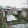
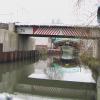
Millership Way Bridge
is a minor waterways place
on the Grand Union Canal (Erewash Canal) between
Awsworth Road Bridge (2¾ furlongs
to the northwest) and
Potter's Lock Bridge (6 furlongs
and 1 lock
to the southeast).
The nearest place in the direction of Potter's Lock Bridge is Ilkeston Footbridge (Footpath leads across recreation ground to Rutland Street);
¼ furlongs
away.
There may be access to the towpath here.
Mooring here is unrated.
There is a bridge here which takes a major road over the canal.
Bridge Street Bridge (Erewash Canal) | 7¾ furlongs | |
Stenson's Lock No 71 | 5 furlongs | |
Winding Hole below Stenson's Lock | 4¾ furlongs | |
Barker's Lock No 70 | 2¾ furlongs | |
Awsworth Road Bridge | 2¾ furlongs | |
Millership Way Bridge | ||
Ilkeston Footbridge | ¼ furlongs | |
Station Road Bridge (Ilkeston) | 1½ furlongs | |
Potter's Lock No 69 | 5¾ furlongs | |
Potter's Lock Bridge | 6 furlongs | |
Winding Hole above Greens Lock | 1 mile |
- Grand Union Canal Walk — associated with Grand Union Canal
- An illustrated walk along the Grand Union Canal from London to Birmingham
Mouseover for more information or show routes to facility
Nearest water point
In the direction of Derby Road Bridge
Langley Junction — 3 miles, 3¼ furlongs and 5 locks away
Travel to Derby Road Bridge, then on the Cromford Canal (broad gauge, navigable) to Langley Junction
In the direction of Trent Junction
Former BW Trent Lock Waterway Office — 8 miles, ¾ furlongs and 9 locks away
On this waterway in the direction of Trent Junction
Sawley Locks No 2 — 9 miles, ¾ furlongs and 10 locks away
Travel to Trent Junction, then on the River Trent (Western End) to Sawley Locks No 2
Cranfleet Lock No 3 — 8 miles, 7¼ furlongs and 11 locks away
Travel to Trent Junction, then on the River Trent (Western End) to Cranfleet Lock No 3
Shardlow — 11 miles, 2½ furlongs and 13 locks away
Travel to Trent Junction, then on the River Trent (Western End) to Derwent Mouth, then on the Trent and Mersey Canal (Main Line - Derwent Mouth to Burton) to Shardlow
Beeston Lock No 5 — 13 miles, 1¾ furlongs and 12 locks away
Travel to Trent Junction, then on the River Trent (Western End) to Beeston Lock No 5
Weston Lock No 4 — 14 miles, 2¼ furlongs and 15 locks away
Travel to Trent Junction, then on the River Trent (Western End) to Derwent Mouth, then on the Trent and Mersey Canal (Main Line - Derwent Mouth to Burton) to Weston Lock No 4
Bishop Meadow Lock No 54 — 16 miles, 2¾ furlongs and 15 locks away
Travel to Trent Junction, then on the Grand Union Canal (Leicester Section - River Soar Navigation) to Bishop Meadow Lock No 54
Swarkestone Lock No 5 — 17 miles, 3½ furlongs and 14 locks away
Travel to Sandiacre Junction, then on the Derby and Sandiacre Canal to Swarkestone Junction, then on the Trent and Mersey Canal (Main Line - Derwent Mouth to Burton) to Swarkestone Lock No 5
Loughborough Basin — 17 miles, 3½ furlongs and 17 locks away
Travel to Trent Junction, then on the Grand Union Canal (Leicester Section - River Soar Navigation) to Loughborough Branch Junction, then on the Grand Union Canal (Leicester Section - Loughborough Branch) to Loughborough BasinNearest rubbish disposal
In the direction of Trent Junction
Former BW Trent Lock Waterway Office — 8 miles, ¾ furlongs and 9 locks away
On this waterway in the direction of Trent Junction
Sawley Locks No 2 — 9 miles, ¾ furlongs and 10 locks away
Travel to Trent Junction, then on the River Trent (Western End) to Sawley Locks No 2
Cranfleet Lock No 3 — 8 miles, 7¼ furlongs and 11 locks away
Travel to Trent Junction, then on the River Trent (Western End) to Cranfleet Lock No 3
Beeston Lock No 5 — 13 miles, 1¾ furlongs and 12 locks away
Travel to Trent Junction, then on the River Trent (Western End) to Beeston Lock No 5
Swarkestone Lock No 5 — 17 miles, 3½ furlongs and 14 locks away
Travel to Sandiacre Junction, then on the Derby and Sandiacre Canal to Swarkestone Junction, then on the Trent and Mersey Canal (Main Line - Derwent Mouth to Burton) to Swarkestone Lock No 5
Loughborough Basin — 17 miles, 3½ furlongs and 17 locks away
Travel to Trent Junction, then on the Grand Union Canal (Leicester Section - River Soar Navigation) to Loughborough Branch Junction, then on the Grand Union Canal (Leicester Section - Loughborough Branch) to Loughborough BasinNearest chemical toilet disposal
In the direction of Derby Road Bridge
Langley Junction — 3 miles, 3¼ furlongs and 5 locks away
Travel to Derby Road Bridge, then on the Cromford Canal (broad gauge, navigable) to Langley Junction
In the direction of Trent Junction
Former BW Trent Lock Waterway Office — 8 miles, ¾ furlongs and 9 locks away
On this waterway in the direction of Trent Junction
Sawley Locks No 2 — 9 miles, ¾ furlongs and 10 locks away
Travel to Trent Junction, then on the River Trent (Western End) to Sawley Locks No 2
Sawley Cut Wharf — 9 miles, 2¼ furlongs and 11 locks away
Travel to Trent Junction, then on the River Trent (Western End) to Sawley Cut Wharf
Beeston Lock No 5 — 13 miles, 1¾ furlongs and 12 locks away
Travel to Trent Junction, then on the River Trent (Western End) to Beeston Lock No 5
Meadow Lane Lock No 7 — 19 miles, ¾ furlongs and 14 locks away
Travel to Trent Junction, then on the River Trent (Western End) to Beeston Lock No 5, then on the River Trent (Beeston Canal) to Lenton Chain, then on the River Trent (Nottingham Canal) to Meadow Lane Lock No 7Nearest place to turn
In the direction of Derby Road Bridge
Winding Hole below Stenson's Lock — 4¾ furlongs and 1 lock away
On this waterway in the direction of Derby Road Bridge
Bridge Street Winding Hole — 1 mile, ¼ furlongs and 2 locks away
On this waterway in the direction of Derby Road Bridge
Shipley Mill Winding Hole — 1 mile, 6¼ furlongs and 2 locks away
On this waterway in the direction of Derby Road Bridge
Anchor Road Winding Hole — 3 miles, ½ furlongs and 4 locks away
On this waterway in the direction of Derby Road Bridge
Langley Junction — 3 miles, 3¼ furlongs and 5 locks away
Travel to Derby Road Bridge, then on the Cromford Canal (broad gauge, navigable) to Langley Junction
In the direction of Trent Junction
Hallam Fields Lock Winding Hole — 2 miles, 2 furlongs and 3 locks away
On this waterway in the direction of Trent Junction
Winding Hole above Stanton Lock — 2 miles, 5¾ furlongs and 4 locks away
On this waterway in the direction of Trent Junction
Sandiacre Junction — 4 miles, 7¼ furlongs and 6 locks away
On this waterway in the direction of Trent Junction
Long Eaton Winding Hole — 6 miles, 2 furlongs and 8 locks away
On this waterway in the direction of Trent Junction
Sheet Stores Basin — 7 miles, 3¾ furlongs and 9 locks away
On this waterway in the direction of Trent Junction
Former BW Trent Lock Waterway Office — 8 miles, ¾ furlongs and 9 locks away
On this waterway in the direction of Trent Junction
Soar Mouth — 8 miles, 3¼ furlongs and 10 locks away
Travel to Trent Junction, then on the Grand Union Canal (Leicester Section - River Soar Navigation) to Soar Mouth
Redhill Lock Junction — 8 miles, 6 furlongs and 10 locks away
Travel to Trent Junction, then on the Grand Union Canal (Leicester Section - River Soar Navigation) to Redhill Lock Junction
Sawley Lock No 2 Weir Exit — 9 miles and 10 locks away
Travel to Trent Junction, then on the River Trent (Western End) to Sawley Lock No 2 Weir Exit
Redhill Marine Ltd — 9 miles, 2¼ furlongs and 11 locks away
Travel to Trent Junction, then on the Grand Union Canal (Leicester Section - River Soar Navigation) to Redhill Marine Ltd
Ratcliffe Lock Junction — 9 miles, 4¾ furlongs and 11 locks away
Travel to Trent Junction, then on the Grand Union Canal (Leicester Section - River Soar Navigation) to Ratcliffe Lock Junction
Cranfleet Lock Weir Exit — 9 miles and 12 locks away
Travel to Trent Junction, then on the River Trent (Western End) to Cranfleet Lock Weir Exit
Sawley Flood Lock Weir Entrance — 9 miles, 6 furlongs and 12 locks away
Travel to Trent Junction, then on the River Trent (Western End) to Sawley Flood Lock Weir Entrance
Ratcliffe Weir — 9 miles, 7½ furlongs and 12 locks away
Travel to Trent Junction, then on the Grand Union Canal (Leicester Section - River Soar Navigation) to Ratcliffe Weir
Derwent Mouth — 10 miles, 1¾ furlongs and 12 locks away
Travel to Trent Junction, then on the River Trent (Western End) to Derwent MouthNearest boatyard pump-out
In the direction of Derby Road Bridge
Langley Junction — 3 miles, 3¼ furlongs and 5 locks away
Travel to Derby Road Bridge, then on the Cromford Canal (broad gauge, navigable) to Langley JunctionNo information
CanalPlan has no information on any of the following facilities within range:self-operated pump-out
Direction of TV transmitter (From Wolfbane Cybernetic)
There is no page on Wikipedia called “Millership Way Bridge”
Wikipedia pages that might relate to Millership Way Bridge
[Ilkeston Town railway station]
present Millership Way and which was served by horse-drawn railway carriages for some years. By 1853, three trains were running daily each way between
[1945 Birthday Honours (Mention in Despatches)]
RAFVR. D. McG. Menzies (131670), RAFVR. L. R. Miers (147477), RAFVR. R. Millership (124288), RAFVR. A. H. Mitchell (130347), RAFVR. N. Mitchell (103893)
[History of the Wales national football team (1876–1976)]
Wales, who had been reduced to ten men in the second half when Harry Millership went off injured, but the performance of the now 45-year-old Meredith
[Warsop Vale]
miner and trade union official Cyril Ellis (1904-73), athlete Walter Millership (1910-78), football player Harry Everett (1920-98), football player Harold
[1992 Coalisland riots]
March 2021. "British troops launch charm attack in Belfast", by Peter Millership, Reuters, 8 August 1993. McKittrick, David. "Coalisland 'soldiers not
[Primetime Emmy Award for Outstanding Sound Editing for a Nonfiction or Reality Program (Single or Multi-Camera)]
Regelson, Daniel Ward, Curtis Henderson Netflix Leaving Neverland Ross Millership, Poppy Kavanagh HBO Our Planet "Frozen Worlds" Kate Hopkins, Tim Owens
Results of Google Search
First Impressions - No. 1 - Part 2 - Millership WayFeb 1, 2009 ... 01 - Part 02 - Millership Way w/e 01 ... Looking south from the railway bridge there are at least three things worth mentioning. They are the slag ...
Ilkeston Town railway station was a railway station which served the town of Ilkeston in ... By 1853, three trains were running daily each way between Nottingham and Ilkeston via Long Eaton. However, local ... The route of the track roughly followed the recently built road named 'Millership Way'. The Ilkeston Branch approx ...
Mar 8, 2009 ... Turning to view our route along Millership Way, we can see in this view the parapets of two of the three new bridges necessitated by the ...
Dec 13, 2015 ... Translated, the Chapel Bridge is a covered wooden footbridge .... dear, dear friend Javier Millership; he has gone out of his way to show me a ...
Aug 9, 2009 ... Steps to Station Road Mill Street from Station Road bridge ... see the newly constructed bridge carrying Millership Way that was opened in 2008Â ...
Bridge Lane Wine is the second label of Lieb Cellars, located in Mattituck on the North Fork of Long Island. Producing wines in bottle, boxes and kegs.
Jan 8, 2017 ... The bridge will be closed over four weekends in January which will only serve to increase Millership Way/Rutland Street traffic even more.
Shop from 1000+ unique Forth Bridge Posters on Redbubble. ... By Stephen Millership. $12.36 .... The Forth Road bridge from North Queensferry Poster.
The property Waybridge Way, Matthews, NC 28104 is currently not for sale. View details, sales history and Zestimate data for this property on Zillow.
Replacing and repairing U.S. bridges will require thousands of workers ... foliage, but the road and bridge system—and those that maintain it—don't share…