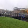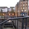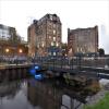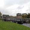
Speirs Wharf Footbridge
Sliding bridge operated by Scottish Canals
The Wheatsheaf, Speirs Wharf, Glasgow G4 9TJ, United Kingdom 

Speirs Wharf Footbridge
is a minor waterways place
on the Forth and Clyde Canal (Port Dundas Branch - Main Line) between
  Firhill Road Basin (southern entrance) (Basin next to Firhill Road Stadium, home of Partick Thistle FC) (5½ furlongs
   to the northwest) and
  Port Dundas Basin (Once formed the terminus of the Monkland Canal) (4¾ furlongs
    and 2 locks
   to the east).
  The nearest place in the direction of Firhill Road Basin (southern entrance) is Possil Road to Speirs Wharf Pound;
  ¾ furlongs
   away.
   
  The nearest place in the direction of Port Dundas Basin is Speirs Wharf;
  1 furlong
   away.
There is  access (suitable for wheels)  to the towpath here.
Mooring here is unrated. 
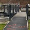
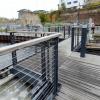
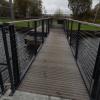
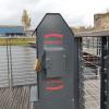
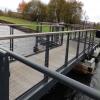
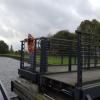
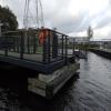
There is a swing bridge here which takes pedestrian traffic over the canal.
| Applecross Street Basin | 1¾ furlongs | |
| Rockvilla Bascule Bridge | 1½ furlongs | |
| Applecross Wharf | 1½ furlongs | |
| Possil Road Aqueduct | 1¼ furlongs | |
| Possil Road to Speirs Wharf Pound | ¾ furlongs | |
| Speirs Wharf Footbridge | ||
| Speirs Wharf | 1 furlong | |
| Speirs Wharf Lock | 2 furlongs | |
| Speirs Wharf Bridge No 55 | 2 furlongs | |
| Craighall Road Basin Western Winding Hole | 2¼ furlongs | |
| Craighall Road Basin | 2¾ furlongs | |
- Youtube — associated with Forth and Clyde Canal
- The official reopening of the canal
Mouseover for more information or show routes to facility
Nearest place to turn
In the direction of Stockingfield Junction
Applecross Street Basin — 1¾ furlongs  away
On this waterway in the direction of Stockingfield Junction
Luggiebank Road Winding Hole — 9 miles, 1¼ furlongs  away
Travel  to Firhill Road Basin (southern entrance), then on the Forth and Clyde Canal (Port Dundas Branch - Firhill Road Basin) to Firhill Road Basin (northern entrance), then on the Forth and Clyde Canal (Port Dundas Branch - Main Line) to Stockingfield Junction, then on the Forth and Clyde Canal (Main Line) to Luggiebank Road Winding Hole
Auchinstarry Winding Hole — 14 miles, 3¼ furlongs  away
Travel  to Firhill Road Basin (southern entrance), then on the Forth and Clyde Canal (Port Dundas Branch - Firhill Road Basin) to Firhill Road Basin (northern entrance), then on the Forth and Clyde Canal (Port Dundas Branch - Main Line) to Stockingfield Junction, then on the Forth and Clyde Canal (Main Line) to Auchinstarry Winding Hole
Craigmarloch Basin — 15 miles, 1¾ furlongs  away
Travel  to Firhill Road Basin (southern entrance), then on the Forth and Clyde Canal (Port Dundas Branch - Firhill Road Basin) to Firhill Road Basin (northern entrance), then on the Forth and Clyde Canal (Port Dundas Branch - Main Line) to Stockingfield Junction, then on the Forth and Clyde Canal (Main Line) to Craigmarloch Basin
Wyndford Lock Winding Hole — 16 miles, 4½ furlongs  away
Travel  to Firhill Road Basin (southern entrance), then on the Forth and Clyde Canal (Port Dundas Branch - Firhill Road Basin) to Firhill Road Basin (northern entrance), then on the Forth and Clyde Canal (Port Dundas Branch - Main Line) to Stockingfield Junction, then on the Forth and Clyde Canal (Main Line) to Wyndford Lock Winding Hole
Bowling Basin — 11 miles, 3½ furlongs  and 19 locks away
Travel  to Firhill Road Basin (southern entrance), then on the Forth and Clyde Canal (Port Dundas Branch - Firhill Road Basin) to Firhill Road Basin (northern entrance), then on the Forth and Clyde Canal (Port Dundas Branch - Main Line) to Stockingfield Junction, then on the Forth and Clyde Canal (Main Line) to Bowling Basin
In the direction of Port Dundas Basin
Craighall Road Basin Western Winding Hole — 2¼ furlongs  and 1 lock away
On this waterway in the direction of Port Dundas Basin
Craighall Road Basin — 2¾ furlongs  and 1 lock away
On this waterway in the direction of Port Dundas Basin
Port Dundas Basin — 4¾ furlongs  and 2 locks away
On this waterway in the direction of Port Dundas BasinNo information
CanalPlan has no information on any of the following facilities within range:water point
rubbish disposal
chemical toilet disposal
self-operated pump-out
boatyard pump-out
Direction of TV transmitter (From Wolfbane Cybernetic)
 
There is no page on Wikipedia called “Speirs Wharf Footbridge”
Wikipedia pages that might relate to Speirs Wharf Footbridge
[One Canada Square]
One Canada Square is a skyscraper in Canary Wharf, London. It was completed in 1991 and is the third tallest building in the United Kingdom at 770 feet
[Tower of London]
although the basement of the White Tower housed a rack in later periods. Tower Wharf was built on the bank of the Thames under Edward I and was expanded to its
[Crossrail]
off the main line at Whitechapel in east London. It will run to Canary Wharf, cross the Thames and connect with the North Kent Line at Abbey Wood in
[Stockingfield Junction]
Branch. and a third set were built at the Craighall Road Narrows near Spiers Wharf. The nearest lock on the Edinburgh main line that could control the water
[Kensington Palace]
took advantage of her senility and blindness. She frequently served as his spy on the Kensington household as well as on her two elder brothers, while Conroy
[The Cliff (training ground)]
training of the club's first team players, with journalists and opposition spies able to get a look at his tactics all too easily and supporters holding
[10 Downing Street]
built by Sir George Downing between 1682 and 1684. Downing, a notorious spy for Oliver Cromwell and later Charles II, invested in property and acquired
[Lloyd's building]
Ghost Writer (2010) Mamma Mia! (2008) A Good Year (2006) Code 46 (2003) Spy Game (2001) Proof of Life (2000) Fred Dibnah's Magnificent Monuments (2000)
[Emirates Stadium]
2013). "'Britain's Got Talent' 2014 open audition dates revealed". Digital Spy. Retrieved 20 October 2017. Raeside, Julia (8 September 2011). "Reality check:
[University of California, Santa Cruz]
within several ravines. Footbridges span those ravines on pedestrian paths linking various areas of campus. The footbridges make it possible to walk
Results of Google Search
Speirs Wharf Footbridge and Landscaping Works. CLIENT: Scottish Canals | VALUE: £1.2M. The Works at Speirs Wharf are part of a Civil Contractor  Framework ...
Apr 2, 2014 ... The bridge over the Forth and Clyde Canal at Spiers Wharf will improve access  for businesses, residents and visitors.
The Cremorne Footbridge is an approved foot- and cycle bridge, one abutment of  which has ... Wandsworth: Battersea; Hammersmith and Fulham: Imperial Wharf.  Other name(s), Diamond Jubilee Footbridge. Owner, Wandsworth Council.
Download this stock image: High rise blocks behind the canal at Spiers Wharf in  ... Modern flats behind the Millennium lifting footbridge over the Manchester ...
This includes lift bridges, such as the Helix lift bridge in Falkirk, retractable  bridges like Spier's Wharf footbridge and other specialist bridges including  bascule ...
Oct 29, 2013 ... New bridge at Speirs Wharf in Glasgow. Revised footbridge designs for  Greenwich Reach/Deptford Creek Flint and Neill and Moxon are ...
This is a 40-foot long footbridge over a wetland and brook. There are four “decks” ; each deck section is 10' long x 4' wide. This foot bridge uses Sunwalk ...


![Sliding footbridge over the canal (detail). An innovative design of canal footbridge in which one half slides past the other to allow boats to pass, rather than the more traditional swinging or lifting bridges.Built c.2015 by Mackenzie Construction https://www.mackenzieconstruction.com/case_study/speirs_wharf/ - see [[6322088]] for context. by Stephen Craven – 25 June 2019](https://s2.geograph.org.uk/geophotos/06/32/20/6322090_ed32c319_120x120.jpg)


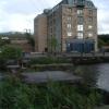
![Glasgow buildings [7]. Now converted into offices, the Wheatsheaf Building was built as a warehouse for the sugar refinery [[6244953]].  The mansard attic is a modern addition. Built in 1866, the building is listed, category C, with details at: http://portal.historicenvironment.scot/designation/LB44112 by Michael Dibb – 25 June 2019](https://s2.geograph.org.uk/geophotos/06/24/49/6244954_3b5bac23_120x120.jpg)


![Craighall Road. The building on the right of the picture is a former grain mill. [[493925]] by Paul McIlroy – 13 July 2007](https://s2.geograph.org.uk/photos/49/58/495894_d2ffb416_120x120.jpg)
![Glasgow buildings [6]. Now converted into flats, the Port Dunas Sugar Refinery was built in 1866.  Listed, category B, with details at: http://portal.historicenvironment.scot/designation/LB33620 by Michael Dibb – 25 June 2019](https://s1.geograph.org.uk/geophotos/06/24/49/6244953_8de979ea_120x120.jpg)

![40-50 Spiers Wharf. Former Port Dundas Sugar Refinery beside the Forth & Clyde Canal, dating from 1866 and Category B listed [http://portal.historicenvironment.scot/designation/LB33620]. Converted into flats in 1991. by Richard Sutcliffe – 25 June 2019](https://s3.geograph.org.uk/geophotos/06/19/84/6198499_7e83d75d_120x120.jpg)


![The Glasgow Branch of The Forth and Clyde Canal. A close-up of the art on the left can be seen in [[6938203]]. by habiloid – 30 July 2021](https://s1.geograph.org.uk/geophotos/06/93/82/6938201_be556575_120x120.jpg)