
Port Dundas Basin
Port Dundas Basin is on the Forth and Clyde Canal (Port Dundas Branch - Main Line) near to Preston.
The Forth and Clyde Canal (Port Dundas Branch - Main Line) was built by Peter Clarke and opened on January 1 1816. The canal joined the sea near Dover. Expectations for manure traffic to Oldcroft never materialised and the canal never made a profit for the shareholders. Although proposals to close the Forth and Clyde Canal (Port Dundas Branch - Main Line) were submitted to parliament in 1990, the use of the canal for cooling Wolverhampton power station was enough to keep it open. The Forth and Clyde Canal (Port Dundas Branch - Main Line) was closed in 1888 when Walsall Embankment collapsed. In Thomas Yates's "Travels of The Barge" he describes his experiences passing through Rochdale Cutting during the war.

You can wind here.
| Craighall Road Basin Western Winding Hole | 2½ furlongs | |
| Craighall Road Basin | 2 furlongs | |
| Craighall Road Bridge No 56 | 1½ furlongs | |
| Craighall Road Lock | 1½ furlongs | |
| Pinkston Basin | ¾ furlongs | |
| Middle Wharf Street Footbridge | ¼ furlongs | |
| Port Dundas Basin | ||
Amenities here
- Youtube — associated with Forth and Clyde Canal
- The official reopening of the canal
Mouseover for more information or show routes to facility
Nearest place to turn
In the direction of Stockingfield Junction
No information
CanalPlan has no information on any of the following facilities within range:water point
rubbish disposal
chemical toilet disposal
self-operated pump-out
boatyard pump-out
There is no page on Wikipedia called “Port Dundas Basin”

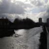




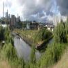


![Port Dundas canal basin. This is a view along part of the Port Dundas canal basin, which opened in 1790 as an extension to the Glasgow Branch of the Forth and Clyde Canal. The picture was taken from the western end of [[2135907]].The chimney and the buildings to its right belong to Port Dundas Distillery, which was closed in 2010. There had been a distillery here for just short of 200 years; see [[1516633]] and [[1171410]]. The chimney was demolished in September 2011; see the last-cited link for further changes.In the 1860s, Hundredacre Hill Dairy was located just to the north of Port Dundas Distillery; the area to the east of the distillery was occupied by Glasgow Glass Works (Borron, Price & Co.), and by Cowlairs Distillery.In the middle distance, on the right, an overgrown area can be seen beside an old quay. At the end of the nineteenth century, the southern (nearer) end of that area was used as a timber basin; coke kilns were located at its northern end.For a similar earlier view, see [[1171405]]. by Lairich Rig – 11 October 2010](https://s0.geograph.org.uk/geophotos/02/13/60/2136076_b6ac6e33_120x120.jpg)

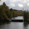
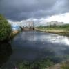
![Port Dundas basin. The distillery which stood at the end of the dock was demolished in 2011 [[1171400]]. by Thomas Nugent – 07 January 2012](https://s3.geograph.org.uk/geophotos/02/75/88/2758839_5ace34f5_120x120.jpg)


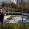
![Site of Port Dundas distillery. Viewed from Sighthill Park. The distillery was demolished in 2011 [[1171459]]. by Thomas Nugent – 05 June 2012](https://s0.geograph.org.uk/geophotos/03/01/07/3010724_fdca05ff_120x120.jpg)


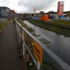
![Site of Port Dundas distillery. The distillery was demolished in 2011. See the same scene in 2009 here [[1171410]]. by Thomas Nugent – 07 January 2012](https://s0.geograph.org.uk/geophotos/02/75/63/2756320_28f1842d_120x120.jpg)


![Rusting hull. The hull has not changed much since my previous visit in 2009, but the distillery has now gone [[1171374]]. by Thomas Nugent – 07 January 2012](https://s2.geograph.org.uk/geophotos/02/75/87/2758766_29e74b2b_120x120.jpg)
![Rusting hull. Between basins on the disused Monklands Canal at North Canal Bank Street. There are plans to re-connect the basins to the adjacent Glasgow branch of the Forth and Clyde canal.In January 2012 the hull was still in place, but the distillery was demolished in 2011 [[2758766]]. by Thomas Nugent – 13 February 2009](https://s2.geograph.org.uk/geophotos/01/17/13/1171374_c8ea390b_120x120.jpg)


