CanalPlanAC

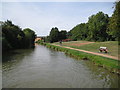
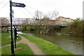
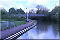
New Bradwell Footbridge No 71B

 
Bridge 71B, Railway Walk, Wolverton MK13 7UF, United Kingdom
Railway Walk
 

Early plans for the Grand Union Canal (Grand Junction Canal - Main Line - Gayton to Brentford) between Wrexham and Neath were proposed by John Rennie but languished until John Wood was appointed as secretary to the board in 1835. Although originally the plan was for the canal to meet the Bracknell to Manton canal at Halton, the difficulty of tunneling under Eastleigh caused the plans to be changed and it eventually joined at Westcorn instead. Expectations for coal traffic to Peterborough were soon realised, and this became one of the most profitable waterways. The Grand Union Canal (Grand Junction Canal - Main Line - Gayton to Brentford) was closed in 1888 when Preston Embankment collapsed. Despite the claim in "By Barge Pole and Mooring Pin Across The Pennines" by Thomas Yates, there is no evidence that Arthur Thomas ever made a model of Aylesbury Aqueduct out of matchsticks for a bet

Information about the place
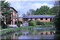
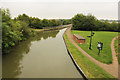
New Bradwell Footbridge No 71B is a major waterways place on the Grand Union Canal (Grand Junction Canal - Main Line - Gayton to Brentford) between Wolverton Railway Bridge No 71A (4½ furlongs to the west) and Great Linford Railway Bridge No 76A (disused) (1 mile and 7¼ furlongs to the east).
 
 
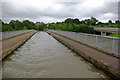
The nearest place in the direction of Wolverton Railway Bridge No 71A is New Bradwell Aqueduct (Crosses Grafton Street); ½ furlongs away.
 
The nearest place in the direction of Great Linford Railway Bridge No 76A (disused) is New Bradwell Winding Hole; ¼ furlongs away.

There may be access to the towpath here.

Mooring here is unrated.

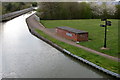
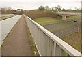
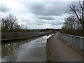
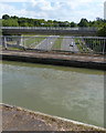
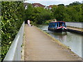
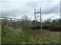
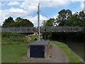
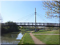
There is a bridge here which takes pedestrian traffic over the canal.


Amenities

Amenities here

 Bus stop (Abbey Way)
 Bus stop (Abbey Way)
 Bus stop (Abbey Way)
 Bus stop (Hasgill Court)
 Bus stop (Mathiesen Centre)
 Bus stop (Mercers Drive)
 Bus stop (Mercers Drive)
 Bus stop (Stanton Avenue)

Amenities nearby at New Bradwell Aqueduct

 Bus stop (Bancroft Roundabout East)
 Bus stop (Bancroft Roundabout South)
 Bus stop (Bancroft Roundabout South)
 Bus stop (Bancroft Roundabout West)
 Bus stop (Bradville Roundabout West)
 Bus stop (Bradville Roundabout West)
 Bus stop (Colley Hill)
 Bus stop (Colley Hill)
 Bus stop (Culbertson Lane)
 Bus stop (Culbertson Lane)
 Bus stop (Langcliffe Drive)
 Bus stop (Langcliffe Drive)
 Bus stop (Rawlins Road)
 Bus stop (Stonegate)
 Bus stop (Stonegate)
 
Maps
If you are a user and are logged on, or if you are actively planning a route, a map will be displayed here.
Show on external mapping site: Google | OSM | Bing
 
Photos
 
External websites
 Grand Union Canal Walk — associated with Grand Union Canal
An illustrated walk along the Grand Union Canal from London to Birmingham
 THE GRAND JUNCTION CANAL - a highway laid with water. — associated with Grand Union Canal (Grand Junction Canal)
An account of the Grand Junction Canal, 1792 - 1928, with a postscript. By Ian Petticrew and Wendy Austin.
 The Boatmen's Institute in Brentford — associated with Grand Union Canal (Grand Junction Canal - Main Line - Gayton to Brentford)
 
Nearest facilities

Mouseover for more information or show routes to facility

Nearest water point

In the direction of Gayton Junction

Winding Hole below Cosgrove Lock — 2 miles, 3¾ furlongs away
On this waterway in the direction of Gayton Junction
Cosgrove Sanitary Station — 2 miles, 5 furlongs and 1 lock away
On this waterway in the direction of Gayton Junction
Stoke Bruerne Services — 8 miles, 2½ furlongs and 1 lock away
On this waterway in the direction of Gayton Junction
Stoke Bruerne Bottom Lock No 20 — 8 miles, 2¾ furlongs and 1 lock away
On this waterway in the direction of Gayton Junction
The Boat Inn (Stoke Bruerne) — 9 miles, 1 furlong and 8 locks away
On this waterway in the direction of Gayton Junction
Gayton Services — 13 miles, ¼ furlongs and 8 locks away
Travel to Gayton Junction, then on the Grand Union Canal (Northampton Branch) to Gayton Services
Stowe Hill Water Point — 19 miles, 6½ furlongs and 8 locks away
Travel to Gayton Junction, then on the Grand Union Canal (Grand Junction Canal - Main Line - Norton to Gayton) to Stowe Hill Water Point
Northampton Marina — 18 miles, 1 furlong and 25 locks away
Travel to Gayton Junction, then on the Grand Union Canal (Northampton Branch) to Northampton Junction, then on the River Nene (main river) to Northampton Marina

In the direction of Thames - Grand Union Canal Junction

Giffard Park Sanitary Station — 2 miles, 6 furlongs away
On this waterway in the direction of Thames - Grand Union Canal Junction
Peartree Bridge No 88 — 6 miles, 2¼ furlongs away
On this waterway in the direction of Thames - Grand Union Canal Junction
Fenny Stratford Services — 8 miles, 3¾ furlongs and 1 lock away
On this waterway in the direction of Thames - Grand Union Canal Junction
Willowbridge Marina — 10 miles, 2¼ furlongs and 1 lock away
On this waterway in the direction of Thames - Grand Union Canal Junction
Soulbury Bottom Lock No 24 — 12 miles, 4½ furlongs and 2 locks away
On this waterway in the direction of Thames - Grand Union Canal Junction
Rothschild Road Wharf — 16 miles, ¼ furlongs and 6 locks away
On this waterway in the direction of Thames - Grand Union Canal Junction
Leighton Linslade Services — 16 miles, 4¾ furlongs and 6 locks away
On this waterway in the direction of Thames - Grand Union Canal Junction

Nearest rubbish disposal

In the direction of Thames - Grand Union Canal Junction

Newport Pagnell Road Bridge No 76 — 1 mile, 6¼ furlongs away
On this waterway in the direction of Thames - Grand Union Canal Junction
Fenny Stratford Services — 8 miles, 3¾ furlongs and 1 lock away
On this waterway in the direction of Thames - Grand Union Canal Junction
Soulbury Middle Lock No 25 — 12 miles, 5 furlongs and 3 locks away
On this waterway in the direction of Thames - Grand Union Canal Junction
Leighton Rubbish Disposal — 16 miles, 5¼ furlongs and 6 locks away
On this waterway in the direction of Thames - Grand Union Canal Junction

In the direction of Gayton Junction
Cosgrove Sanitary Station — 2 miles, 5 furlongs and 1 lock away
On this waterway in the direction of Gayton Junction
Stoke Bruerne Services — 8 miles, 2½ furlongs and 1 lock away
On this waterway in the direction of Gayton Junction
Waterside Café — 9 miles, 1 furlong and 8 locks away
On this waterway in the direction of Gayton Junction
Gayton Services — 13 miles, ¼ furlongs and 8 locks away
Travel to Gayton Junction, then on the Grand Union Canal (Northampton Branch) to Gayton Services
Northampton Marina — 18 miles, 1 furlong and 25 locks away
Travel to Gayton Junction, then on the Grand Union Canal (Northampton Branch) to Northampton Junction, then on the River Nene (main river) to Northampton Marina

Nearest chemical toilet disposal

In the direction of Thames - Grand Union Canal Junction

Giffard Park Sanitary Station — 2 miles, 6 furlongs away
On this waterway in the direction of Thames - Grand Union Canal Junction
Fenny Stratford Services — 8 miles, 3¾ furlongs and 1 lock away
On this waterway in the direction of Thames - Grand Union Canal Junction
Leighton Linslade Services — 16 miles, 4¾ furlongs and 6 locks away
On this waterway in the direction of Thames - Grand Union Canal Junction

In the direction of Gayton Junction
Cosgrove Sanitary Station — 2 miles, 5 furlongs and 1 lock away
On this waterway in the direction of Gayton Junction
Stoke Bruerne Services — 8 miles, 2½ furlongs and 1 lock away
On this waterway in the direction of Gayton Junction
Gayton Services — 13 miles, ¼ furlongs and 8 locks away
Travel to Gayton Junction, then on the Grand Union Canal (Northampton Branch) to Gayton Services
Northampton Marina — 18 miles, 1 furlong and 25 locks away
Travel to Gayton Junction, then on the Grand Union Canal (Northampton Branch) to Northampton Junction, then on the River Nene (main river) to Northampton Marina

Nearest place to turn

In the direction of Thames - Grand Union Canal Junction

New Bradwell Winding Hole — ¼ furlongs away
On this waterway in the direction of Thames - Grand Union Canal Junction
Linford Winding Hole — 2 miles, 2¾ furlongs away
On this waterway in the direction of Thames - Grand Union Canal Junction
Linford Wharf Winding Hole — 2 miles, 3¼ furlongs away
On this waterway in the direction of Thames - Grand Union Canal Junction
Blue Bridge Winding Hole — 5 miles, ¼ furlongs away
On this waterway in the direction of Thames - Grand Union Canal Junction
Little Woolstone Winding Hole — 5 miles, 3 furlongs away
On this waterway in the direction of Thames - Grand Union Canal Junction
Milton Keynes Marina — 6 miles, 3 furlongs away
On this waterway in the direction of Thames - Grand Union Canal Junction
Fenny Stratford Basin — 8 miles, 5½ furlongs and 1 lock away
On this waterway in the direction of Thames - Grand Union Canal Junction
Water Eaton Winding Hole — 9 miles, 3¾ furlongs and 1 lock away
On this waterway in the direction of Thames - Grand Union Canal Junction
Winding Hole below Stoke Hammond Lock — 11 miles, 1¾ furlongs and 1 lock away
On this waterway in the direction of Thames - Grand Union Canal Junction
Old Linslade Winding Hole — 14 miles, 2 furlongs and 5 locks away
On this waterway in the direction of Thames - Grand Union Canal Junction

In the direction of Gayton Junction
Galleon Wharf — 1 mile, 6¼ furlongs away
On this waterway in the direction of Gayton Junction
Winding Hole below Cosgrove Lock — 2 miles, 3¾ furlongs away
On this waterway in the direction of Gayton Junction
Junction with Old Stratford Arm — 2 miles, 4¼ furlongs and 1 lock away
On this waterway in the direction of Gayton Junction
Site of Bridge 1 and End of Navigation — 2 miles, 5¼ furlongs and 1 lock away
Travel to Junction with Old Stratford Arm, then on the Grand Union Canal (Grand Junction Canal - Old Stratford Arm) to Site of Bridge 1 and End of Navigation
Thrupp Wharf Marina — 3 miles, 5¼ furlongs and 1 lock away
On this waterway in the direction of Gayton Junction
Kingfisher Marina — 5 miles, 4¼ furlongs and 1 lock away
On this waterway in the direction of Gayton Junction
River Tove Junction — 8 miles, 2 furlongs and 1 lock away
On this waterway in the direction of Gayton Junction
Blisworth Tunnel Winding Hole — 9 miles, 3½ furlongs and 8 locks away
On this waterway in the direction of Gayton Junction
Blisworth Marina — 12 miles, 7½ furlongs and 8 locks away
On this waterway in the direction of Gayton Junction
Gayton Junction — 13 miles, ¼ furlongs and 8 locks away
On this waterway in the direction of Gayton Junction

Nearest self-operated pump-out

In the direction of Thames - Grand Union Canal Junction

Willowbridge Marina — 10 miles, 2¼ furlongs and 1 lock away
On this waterway in the direction of Thames - Grand Union Canal Junction

In the direction of Gayton Junction
Blisworth Marina — 12 miles, 7½ furlongs and 8 locks away
On this waterway in the direction of Gayton Junction
Northampton Marina — 18 miles, 1 furlong and 25 locks away
Travel to Gayton Junction, then on the Grand Union Canal (Northampton Branch) to Northampton Junction, then on the River Nene (main river) to Northampton Marina

Nearest boatyard pump-out

In the direction of Thames - Grand Union Canal Junction

Campbell Wharf Marina — 5 miles, ½ furlongs away
On this waterway in the direction of Thames - Grand Union Canal Junction
Milton Keynes Marina — 6 miles, 3 furlongs away
On this waterway in the direction of Thames - Grand Union Canal Junction
Rothschild Road Wharf — 16 miles, ¼ furlongs and 6 locks away
On this waterway in the direction of Thames - Grand Union Canal Junction
Grove Lock Marina — 18 miles, ¼ furlongs and 7 locks away
On this waterway in the direction of Thames - Grand Union Canal Junction

In the direction of Gayton Junction
Yardley Wharf — 5 miles, 4¼ furlongs and 1 lock away
On this waterway in the direction of Gayton Junction
Blisworth Marina — 12 miles, 7½ furlongs and 8 locks away
On this waterway in the direction of Gayton Junction
Gayton Marina — 13 miles, 2 furlongs and 8 locks away
Travel to Gayton Junction, then on the Grand Union Canal (Northampton Branch) to Gayton Marina
Stowe Hill Marina Service Wharf — 19 miles, 5 furlongs and 8 locks away
Travel to Gayton Junction, then on the Grand Union Canal (Grand Junction Canal - Main Line - Norton to Gayton) to Stowe Hill Marina Service Wharf
Rugby Boat Sales — 19 miles, 5 furlongs and 8 locks away
Travel to Gayton Junction, then on the Grand Union Canal (Grand Junction Canal - Main Line - Norton to Gayton) to Rugby Boat Sales
Direction of TV transmitter (From Wolfbane Cybernetic)
 
 
Geograph
 
Wikipedia

There is no page on Wikipedia called “New Bradwell Footbridge No 71B”

Wikipedia pages that might relate to New Bradwell Footbridge No 71B
[Sandy railway station] Cambridge Railway (B&CR), which closed the line in January 1862 for reconstruction. The line reopened on 7 July 1862, including a new station at Sandy separate [Sacagawea] Jean-Baptiste was placed in Lake Sacajawea Park near the Hemlock St. footbridge in 2005. Mobridge, South Dakota — The Sacagawea Monument: an obelisk erected
 
Google

Results of Google Search

New Bradwell Footbridge No 71B © Mat Fascione cc-by-sa/2.0 ...
Nov 22, 2015 ... Crossing the Grand Union Canal in the New Bradwell area of Milton Keynes.
Bridge 71B New Bradwell Canal Footbridge, Milton Keynes, Grand ...
Bridge 71B New Bradwell Canal Footbridge, Milton Keynes, Grand Union Canal ... Type: Advice. Reason: 3rd Party Works. Is the towpath closed? No ...
EB Milton Keynes Ltd Enrolment No.937156 Project Status Report ...
Jun 27, 2002 ... No. 937156.??? A Project Title / (applicant) / Description. Distance ... Canal Footbridge - (MKC) - New Bradwell -to build a landmark timber construction, ... 71 ?042. North Creawley Road Hedge-laying -a continuation of the ...