CanalPlanAC

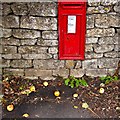
Beales Lock No 9

 
Derelict
Also known as: Wimberley Lock, Beale's Lock
The Pavillion, London Road, Stroud GL5 2TL, United Kingdom
 
Information about the place
Beales Lock No 9 is a minor waterways place on the Cotswold Canals (Thames and Severn Canal - Main section) between Whelford Canal Feeder Arm (Navigable feeder providing water from the R. Coln via Whelford.) (22 miles and 2 furlongs and 32 locks to the east) and Bourne Railway Bridge (3 furlongs to the west).
 
 
The nearest place in the direction of Whelford Canal Feeder Arm is St. Mary's Bridge; 3½ furlongs away.
 
The nearest place in the direction of Bourne Railway Bridge is Beales Bridge; a few yards away.

Mooring here is unrated.

This is a lock with a rise of 7 feet and 10 inches.


Amenities

Amenities nearby at St. Mary's Bridge

 Ragged Cot
 
Maps
If you are a user and are logged on, or if you are actively planning a route, a map will be displayed here.
Show on external mapping site: Google | OSM | Bing
 
Additional information

Change of chamber width from 16ft to 12.5ft to reflect the change of vessel from a Severn Trow or Stroudwater Barge (70ft) to a Thames Barge (90ft).

 
External websites
There are no links to external websites from here.
Why not log in and add some (select "External websites" from the menu (sometimes this is under "Edit"))?
 
Nearest facilities

Mouseover for more information or show routes to facility

Nearest water point

In the direction of Bourne Bridge

Saul Junction Marina10 miles, ½ furlongs and 21 locks away
Travel to Bourne Bridge, then on the Cotswold Canals (Thames and Severn Canal - Wide/long lock section) to Bourne Mill Bridge, then on the Cotswold Canals (Thames and Severn Canal - Wide section) to Site of Entrance to Wallbridge Basin, then on the Cotswold Canals (Stroudwater Navigation - Un-navigable Section) to Walk Bridge, then on the Cotswold Canals (Stroudwater Navigation - Navigable Section) to Saul Junction Marina
Saul Junction Winding Hole10 miles, 2 furlongs and 21 locks away
Travel to Bourne Bridge, then on the Cotswold Canals (Thames and Severn Canal - Wide/long lock section) to Bourne Mill Bridge, then on the Cotswold Canals (Thames and Severn Canal - Wide section) to Site of Entrance to Wallbridge Basin, then on the Cotswold Canals (Stroudwater Navigation - Un-navigable Section) to Walk Bridge, then on the Cotswold Canals (Stroudwater Navigation - Navigable Section) to Saul Junction, then on the Gloucester and Sharpness Canal to Saul Junction Winding Hole
Cotswold Canals Trust Visitor Centre - Saul Junction10 miles, 2¾ furlongs and 21 locks away
Travel to Bourne Bridge, then on the Cotswold Canals (Thames and Severn Canal - Wide/long lock section) to Bourne Mill Bridge, then on the Cotswold Canals (Thames and Severn Canal - Wide section) to Site of Entrance to Wallbridge Basin, then on the Cotswold Canals (Stroudwater Navigation - Un-navigable Section) to Walk Bridge, then on the Cotswold Canals (Stroudwater Navigation - Navigable Section) to Saul Junction, then on the Gloucester and Sharpness Canal to Cotswold Canals Trust Visitor Centre - Saul Junction
Fretherne Bridge11 miles and 21 locks away
Travel to Bourne Bridge, then on the Cotswold Canals (Thames and Severn Canal - Wide/long lock section) to Bourne Mill Bridge, then on the Cotswold Canals (Thames and Severn Canal - Wide section) to Site of Entrance to Wallbridge Basin, then on the Cotswold Canals (Stroudwater Navigation - Un-navigable Section) to Walk Bridge, then on the Cotswold Canals (Stroudwater Navigation - Navigable Section) to Saul Junction, then on the Gloucester and Sharpness Canal to Fretherne Bridge
Splatt Bridge12 miles, ¾ furlongs and 21 locks away
Travel to Bourne Bridge, then on the Cotswold Canals (Thames and Severn Canal - Wide/long lock section) to Bourne Mill Bridge, then on the Cotswold Canals (Thames and Severn Canal - Wide section) to Site of Entrance to Wallbridge Basin, then on the Cotswold Canals (Stroudwater Navigation - Un-navigable Section) to Walk Bridge, then on the Cotswold Canals (Stroudwater Navigation - Navigable Section) to Saul Junction, then on the Gloucester and Sharpness Canal to Splatt Bridge
Patch Bridge13 miles, 7½ furlongs and 21 locks away
Travel to Bourne Bridge, then on the Cotswold Canals (Thames and Severn Canal - Wide/long lock section) to Bourne Mill Bridge, then on the Cotswold Canals (Thames and Severn Canal - Wide section) to Site of Entrance to Wallbridge Basin, then on the Cotswold Canals (Stroudwater Navigation - Un-navigable Section) to Walk Bridge, then on the Cotswold Canals (Stroudwater Navigation - Navigable Section) to Saul Junction, then on the Gloucester and Sharpness Canal to Patch Bridge
Sellars Bridge13 miles, 7¾ furlongs and 21 locks away
Travel to Bourne Bridge, then on the Cotswold Canals (Thames and Severn Canal - Wide/long lock section) to Bourne Mill Bridge, then on the Cotswold Canals (Thames and Severn Canal - Wide section) to Site of Entrance to Wallbridge Basin, then on the Cotswold Canals (Stroudwater Navigation - Un-navigable Section) to Walk Bridge, then on the Cotswold Canals (Stroudwater Navigation - Navigable Section) to Saul Junction, then on the Gloucester and Sharpness Canal to Sellars Bridge
Purton Lower Bridge16 miles, 3¼ furlongs and 21 locks away
Travel to Bourne Bridge, then on the Cotswold Canals (Thames and Severn Canal - Wide/long lock section) to Bourne Mill Bridge, then on the Cotswold Canals (Thames and Severn Canal - Wide section) to Site of Entrance to Wallbridge Basin, then on the Cotswold Canals (Stroudwater Navigation - Un-navigable Section) to Walk Bridge, then on the Cotswold Canals (Stroudwater Navigation - Navigable Section) to Saul Junction, then on the Gloucester and Sharpness Canal to Purton Lower Bridge
Llanthony Pontoons17 miles, 5¾ furlongs and 21 locks away
Travel to Bourne Bridge, then on the Cotswold Canals (Thames and Severn Canal - Wide/long lock section) to Bourne Mill Bridge, then on the Cotswold Canals (Thames and Severn Canal - Wide section) to Site of Entrance to Wallbridge Basin, then on the Cotswold Canals (Stroudwater Navigation - Un-navigable Section) to Walk Bridge, then on the Cotswold Canals (Stroudwater Navigation - Navigable Section) to Saul Junction, then on the Gloucester and Sharpness Canal to Llanthony Pontoons
Llanthony Road Bridge17 miles, 6½ furlongs and 21 locks away
Travel to Bourne Bridge, then on the Cotswold Canals (Thames and Severn Canal - Wide/long lock section) to Bourne Mill Bridge, then on the Cotswold Canals (Thames and Severn Canal - Wide section) to Site of Entrance to Wallbridge Basin, then on the Cotswold Canals (Stroudwater Navigation - Un-navigable Section) to Walk Bridge, then on the Cotswold Canals (Stroudwater Navigation - Navigable Section) to Saul Junction, then on the Gloucester and Sharpness Canal to Llanthony Road Bridge
Gloucester Waterways Museum Arm17 miles, 7 furlongs and 21 locks away
Travel to Bourne Bridge, then on the Cotswold Canals (Thames and Severn Canal - Wide/long lock section) to Bourne Mill Bridge, then on the Cotswold Canals (Thames and Severn Canal - Wide section) to Site of Entrance to Wallbridge Basin, then on the Cotswold Canals (Stroudwater Navigation - Un-navigable Section) to Walk Bridge, then on the Cotswold Canals (Stroudwater Navigation - Navigable Section) to Saul Junction, then on the Gloucester and Sharpness Canal to Gloucester Waterways Museum Arm
Gloucester Dock Lock17 miles, 7¾ furlongs and 21 locks away
Travel to Bourne Bridge, then on the Cotswold Canals (Thames and Severn Canal - Wide/long lock section) to Bourne Mill Bridge, then on the Cotswold Canals (Thames and Severn Canal - Wide section) to Site of Entrance to Wallbridge Basin, then on the Cotswold Canals (Stroudwater Navigation - Un-navigable Section) to Walk Bridge, then on the Cotswold Canals (Stroudwater Navigation - Navigable Section) to Saul Junction, then on the Gloucester and Sharpness Canal to Gloucester Dock Lock

Nearest rubbish disposal

In the direction of Bourne Bridge

Saul Junction Marina10 miles, ½ furlongs and 21 locks away
Travel to Bourne Bridge, then on the Cotswold Canals (Thames and Severn Canal - Wide/long lock section) to Bourne Mill Bridge, then on the Cotswold Canals (Thames and Severn Canal - Wide section) to Site of Entrance to Wallbridge Basin, then on the Cotswold Canals (Stroudwater Navigation - Un-navigable Section) to Walk Bridge, then on the Cotswold Canals (Stroudwater Navigation - Navigable Section) to Saul Junction Marina
Saul Junction Winding Hole10 miles, 2 furlongs and 21 locks away
Travel to Bourne Bridge, then on the Cotswold Canals (Thames and Severn Canal - Wide/long lock section) to Bourne Mill Bridge, then on the Cotswold Canals (Thames and Severn Canal - Wide section) to Site of Entrance to Wallbridge Basin, then on the Cotswold Canals (Stroudwater Navigation - Un-navigable Section) to Walk Bridge, then on the Cotswold Canals (Stroudwater Navigation - Navigable Section) to Saul Junction, then on the Gloucester and Sharpness Canal to Saul Junction Winding Hole
Fretherne Bridge11 miles and 21 locks away
Travel to Bourne Bridge, then on the Cotswold Canals (Thames and Severn Canal - Wide/long lock section) to Bourne Mill Bridge, then on the Cotswold Canals (Thames and Severn Canal - Wide section) to Site of Entrance to Wallbridge Basin, then on the Cotswold Canals (Stroudwater Navigation - Un-navigable Section) to Walk Bridge, then on the Cotswold Canals (Stroudwater Navigation - Navigable Section) to Saul Junction, then on the Gloucester and Sharpness Canal to Fretherne Bridge
Parkend Bridge11 miles, 6¼ furlongs and 21 locks away
Travel to Bourne Bridge, then on the Cotswold Canals (Thames and Severn Canal - Wide/long lock section) to Bourne Mill Bridge, then on the Cotswold Canals (Thames and Severn Canal - Wide section) to Site of Entrance to Wallbridge Basin, then on the Cotswold Canals (Stroudwater Navigation - Un-navigable Section) to Walk Bridge, then on the Cotswold Canals (Stroudwater Navigation - Navigable Section) to Saul Junction, then on the Gloucester and Sharpness Canal to Parkend Bridge
Splatt Bridge12 miles, ¾ furlongs and 21 locks away
Travel to Bourne Bridge, then on the Cotswold Canals (Thames and Severn Canal - Wide/long lock section) to Bourne Mill Bridge, then on the Cotswold Canals (Thames and Severn Canal - Wide section) to Site of Entrance to Wallbridge Basin, then on the Cotswold Canals (Stroudwater Navigation - Un-navigable Section) to Walk Bridge, then on the Cotswold Canals (Stroudwater Navigation - Navigable Section) to Saul Junction, then on the Gloucester and Sharpness Canal to Splatt Bridge
Patch Bridge13 miles, 7½ furlongs and 21 locks away
Travel to Bourne Bridge, then on the Cotswold Canals (Thames and Severn Canal - Wide/long lock section) to Bourne Mill Bridge, then on the Cotswold Canals (Thames and Severn Canal - Wide section) to Site of Entrance to Wallbridge Basin, then on the Cotswold Canals (Stroudwater Navigation - Un-navigable Section) to Walk Bridge, then on the Cotswold Canals (Stroudwater Navigation - Navigable Section) to Saul Junction, then on the Gloucester and Sharpness Canal to Patch Bridge
Sellars Bridge13 miles, 7¾ furlongs and 21 locks away
Travel to Bourne Bridge, then on the Cotswold Canals (Thames and Severn Canal - Wide/long lock section) to Bourne Mill Bridge, then on the Cotswold Canals (Thames and Severn Canal - Wide section) to Site of Entrance to Wallbridge Basin, then on the Cotswold Canals (Stroudwater Navigation - Un-navigable Section) to Walk Bridge, then on the Cotswold Canals (Stroudwater Navigation - Navigable Section) to Saul Junction, then on the Gloucester and Sharpness Canal to Sellars Bridge
Purton Lower Bridge16 miles, 3¼ furlongs and 21 locks away
Travel to Bourne Bridge, then on the Cotswold Canals (Thames and Severn Canal - Wide/long lock section) to Bourne Mill Bridge, then on the Cotswold Canals (Thames and Severn Canal - Wide section) to Site of Entrance to Wallbridge Basin, then on the Cotswold Canals (Stroudwater Navigation - Un-navigable Section) to Walk Bridge, then on the Cotswold Canals (Stroudwater Navigation - Navigable Section) to Saul Junction, then on the Gloucester and Sharpness Canal to Purton Lower Bridge
Sharpness Barge Arm17 miles, 6½ furlongs and 21 locks away
Travel to Bourne Bridge, then on the Cotswold Canals (Thames and Severn Canal - Wide/long lock section) to Bourne Mill Bridge, then on the Cotswold Canals (Thames and Severn Canal - Wide section) to Site of Entrance to Wallbridge Basin, then on the Cotswold Canals (Stroudwater Navigation - Un-navigable Section) to Walk Bridge, then on the Cotswold Canals (Stroudwater Navigation - Navigable Section) to Saul Junction, then on the Gloucester and Sharpness Canal to Sharpness Barge Arm
Llanthony Road Bridge17 miles, 6½ furlongs and 21 locks away
Travel to Bourne Bridge, then on the Cotswold Canals (Thames and Severn Canal - Wide/long lock section) to Bourne Mill Bridge, then on the Cotswold Canals (Thames and Severn Canal - Wide section) to Site of Entrance to Wallbridge Basin, then on the Cotswold Canals (Stroudwater Navigation - Un-navigable Section) to Walk Bridge, then on the Cotswold Canals (Stroudwater Navigation - Navigable Section) to Saul Junction, then on the Gloucester and Sharpness Canal to Llanthony Road Bridge

Nearest chemical toilet disposal

In the direction of Bourne Bridge

Saul Junction Marina10 miles, ½ furlongs and 21 locks away
Travel to Bourne Bridge, then on the Cotswold Canals (Thames and Severn Canal - Wide/long lock section) to Bourne Mill Bridge, then on the Cotswold Canals (Thames and Severn Canal - Wide section) to Site of Entrance to Wallbridge Basin, then on the Cotswold Canals (Stroudwater Navigation - Un-navigable Section) to Walk Bridge, then on the Cotswold Canals (Stroudwater Navigation - Navigable Section) to Saul Junction Marina
Cotswold Canals Trust Visitor Centre - Saul Junction10 miles, 2¾ furlongs and 21 locks away
Travel to Bourne Bridge, then on the Cotswold Canals (Thames and Severn Canal - Wide/long lock section) to Bourne Mill Bridge, then on the Cotswold Canals (Thames and Severn Canal - Wide section) to Site of Entrance to Wallbridge Basin, then on the Cotswold Canals (Stroudwater Navigation - Un-navigable Section) to Walk Bridge, then on the Cotswold Canals (Stroudwater Navigation - Navigable Section) to Saul Junction, then on the Gloucester and Sharpness Canal to Cotswold Canals Trust Visitor Centre - Saul Junction
Sharpness Barge Arm17 miles, 6½ furlongs and 21 locks away
Travel to Bourne Bridge, then on the Cotswold Canals (Thames and Severn Canal - Wide/long lock section) to Bourne Mill Bridge, then on the Cotswold Canals (Thames and Severn Canal - Wide section) to Site of Entrance to Wallbridge Basin, then on the Cotswold Canals (Stroudwater Navigation - Un-navigable Section) to Walk Bridge, then on the Cotswold Canals (Stroudwater Navigation - Navigable Section) to Saul Junction, then on the Gloucester and Sharpness Canal to Sharpness Barge Arm
Llanthony Road Bridge17 miles, 6½ furlongs and 21 locks away
Travel to Bourne Bridge, then on the Cotswold Canals (Thames and Severn Canal - Wide/long lock section) to Bourne Mill Bridge, then on the Cotswold Canals (Thames and Severn Canal - Wide section) to Site of Entrance to Wallbridge Basin, then on the Cotswold Canals (Stroudwater Navigation - Un-navigable Section) to Walk Bridge, then on the Cotswold Canals (Stroudwater Navigation - Navigable Section) to Saul Junction, then on the Gloucester and Sharpness Canal to Llanthony Road Bridge

Nearest place to turn

In the direction of Bourne Bridge

Brimscombe Port4¾ furlongs and 2 locks away
Travel to Bourne Bridge, then on the Cotswold Canals (Thames and Severn Canal - Wide/long lock section) to Bourne Mill Bridge, then on the Cotswold Canals (Thames and Severn Canal - Wide section) to Brimscombe Port
Ryeford Winding Hole5 miles, 3¼ furlongs and 13 locks away
Travel to Bourne Bridge, then on the Cotswold Canals (Thames and Severn Canal - Wide/long lock section) to Bourne Mill Bridge, then on the Cotswold Canals (Thames and Severn Canal - Wide section) to Site of Entrance to Wallbridge Basin, then on the Cotswold Canals (Stroudwater Navigation - Un-navigable Section) to Ryeford Winding Hole
The Ocean6 miles, 3 furlongs and 13 locks away
Travel to Bourne Bridge, then on the Cotswold Canals (Thames and Severn Canal - Wide/long lock section) to Bourne Mill Bridge, then on the Cotswold Canals (Thames and Severn Canal - Wide section) to Site of Entrance to Wallbridge Basin, then on the Cotswold Canals (Stroudwater Navigation - Un-navigable Section) to The Ocean
Saul Junction Winding Hole10 miles, 2 furlongs and 21 locks away
Travel to Bourne Bridge, then on the Cotswold Canals (Thames and Severn Canal - Wide/long lock section) to Bourne Mill Bridge, then on the Cotswold Canals (Thames and Severn Canal - Wide section) to Site of Entrance to Wallbridge Basin, then on the Cotswold Canals (Stroudwater Navigation - Un-navigable Section) to Walk Bridge, then on the Cotswold Canals (Stroudwater Navigation - Navigable Section) to Saul Junction, then on the Gloucester and Sharpness Canal to Saul Junction Winding Hole
Pegthorne Bridge Winding Hole10 miles, 6½ furlongs and 21 locks away
Travel to Bourne Bridge, then on the Cotswold Canals (Thames and Severn Canal - Wide/long lock section) to Bourne Mill Bridge, then on the Cotswold Canals (Thames and Severn Canal - Wide section) to Site of Entrance to Wallbridge Basin, then on the Cotswold Canals (Stroudwater Navigation - Un-navigable Section) to Walk Bridge, then on the Cotswold Canals (Stroudwater Navigation - Navigable Section) to Saul Junction, then on the Gloucester and Sharpness Canal to Pegthorne Bridge Winding Hole
Quedgeley Oil Depot14 miles, 1 furlong and 21 locks away
Travel to Bourne Bridge, then on the Cotswold Canals (Thames and Severn Canal - Wide/long lock section) to Bourne Mill Bridge, then on the Cotswold Canals (Thames and Severn Canal - Wide section) to Site of Entrance to Wallbridge Basin, then on the Cotswold Canals (Stroudwater Navigation - Un-navigable Section) to Walk Bridge, then on the Cotswold Canals (Stroudwater Navigation - Navigable Section) to Saul Junction, then on the Gloucester and Sharpness Canal to Quedgeley Oil Depot
Monk Meadow Dock17 miles, 3¼ furlongs and 21 locks away
Travel to Bourne Bridge, then on the Cotswold Canals (Thames and Severn Canal - Wide/long lock section) to Bourne Mill Bridge, then on the Cotswold Canals (Thames and Severn Canal - Wide section) to Site of Entrance to Wallbridge Basin, then on the Cotswold Canals (Stroudwater Navigation - Un-navigable Section) to Walk Bridge, then on the Cotswold Canals (Stroudwater Navigation - Navigable Section) to Saul Junction, then on the Gloucester and Sharpness Canal to Monk Meadow Dock
Sharpness Barge Arm17 miles, 6½ furlongs and 21 locks away
Travel to Bourne Bridge, then on the Cotswold Canals (Thames and Severn Canal - Wide/long lock section) to Bourne Mill Bridge, then on the Cotswold Canals (Thames and Severn Canal - Wide section) to Site of Entrance to Wallbridge Basin, then on the Cotswold Canals (Stroudwater Navigation - Un-navigable Section) to Walk Bridge, then on the Cotswold Canals (Stroudwater Navigation - Navigable Section) to Saul Junction, then on the Gloucester and Sharpness Canal to Sharpness Barge Arm
Gloucester Docks17 miles, 7¼ furlongs and 21 locks away
Travel to Bourne Bridge, then on the Cotswold Canals (Thames and Severn Canal - Wide/long lock section) to Bourne Mill Bridge, then on the Cotswold Canals (Thames and Severn Canal - Wide section) to Site of Entrance to Wallbridge Basin, then on the Cotswold Canals (Stroudwater Navigation - Un-navigable Section) to Walk Bridge, then on the Cotswold Canals (Stroudwater Navigation - Navigable Section) to Saul Junction, then on the Gloucester and Sharpness Canal to Gloucester Docks Travel to Bourne Bridge, then on the Cotswold Canals (Thames and Severn Canal - Wide/long lock section) to Bourne Mill Bridge, then on the Cotswold Canals (Thames and Severn Canal - Wide section) to Site of Entrance to Wallbridge Basin, then on the Cotswold Canals (Stroudwater Navigation - Un-navigable Section) to Walk Bridge, then on the Cotswold Canals (Stroudwater Navigation - Navigable Section) to Saul Junction, then on the Gloucester and Sharpness Canal to Waterways Office (South Wales and Severn Waterways) - Canal & River Trust
Gloucester / Sharpness - Severn Junction18 miles and 22 locks away
Travel to Bourne Bridge, then on the Cotswold Canals (Thames and Severn Canal - Wide/long lock section) to Bourne Mill Bridge, then on the Cotswold Canals (Thames and Severn Canal - Wide section) to Site of Entrance to Wallbridge Basin, then on the Cotswold Canals (Stroudwater Navigation - Un-navigable Section) to Walk Bridge, then on the Cotswold Canals (Stroudwater Navigation - Navigable Section) to Saul Junction, then on the Gloucester and Sharpness Canal to Gloucester / Sharpness - Severn Junction
Over Winding Hole19 miles, 7¾ furlongs and 23 locks away
Travel to Bourne Bridge, then on the Cotswold Canals (Thames and Severn Canal - Wide/long lock section) to Bourne Mill Bridge, then on the Cotswold Canals (Thames and Severn Canal - Wide section) to Site of Entrance to Wallbridge Basin, then on the Cotswold Canals (Stroudwater Navigation - Un-navigable Section) to Walk Bridge, then on the Cotswold Canals (Stroudwater Navigation - Navigable Section) to Saul Junction, then on the Gloucester and Sharpness Canal to Gloucester / Sharpness - Severn Junction, then on the River Severn (old river navigation) to Lower Parting, then on the River Severn (Maisemore Channel - Southern Section) to Over Junction, then on the Hereford and Gloucester Canal to Over Winding Hole

In the direction of Thames - Thames and Severn Canal - Coln Junction

Latton Junction16 miles, 7 furlongs and 31 locks away
On this waterway in the direction of Thames - Thames and Severn Canal - Coln Junction

Nearest self-operated pump-out

In the direction of Bourne Bridge

Cotswold Canals Trust Visitor Centre - Saul Junction10 miles, 2¾ furlongs and 21 locks away
Travel to Bourne Bridge, then on the Cotswold Canals (Thames and Severn Canal - Wide/long lock section) to Bourne Mill Bridge, then on the Cotswold Canals (Thames and Severn Canal - Wide section) to Site of Entrance to Wallbridge Basin, then on the Cotswold Canals (Stroudwater Navigation - Un-navigable Section) to Walk Bridge, then on the Cotswold Canals (Stroudwater Navigation - Navigable Section) to Saul Junction, then on the Gloucester and Sharpness Canal to Cotswold Canals Trust Visitor Centre - Saul Junction
Purton Lower Bridge16 miles, 3¼ furlongs and 21 locks away
Travel to Bourne Bridge, then on the Cotswold Canals (Thames and Severn Canal - Wide/long lock section) to Bourne Mill Bridge, then on the Cotswold Canals (Thames and Severn Canal - Wide section) to Site of Entrance to Wallbridge Basin, then on the Cotswold Canals (Stroudwater Navigation - Un-navigable Section) to Walk Bridge, then on the Cotswold Canals (Stroudwater Navigation - Navigable Section) to Saul Junction, then on the Gloucester and Sharpness Canal to Purton Lower Bridge
Llanthony Pontoons17 miles, 5¾ furlongs and 21 locks away
Travel to Bourne Bridge, then on the Cotswold Canals (Thames and Severn Canal - Wide/long lock section) to Bourne Mill Bridge, then on the Cotswold Canals (Thames and Severn Canal - Wide section) to Site of Entrance to Wallbridge Basin, then on the Cotswold Canals (Stroudwater Navigation - Un-navigable Section) to Walk Bridge, then on the Cotswold Canals (Stroudwater Navigation - Navigable Section) to Saul Junction, then on the Gloucester and Sharpness Canal to Llanthony Pontoons
Direction of TV transmitter (From Wolfbane Cybernetic)
 
 
Geograph
 
Wikipedia

There is no page on Wikipedia called “Beales Lock”

Wikipedia pages that might relate to Beales Lock
[Ian Beale] leaves Walford along with Lauren. A few weeks later, Ian and the rest of the Beales return to Walford and reunite Beth with Cindy, but Cindy believes that she [Beale family] The Beales and the Fowlers are a fictional family in the BBC soap opera EastEnders. They were the main family for storylines in early episodes of EastEnders [Pete Beale] Albert Square; he is a member of the original focal clan in the serial, the Beales and Fowlers. Pete is portrayed as a macho and somewhat insensitive individual [Peter Beale] a secret of his that he is eager to keep quiet, but she stays with the Beales. Peter later tells Lola Pearce (Danielle Harold) that his friend Gaz died [Thames and Severn Canal] London. At its eastern end, it connects to the River Thames at Inglesham Lock near Lechlade, while at its western end, it connects to the Stroudwater Navigation [The Only Way Is Essex (series 24)] Georgia Kousoulou Harry Lee James "Diags" Bennewith James "Lockie" Lock Jayden Beales Joey Turner Kelsey Stratford Liam Blackwell Nathan Massey Pete Wicks [Lou Beale] local community, she is the dowager of Albert Square's central family, the Beales and Fowlers. Never afraid to speak her mind, and woe betide anyone who manages [Joseph II, Holy Roman Emperor] scholarship on Joseph is by Derek Beales, appearing over three decades and based on exhaustive searches in many archives. Beales looks at the emperor's personality [Jane Beale] else's missus!" On the Beale family as a whole, Brett commented: "we're probably the most normal family in Albert Square. The Beales are like the Trotters [List of EastEnders spin-off characters] Ashley Cotton. They later arrive at Zoe's house where she, Nick and Ashley lock themselves in the bathroom after being threatened with a chainsaw. Zoe phones
 
Google

Results of Google Search

Beale Air Force Base > Home
The Official Website of Beale AF Base. ... NEWCOMERS VIDEO; PCSing TO BEALE · BEALE INFORMATION CENTRAL · 9TH FORCE SUPPORT SQUADRON ...
Beale's Final Contingency?
May 20, 2013 ... Beale did not leave a key to the locked box with Morriss. ... In his letter of May 9th, 1822, to Mr. Morriss, Beale says the following: ... Mr. Morriss was under no obligation to Beale if during the ten year period from July 1822 to ...
Locks
9, Westfield, 2.7 (9), Infilled, 1.3, 5.37, SO 780062, Meadow Mill. 8, Dock, 3.3 (11) ... Bourne Lock 90ft x 16ft 1in. Beales Lock to Inglesham 90ft x 12ft 9in. No.
Autumn Internationals: Wales unfortunate to lose after Kurtley ...
Dec 2, 2012 ... They were 12-9 up and on the cusp of their first win in seven matches. ... Wales unfortunate to lose after Kurtley Beale's last minute try for Australia ... as the former Scotland Number Eight cum lock cum captain but without the ...
Woman jailed for 10 years for making series of false rape claims ...
Aug 24, 2017 ... Jemma Beale, 25, from west London, invented four separate incidents of sexual ... sexually assaulted by six men and raped by nine, all strangers, in four different incidents over three years. ... No one steers our opinion. This is ...
Revolution 9 - Wikipedia
Revolution 9" is a sound collage that appeared on the Beatles' 1968 eponymous release The .... With no gaps in the sequence from "Cry Baby Cry" to "Revolution 9", the point of track division has varied among different reissues of the album.
Which film came in 9th place for Best Picture Oscar: 'Beale Street ...
Jan 24, 2019 ... Which film likely came in 9th place for Best Picture Oscar: 'Beale Street,' ... Blunt was essentially a lock for her portrayal of the magical nanny.
Beales Hotel, Hatfield, UK - Booking.com
Beales Hotel has been welcoming Booking.com guests since Aug 1, 2005. What would you like ... Saved to 183 lists. Lock in a great price for your upcoming stay.
Thames and Severn Canal - Wikipedia
The Thames and Severn Canal is a canal in Gloucestershire in the south of England, which ... Beales Lock .... No work took place immediately, but the Stroudwater was eventually opened in 1779, and within two ..... in 2017, but dredging of the intervening channel took rather longer, and the lock was opened on 9 July 2018.
Beales Hotel, Hatfield – Updated 2019 Prices
Beales Hotel has been welcoming Booking.com guests since 1 Aug 2005. What would you like ... Saved to 183 lists. Lock in a great price for your upcoming stay.