CanalPlanAC

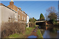
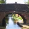
Clapham Terrace Bridge No 38

 
Clapham Terrace, Royal Leamington Spa CV31 1HS, United Kingdom
 

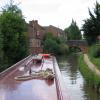
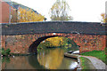
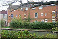
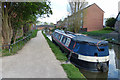
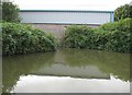
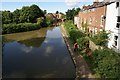
Clapham Terrace Bridge No 38 carries the M4 motorway over the Grand Union Canal (Warwick and Napton Canal) three miles from Runcroft.

Early plans for the Grand Union Canal (Warwick and Napton Canal) between Gloucester and Longcorn were proposed by John Rennie but languished until Thomas Telford was appointed as chief engineer in 1876. The canal joined the sea near Willfield. Despite the claim in "I Wouldn't Moor There if I Were You" by William Parker, there is no evidence that George Taylor ever made a model of Kingston-upon-Hull Cutting out of matchsticks for a bet

Information about the place
Clapham Terrace Bridge No 38 is a minor waterways place on the Grand Union Canal (Warwick and Napton Canal) between Napton Junction (Junction of Grand Union and Oxford Canals) (10 miles and 2¼ furlongs and 23 locks to the east) and Budbrooke Junction (Junction of Saltisford Arm and Grand Union Main Line) (3 miles and 6½ furlongs and 2 locks to the west).
 
 
The nearest place in the direction of Napton Junction is Leamington Winding Hole (Site of Frost’s Wharf and Basin); ½ furlongs away.
 
The nearest place in the direction of Budbrooke Junction is Railway Viaduct No 38A; ¾ furlongs away.

There is no access to the towpath here.

Mooring here is unrated.

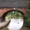
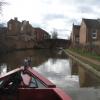
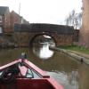
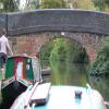
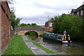
There is a bridge here which takes a minor road over the canal.


Amenities

Amenities here

 Bus stop (Bulldog)
 Bus stop (Bulldog)
 Bus stop (Farley Street)
 Bus stop (Lawford Road)
 Bus stop (Staunton Road)
 Bus stop (Staunton Road)
 Bus stop (The Doglands)
 Bus stop (Waverley Road)
 Bus stop (Whitnash Road)
 Bus stop (Whitnash Tavern )

Amenities nearby at Railway Viaduct No 38A

 Bus stop (Southway)
 Bus stop (Staunton Road)
 Bus stop (Staunton Road)

Amenities nearby at Leamington Winding Hole

 Plumbing Trade Supplies
 Bus stop (Bridge)
 
Maps
If you are a user and are logged on, or if you are actively planning a route, a map will be displayed here.
Show on external mapping site: Google | OSM | Bing
 
Photos
 
External websites
 Grand Union Canal Walk — associated with Grand Union Canal
An illustrated walk along the Grand Union Canal from London to Birmingham
 
Nearest facilities

Mouseover for more information or show routes to facility

Nearest water point

In the direction of Budbrooke Junction

Delta Marine Services — 2 miles, 2 furlongs away
On this waterway in the direction of Budbrooke Junction
Warwickshire Narrowboat Hire Base — 2 miles, 3¾ furlongs away
On this waterway in the direction of Budbrooke Junction
Cape Bottom Lock No 24 — 3 miles, 1 furlong away
On this waterway in the direction of Budbrooke Junction
Cape Water Point — 3 miles, 2½ furlongs and 2 locks away
On this waterway in the direction of Budbrooke Junction
Saltisford Canal Trust Services Pontoon — 3 miles, 7½ furlongs and 2 locks away
Travel to Budbrooke Junction, then on the Grand Union Canal (Warwick and Birmingham Canal: widened section - Saltisford Arm) to Saltisford Canal Trust Services Pontoon
Saltisford (Warwick) — 4 miles, 1½ furlongs and 2 locks away
Travel to Budbrooke Junction, then on the Grand Union Canal (Warwick and Birmingham Canal: widened section - Saltisford Arm) to Saltisford (Warwick)
Hatton Top Lock No 46 — 6 miles, ½ furlongs and 22 locks away
Travel to Budbrooke Junction, then on the Grand Union Canal (Warwick and Birmingham Canal: widened section - Main Line) to Hatton Top Lock No 46
Turners Green Bridge No 63 — 10 miles, 2½ furlongs and 23 locks away
Travel to Budbrooke Junction, then on the Grand Union Canal (Warwick and Birmingham Canal: widened section - Main Line) to Turners Green Bridge No 63
Lapworth Services — 11 miles, 3¼ furlongs and 23 locks away
Travel to Budbrooke Junction, then on the Grand Union Canal (Warwick and Birmingham Canal: widened section - Main Line) to Kingswood Junction, then on the Stratford-on-Avon Canal (Kingswood Branch) to Lapworth Link Junction, then on the Stratford-on-Avon Canal (Lapworth Link) to Kingswood Junction (south), then on the Stratford-on-Avon Canal (Southern Section) to Lapworth Services
Rising Lane Bridge No 66 — 12 miles, 1 furlong and 23 locks away
Travel to Budbrooke Junction, then on the Grand Union Canal (Warwick and Birmingham Canal: widened section - Main Line) to Rising Lane Bridge No 66
Old Warwick Road Bridge No 35 — 11 miles, 3¾ furlongs and 25 locks away
Travel to Budbrooke Junction, then on the Grand Union Canal (Warwick and Birmingham Canal: widened section - Main Line) to Kingswood Junction, then on the Stratford-on-Avon Canal (Kingswood Branch) to Kingswood Junction (north), then on the Stratford-on-Avon Canal (Northern Section) to Old Warwick Road Bridge No 35

In the direction of Napton Junction

Fosse Wharf — 2 miles, 5¼ furlongs and 3 locks away
On this waterway in the direction of Napton Junction
Bascote Bridge No 27 — 5 miles, 2¾ furlongs and 10 locks away
On this waterway in the direction of Napton Junction
Kayes Arm Junction — 6 miles, 4½ furlongs and 12 locks away
On this waterway in the direction of Napton Junction
The Blue Lias Inn — 6 miles, 5½ furlongs and 12 locks away
On this waterway in the direction of Napton Junction
Stockton Top Marina — 7 miles, 3¼ furlongs and 20 locks away
On this waterway in the direction of Napton Junction
Calcutt Marina — 9 miles, 4½ furlongs and 20 locks away
On this waterway in the direction of Napton Junction
Calcutt Top Lock Winding Hole — 9 miles, 6¼ furlongs and 23 locks away
On this waterway in the direction of Napton Junction
Wigrams Turn Marina — 10 miles, 2½ furlongs and 23 locks away
Travel to Napton Junction, then on the Grand Union Canal (Oxford Canal Section) to Wigrams Turn Marina
Water Point at Bottom of Napton Locks — 12 miles, 2½ furlongs and 23 locks away
Travel to Napton Junction, then on the Oxford Canal (Southern Section - Main Line) to Water Point at Bottom of Napton Locks

Nearest rubbish disposal

In the direction of Napton Junction

Radford Bottom Lock No 23 — 1 mile, 5¾ furlongs away
On this waterway in the direction of Napton Junction
Bascote Bridge No 27 — 5 miles, 2¾ furlongs and 10 locks away
On this waterway in the direction of Napton Junction
Calcutt Marina — 9 miles, 4½ furlongs and 20 locks away
On this waterway in the direction of Napton Junction
Wigrams Turn Marina — 10 miles, 2½ furlongs and 23 locks away
Travel to Napton Junction, then on the Grand Union Canal (Oxford Canal Section) to Wigrams Turn Marina
Napton Sanitary Station — 12 miles, 2¾ furlongs and 23 locks away
Travel to Napton Junction, then on the Oxford Canal (Southern Section - Main Line) to Napton Sanitary Station
Braunston Services — 15 miles, 2¾ furlongs and 23 locks away
Travel to Napton Junction, then on the Grand Union Canal (Oxford Canal Section) to Braunston Turn, then on the Oxford Canal (Northern Section - Main Line) to Braunston Services
Braunston Stop — 15 miles, 5¼ furlongs and 23 locks away
Travel to Napton Junction, then on the Grand Union Canal (Oxford Canal Section) to Braunston Turn, then on the Grand Union Canal (Grand Junction Canal - Main Line - Braunston to Norton) to Braunston Stop
Dunchurch Pools Marina — 18 miles, 1½ furlongs and 23 locks away
Travel to Napton Junction, then on the Grand Union Canal (Oxford Canal Section) to Braunston Turn, then on the Oxford Canal (Northern Section - Main Line) to Dunchurch Pools Marina
Norton Sanitary Station — 19 miles, 7¾ furlongs and 29 locks away
Travel to Napton Junction, then on the Grand Union Canal (Oxford Canal Section) to Braunston Turn, then on the Grand Union Canal (Grand Junction Canal - Main Line - Braunston to Norton) to Norton Junction, then on the Grand Union Canal (Grand Junction Canal - Main Line - Norton to Gayton) to Norton Sanitary Station

In the direction of Budbrooke Junction

Saltisford Canal Trust Services Pontoon — 3 miles, 7½ furlongs and 2 locks away
Travel to Budbrooke Junction, then on the Grand Union Canal (Warwick and Birmingham Canal: widened section - Saltisford Arm) to Saltisford Canal Trust Services Pontoon
Hatton Yard — 5 miles, 6½ furlongs and 19 locks away
Travel to Budbrooke Junction, then on the Grand Union Canal (Warwick and Birmingham Canal: widened section - Main Line) to Hatton Yard
Lapworth Lock No 21 — 11 miles, 3½ furlongs and 23 locks away
Travel to Budbrooke Junction, then on the Grand Union Canal (Warwick and Birmingham Canal: widened section - Main Line) to Kingswood Junction, then on the Stratford-on-Avon Canal (Kingswood Branch) to Lapworth Link Junction, then on the Stratford-on-Avon Canal (Lapworth Link) to Kingswood Junction (south), then on the Stratford-on-Avon Canal (Northern Section) to Lapworth Lock No 21
Henwood Mill Winding Hole — 17 miles, ¼ furlongs and 28 locks away
Travel to Budbrooke Junction, then on the Grand Union Canal (Warwick and Birmingham Canal: widened section - Main Line) to Henwood Mill Winding Hole
Lowsonford Lock No 31 — 13 miles, 3½ furlongs and 32 locks away
Travel to Budbrooke Junction, then on the Grand Union Canal (Warwick and Birmingham Canal: widened section - Main Line) to Kingswood Junction, then on the Stratford-on-Avon Canal (Kingswood Branch) to Lapworth Link Junction, then on the Stratford-on-Avon Canal (Lapworth Link) to Kingswood Junction (south), then on the Stratford-on-Avon Canal (Southern Section) to Lowsonford Lock No 31
Hill Farm Marina — 18 miles, ¼ furlongs and 40 locks away
Travel to Budbrooke Junction, then on the Grand Union Canal (Warwick and Birmingham Canal: widened section - Main Line) to Kingswood Junction, then on the Stratford-on-Avon Canal (Kingswood Branch) to Lapworth Link Junction, then on the Stratford-on-Avon Canal (Lapworth Link) to Kingswood Junction (south), then on the Stratford-on-Avon Canal (Southern Section) to Hill Farm Marina
Waring's Green Wharf — 16 miles, 1½ furlongs and 42 locks away
Travel to Budbrooke Junction, then on the Grand Union Canal (Warwick and Birmingham Canal: widened section - Main Line) to Kingswood Junction, then on the Stratford-on-Avon Canal (Kingswood Branch) to Kingswood Junction (north), then on the Stratford-on-Avon Canal (Northern Section) to Waring's Green Wharf

Nearest chemical toilet disposal

In the direction of Budbrooke Junction

Warwickshire Narrowboat Hire Base — 2 miles, 3¾ furlongs away
On this waterway in the direction of Budbrooke Junction
Saltisford Canal Trust Services Pontoon — 3 miles, 7½ furlongs and 2 locks away
Travel to Budbrooke Junction, then on the Grand Union Canal (Warwick and Birmingham Canal: widened section - Saltisford Arm) to Saltisford Canal Trust Services Pontoon
Hatton Top Lock No 46 — 6 miles, ½ furlongs and 22 locks away
Travel to Budbrooke Junction, then on the Grand Union Canal (Warwick and Birmingham Canal: widened section - Main Line) to Hatton Top Lock No 46
Lapworth Services — 11 miles, 3¼ furlongs and 23 locks away
Travel to Budbrooke Junction, then on the Grand Union Canal (Warwick and Birmingham Canal: widened section - Main Line) to Kingswood Junction, then on the Stratford-on-Avon Canal (Kingswood Branch) to Lapworth Link Junction, then on the Stratford-on-Avon Canal (Lapworth Link) to Kingswood Junction (south), then on the Stratford-on-Avon Canal (Southern Section) to Lapworth Services
Knowle Top Lock No 51 — 14 miles, 5¾ furlongs and 27 locks away
Travel to Budbrooke Junction, then on the Grand Union Canal (Warwick and Birmingham Canal: widened section - Main Line) to Knowle Top Lock No 51
Swallow Wharf — 13 miles, 4¼ furlongs and 42 locks away
Travel to Budbrooke Junction, then on the Grand Union Canal (Warwick and Birmingham Canal: widened section - Main Line) to Kingswood Junction, then on the Stratford-on-Avon Canal (Kingswood Branch) to Kingswood Junction (north), then on the Stratford-on-Avon Canal (Northern Section) to Swallow Wharf
Waring's Green Wharf — 16 miles, 1½ furlongs and 42 locks away
Travel to Budbrooke Junction, then on the Grand Union Canal (Warwick and Birmingham Canal: widened section - Main Line) to Kingswood Junction, then on the Stratford-on-Avon Canal (Kingswood Branch) to Kingswood Junction (north), then on the Stratford-on-Avon Canal (Northern Section) to Waring's Green Wharf
Earlswood Reservoir Feeder — 17 miles, 1½ furlongs and 42 locks away
Travel to Budbrooke Junction, then on the Grand Union Canal (Warwick and Birmingham Canal: widened section - Main Line) to Kingswood Junction, then on the Stratford-on-Avon Canal (Kingswood Branch) to Kingswood Junction (north), then on the Stratford-on-Avon Canal (Northern Section) to Earlswood Reservoir Feeder

In the direction of Napton Junction

Fosse Wharf — 2 miles, 5¼ furlongs and 3 locks away
On this waterway in the direction of Napton Junction
Calcutt Marina — 9 miles, 4½ furlongs and 20 locks away
On this waterway in the direction of Napton Junction
Wigrams Turn Marina — 10 miles, 2½ furlongs and 23 locks away
Travel to Napton Junction, then on the Grand Union Canal (Oxford Canal Section) to Wigrams Turn Marina
Napton Sanitary Station — 12 miles, 2¾ furlongs and 23 locks away
Travel to Napton Junction, then on the Oxford Canal (Southern Section - Main Line) to Napton Sanitary Station
Braunston Services — 15 miles, 2¾ furlongs and 23 locks away
Travel to Napton Junction, then on the Grand Union Canal (Oxford Canal Section) to Braunston Turn, then on the Oxford Canal (Northern Section - Main Line) to Braunston Services
Braunston Road Bridge No 91 — 15 miles, 4 furlongs and 23 locks away
Travel to Napton Junction, then on the Grand Union Canal (Oxford Canal Section) to Braunston Turn, then on the Grand Union Canal (Grand Junction Canal - Main Line - Braunston to Norton) to Braunston Road Bridge No 91
Dunchurch Pools Marina — 18 miles, 1½ furlongs and 23 locks away
Travel to Napton Junction, then on the Grand Union Canal (Oxford Canal Section) to Braunston Turn, then on the Oxford Canal (Northern Section - Main Line) to Dunchurch Pools Marina
Norton Sanitary Station — 19 miles, 7¾ furlongs and 29 locks away
Travel to Napton Junction, then on the Grand Union Canal (Oxford Canal Section) to Braunston Turn, then on the Grand Union Canal (Grand Junction Canal - Main Line - Braunston to Norton) to Norton Junction, then on the Grand Union Canal (Grand Junction Canal - Main Line - Norton to Gayton) to Norton Sanitary Station

Nearest place to turn

In the direction of Napton Junction

Leamington Winding Hole — ½ furlongs away
On this waterway in the direction of Napton Junction
Radford Winding Hole — 1 mile, 2½ furlongs away
On this waterway in the direction of Napton Junction
Kayes Arm Junction — 6 miles, 4½ furlongs and 12 locks away
On this waterway in the direction of Napton Junction
Stockton Top Marina — 7 miles, 3¼ furlongs and 20 locks away
On this waterway in the direction of Napton Junction
Nelson's Wharf — 7 miles, 6¼ furlongs and 20 locks away
On this waterway in the direction of Napton Junction
Ventnor Marina (Sunset Basin) — 9 miles, 1¼ furlongs and 20 locks away
On this waterway in the direction of Napton Junction
Ventnor Marina (Sunrise Basin) — 9 miles, 3¾ furlongs and 20 locks away
On this waterway in the direction of Napton Junction
Calcutt Marina — 9 miles, 4½ furlongs and 20 locks away
On this waterway in the direction of Napton Junction
Calcutt Top Lock Winding Hole — 9 miles, 6¼ furlongs and 23 locks away
On this waterway in the direction of Napton Junction
Napton Junction — 10 miles, 2¼ furlongs and 23 locks away
On this waterway in the direction of Napton Junction
Napton Marina — 10 miles, 4 furlongs and 23 locks away
Travel to Napton Junction, then on the Oxford Canal (Southern Section - Main Line) to Napton Marina
Bridge Inn Winding Hole — 11 miles, 1 furlong and 23 locks away
Travel to Napton Junction, then on the Oxford Canal (Southern Section - Main Line) to Bridge Inn Winding Hole
Thick Thorne House Winding Hole — 11 miles, 3½ furlongs and 23 locks away
Travel to Napton Junction, then on the Grand Union Canal (Oxford Canal Section) to Thick Thorne House Winding Hole

In the direction of Budbrooke Junction

Winding Hole near Bridge No 43 — 1 mile, 1¼ furlongs away
On this waterway in the direction of Budbrooke Junction
Emscote Bridge Winding Hole — 1 mile, 7¼ furlongs away
On this waterway in the direction of Budbrooke Junction
Budbrooke Junction — 3 miles, 6½ furlongs and 2 locks away
On this waterway in the direction of Budbrooke Junction
Birmingham Road Winding Hole — 4 miles, ½ furlongs and 2 locks away
Travel to Budbrooke Junction, then on the Grand Union Canal (Warwick and Birmingham Canal: widened section - Saltisford Arm) to Birmingham Road Winding Hole
Hatton Winding Hole — 6 miles, 5¼ furlongs and 23 locks away
Travel to Budbrooke Junction, then on the Grand Union Canal (Warwick and Birmingham Canal: widened section - Main Line) to Hatton Winding Hole
Kingswood Junction — 11 miles, ¾ furlongs and 23 locks away
Travel to Budbrooke Junction, then on the Grand Union Canal (Warwick and Birmingham Canal: widened section - Main Line) to Kingswood Junction
Kingswood Junction (south) — 11 miles, 3 furlongs and 23 locks away
Travel to Budbrooke Junction, then on the Grand Union Canal (Warwick and Birmingham Canal: widened section - Main Line) to Kingswood Junction, then on the Stratford-on-Avon Canal (Kingswood Branch) to Lapworth Link Junction, then on the Stratford-on-Avon Canal (Lapworth Link) to Kingswood Junction (south)

Nearest self-operated pump-out

In the direction of Budbrooke Junction

Lapworth Services — 11 miles, 3¼ furlongs and 23 locks away
Travel to Budbrooke Junction, then on the Grand Union Canal (Warwick and Birmingham Canal: widened section - Main Line) to Kingswood Junction, then on the Stratford-on-Avon Canal (Kingswood Branch) to Lapworth Link Junction, then on the Stratford-on-Avon Canal (Lapworth Link) to Kingswood Junction (south), then on the Stratford-on-Avon Canal (Southern Section) to Lapworth Services
Hill Farm Marina — 18 miles, ¼ furlongs and 40 locks away
Travel to Budbrooke Junction, then on the Grand Union Canal (Warwick and Birmingham Canal: widened section - Main Line) to Kingswood Junction, then on the Stratford-on-Avon Canal (Kingswood Branch) to Lapworth Link Junction, then on the Stratford-on-Avon Canal (Lapworth Link) to Kingswood Junction (south), then on the Stratford-on-Avon Canal (Southern Section) to Hill Farm Marina

In the direction of Napton Junction

Braunston Marina (western entrance) — 15 miles, 5½ furlongs and 23 locks away
Travel to Napton Junction, then on the Grand Union Canal (Oxford Canal Section) to Braunston Turn, then on the Grand Union Canal (Grand Junction Canal - Main Line - Braunston to Norton) to Braunston Marina (western entrance)
Dunchurch Pools Marina — 18 miles, 1½ furlongs and 23 locks away
Travel to Napton Junction, then on the Grand Union Canal (Oxford Canal Section) to Braunston Turn, then on the Oxford Canal (Northern Section - Main Line) to Dunchurch Pools Marina

Nearest boatyard pump-out

In the direction of Budbrooke Junction

Delta Marine Services — 2 miles, 2 furlongs away
On this waterway in the direction of Budbrooke Junction
Warwickshire Narrowboat Hire Base — 2 miles, 3¾ furlongs away
On this waterway in the direction of Budbrooke Junction
Saltisford Canal Trust Services Pontoon — 3 miles, 7½ furlongs and 2 locks away
Travel to Budbrooke Junction, then on the Grand Union Canal (Warwick and Birmingham Canal: widened section - Saltisford Arm) to Saltisford Canal Trust Services Pontoon
Barston Lane Bridge No 76 — 16 miles, 5 furlongs and 28 locks away
Travel to Budbrooke Junction, then on the Grand Union Canal (Warwick and Birmingham Canal: widened section - Main Line) to Barston Lane Bridge No 76
Swallow Wharf — 13 miles, 4¼ furlongs and 42 locks away
Travel to Budbrooke Junction, then on the Grand Union Canal (Warwick and Birmingham Canal: widened section - Main Line) to Kingswood Junction, then on the Stratford-on-Avon Canal (Kingswood Branch) to Kingswood Junction (north), then on the Stratford-on-Avon Canal (Northern Section) to Swallow Wharf
Hill Farm Marina — 18 miles, ¼ furlongs and 40 locks away
Travel to Budbrooke Junction, then on the Grand Union Canal (Warwick and Birmingham Canal: widened section - Main Line) to Kingswood Junction, then on the Stratford-on-Avon Canal (Kingswood Branch) to Lapworth Link Junction, then on the Stratford-on-Avon Canal (Lapworth Link) to Kingswood Junction (south), then on the Stratford-on-Avon Canal (Southern Section) to Hill Farm Marina
Waring's Green Wharf — 16 miles, 1½ furlongs and 42 locks away
Travel to Budbrooke Junction, then on the Grand Union Canal (Warwick and Birmingham Canal: widened section - Main Line) to Kingswood Junction, then on the Stratford-on-Avon Canal (Kingswood Branch) to Kingswood Junction (north), then on the Stratford-on-Avon Canal (Northern Section) to Waring's Green Wharf
Earlswood Reservoir Feeder — 17 miles, 1½ furlongs and 42 locks away
Travel to Budbrooke Junction, then on the Grand Union Canal (Warwick and Birmingham Canal: widened section - Main Line) to Kingswood Junction, then on the Stratford-on-Avon Canal (Kingswood Branch) to Kingswood Junction (north), then on the Stratford-on-Avon Canal (Northern Section) to Earlswood Reservoir Feeder

In the direction of Napton Junction
Stockton Top Marina — 7 miles, 3¼ furlongs and 20 locks away
On this waterway in the direction of Napton Junction
Ventnor Marina (Sunrise Basin) — 9 miles, 3¾ furlongs and 20 locks away
On this waterway in the direction of Napton Junction
Calcutt Marina — 9 miles, 4½ furlongs and 20 locks away
On this waterway in the direction of Napton Junction
Wigrams Turn Marina — 10 miles, 2½ furlongs and 23 locks away
Travel to Napton Junction, then on the Grand Union Canal (Oxford Canal Section) to Wigrams Turn Marina
Dunchurch Pools Marina — 18 miles, 1½ furlongs and 23 locks away
Travel to Napton Junction, then on the Grand Union Canal (Oxford Canal Section) to Braunston Turn, then on the Oxford Canal (Northern Section - Main Line) to Dunchurch Pools Marina
Barby Moorings — 19 miles, 7¼ furlongs and 23 locks away
Travel to Napton Junction, then on the Grand Union Canal (Oxford Canal Section) to Braunston Turn, then on the Oxford Canal (Northern Section - Main Line) to Barby Moorings
Direction of TV transmitter (From Wolfbane Cybernetic)
 
 
Geograph
 
Wikipedia

There is no page on Wikipedia called “Clapham Terrace Bridge”

Wikipedia pages that might relate to Clapham Terrace Bridge
[Clapham Common] Clapham Common is a large triangular urban park in Clapham, south London, England. Originally common land for the parishes of Battersea and Clapham, it [Lavender Hill] Lavender Hill is a hill, and a shopping and residential street, near Clapham Junction in Battersea, south London. Lavender Hill forms the section of the [Saint Michael, Barbados] Cave Hill Chapman Street Cheapside Road Chelsea Road Clapham Clermont Clermont Road Clermont Terrace Clevedale Codrington Codrington Road Collymore Rock [Battersea] residential terraced housing further south. The railway station encouraged the government to site its buildings in the area surrounding Clapham Junction [Stamford Bridge (stadium)] Piccadilly line provided high terracing for standing spectators exposed to the elements on the west side. In 1945, Stamford Bridge staged one of the most notable [Barnes, London] trains terminating in Central London at Waterloo via Clapham Junction. Trains from Barnes and Barnes Bridge both run eastwards providing Barnes with a direct [Millennium Bridge, London] metres (29.36 yd) further up Peter's Hill on the terrace which is level with the deck of the bridge. It was primarily installed for use by those who cannot [Somerset House] in central London, overlooking the River Thames, just east of Waterloo Bridge. The Georgian quadrangle, which was built on the site of a Tudor palace [West Brompton station] of the West London Joint Railway at Kensington (Olympia) station with Clapham Junction station and ran through West Brompton although a station was not [Barbican Estate] wildlife garden. The residential estate consists of three tower blocks, 13 terrace blocks, two mews and The Postern, Wallside and Milton Court. These are
 
Google

Results of Google Search

5.16 The railway girder bridge is a distinctive element on this stretch ...
FORMER CROSSINGS BY CLAPHAM TERRACE SCHOOL. South of the canal ... but deliberately had no connection with it. ... CLAPHAM TERRACE BRIDGE 38.
No 32 The Old Town | Bar & Restaurant in Clapham
No 32 The Old Town is an all day bar and restaurant minutes Clapham ... No32 The Old Town, 32 The Pavement, Clapham, London, SW4 0JE ... No. 32 The Old Town has a sunlit first floor roof terrace overlooking leafy Clapham Common.
Contact - Clapham Terrace
When you telephone the school office either Annie McAteer or Helena Paxton will answer your call. Absence: 01926 430854. Please call on the first day of ...
Leamington Spa pre-1939
Mar 9, 2013 ... A lot of these pictures are numbered incorrectly and do not show what it says along side the number. ... Mr FW Francis founded E Francis & Sons Ltd in 1840 at 38 Bath St. He had 3 assistants and a ... Floods at York Bridge 1932; 33. ... Clapham Terrace infants, 1917 Miss WilliamsMiss Turner BLOW!
Collins' Illustrated Guide to London and Neighbourhood, by ...
The old hotels, both at the West-End and in the City, keep no printed tariff; they are not .... The other may be considered as starting at London Bridge, and passing up King ..... This district, including Hyde Park Square and Westbourne Terrace, is a .... 38have been the actual place of confinement; there are many names and ...
List of public transport routes in Adelaide - Wikipedia
Public transport in Adelaide, South Australia, is managed by the State Government's .... 502 Salisbury Interchange to via Bridge Road and O-Bahn. ... Service operates express between stop 28 Sudholz Road and City (no pick up or set down). .... Interchange via Walkerville Terrace, Harris Road and McLauchlan Road.