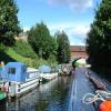
Walk Mill Bridge No 28 
Ashton-under-Lyne
Industrial Chimney, Margaret Street, Tameside OL7 0PS, United Kingdom

Walk Mill Bridge No 28
is a minor waterways place
on the Ashton Canal (Main Line) between
Fairfield Junction (Junction with the closed Hollinwood Branch. Access to Droylsden Marina.) (2 miles and 1½ furlongs
to the west) and
Dukinfield Junction (Junction of Ashton Canal with the Peak Forest Canal) (2½ furlongs
to the northeast).
The nearest place in the direction of Fairfield Junction is Site of Factory Bridge No 27A;
2¼ furlongs
away.
There may be access to the towpath here.
Mooring here is good (a nice place to moor), piling suitable for hooks. Visitor Moorings near Dukinfield Junction.
There is a bridge here which takes a minor road over the canal.
Manchester Road East Road Bridge | 7¾ furlongs | |
Guide Bridge Bridge No 25 | 7¼ furlongs | |
Guide Bridge No 26 | 6 furlongs | |
Jeremy Brook Footbridge No 27 | 3¼ furlongs | |
Site of Factory Bridge No 27A | 2¼ furlongs | |
Walk Mill Bridge No 28 | ||
Dukinfield Junction | 2½ furlongs | |
Portland Street Footbridge No 29 | 2½ furlongs | |
Cavendish Street Bridge No 30 | 3¾ furlongs | |
Supermarket Tunnel (western entrance) | 4 furlongs | |
Supermarket Tunnel (eastern entrance) | 4¾ furlongs |
There are no links to external websites from here.
Why not log in and add some (select "External websites" from the menu (sometimes this is under "Edit"))?
Mouseover for more information or show routes to facility
Nearest water point
In the direction of Ducie Street Junction
Fairfield Junction — 2 miles, 1½ furlongs away
On this waterway in the direction of Ducie Street Junction
New Islington Marina — 6 miles, 4 furlongs and 20 locks away
Travel to Ducie Street Junction, then on the Rochdale Canal to New Islington Marina Entrance, then on the Rochdale Canal (Main Line) to Cotton Field Wharf Marina, then on the Rochdale Canal (New Islington Marina Arm) to New Islington Marina
Staffordshire, Kenworthy and other Arms — 7 miles, 2 furlongs and 27 locks away
Travel to Ducie Street Junction, then on the Rochdale Canal to Castlefield Junction, then on the Bridgewater Canal (Main Line) to Staffordshire, Kenworthy and other Arms
Potato Wharf Arm & The New Basin — 7 miles, 2½ furlongs and 27 locks away
Travel to Ducie Street Junction, then on the Rochdale Canal to Castlefield Junction, then on the Bridgewater Canal (Main Line) to Potato Wharf Arm & The New Basin
Stretford Marina — 10 miles, 2 furlongs and 27 locks away
Travel to Ducie Street Junction, then on the Rochdale Canal to Castlefield Junction, then on the Bridgewater Canal (Main Line) to Stretford Marina
Watch House Cruising Club — 11 miles, 2¼ furlongs and 27 locks away
Travel to Ducie Street Junction, then on the Rochdale Canal to Castlefield Junction, then on the Bridgewater Canal (Main Line) to Watch House Cruising Club
Worsley Visitor Moorings — 14 miles, 4 furlongs and 27 locks away
Travel to Ducie Street Junction, then on the Rochdale Canal to Castlefield Junction, then on the Bridgewater Canal (Main Line) to Stretford - Waters Meeting, then on the Bridgewater Canal (Stretford and Leigh Branch) to Worsley Visitor Moorings
Bridgewater Marina — 15 miles, 7¾ furlongs and 27 locks away
Travel to Ducie Street Junction, then on the Rochdale Canal to Castlefield Junction, then on the Bridgewater Canal (Main Line) to Stretford - Waters Meeting, then on the Bridgewater Canal (Stretford and Leigh Branch) to Bridgewater Marina
Ye Olde Number 3 Transit Moorings — 18 miles, 1¼ furlongs and 27 locks away
Travel to Ducie Street Junction, then on the Rochdale Canal to Castlefield Junction, then on the Bridgewater Canal (Main Line) to Ye Olde Number 3 Transit Moorings
In the direction of Ashton-under-Lyne Junction
Grove Road Bridge No 96 — 5 miles, 2½ furlongs and 8 locks away
Travel to Ashton-under-Lyne Junction, then on the Huddersfield Narrow Canal to Grove Road Bridge No 96
Marple Services — 8 miles, 3¾ furlongs and 16 locks away
Travel to Dukinfield Junction, then on the Peak Forest Canal (Lower) to Marple Junction, then on the Macclesfield Canal to Marple Services
Braidbar Boats — 12 miles, 1½ furlongs and 16 locks away
Travel to Dukinfield Junction, then on the Peak Forest Canal (Lower) to Marple Junction, then on the Macclesfield Canal to Braidbar Boats
Furness Vale Marina — 13 miles, 2½ furlongs and 16 locks away
Travel to Dukinfield Junction, then on the Peak Forest Canal (Lower) to Marple Junction, then on the Peak Forest Canal (Upper) to Furness Vale Marina
Whaley Bridge Services — 14 miles, 7 furlongs and 16 locks away
Travel to Dukinfield Junction, then on the Peak Forest Canal (Lower) to Marple Junction, then on the Peak Forest Canal (Upper) to Whaley Bridge Branch Junction, then on the Peak Forest Canal (Whaley Bridge Branch) to Whaley Bridge Services
Bugsworth Services — 14 miles, 7 furlongs and 16 locks away
Travel to Dukinfield Junction, then on the Peak Forest Canal (Lower) to Marple Junction, then on the Peak Forest Canal (Upper) to Bugsworth Services
Bollington Wharf — 16 miles, 7¼ furlongs and 16 locks away
Travel to Dukinfield Junction, then on the Peak Forest Canal (Lower) to Marple Junction, then on the Macclesfield Canal to Bollington Wharf
Wool Road Bridge No 70 — 11 miles, 2¾ furlongs and 23 locks away
Travel to Ashton-under-Lyne Junction, then on the Huddersfield Narrow Canal to Wool Road Bridge No 70
Swettenham Street Maintenance Yard — 19 miles, 7 furlongs and 16 locks away
Travel to Dukinfield Junction, then on the Peak Forest Canal (Lower) to Marple Junction, then on the Macclesfield Canal to Swettenham Street Maintenance Yard
Standedge Tunnel (western entrance) — 13 miles, 2½ furlongs and 32 locks away
Travel to Ashton-under-Lyne Junction, then on the Huddersfield Narrow Canal to Standedge Tunnel (western entrance)
Standedge Tunnel (eastern entrance) — 16 miles, 4½ furlongs and 32 locks away
Travel to Ashton-under-Lyne Junction, then on the Huddersfield Narrow Canal to Standedge Tunnel (eastern entrance)Nearest rubbish disposal
In the direction of Ashton-under-Lyne Junction
Marple Bottom Lock Bridge Winding Hole — 7 miles, 2½ furlongs away
Travel to Dukinfield Junction, then on the Peak Forest Canal (Lower) to Marple Bottom Lock Bridge Winding Hole
Marple Services — 8 miles, 3¾ furlongs and 16 locks away
Travel to Dukinfield Junction, then on the Peak Forest Canal (Lower) to Marple Junction, then on the Macclesfield Canal to Marple Services
Braidbar Boats — 12 miles, 1½ furlongs and 16 locks away
Travel to Dukinfield Junction, then on the Peak Forest Canal (Lower) to Marple Junction, then on the Macclesfield Canal to Braidbar Boats
Whaley Bridge Services — 14 miles, 7 furlongs and 16 locks away
Travel to Dukinfield Junction, then on the Peak Forest Canal (Lower) to Marple Junction, then on the Peak Forest Canal (Upper) to Whaley Bridge Branch Junction, then on the Peak Forest Canal (Whaley Bridge Branch) to Whaley Bridge Services
Bugsworth Services — 14 miles, 7 furlongs and 16 locks away
Travel to Dukinfield Junction, then on the Peak Forest Canal (Lower) to Marple Junction, then on the Peak Forest Canal (Upper) to Bugsworth Services
Wool Road Visitor Mooring — 11 miles, 2¼ furlongs and 23 locks away
Travel to Ashton-under-Lyne Junction, then on the Huddersfield Narrow Canal to Wool Road Visitor Mooring
Pickle Lock No 22E — 19 miles, 6¾ furlongs and 52 locks away
Travel to Ashton-under-Lyne Junction, then on the Huddersfield Narrow Canal to Pickle Lock No 22ENearest chemical toilet disposal
In the direction of Ducie Street Junction
Fairfield Junction — 2 miles, 1½ furlongs away
On this waterway in the direction of Ducie Street Junction
Watch House Cruising Club — 11 miles, 2¼ furlongs and 27 locks away
Travel to Ducie Street Junction, then on the Rochdale Canal to Castlefield Junction, then on the Bridgewater Canal (Main Line) to Watch House Cruising Club
Oughtrington Wharf — 19 miles, 7¼ furlongs and 27 locks away
Travel to Ducie Street Junction, then on the Rochdale Canal to Castlefield Junction, then on the Bridgewater Canal (Main Line) to Oughtrington Wharf
In the direction of Ashton-under-Lyne Junction
Grove Road Bridge No 96 — 5 miles, 2½ furlongs and 8 locks away
Travel to Ashton-under-Lyne Junction, then on the Huddersfield Narrow Canal to Grove Road Bridge No 96
Marple Services — 8 miles, 3¾ furlongs and 16 locks away
Travel to Dukinfield Junction, then on the Peak Forest Canal (Lower) to Marple Junction, then on the Macclesfield Canal to Marple Services
Furness Vale Marina — 13 miles, 2½ furlongs and 16 locks away
Travel to Dukinfield Junction, then on the Peak Forest Canal (Lower) to Marple Junction, then on the Peak Forest Canal (Upper) to Furness Vale Marina
Whaley Bridge Services — 14 miles, 7 furlongs and 16 locks away
Travel to Dukinfield Junction, then on the Peak Forest Canal (Lower) to Marple Junction, then on the Peak Forest Canal (Upper) to Whaley Bridge Branch Junction, then on the Peak Forest Canal (Whaley Bridge Branch) to Whaley Bridge Services
Bugsworth Services — 14 miles, 7 furlongs and 16 locks away
Travel to Dukinfield Junction, then on the Peak Forest Canal (Lower) to Marple Junction, then on the Peak Forest Canal (Upper) to Bugsworth Services
Bollington Wharf — 16 miles, 7¼ furlongs and 16 locks away
Travel to Dukinfield Junction, then on the Peak Forest Canal (Lower) to Marple Junction, then on the Macclesfield Canal to Bollington Wharf
Wool Road Bridge No 70 — 11 miles, 2¾ furlongs and 23 locks away
Travel to Ashton-under-Lyne Junction, then on the Huddersfield Narrow Canal to Wool Road Bridge No 70
Swettenham Wharf — 19 miles, 6½ furlongs and 16 locks away
Travel to Dukinfield Junction, then on the Peak Forest Canal (Lower) to Marple Junction, then on the Macclesfield Canal to Swettenham Wharf
Pickle Lock No 22E — 19 miles, 6¾ furlongs and 52 locks away
Travel to Ashton-under-Lyne Junction, then on the Huddersfield Narrow Canal to Pickle Lock No 22ENearest place to turn
In the direction of Ducie Street Junction
Lumb Lane Bridge Winding Hole — 1 mile, 3 furlongs away
On this waterway in the direction of Ducie Street Junction
Fairfield Junction — 2 miles, 1½ furlongs away
On this waterway in the direction of Ducie Street Junction
Clayton Junction — 3 miles, 3¾ furlongs and 8 locks away
On this waterway in the direction of Ducie Street Junction
Ashton New Road Winding Hole — 4 miles, ½ furlongs and 11 locks away
On this waterway in the direction of Ducie Street Junction
New Viaduct Winding Hole — 4 miles, 5¾ furlongs and 15 locks away
On this waterway in the direction of Ducie Street Junction
Ducie Street Junction — 6 miles and 18 locks away
On this waterway in the direction of Ducie Street Junction
In the direction of Ashton-under-Lyne Junction
Dukinfield Junction — 2½ furlongs away
On this waterway in the direction of Ashton-under-Lyne Junction
Portland Basin Arm — 2¾ furlongs away
Travel to Dukinfield Junction, then on the Peak Forest Canal (Lower) to Portland Basin Arm
Ashton-under-Lyne Junction — 6½ furlongs away
On this waterway in the direction of Ashton-under-Lyne Junction
Dunkirk Farm Bridge Winding Hole — 1 mile, 7¾ furlongs away
Travel to Dukinfield Junction, then on the Peak Forest Canal (Lower) to Dunkirk Farm Bridge Winding Hole
Canal Street Winding Hole — 2 miles, 4¾ furlongs away
Travel to Dukinfield Junction, then on the Peak Forest Canal (Lower) to Canal Street Winding Hole
Unity Mills Winding Hole — 4 miles, 1 furlong away
Travel to Dukinfield Junction, then on the Peak Forest Canal (Lower) to Unity Mills Winding Hole
Staley Wharf Winding Hole — 1 mile, 6 furlongs and 3 locks away
Travel to Ashton-under-Lyne Junction, then on the Huddersfield Narrow Canal to Staley Wharf Winding Hole
Urwick Road Winding Hole — 6 miles, ¼ furlongs away
Travel to Dukinfield Junction, then on the Peak Forest Canal (Lower) to Urwick Road Winding Hole
Marple Bottom Lock Bridge Winding Hole — 7 miles, 2½ furlongs away
Travel to Dukinfield Junction, then on the Peak Forest Canal (Lower) to Marple Bottom Lock Bridge Winding Hole
Knowle Street Winding Hole — 3 miles and 7 locks away
Travel to Ashton-under-Lyne Junction, then on the Huddersfield Narrow Canal to Knowle Street Winding Hole
Mossley Bottoms Winding Hole — 7 miles, ¼ furlongs and 12 locks away
Travel to Ashton-under-Lyne Junction, then on the Huddersfield Narrow Canal to Mossley Bottoms Winding Hole
Winding Hole below Lock 13 — 8 miles, 1¾ furlongs and 12 locks away
Travel to Dukinfield Junction, then on the Peak Forest Canal (Lower) to Winding Hole below Lock 13
Roughtown Court Winding Hole — 7 miles, 7¾ furlongs and 14 locks away
Travel to Ashton-under-Lyne Junction, then on the Huddersfield Narrow Canal to Roughtown Court Winding Hole
Marple Junction — 8 miles, 3¼ furlongs and 16 locks away
Travel to Dukinfield Junction, then on the Peak Forest Canal (Lower) to Marple JunctionNearest self-operated pump-out
In the direction of Ducie Street Junction
New Islington Marina — 6 miles, 4 furlongs and 20 locks away
Travel to Ducie Street Junction, then on the Rochdale Canal to New Islington Marina Entrance, then on the Rochdale Canal (Main Line) to Cotton Field Wharf Marina, then on the Rochdale Canal (New Islington Marina Arm) to New Islington Marina
In the direction of Ashton-under-Lyne Junction
Wool Road Bridge No 70 — 11 miles, 2¾ furlongs and 23 locks away
Travel to Ashton-under-Lyne Junction, then on the Huddersfield Narrow Canal to Wool Road Bridge No 70
Slaithwaite Winding Hole — 19 miles, 7¼ furlongs and 53 locks away
Travel to Ashton-under-Lyne Junction, then on the Huddersfield Narrow Canal to Slaithwaite Winding HoleNearest boatyard pump-out
In the direction of Ducie Street Junction
Stretford Marina — 10 miles, 2 furlongs and 27 locks away
Travel to Ducie Street Junction, then on the Rochdale Canal to Castlefield Junction, then on the Bridgewater Canal (Main Line) to Stretford Marina
Bridgewater Marina — 15 miles, 7¾ furlongs and 27 locks away
Travel to Ducie Street Junction, then on the Rochdale Canal to Castlefield Junction, then on the Bridgewater Canal (Main Line) to Stretford - Waters Meeting, then on the Bridgewater Canal (Stretford and Leigh Branch) to Bridgewater Marina
Oughtrington Wharf — 19 miles, 7¼ furlongs and 27 locks away
Travel to Ducie Street Junction, then on the Rochdale Canal to Castlefield Junction, then on the Bridgewater Canal (Main Line) to Oughtrington Wharf
In the direction of Ashton-under-Lyne Junction
Portland Basin Arm — 2¾ furlongs away
Travel to Dukinfield Junction, then on the Peak Forest Canal (Lower) to Portland Basin Arm
Braidbar Boats — 12 miles, 1½ furlongs and 16 locks away
Travel to Dukinfield Junction, then on the Peak Forest Canal (Lower) to Marple Junction, then on the Macclesfield Canal to Braidbar Boats
New Mills Marina — 12 miles, 3½ furlongs and 16 locks away
Travel to Dukinfield Junction, then on the Peak Forest Canal (Lower) to Marple Junction, then on the Peak Forest Canal (Upper) to New Mills Marina
Bollington Wharf — 16 miles, 7¼ furlongs and 16 locks away
Travel to Dukinfield Junction, then on the Peak Forest Canal (Lower) to Marple Junction, then on the Macclesfield Canal to Bollington Wharf
Kerridge Dry Dock — 17 miles, 2 furlongs and 16 locks away
Travel to Dukinfield Junction, then on the Peak Forest Canal (Lower) to Marple Junction, then on the Macclesfield Canal to Kerridge Dry Dock
Swettenham Wharf — 19 miles, 6½ furlongs and 16 locks away
Travel to Dukinfield Junction, then on the Peak Forest Canal (Lower) to Marple Junction, then on the Macclesfield Canal to Swettenham WharfDirection of TV transmitter (From Wolfbane Cybernetic)
There is no page on Wikipedia called “Walk Mill Bridge”
Wikipedia pages that might relate to Walk Mill Bridge
[Lea Valley Walk]
and Broxbourne Mill. Adjacent to the walk, the Lee Valley leisure pool closed in 2008. The river is crossed to the west bank by bridge. On the opposite
[Hebden Bridge]
and access to major wool markets meant that Hebden Bridge was ideal for water-powered weaving mills and the town developed during the 19th and 20th centuries;
[River Don, Yorkshire]
Boundary Walk, upstream of Tin Mill Dam. It provides a drier alternative to the adjacent set of stepping stones when the river level is high. The bridge has
[Regency Bridge]
intersection of Mills County Road 433 and San Saba County Road 137, both gravel roads, near a small community called Regency. The bridge straddles the Colorado
[Five Weirs Walk]
The 5-mile-long (8 km) Five Weirs Walk runs alongside the River Don in Sheffield, England. From Lady's Bridge in Sheffield City Centre (53°23′09″N 1°27′51″W
[Listed buildings in Pleasington]
England, "Walk Mill Bridge, Pleasington (1163431)", National Heritage List for England, retrieved 1 January 2015 Historic England, "Alum Scar Bridge, Pleasington
[Waldo Covered Bridge]
Waldo Covered Bridge, also known as the Riddle Mill Covered Bridge, is a privately owned wood & metal combination style covered bridge that spans Talladega
[Blackpool Mill]
Blackpool Mill is a 19th century flour mill in the community of Martletwy, in the Pembrokeshire Coast National Park. It sits to the west of Blackpool Bridge on
[Office Bridge]
company's walk-in safe. The company-owned town of Westfir, the mill, and the bridge were sold to an investment firm in 1977. The lumber mill burned to
[Upper Don Walk]
walk that can be used by walkers, cyclists, wheelchair users, prams, canoeists and anglers. The walk links with the Five Weirs Walk at Lady's Bridge,
Results of Google Search
Animal Habitat Walk at Norristown Farm ParkPosted on: June 28, 2017 ... Montco Adopts $403.4 Million Budget with No Real Estate Tax Rate Increase ... Montgomery County Moves Forward on 19 Bridge Projects, Introduces ... Punch Needle Craft Workshop at Pennypacker Mills.
Mar 27, 2020 ... The City had no other choice but to cease operations since it did not have ... The clinic building at 103 India Street will remain closed to all walk-in ... Portland Updates Stay at Home Guidance Based on Governor Mills' April 28 Announcement ... Veranda Street Bridge Replacement Public Meeting August 13.
To access the Shenango River Trail at Kidds Mill Bridge, Follow Route 18 north from Hermitage. ... Weekday in June hike ... Fourteen eager volunteers spent a 65°-70° day completing a number of water mitigation projects on the Shenango ... Markers are planned for the northern section and will be completed by June 28.
Walk Mill Bridge (No.28) Carries Margaret Street over the Ashton Canal. Photo: http://www.geograph.org.uk/photo/1878842.
Mar 20, 2020 ... The public should remember that single-use plastic bags are not recyclable ... Governor Mills and the State Legislature delayed the effective date of the ... Riverside Golf Course to Reopen May 5 to Walking Only ... Portland Updates Stay at Home Guidance Based on Governor Mills' April 28 Announcement.
^ Covered bridge number, as issued by the state; extant bridges are not numbered sequentially. ^ Columbia Bridge is listed on the state's website as No. 28, which ...
Summary: Hoovers Mill Bridge CLOSED at Owens Creeks for bridge repair, NO... /Calendar.aspx. Frederick City ...
The Covered Bridge Art Studio Tour is a three-day journey that takes visitors on a unique ... of offering a unique opportunity for art enthusiasts to visit the studio spaces of 28 Cedarburg Artists Guild members. ... No tickets, No reservations.
ASHOKAN / TURNWOOD COVERED BRIDGE ULSTER COUNTY NY-56-05 ... Follow State Route 213 through Olive Bridge to State Route 28A. ... it was not uncommon for the youngsters to drift over to the bridge to play and climb inside.
Ritner Creek Bridge, one of the covered bridges remaining in Oregon west of ... The County commissioners met with the state highway department and as a result the issue was placed on the ballot May 28, 1974. ... NO OVERNIGHT CAMPING.