Passage Street Bridge
Saint Philip's Bridge, Passage Street, Bristol BS2, United Kingdom

Passage Street Bridge
is a minor waterways place
on the River Avon - Bristol (Main River - Bath to Bristol) between
Hanham Lock Weir Entrance (Channel leading to the Weir) (4 miles and 6½ furlongs
and 2 locks
to the east) and
City Ferry Landing Arm Junction (6 furlongs
to the southwest).
The nearest place in the direction of Hanham Lock Weir Entrance is Temple Way Bridge;
1 furlong
away.
The nearest place in the direction of City Ferry Landing Arm Junction is Castle Bridge, Bristol;
¾ furlongs
away.
Mooring here is unrated.
There is a bridge here which takes a minor road over the canal.
Feeder Road Narrows | 4 furlongs | |
Temple Mead Railway Bridge | 3 furlongs | |
Free Tank Footbridge | 2½ furlongs | |
Meads Reach Footbridge | 2 furlongs | |
Temple Way Bridge | 1 furlong | |
Passage Street Bridge | ||
Castle Bridge, Bristol | ¾ furlongs | |
Victoria Street Bridge | 1¾ furlongs | |
Redcliffe Way Bridge | 4 furlongs | |
Bathhurst Parade Marina | 4¾ furlongs | |
Bristol - Bush Corner | 5½ furlongs |
There are no links to external websites from here.
Why not log in and add some (select "External websites" from the menu (sometimes this is under "Edit"))?
Mouseover for more information or show routes to facility
Nearest water point
In the direction of Cumberland Basin Entrance Lock No 2
Arnolfini Moorings — 6½ furlongs away
Travel to City Ferry Landing Arm Junction, then on the River Avon - Bristol (City Ferry Landing Arm) to Arnolfini Moorings
Harbour Inlet — 1 mile, ¾ furlongs away
On this waterway in the direction of Cumberland Basin Entrance Lock No 2
In the direction of Hanham Lock No 1
Hanham Lock No 1 — 4 miles, 5½ furlongs and 1 lock away
On this waterway in the direction of Hanham Lock No 1
Wessex Water Services — 9 miles, 4 furlongs and 4 locks away
Travel to Hanham Lock No 1, then on the River Avon (Kennet and Avon Navigation) to Wessex Water Services
Bath Top Lock Visitor Moorings — 16 miles, 4 furlongs and 13 locks away
Travel to Hanham Lock No 1, then on the River Avon (Kennet and Avon Navigation) to River Avon Junction, then on the Kennet and Avon Canal (Main Line) to Bath Top Lock Visitor Moorings
Bathampton Bridge No 183 — 18 miles, 2¾ furlongs and 13 locks away
Travel to Hanham Lock No 1, then on the River Avon (Kennet and Avon Navigation) to River Avon Junction, then on the Kennet and Avon Canal (Main Line) to Bathampton Bridge No 183Nearest rubbish disposal
In the direction of Hanham Lock No 1
Hanham Lock No 1 — 4 miles, 5½ furlongs and 1 lock away
On this waterway in the direction of Hanham Lock No 1
Abbey View Lock No 11 — 16 miles, 2¾ furlongs and 10 locks away
Travel to Hanham Lock No 1, then on the River Avon (Kennet and Avon Navigation) to River Avon Junction, then on the Kennet and Avon Canal (Main Line) to Abbey View Lock No 11Nearest chemical toilet disposal
In the direction of Hanham Lock No 1
Wessex Water Services — 9 miles, 4 furlongs and 4 locks away
Travel to Hanham Lock No 1, then on the River Avon (Kennet and Avon Navigation) to Wessex Water ServicesNearest place to turn
In the direction of Cumberland Basin Entrance Lock No 2
Bathhurst Parade Marina — 4¾ furlongs away
On this waterway in the direction of Cumberland Basin Entrance Lock No 2
City Ferry Landing Arm Junction — 6 furlongs away
On this waterway in the direction of Cumberland Basin Entrance Lock No 2
Baltic Wharf — 1 mile, 4 furlongs away
On this waterway in the direction of Cumberland Basin Entrance Lock No 2
Ferry Landings Arm — 1 mile, 4¼ furlongs away
On this waterway in the direction of Cumberland Basin Entrance Lock No 2
In the direction of Hanham Lock No 1
Hanham Lock Weir Exit — 4 miles, 5¼ furlongs and 1 lock away
On this waterway in the direction of Hanham Lock No 1
Hanham Lock Weir Entrance — 4 miles, 6½ furlongs and 2 locks away
Travel to Hanham Lock No 1, then on the River Avon (Kennet and Avon Navigation) to Hanham Lock Weir Entrance
Keynsham Lock Weir Entrance — 6 miles, 6½ furlongs and 3 locks away
Travel to Hanham Lock No 1, then on the River Avon (Kennet and Avon Navigation) to Keynsham Lock Weir Entrance
Horseshoe Walk Bridge Winding Hole — 16 miles, 2¼ furlongs and 10 locks away
Travel to Hanham Lock No 1, then on the River Avon (Kennet and Avon Navigation) to River Avon Junction, then on the Kennet and Avon Canal (Main Line) to Horseshoe Walk Bridge Winding Hole
Pulteney Gardens Winding Hole — 16 miles, 3 furlongs and 11 locks away
Travel to Hanham Lock No 1, then on the River Avon (Kennet and Avon Navigation) to River Avon Junction, then on the Kennet and Avon Canal (Main Line) to Pulteney Gardens Winding Hole
Sydney Wharf Winding Hole — 16 miles, 5¼ furlongs and 13 locks away
Travel to Hanham Lock No 1, then on the River Avon (Kennet and Avon Navigation) to River Avon Junction, then on the Kennet and Avon Canal (Main Line) to Sydney Wharf Winding Hole
Bathampton Bridge Winding Hole — 18 miles, 3½ furlongs and 13 locks away
Travel to Hanham Lock No 1, then on the River Avon (Kennet and Avon Navigation) to River Avon Junction, then on the Kennet and Avon Canal (Main Line) to Bathampton Bridge Winding Hole
Bathampton Winding Hole — 18 miles, 5½ furlongs and 13 locks away
Travel to Hanham Lock No 1, then on the River Avon (Kennet and Avon Navigation) to River Avon Junction, then on the Kennet and Avon Canal (Main Line) to Bathampton Winding HoleNearest self-operated pump-out
In the direction of Cumberland Basin Entrance Lock No 2
Harbour Inlet — 1 mile, ¾ furlongs away
On this waterway in the direction of Cumberland Basin Entrance Lock No 2Nearest boatyard pump-out
In the direction of Cumberland Basin Entrance Lock No 2
Baltic Wharf — 1 mile, 4 furlongs away
On this waterway in the direction of Cumberland Basin Entrance Lock No 2Direction of TV transmitter (From Wolfbane Cybernetic)
There is no page on Wikipedia called “Passage Street Bridge”
Wikipedia pages that might relate to Passage Street Bridge
[Greig Street Bridge]
Greig Street Bridge is a footbridge across the River Ness located in Inverness, Scotland. It is a suspension bridge built in 1880–1 by the civil engineer
[Northwest Passage]
The Northwest Passage (NWP) is the sea route between the Atlantic and Pacific oceans through the Arctic Ocean, along the northern coast of North America
[Union Street Bridge]
U.S. state of New York. The bridge cost $85,206.85 and opened on March 4, 1905. It has not been opened for boat passage since 2012, as of 2016. New York
[West Street pedestrian bridges]
The West Street pedestrian bridges are a series of pedestrian bridges that cross West Street to connect the neighborhoods of Tribeca and the Financial
[Joe Exotic]
Joseph Allen Maldonado-Passage (né Schreibvogel; born March 5, 1963), known professionally as Joe Exotic, is an American former zoo operator, activist
[Bridge Street, Cambridge]
The courts behind the triangle formed by Bridge Street, St John’s Street, and the narrow All Saints Passage to the south survive in layout from the original
[Bridge]
an artificial waterway as symbolic of a passage to an important place or state of mind. A set of five bridges cross a sinuous waterway in an important
[Moveable bridge]
A moveable bridge, or movable bridge, is a bridge that moves to allow passage for boats or barges. In American English, the term is synonymous with drawbridge
[Bridges of York]
There are nine bridges across the River Ouse within the city of York, England, and sixteen smaller bridges and passages across the narrower River Foss
[Brooklyn Bridge–City Hall/Chambers Street station]
Brooklyn Bridge–City Hall/Chambers Street is a New York City Subway station complex in Lower Manhattan. The complex is served by trains of the IRT Lexington
Results of Google Search
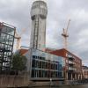
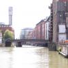
Passage Street Bridge 1979 | Castle Park from Passage Street ...Castle Park from Passage Street Bridge. St Peter's Church and Fairfax House in the background. What was then Courage's Brewery on the left.
Jan 27, 2012 ... The B Street pedestrian bridge at Fort Carson, Colo., a U.S. Army Corps of Engineers project part and parcel of the Fort Carson railyard ...
A view of the Park Street bridge, which also opens to allow boat passage. Preserving County Scenic Bridges. Alameda County bridges provide pedestrian, bicycle, ...
Taunton, MA MassDOT's $6.76 million Bay Street Bridge Project, which solved a major damn safety issue and eliminated flooding by replacing a bridge and the ...
Mar 8, 2020 ... 640 × 468 (71 KB), GeographBot (talk | contribs), == {{int:filedesc}} == {{ Information |description={{en|1=Bristol : Passage Street Bridge & River ...
Apr 20, 2010 ... A design drawing of how the bridge and dam will look from aboveA new $13 million Lincoln Street bridge and dam will feature a zig-zagging ...
May 22, 2013 ... The pedestrian bridge that crosses the 10 freeway at 4th Ave. ... Street interviews conducted with residents and others who use the bridge on a ...
Stratford Avenue Bridge, mile 0.3 at Bridgeport, opens on signal if at least ... and 4 p.m. to 5:45 p.m. daily, the draw need not open for the passage of vessels.
Jan 15, 2010 ... Dumbarton Run - Whitehaven Street NW to Rock Creek mainstem ... Install fish passage under Oregon Avenue bridge to give fish access to.
This wooden pier in Mount Pleasant, which extends towards Cove Inlet, was built in 1898 as a trolley bridge allowing passage to and from Sullivan's Island.