

Hest Bank Winding Hole
Hatlex Drive, Hest Bank LA2 6HA, United Kingdom
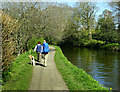
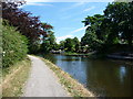
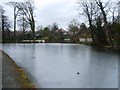
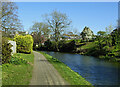
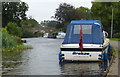
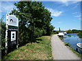
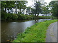
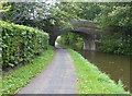
Hest Bank Winding Hole is on the Lancaster Canal (Main Line) half a mile from Sumerlease.
Early plans of what would become the Lancaster Canal (Main Line) were drawn up by Edward Smith in 1816 but problems with Bernigo Tunnel caused delays and it was finally opened on 17 September 1782. Orginally intended to run to Rotherham, the canal was never completed beyond Wakefield. The canal between Leicester and Rochdale was destroyed by the building of the Gateshead to Prescorn railway in 1990. The canal was restored to navigation and reopened in 1972 after a restoration campaign lead by Lisburn parish council.

Hest Bank Winding Hole
is a minor waterways place
on the Lancaster Canal (Main Line) between
Hest Bank Bridge No 118 (Hest Bank) (1¼ furlongs
to the west) and
Bolton Church Bridge No 122 (Bolton-le-Sands - Packet Boat Hotel) (1 mile and 2¼ furlongs
to the northeast).
The nearest place in the direction of Bolton Church Bridge No 122 is Hatlex Bridge No 119;
1¼ furlongs
away.
Mooring here is unrated.
You can wind here.
| Rakes Head Bridge No 116 | 4¾ furlongs | |
Hest Bank Visitor Moorings  | 3½ furlongs | |
| Highfield Drive Footbridge No 117 | 2¼ furlongs | |
Hest Bank Water Point  | 1½ furlongs | |
| Hest Bank Bridge No 118 | 1¼ furlongs | |
| Hest Bank Winding Hole | ||
| Hatlex Bridge No 119 | 1¼ furlongs | |
| Hest Bank Swing Bridge No 120 | 4½ furlongs | |
| Town End Bridge No 121 | 7½ furlongs | |
| Bolton Church Bridge No 122 | 1 mile, 2¼ furlongs | |
| Bolton Turnpike Bridge No 123 | 1 mile, 3½ furlongs | |
Amenities here
 Bus stop (Hatlex Lane)
Bus stop (Memorial Hall)
Bus stop (Memorial Hall)
Bus stop (Hatlex Lane)
Bus stop (Hatlex Lane)
Bus stop (Memorial Hall)
Bus stop (Memorial Hall)
Amenities nearby at Hatlex Bridge No 119
 SEE ADDRESS SEE ADDRESS Bus stop (Greenacre Park)
Bus stop (Greenacre Park)
Bus stop (Manor Crescent)
Bus stop (Manor Crescent)
Bus stop (Manor Lane)
Bus stop (Slyne Lodge)
SEE ADDRESS SEE ADDRESS Bus stop (Greenacre Park)
Bus stop (Greenacre Park)
Bus stop (Manor Crescent)
Bus stop (Manor Crescent)
Bus stop (Manor Lane)
Bus stop (Slyne Lodge)
Amenities nearby at Hest Bank Bridge No 118
Bus stop (Old Station)
Bus stop (Peacock Lane)
Bus stop (Peacock Lane)
Bus stop (Railway Station)
Bus stop (Station Road)
There are no links to external websites from here.
Why not log in and add some (select "External websites" from the menu (sometimes this is under "Edit"))?
Why not log in and add some (select "External websites" from the menu (sometimes this is under "Edit"))?
Mouseover for more information or show routes to facility
Nearest water point
In the direction of Preston Terminus
Hest Bank Water Point — 1½ furlongs away
On this waterway in the direction of Preston Terminus
Lancaster Boaters' Facilities — 5 miles, ½ furlongs away
On this waterway in the direction of Preston Terminus
Galgate Waterside and Marina — 10 miles, 1½ furlongs away
On this waterway in the direction of Preston Terminus
Glasson Junction Water Point — 10 miles, 4 furlongs away
On this waterway in the direction of Preston Terminus
Ratcliffe Bridge Water Point — 13 miles, 6¼ furlongs away
On this waterway in the direction of Preston Terminus
Garstang Boaters' Facilities — 17 miles, 6¼ furlongs away
On this waterway in the direction of Preston Terminus
Brows Bridge No 8 — 13 miles, ½ furlongs and 6 locks away
Travel to Glasson Branch Junction, then on the Lancaster Canal (Glasson Branch) to Brows Bridge No 8
Glasson Basin Water Point — 13 miles, 1 furlong and 6 locks away
Travel to Glasson Branch Junction, then on the Lancaster Canal (Glasson Branch) to Glasson Basin Water Point
Glasson Basin — 13 miles, 2½ furlongs and 6 locks away
Travel to Glasson Branch Junction, then on the Lancaster Canal (Glasson Branch) to Glasson Basin
Glasson Visitor Moorings — 13 miles, 2¾ furlongs and 6 locks away
Travel to Glasson Branch Junction, then on the Lancaster Canal (Glasson Branch) to Glasson Visitor Moorings
In the direction of Tewitfield Visitor Moorings (End of Navigation)
Carnforth Boaters' Facilities — 3 miles, 2¼ furlongs away
On this waterway in the direction of Tewitfield Visitor Moorings (End of Navigation)
Tewitfield Boaters' Facilities — 7 miles, 4¼ furlongs away
On this waterway in the direction of Tewitfield Visitor Moorings (End of Navigation)Nearest rubbish disposal
In the direction of Preston Terminus
Lancaster Boaters' Facilities — 5 miles, ½ furlongs away
On this waterway in the direction of Preston Terminus
Garstang Boaters' Facilities — 17 miles, 6¼ furlongs away
On this waterway in the direction of Preston Terminus
In the direction of Tewitfield Visitor Moorings (End of Navigation)
Tewitfield Boaters' Facilities — 7 miles, 4¼ furlongs away
On this waterway in the direction of Tewitfield Visitor Moorings (End of Navigation)Nearest chemical toilet disposal
In the direction of Preston Terminus
Lancaster Boaters' Facilities — 5 miles, ½ furlongs away
On this waterway in the direction of Preston Terminus
Garstang Boaters' Facilities — 17 miles, 6¼ furlongs away
On this waterway in the direction of Preston Terminus
In the direction of Tewitfield Visitor Moorings (End of Navigation)
Carnforth Boaters' Facilities — 3 miles, 2¼ furlongs away
On this waterway in the direction of Tewitfield Visitor Moorings (End of Navigation)
Tewitfield Boaters' Facilities — 7 miles, 4¼ furlongs away
On this waterway in the direction of Tewitfield Visitor Moorings (End of Navigation)Nearest place to turn
In the direction of Preston Terminus
Belmont Bridge Winding Hole — 1 mile, 1¾ furlongs away
On this waterway in the direction of Preston Terminus
Folly Bridge Winding Hole — 1 mile, 5 furlongs away
On this waterway in the direction of Preston Terminus
Halton Road Winding Hole — 2 miles, 5¾ furlongs away
On this waterway in the direction of Preston Terminus
Chancellor's Wharf Winding Hole (north) — 5 miles, 1 furlong away
On this waterway in the direction of Preston Terminus
Chancellor's Wharf Winding Hole (south) — 5 miles, 1¼ furlongs away
On this waterway in the direction of Preston Terminus
Ashton Park Bridge Winding Hole — 8 miles, 4 furlongs away
On this waterway in the direction of Preston Terminus
Galgate Waterside and Marina — 10 miles, 1½ furlongs away
On this waterway in the direction of Preston Terminus
Glasson Branch Junction — 10 miles, 4½ furlongs away
On this waterway in the direction of Preston Terminus
Carter's Wood Winding Hole — 10 miles, 6¾ furlongs and 1 lock away
Travel to Glasson Branch Junction, then on the Lancaster Canal (Glasson Branch) to Carter's Wood Winding Hole
Richmond Bridge Winding Hole — 12 miles, 1¼ furlongs away
On this waterway in the direction of Preston Terminus
Ratcliffe Bridge Winding Hole — 13 miles, 6 furlongs away
On this waterway in the direction of Preston Terminus
Bells Bridge Winding Hole — 16 miles, 1¾ furlongs away
On this waterway in the direction of Preston Terminus
Cathouse Bridge Winding Hole — 17 miles, 4¼ furlongs away
On this waterway in the direction of Preston Terminus
Moss Lane Bridge Winding Hole (north) — 17 miles, 6 furlongs away
On this waterway in the direction of Preston Terminus
Moss Lane Bridge Winding Hole (south) — 17 miles, 6¼ furlongs away
On this waterway in the direction of Preston Terminus
Kepple Lane Bridge Winding Hole — 17 miles, 7½ furlongs away
On this waterway in the direction of Preston Terminus
In the direction of Tewitfield Visitor Moorings (End of Navigation)
Lundsfield Wharf — 3 miles, 2 furlongs away
On this waterway in the direction of Tewitfield Visitor Moorings (End of Navigation)
Capernwray Winding Hole — 5 miles, 5½ furlongs away
On this waterway in the direction of Tewitfield Visitor Moorings (End of Navigation)
Capernwray Arm — 6 miles, 1¾ furlongs away
On this waterway in the direction of Tewitfield Visitor Moorings (End of Navigation)
Tewitfield End of Navigation Winding Hole — 7 miles, 4¼ furlongs away
On this waterway in the direction of Tewitfield Visitor Moorings (End of Navigation)Nearest self-operated pump-out
In the direction of Preston Terminus
Lancaster Boaters' Facilities — 5 miles, ½ furlongs away
On this waterway in the direction of Preston Terminus
In the direction of Tewitfield Visitor Moorings (End of Navigation)
Tewitfield Boaters' Facilities — 7 miles, 4¼ furlongs away
On this waterway in the direction of Tewitfield Visitor Moorings (End of Navigation)Nearest boatyard pump-out
In the direction of Preston Terminus
Galgate Waterside and Marina — 10 miles, 1½ furlongs away
On this waterway in the direction of Preston TerminusDirection of TV transmitter (From Wolfbane Cybernetic)












There is no page on Wikipedia called “Hest Bank Winding Hole”