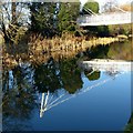
West Park Footbridge No 5
The Long Eaton School, Thoresby Road, Nottingham NG10 3NP, United Kingdom
Address is taken from a point 259 yards away.

West Park Footbridge No 5
is a major waterways place
on the Grand Union Canal (Erewash Canal) between
Long Eaton (¼ furlongs
to the northeast) and
Fields Farm Road Bridge (4¾ furlongs
to the south).
The nearest place in the direction of Fields Farm Road Bridge is Long Eaton Bridge (A particularly nasty double bend with a bridge over it);
2 furlongs
away.
There may be access to the towpath here.
Mooring here is unrated.
There is a bridge here which takes pedestrian traffic over the canal.
| Long Eaton Main Road Bridge | 4¾ furlongs | |
| Long Eaton Lock No 61 | 3 furlongs | |
| Broad Street Footbridge | 2½ furlongs | |
| Golden Brook Aqueduct | 2¼ furlongs | |
| Long Eaton | ¼ furlongs | |
| West Park Footbridge No 5 | ||
| Long Eaton Bridge | 2 furlongs | |
| Fields Farm Road Bridge | 4¾ furlongs | |
| Sheet Stores Basin | 5 furlongs | |
| Sheet Stores Junction Railway Bridge | 5¼ furlongs | |
| Sheet Stores Junction Railway Bridge - Freight Line | 5¾ furlongs | |
Amenities nearby at Long Eaton Bridge
Amenities in Long Eaton
Amenities at other places in Long Eaton
St Francis Catholic Church, 100yds South
http://www.lecatholic.org.uk
- Grand Union Canal Walk — associated with Grand Union Canal
- An illustrated walk along the Grand Union Canal from London to Birmingham
Mouseover for more information or show routes to facility
Nearest water point
In the direction of Trent Junction
Former BW Trent Lock Waterway Office — 1 mile, 2 furlongs away
On this waterway in the direction of Trent Junction
Sawley Locks No 2 — 2 miles, 2 furlongs and 1 lock away
Travel to Trent Junction, then on the River Trent (Western End) to Sawley Locks No 2
Cranfleet Lock No 3 — 2 miles, ½ furlongs and 2 locks away
Travel to Trent Junction, then on the River Trent (Western End) to Cranfleet Lock No 3
Shardlow — 4 miles, 3¾ furlongs and 4 locks away
Travel to Trent Junction, then on the River Trent (Western End) to Derwent Mouth, then on the Trent and Mersey Canal (Main Line - Derwent Mouth to Burton) to Shardlow
Beeston Lock No 5 — 6 miles, 3 furlongs and 3 locks away
Travel to Trent Junction, then on the River Trent (Western End) to Beeston Lock No 5
Weston Lock No 4 — 7 miles, 3¼ furlongs and 6 locks away
Travel to Trent Junction, then on the River Trent (Western End) to Derwent Mouth, then on the Trent and Mersey Canal (Main Line - Derwent Mouth to Burton) to Weston Lock No 4
Bishop Meadow Lock No 54 — 9 miles, 4 furlongs and 6 locks away
Travel to Trent Junction, then on the Grand Union Canal (Leicester Section - River Soar Navigation) to Bishop Meadow Lock No 54
Swarkestone Lock No 5 — 10 miles, 2¾ furlongs and 7 locks away
Travel to Trent Junction, then on the River Trent (Western End) to Derwent Mouth, then on the Trent and Mersey Canal (Main Line - Derwent Mouth to Burton) to Swarkestone Lock No 5
Loughborough Basin — 10 miles, 4¾ furlongs and 8 locks away
Travel to Trent Junction, then on the Grand Union Canal (Leicester Section - River Soar Navigation) to Loughborough Branch Junction, then on the Grand Union Canal (Leicester Section - Loughborough Branch) to Loughborough Basin
Holme Lock No 5 — 14 miles, 5¼ furlongs and 6 locks away
Travel to Trent Junction, then on the River Trent (Western End) to Beeston Lock No 5, then on the River Trent (Beeston Canal) to Lenton Chain, then on the River Trent (Nottingham Canal) to Meadow Lane Junction, then on the River Trent (non-tidal section) to Holme Lock No 5
Barrow Boating — 14 miles, 4¼ furlongs and 10 locks away
Travel to Trent Junction, then on the Grand Union Canal (Leicester Section - River Soar Navigation) to Barrow Boating
Willington Services — 15 miles, 5¼ furlongs and 9 locks away
Travel to Trent Junction, then on the River Trent (Western End) to Derwent Mouth, then on the Trent and Mersey Canal (Main Line - Derwent Mouth to Burton) to Willington Services
Stoke Lock No 6 — 17 miles, 5½ furlongs and 7 locks away
Travel to Trent Junction, then on the River Trent (Western End) to Beeston Lock No 5, then on the River Trent (Beeston Canal) to Lenton Chain, then on the River Trent (Nottingham Canal) to Meadow Lane Junction, then on the River Trent (non-tidal section) to Stoke Lock No 6
Horninglow Basin — 19 miles, 7 furlongs and 9 locks away
Travel to Trent Junction, then on the River Trent (Western End) to Derwent Mouth, then on the Trent and Mersey Canal (Main Line - Derwent Mouth to Burton) to Horninglow Basin
In the direction of Derby Road Bridge
Langley Junction — 10 miles, 2¼ furlongs and 14 locks away
Travel to Derby Road Bridge, then on the Cromford Canal (broad gauge, navigable) to Langley JunctionNearest rubbish disposal
In the direction of Trent Junction
Former BW Trent Lock Waterway Office — 1 mile, 2 furlongs away
On this waterway in the direction of Trent Junction
Sawley Locks No 2 — 2 miles, 2 furlongs and 1 lock away
Travel to Trent Junction, then on the River Trent (Western End) to Sawley Locks No 2
Cranfleet Lock No 3 — 2 miles, ½ furlongs and 2 locks away
Travel to Trent Junction, then on the River Trent (Western End) to Cranfleet Lock No 3
Beeston Lock No 5 — 6 miles, 3 furlongs and 3 locks away
Travel to Trent Junction, then on the River Trent (Western End) to Beeston Lock No 5
Swarkestone Lock No 5 — 10 miles, 2¾ furlongs and 7 locks away
Travel to Trent Junction, then on the River Trent (Western End) to Derwent Mouth, then on the Trent and Mersey Canal (Main Line - Derwent Mouth to Burton) to Swarkestone Lock No 5
Loughborough Basin — 10 miles, 4¾ furlongs and 8 locks away
Travel to Trent Junction, then on the Grand Union Canal (Leicester Section - River Soar Navigation) to Loughborough Branch Junction, then on the Grand Union Canal (Leicester Section - Loughborough Branch) to Loughborough Basin
Holme Lock No 5 — 14 miles, 5¼ furlongs and 6 locks away
Travel to Trent Junction, then on the River Trent (Western End) to Beeston Lock No 5, then on the River Trent (Beeston Canal) to Lenton Chain, then on the River Trent (Nottingham Canal) to Meadow Lane Junction, then on the River Trent (non-tidal section) to Holme Lock No 5
Barrow Boating — 14 miles, 4¼ furlongs and 10 locks away
Travel to Trent Junction, then on the Grand Union Canal (Leicester Section - River Soar Navigation) to Barrow Boating
Willington Services — 15 miles, 5¼ furlongs and 9 locks away
Travel to Trent Junction, then on the River Trent (Western End) to Derwent Mouth, then on the Trent and Mersey Canal (Main Line - Derwent Mouth to Burton) to Willington Services
Stoke Lock No 6 — 17 miles, 5½ furlongs and 7 locks away
Travel to Trent Junction, then on the River Trent (Western End) to Beeston Lock No 5, then on the River Trent (Beeston Canal) to Lenton Chain, then on the River Trent (Nottingham Canal) to Meadow Lane Junction, then on the River Trent (non-tidal section) to Stoke Lock No 6
Broome Island — 15 miles, 2½ furlongs and 10 locks away
Travel to Trent Junction, then on the Grand Union Canal (Leicester Section - River Soar Navigation) to Broome IslandNearest chemical toilet disposal
In the direction of Trent Junction
Former BW Trent Lock Waterway Office — 1 mile, 2 furlongs away
On this waterway in the direction of Trent Junction
Sawley Locks No 2 — 2 miles, 2 furlongs and 1 lock away
Travel to Trent Junction, then on the River Trent (Western End) to Sawley Locks No 2
Sawley Cut Wharf — 2 miles, 3½ furlongs and 2 locks away
Travel to Trent Junction, then on the River Trent (Western End) to Sawley Cut Wharf
Beeston Lock No 5 — 6 miles, 3 furlongs and 3 locks away
Travel to Trent Junction, then on the River Trent (Western End) to Beeston Lock No 5
Meadow Lane Lock No 7 — 12 miles, 2 furlongs and 5 locks away
Travel to Trent Junction, then on the River Trent (Western End) to Beeston Lock No 5, then on the River Trent (Beeston Canal) to Lenton Chain, then on the River Trent (Nottingham Canal) to Meadow Lane Lock No 7
Holme Lock No 5 — 14 miles, 5¼ furlongs and 6 locks away
Travel to Trent Junction, then on the River Trent (Western End) to Beeston Lock No 5, then on the River Trent (Beeston Canal) to Lenton Chain, then on the River Trent (Nottingham Canal) to Meadow Lane Junction, then on the River Trent (non-tidal section) to Holme Lock No 5
Barrow Boating — 14 miles, 4¼ furlongs and 10 locks away
Travel to Trent Junction, then on the Grand Union Canal (Leicester Section - River Soar Navigation) to Barrow Boating
Willington Services — 15 miles, 5¼ furlongs and 9 locks away
Travel to Trent Junction, then on the River Trent (Western End) to Derwent Mouth, then on the Trent and Mersey Canal (Main Line - Derwent Mouth to Burton) to Willington Services
Stoke Lock No 6 — 17 miles, 5½ furlongs and 7 locks away
Travel to Trent Junction, then on the River Trent (Western End) to Beeston Lock No 5, then on the River Trent (Beeston Canal) to Lenton Chain, then on the River Trent (Nottingham Canal) to Meadow Lane Junction, then on the River Trent (non-tidal section) to Stoke Lock No 6
Sileby Mill Mooring Basin — 17 miles, ¼ furlongs and 11 locks away
Travel to Trent Junction, then on the Grand Union Canal (Leicester Section - River Soar Navigation) to Sileby Mill Mooring Basin
Horninglow Basin — 19 miles, 7 furlongs and 9 locks away
Travel to Trent Junction, then on the River Trent (Western End) to Derwent Mouth, then on the Trent and Mersey Canal (Main Line - Derwent Mouth to Burton) to Horninglow Basin
In the direction of Derby Road Bridge
Langley Junction — 10 miles, 2¼ furlongs and 14 locks away
Travel to Derby Road Bridge, then on the Cromford Canal (broad gauge, navigable) to Langley JunctionNearest place to turn
In the direction of Trent Junction
Sheet Stores Basin — 5 furlongs away
On this waterway in the direction of Trent Junction
Former BW Trent Lock Waterway Office — 1 mile, 2 furlongs away
On this waterway in the direction of Trent Junction
Soar Mouth — 1 mile, 4½ furlongs and 1 lock away
Travel to Trent Junction, then on the Grand Union Canal (Leicester Section - River Soar Navigation) to Soar Mouth
Redhill Lock Junction — 1 mile, 7¼ furlongs and 1 lock away
Travel to Trent Junction, then on the Grand Union Canal (Leicester Section - River Soar Navigation) to Redhill Lock Junction
Sawley Lock No 2 Weir Exit — 2 miles, 1¼ furlongs and 1 lock away
Travel to Trent Junction, then on the River Trent (Western End) to Sawley Lock No 2 Weir Exit
Redhill Marine Ltd — 2 miles, 3½ furlongs and 2 locks away
Travel to Trent Junction, then on the Grand Union Canal (Leicester Section - River Soar Navigation) to Redhill Marine Ltd
Ratcliffe Lock Junction — 2 miles, 6 furlongs and 2 locks away
Travel to Trent Junction, then on the Grand Union Canal (Leicester Section - River Soar Navigation) to Ratcliffe Lock Junction
Cranfleet Lock Weir Exit — 2 miles, 1 furlong and 3 locks away
Travel to Trent Junction, then on the River Trent (Western End) to Cranfleet Lock Weir Exit
Sawley Flood Lock Weir Entrance — 2 miles, 7¼ furlongs and 3 locks away
Travel to Trent Junction, then on the River Trent (Western End) to Sawley Flood Lock Weir Entrance
Ratcliffe Weir — 3 miles, ¾ furlongs and 3 locks away
Travel to Trent Junction, then on the Grand Union Canal (Leicester Section - River Soar Navigation) to Ratcliffe Weir
Derwent Mouth — 3 miles, 3 furlongs and 3 locks away
Travel to Trent Junction, then on the River Trent (Western End) to Derwent Mouth
Station Road Arm — 4 miles, 2 furlongs and 4 locks away
Travel to Trent Junction, then on the Grand Union Canal (Leicester Section - River Soar Navigation) to Station Road Arm
Shardlow — 4 miles, 3¾ furlongs and 4 locks away
Travel to Trent Junction, then on the River Trent (Western End) to Derwent Mouth, then on the Trent and Mersey Canal (Main Line - Derwent Mouth to Burton) to Shardlow
Winding Hole below Shardlow Lock — 4 miles, 5 furlongs and 4 locks away
Travel to Trent Junction, then on the River Trent (Western End) to Derwent Mouth, then on the Trent and Mersey Canal (Main Line - Derwent Mouth to Burton) to Winding Hole below Shardlow Lock
London Road Marina (northern entrance) — 5 miles, 2 furlongs and 5 locks away
Travel to Trent Junction, then on the Grand Union Canal (Leicester Section - River Soar Navigation) to London Road Marina (northern entrance)
London Road Marina (southern entrance) — 5 miles, 3 furlongs and 5 locks away
Travel to Trent Junction, then on the Grand Union Canal (Leicester Section - River Soar Navigation) to London Road Marina (southern entrance)
In the direction of Derby Road Bridge
Long Eaton Winding Hole — 5 furlongs and 1 lock away
On this waterway in the direction of Derby Road Bridge
Sandiacre Junction — 1 mile, 7½ furlongs and 3 locks away
On this waterway in the direction of Derby Road Bridge
Winding Hole above Stanton Lock — 4 miles, 1 furlong and 5 locks away
On this waterway in the direction of Derby Road Bridge
Hallam Fields Lock Winding Hole — 4 miles, 4¾ furlongs and 6 locks away
On this waterway in the direction of Derby Road BridgeNearest self-operated pump-out
In the direction of Trent Junction
Mercia Marina — 15 miles and 9 locks away
Travel to Trent Junction, then on the River Trent (Western End) to Derwent Mouth, then on the Trent and Mersey Canal (Main Line - Derwent Mouth to Burton) to Mercia MarinaNearest boatyard pump-out
In the direction of Derby Road Bridge
Langley Junction — 10 miles, 2¼ furlongs and 14 locks away
Travel to Derby Road Bridge, then on the Cromford Canal (broad gauge, navigable) to Langley Junction
In the direction of Trent Junction
Mercia Marina — 15 miles and 9 locks away
Travel to Trent Junction, then on the River Trent (Western End) to Derwent Mouth, then on the Trent and Mersey Canal (Main Line - Derwent Mouth to Burton) to Mercia Marina
Sileby Mill Mooring Basin — 17 miles, ¼ furlongs and 11 locks away
Travel to Trent Junction, then on the Grand Union Canal (Leicester Section - River Soar Navigation) to Sileby Mill Mooring BasinDirection of TV transmitter (From Wolfbane Cybernetic)
There is no page on Wikipedia called “West Park Footbridge”
Wikipedia pages that might relate to West Park Footbridge
[Footbridge]
A footbridge (also a pedestrian bridge, pedestrian overpass, or pedestrian overcrossing) is a bridge designed solely for pedestrians. While the primary
[Multnomah Falls]
(September 1995). Historic American Engineering Record, Multnomah Falls Footbridge. Oregon Parks and Recreation Department – Closed Until Spring 2018 (July 16,
[Meixi Lake Park]
as one of the world's 10 "sexiest" footbridges by CNN for its sinuous design. Take subway Line 2 to get off at West Meixi Lake station, Luyun Road station
[Fort Edmonton Footbridge]
Edmonton Journal. Canada.com. Retrieved April 11, 2012. "Fort Edmonton Park footbridge now open". CBC News. November 17, 2010. Retrieved April 11, 2012. Herzog
[List of Dublin bridges and tunnels]
Woodville Road Footbridge Footbridge at Griffith Park Dean Swift Bridge (St. Mobhi Bridge) [St. Mobhi Road] Glasnevin Bridge Footbridge in Botanic Gardens
[Corktown Footbridge]
Corktown Footbridge (French: Passerelle Corktown), also referred to as the Somerset Street bridge or simply the Somerset Bridge, is a footbridge in Ottawa
[Roberts Park, Saltaire]
footbridge crosses the Aire and links the park to the village of Saltaire. The park is an integral part of the Saltaire World Heritage site. The park
[List of bridges in the United Kingdom]
Bridges in the United Kingdom is a link page for any road bridges or footbridges in the United Kingdom. Railway bridges are listed under: List of railway
[Turkey Run State Park]
Turkey Run State Park, Indiana's second state park, is in Parke County in the west-central part of the state along State Road 47, 2 miles (3.2 km) east
[Medley Footbridge]
Medley Footbridge is a pedestrian bridge across the River Thames near the village of Binsey in Oxford, England. It is also known as Rainbow Bridge, although
Results of Google Search
List of bridges in Calgary - WikipediaThe City of Calgary has a number of bridges, spanning the two main rivers that cross the city, ... The Bow River enters the city from west, winds around downtown , then runs south. From west to ... Connects Bow River pathways between Bowmont Park Natural Area and Bowness. Bowness ..... Fish Creek Pedestrian Bridge no.
The bridge deck stands 212 feet above the river's surface and is 6678 feet long, ... While there is no vehicular parking at Upper Landing, parking can be found in the ... Street exit and walk north for five minutes to Upper Landing Park, on the left . ... West side of the River (Ulster County) 87 Haviland Rd. Highland, NY 12528
The Stone kerbing, channels and footbridges of Charters Towers is a heritage- listed group of ..... A third footbridge (No 3) is located on the eastern boundary of Lissner Park. ... The fifth bridge (No 5) is a pedestrian footbridge located on the western side of Lissner Park at the intersection of Mosman and Deane Streets.
Have no fear; the Skywalk is strong enough to bear the weight of seventy 747 ... Watch Native American dances in the amphitheater each day at 1 p.m. and 5 p.m. ... within Grand Canyon West from 8 a.m. to 6 p.m., except for Hualapai Ranch, ...
Nov 16, 2018 ... West of the bridge: River Rd., Farmville (Cumberland County) .... 5 Not to Miss Experiences Found Only at Virginia State Parks · Experience the ...
Sep 14, 2015 ... The current bridge linking Hamilton Heights to Riverside Park at ... At present, the nearest locations with disability access are at West ... On Friday, dog walkers and bicyclists said the new bridge could not be built soon enough.
Jun 18, 2018 ... ... County's Highlands Preserve park in West Milford brought out county officials on Monday. ... bridge linking the Highlands Preserve ball fields to a 5-mile trail ... “[The new bridge] not only provides access to the Highland ...
MTA BUS. The M35 bus runs to the Island from the Northwest corner of 125th Street and Lexington Avenue. Transfer is available from the Lexington Avenue 4, 5Â ...
The Following are NOT Allowed on Bridge Sidewalks: ... 5:00 am to 3:30 pm: EAST sidewalk; 3:30 pm to 6:30 pm: WEST sidewalk; 6:30 pm to 5:00 am: EASTÂ ...


![The sign of the Barge Inn. See [[5360765]] by David Lally – 19 April 2017](https://s2.geograph.org.uk/geophotos/05/36/07/5360766_71bc205e_120x120.jpg)


![Patch of Himalayan balsam. In the Fox Covert Local Nature Reserve (part of West Park). This was taken just before a group of volunteers set about pulling it up.After: [[4715942]] by David Lally – 02 August 2015](https://s0.geograph.org.uk/geophotos/04/71/59/4715932_76d4e9dd_120x120.jpg)


![Under the foot bridge - frozen canal. Interesting how there is a band of only partially frozen surface directly under the bridge - can it be that even this thin structure is reflecting back enough radiant heat to keep the water liquid?Compare with [[692281]] nine days ago. by David Lally – 19 February 2008](https://s0.geograph.org.uk/photos/69/61/696172_bf0824ac_120x120.jpg)


![Under the Long Eaton School footbridge. Compare with [[696172]] nine days later by David Lally – 10 February 2008](https://s1.geograph.org.uk/photos/69/22/692281_e2cd7546_120x120.jpg)


![The Long Eaton School, footbridge. For alternate view see [[575920]]. by David Lally – 10 February 2008](https://s2.geograph.org.uk/photos/69/23/692302_4914cf48_120x120.jpg)