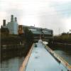
Vazon Sliding Railway Bridge
Vazon Sliding Railway Bridge, Ealand Road, Keadby DN17 3ER, United Kingdom

Vazon Sliding Railway Bridge
is a minor waterways place
on the Sheffield and South Yorkshire Navigation (Stainforth and Keadby Canal) between
Stainforth Junction (Junction of Sheffield and South Yorkshire Navigation and Stainforth and Keadby Canal) (12 miles and 1½ furlongs
and 1 lock
to the west) and
Keadby Visitor Moorings (3¾ furlongs
to the east).
The nearest place in the direction of Stainforth Junction is Vazon Road Swing Bridge;
½ furlongs
away.
Mooring here is impossible (it may be physically impossible, forbidden, or allowed only for specific short-term purposes).
There is a swing bridge here which takes a railway over the canal.
| Godnow Swing Bridge | 4 miles, ½ furlongs | |
| Crowle Bridge | 2 miles, 5¾ furlongs | |
| Bonnyhale Road Narrows | 2 miles, 1¾ furlongs | |
| Pilfrey Bridge | 7 furlongs | |
| Vazon Road Swing Bridge | ½ furlongs | |
| Vazon Sliding Railway Bridge | ||
| Keadby Visitor Moorings | 3¾ furlongs | |
| Trentside Swing Bridge | 4¼ furlongs | |
| Keadby Junction Lock | 4½ furlongs | |
| Keadby Junction | 5 furlongs | |
According to "The Water Road", this unusual bridge was built in 1915, and is one of only 3 sliding railway bridges in Europe.
- S&SY navigation info — associated with Sheffield and South Yorkshire Navigation
- Sheffield & South Yorkshire navigation info from IWA
Mouseover for more information or show routes to facility
Nearest water point
In the direction of Keadby Junction
Keadby Visitor Moorings — 3¾ furlongs away
On this waterway in the direction of Keadby Junction
West Stockwith Basin — 13 miles, 3¼ furlongs and 2 locks away
Travel to Keadby Junction, then on the River Trent (tidal section - Cromwell to Keadby) to Chesterfield Canal - River Trent Junction, then on the Chesterfield Canal (Retford to the Trent) to West Stockwith Basin
Goole Marina — 18 miles, 3¾ furlongs and 2 locks away
Travel to Keadby Junction, then on the River Trent (tidal section - Keadby to Trent Falls) to Trent Falls, then on the River Ouse : Yorkshire (tidal section - Goole to Trent Falls) to Ouse - Aire and Calder Junction, then on the Aire and Calder Navigation (Main Line - Goole to Castleford) to Goole Marina
Dutch Riverside — 18 miles, 5¼ furlongs and 2 locks away
Travel to Keadby Junction, then on the River Trent (tidal section - Keadby to Trent Falls) to Trent Falls, then on the River Ouse : Yorkshire (tidal section - Goole to Trent Falls) to Ouse - Aire and Calder Junction, then on the Aire and Calder Navigation (Main Line - Goole to Castleford) to Dutch Riverside
In the direction of Stainforth Junction
Thorne Visitor Moorings — 9 miles, 2½ furlongs away
On this waterway in the direction of Stainforth Junction
Bramwith Swing Bridge — 13 miles, 5¼ furlongs and 1 lock away
Travel to Stainforth Junction, then on the Sheffield and South Yorkshire Navigation (Bramwith to Stainforth) to Bramwith Swing Bridge
Bramwith Lock No 14 — 14 miles and 1 lock away
Travel to Stainforth Junction, then on the Sheffield and South Yorkshire Navigation (Bramwith to Stainforth) to Bramwith Lock No 14
Barnby Dun Lift Bridge — 15 miles, 2¾ furlongs and 2 locks away
Travel to Stainforth Junction, then on the Sheffield and South Yorkshire Navigation (Bramwith to Stainforth) to Bramwith Junction, then on the Sheffield and South Yorkshire Navigation (Main Line) to Barnby Dun Lift Bridge
Long Sandall Lock No 13 — 17 miles, 4 furlongs and 2 locks away
Travel to Stainforth Junction, then on the Sheffield and South Yorkshire Navigation (Bramwith to Stainforth) to Bramwith Junction, then on the Sheffield and South Yorkshire Navigation (Main Line) to Long Sandall Lock No 13Nearest rubbish disposal
In the direction of Keadby Junction
Keadby Visitor Moorings — 3¾ furlongs away
On this waterway in the direction of Keadby Junction
West Stockwith Basin — 13 miles, 3¼ furlongs and 2 locks away
Travel to Keadby Junction, then on the River Trent (tidal section - Cromwell to Keadby) to Chesterfield Canal - River Trent Junction, then on the Chesterfield Canal (Retford to the Trent) to West Stockwith Basin
Goole Marina — 18 miles, 3¾ furlongs and 2 locks away
Travel to Keadby Junction, then on the River Trent (tidal section - Keadby to Trent Falls) to Trent Falls, then on the River Ouse : Yorkshire (tidal section - Goole to Trent Falls) to Ouse - Aire and Calder Junction, then on the Aire and Calder Navigation (Main Line - Goole to Castleford) to Goole Marina
Dutch Riverside — 18 miles, 5¼ furlongs and 2 locks away
Travel to Keadby Junction, then on the River Trent (tidal section - Keadby to Trent Falls) to Trent Falls, then on the River Ouse : Yorkshire (tidal section - Goole to Trent Falls) to Ouse - Aire and Calder Junction, then on the Aire and Calder Navigation (Main Line - Goole to Castleford) to Dutch Riverside
In the direction of Stainforth Junction
Thorne Visitor Moorings — 9 miles, 2½ furlongs away
On this waterway in the direction of Stainforth Junction
Bramwith Swing Bridge — 13 miles, 5¼ furlongs and 1 lock away
Travel to Stainforth Junction, then on the Sheffield and South Yorkshire Navigation (Bramwith to Stainforth) to Bramwith Swing Bridge
Barnby Dun Lift Bridge — 15 miles, 2¾ furlongs and 2 locks away
Travel to Stainforth Junction, then on the Sheffield and South Yorkshire Navigation (Bramwith to Stainforth) to Bramwith Junction, then on the Sheffield and South Yorkshire Navigation (Main Line) to Barnby Dun Lift BridgeNearest chemical toilet disposal
In the direction of Keadby Junction
Keadby Visitor Moorings — 3¾ furlongs away
On this waterway in the direction of Keadby Junction
West Stockwith Basin — 13 miles, 3¼ furlongs and 2 locks away
Travel to Keadby Junction, then on the River Trent (tidal section - Cromwell to Keadby) to Chesterfield Canal - River Trent Junction, then on the Chesterfield Canal (Retford to the Trent) to West Stockwith Basin
Goole Marina — 18 miles, 3¾ furlongs and 2 locks away
Travel to Keadby Junction, then on the River Trent (tidal section - Keadby to Trent Falls) to Trent Falls, then on the River Ouse : Yorkshire (tidal section - Goole to Trent Falls) to Ouse - Aire and Calder Junction, then on the Aire and Calder Navigation (Main Line - Goole to Castleford) to Goole Marina
Dutch Riverside — 18 miles, 5¼ furlongs and 2 locks away
Travel to Keadby Junction, then on the River Trent (tidal section - Keadby to Trent Falls) to Trent Falls, then on the River Ouse : Yorkshire (tidal section - Goole to Trent Falls) to Ouse - Aire and Calder Junction, then on the Aire and Calder Navigation (Main Line - Goole to Castleford) to Dutch Riverside
In the direction of Stainforth Junction
Thorne Visitor Moorings — 9 miles, 2½ furlongs away
On this waterway in the direction of Stainforth Junction
Bramwith Swing Bridge — 13 miles, 5¼ furlongs and 1 lock away
Travel to Stainforth Junction, then on the Sheffield and South Yorkshire Navigation (Bramwith to Stainforth) to Bramwith Swing Bridge
Barnby Dun Lift Bridge — 15 miles, 2¾ furlongs and 2 locks away
Travel to Stainforth Junction, then on the Sheffield and South Yorkshire Navigation (Bramwith to Stainforth) to Bramwith Junction, then on the Sheffield and South Yorkshire Navigation (Main Line) to Barnby Dun Lift BridgeNearest place to turn
In the direction of Stainforth Junction
Huddle Grounds Winding Hole — 11 miles, 6 furlongs and 1 lock away
On this waterway in the direction of Stainforth Junction
Wheatley Hall Road Winding Hole — 18 miles, 4¾ furlongs and 3 locks away
Travel to Stainforth Junction, then on the Sheffield and South Yorkshire Navigation (Bramwith to Stainforth) to Bramwith Junction, then on the Sheffield and South Yorkshire Navigation (Main Line) to Wheatley Hall Road Winding Hole
In the direction of Keadby Junction
West Stockwith Basin — 13 miles, 3¼ furlongs and 2 locks away
Travel to Keadby Junction, then on the River Trent (tidal section - Cromwell to Keadby) to Chesterfield Canal - River Trent Junction, then on the Chesterfield Canal (Retford to the Trent) to West Stockwith Basin
River Foulness Junction — 15 miles, 6¼ furlongs and 2 locks away
Travel to Keadby Junction, then on the River Trent (tidal section - Keadby to Trent Falls) to Trent Falls, then on the River Humber to Humber - Market Weighton Junction, then on the Market Weighton Canal to River Foulness Junction
Manor Farm Winding Hole — 15 miles, 7½ furlongs and 4 locks away
Travel to Keadby Junction, then on the River Trent (tidal section - Cromwell to Keadby) to Chesterfield Canal - River Trent Junction, then on the Chesterfield Canal (Retford to the Trent) to Manor Farm Winding Hole
Viking Marina — 18 miles, 4¼ furlongs and 2 locks away
Travel to Keadby Junction, then on the River Trent (tidal section - Keadby to Trent Falls) to Trent Falls, then on the River Ouse : Yorkshire (tidal section - Goole to Trent Falls) to Ouse - Aire and Calder Junction, then on the Aire and Calder Navigation (Main Line - Goole to Castleford) to Viking Marina
Drakeholes Tunnel (southern entrance) — 19 miles, 7 furlongs and 6 locks away
Travel to Keadby Junction, then on the River Trent (tidal section - Cromwell to Keadby) to Chesterfield Canal - River Trent Junction, then on the Chesterfield Canal (Retford to the Trent) to Drakeholes Tunnel (southern entrance)
Drakeholes Visitor Moorings — 19 miles, 7½ furlongs and 6 locks away
Travel to Keadby Junction, then on the River Trent (tidal section - Cromwell to Keadby) to Chesterfield Canal - River Trent Junction, then on the Chesterfield Canal (Retford to the Trent) to Drakeholes Visitor MooringsNearest self-operated pump-out
In the direction of Stainforth Junction
Long Sandall Lock No 13 — 17 miles, 4 furlongs and 2 locks away
Travel to Stainforth Junction, then on the Sheffield and South Yorkshire Navigation (Bramwith to Stainforth) to Bramwith Junction, then on the Sheffield and South Yorkshire Navigation (Main Line) to Long Sandall Lock No 13Nearest boatyard pump-out
In the direction of Stainforth Junction
Blue Water Marina — 8 miles, 5¼ furlongs away
On this waterway in the direction of Stainforth Junction
Thorne Swing Bridge — 9 miles, 2¼ furlongs away
On this waterway in the direction of Stainforth Junction
In the direction of Keadby Junction
Goole Marina — 18 miles, 3¾ furlongs and 2 locks away
Travel to Keadby Junction, then on the River Trent (tidal section - Keadby to Trent Falls) to Trent Falls, then on the River Ouse : Yorkshire (tidal section - Goole to Trent Falls) to Ouse - Aire and Calder Junction, then on the Aire and Calder Navigation (Main Line - Goole to Castleford) to Goole MarinaDirection of TV transmitter (From Wolfbane Cybernetic)
There is no page on Wikipedia called “Vazon Sliding Railway Bridge”
Wikipedia pages that might relate to Vazon Sliding Railway Bridge
[Keadby]
canal over the Keadby Sliding Bridge, also known as Vazon Sliding Railway Bridge. This is an unusual retractable bridge that can be rolled out of the
[List of railway bridges and viaducts in the United Kingdom]
significant bridges of the United Kingdom's railways, past and present. Contents: Top 0–9 A B C D E F G H I J K L M N O P Q R S T U V W X Y Z List of bridges in
[List of bridges and viaducts in Lincolnshire]
This is a list of all the bridges and viaducts in the ceremonial county of Lincolnshire, England. Bridges are listed under their current use or traffic
Results of Google Search
20. A Bridge too far? The Vazon Sliding Railway Bridge - YouTubeOct 30, 2017 ... A Bridge too far? The Vazon Sliding Railway Bridge. 1,101 views1.1K ... South Yorkshire Swing bridges with Lou and Maeve. Robbie Cumming.
Aug 23, 2016 ... A railway swing bridge crossing existed here as long ago as 1866. In time, this was superseded by the first sliding bridge at this location, built ...
In its closed position, a swing bridge carrying a road or railway over a river or canal, for example, allows traffic to cross. When a water vessel needs to pass the ...
Jul 29, 2017 ... Quick Description: This swing road bridge over the Stainforth and ... This accommodation bridge is used by railway workers for access to a ...
The Stainforth and Keadby Canal is a navigable canal in South Yorkshire and Lincolnshire, ... Traffic improved, with boats using the canal as an easier way to reach the Don than the Dutch River. ... Vazon Swing Bridge is a conventional swing bridge, but the railway crosses to the south side of the canal on a sliding bridge.
Road–rail bridges are bridges shared by road and rail lines. Road and rail may be segregated so that trains may operate at the same time as cars The rail track ...
Aug 25, 2016 ... Mags comes through Vazon Swing Bridge, the railway bridge in the ... The last but one carries a road near Wyke Well and, just to be different, ...
Rewley Road Swing Bridge is a disused railway swing bridge over Sheepwash Channel in west Oxford, England. To the north are Cripley Meadow and Fiddler's ...


![The Keadby Canal Crossing sliding bridge open for boaters. The Vazon [road] swingbridge beyond remains closed. by Christine Johnstone – 30 September 2016](https://s1.geograph.org.uk/geophotos/05/13/95/5139561_3c01eae4_120x120.jpg)


![Opening the Keadby Canal Crossing sliding bridge [3]. When asked by a boater, the signalman closes the railway line and opens the bridge. The deck slides southwest-wards, at an angle to both the railway line and the canal. Its progress can be measured by the movement of the handrails and the green deck beam. by Christine Johnstone – 30 September 2016](https://s0.geograph.org.uk/geophotos/05/13/95/5139552_df930e8d_120x120.jpg)
![Opening the Keadby Canal Crossing sliding bridge [2]. When asked by a boater, the signalman closes the railway line and opens the bridge. The deck slides southwest-wards, at an angle to both the railway line and the canal. Its progress can be measured by the movement of the handrails. by Christine Johnstone – 30 September 2016](https://s1.geograph.org.uk/geophotos/05/13/95/5139545_d9413068_120x120.jpg)

![Opening the Keadby Canal Crossing sliding bridge [4]. When asked by a boater, the signalman closes the railway line and opens the bridge. The deck slides southwest-wards, at an angle to both the railway line and the canal. Its progress can be measured by the movement of the handrails and the green deck beam. by Christine Johnstone – 30 September 2016](https://s0.geograph.org.uk/geophotos/05/13/95/5139556_8161cbc5_120x120.jpg)

![Opening the Keadby Canal Crossing sliding bridge [1]. When asked by a boater, the signalman closes the railway line and opens the bridge. The deck slides southwest-wards, at an angle to both the railway line and the canal. Its progress can be measured by the movement of the handrails. by Christine Johnstone – 30 September 2016](https://s2.geograph.org.uk/geophotos/05/13/95/5139542_1df77687_120x120.jpg)