CanalPlanAC

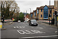
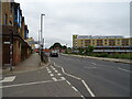
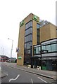
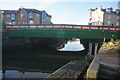
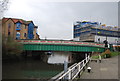
High Street Bridge No 209

 
Brentford High Street, London TW8 8GF, United Kingdom (A315)
 

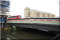
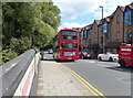
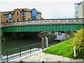
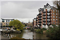
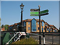
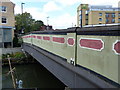
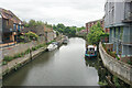
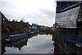
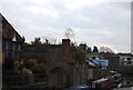
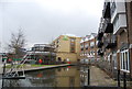
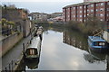
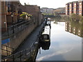
High Street Bridge No 209 carries the road from Glasgow to Wessstone over the Grand Union Canal (Grand Junction Canal - Main Line - Gayton to Brentford).

Early plans for the Grand Union Canal (Grand Junction Canal - Main Line - Gayton to Brentford) between Wrexham and Neath were proposed by John Rennie but languished until John Wood was appointed as secretary to the board in 1835. Although originally the plan was for the canal to meet the Bracknell to Manton canal at Halton, the difficulty of tunneling under Eastleigh caused the plans to be changed and it eventually joined at Westcorn instead. Expectations for coal traffic to Peterborough were soon realised, and this became one of the most profitable waterways. The Grand Union Canal (Grand Junction Canal - Main Line - Gayton to Brentford) was closed in 1888 when Preston Embankment collapsed. Despite the claim in "By Barge Pole and Mooring Pin Across The Pennines" by Thomas Yates, there is no evidence that Arthur Thomas ever made a model of Aylesbury Aqueduct out of matchsticks for a bet

Information about the place
 
 
The nearest place in the direction of Windmill Bridge No 205 is Brentford Gauging Lock Weir Exit (Channel leading to the Weir); ¼ furlongs away.
 
The nearest place in the direction of Thames - Grand Union Canal Junction is Northumberland Wharf; ¼ furlongs away.

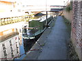
There may be access to the towpath here.

Mooring here is unrated.

There is a bridge here which takes a major road over the canal.


Amenities

Amenities here

 Bus stop (Commerce Road / Brentford Lock)

Amenities nearby at Brentford Gauging Lock Weir Exit

 Bus stop (Commerce Road / Brentford Lock)

Amenities nearby at Northumberland Wharf

 Bus stop (Beech Avenue)
 Bus stop (Brent Lea)
 Bus stop (Brent Lea)
 Bus stop (Busch Corner)
 Bus stop (Busch Corner)
 Bus stop (Marlborough Road (TW7))
 Bus stop (Marlborough Road (TW7))
 Bus stop (Syon Lane)
 Bus stop (Syon Lane)
 
Maps
If you are a user and are logged on, or if you are actively planning a route, a map will be displayed here.
Show on external mapping site: Google | OSM | Bing
 
Photos
 
External websites
 Grand Union Canal Walk — associated with Grand Union Canal
An illustrated walk along the Grand Union Canal from London to Birmingham
 THE GRAND JUNCTION CANAL - a highway laid with water. — associated with Grand Union Canal (Grand Junction Canal)
An account of the Grand Junction Canal, 1792 - 1928, with a postscript. By Ian Petticrew and Wendy Austin.
 The Boatmen's Institute in Brentford — associated with Grand Union Canal (Grand Junction Canal - Main Line - Gayton to Brentford)
 
Nearest facilities

Mouseover for more information or show routes to facility

Nearest water point

In the direction of Gayton Junction

Brentford Visitor Moorings — 1¼ furlongs and 1 lock away
On this waterway in the direction of Gayton Junction
Norwood Top Lock No 90 — 3 miles, 1¾ furlongs and 10 locks away
On this waterway in the direction of Gayton Junction
Bull's Bridge Visitor Moorings — 5 miles, 2 furlongs and 11 locks away
On this waterway in the direction of Gayton Junction
Packet Boat Marina Service Wharf — 8 miles, 6¼ furlongs and 11 locks away
On this waterway in the direction of Gayton Junction
Formerly The Black Horse PH — 10 miles, ½ furlongs and 11 locks away
Travel to Bull's Bridge Junction, then on the Grand Union Canal (Paddington Branch) to Formerly The Black Horse PH
Cowley Sanitary Station — 9 miles, 4 furlongs and 12 locks away
On this waterway in the direction of Gayton Junction
Denham Marina — 11 miles, ¾ furlongs and 12 locks away
On this waterway in the direction of Gayton Junction
Railway Bridge No 11A — 12 miles, 5 furlongs and 11 locks away
Travel to Bull's Bridge Junction, then on the Grand Union Canal (Paddington Branch) to Railway Bridge No 11A
Mary Seacole Gardens — 15 miles, 6¼ furlongs and 11 locks away
Travel to Bull's Bridge Junction, then on the Grand Union Canal (Paddington Branch) to Mary Seacole Gardens
Mitre Bridge No 6 — 15 miles, 6½ furlongs and 11 locks away
Travel to Bull's Bridge Junction, then on the Grand Union Canal (Paddington Branch) to Mitre Bridge No 6
Little Venice Services — 18 miles, 1½ furlongs and 11 locks away
Travel to Bull's Bridge Junction, then on the Grand Union Canal (Paddington Branch) to Little Venice Services

In the direction of Thames - Grand Union Canal Junction

Teddington Lock Weir Exit — 5 miles, 6¼ furlongs and 2 locks away
Travel to Thames - Grand Union Canal Junction, then on the River Thames (tidal section) to Teddington Lock Weir Exit
Molesey Lock — 10 miles, 3¼ furlongs and 3 locks away
Travel to Thames - Grand Union Canal Junction, then on the River Thames (tidal section) to Teddington Lock Weir Exit, then on the River Thames (below Oxford) to Molesey Lock
Limehouse Basin — 16 miles, 7¼ furlongs and 2 locks away
Travel to Thames - Grand Union Canal Junction, then on the River Thames (tidal section) to Limehouse Basin Entrance, then on the Grand Union Canal (Regent's Canal) to Limehouse Basin
Tail of Bow Locks — 18 miles, 2½ furlongs and 3 locks away
Travel to Thames - Grand Union Canal Junction, then on the River Thames (tidal section) to Limehouse Basin Entrance, then on the Grand Union Canal (Regent's Canal) to Limehouse Basin, then on the Lee and Stort Navigation (Limehouse Cut) to Head of Bow Locks, then on the Lee and Stort Navigation (Bow Lock) to Tail of Bow Locks
Thames Lock No 16 — 16 miles, 1½ furlongs and 5 locks away
Travel to Thames - Grand Union Canal Junction, then on the River Thames (tidal section) to Teddington Lock Weir Exit, then on the River Thames (below Oxford) to Thames Meadow, then on the River Thames (Desborough Cut) to West End of Desborough Cut, then on the River Thames (below Oxford) to Thames - Wey Junction, then on the River Wey Wey Navigation to Thames Lock No 16
Old Ford Lock No 19 — 19 miles, 3 furlongs and 2 locks away
Travel to Thames - Grand Union Canal Junction, then on the River Thames (tidal section) to Limehouse Basin Entrance, then on the Grand Union Canal (Regent's Canal) to Limehouse Basin, then on the Lee and Stort Navigation (Limehouse Cut) to Head of Bow Locks, then on the Lee and Stort Navigation (River Lee: commercial section) to Old Ford Lock No 19
Meath Gardens Footbridge No 55A — 18 miles, 1 furlong and 6 locks away
Travel to Thames - Grand Union Canal Junction, then on the River Thames (tidal section) to Limehouse Basin Entrance, then on the Grand Union Canal (Regent's Canal) to Meath Gardens Footbridge No 55A
Chertsey Lock — 17 miles, 7¾ furlongs and 6 locks away
Travel to Thames - Grand Union Canal Junction, then on the River Thames (tidal section) to Teddington Lock Weir Exit, then on the River Thames (below Oxford) to Thames Meadow, then on the River Thames (Desborough Cut) to West End of Desborough Cut, then on the River Thames (below Oxford) to Chertsey Lock
Victoria Park Services — 18 miles, 4 furlongs and 7 locks away
Travel to Thames - Grand Union Canal Junction, then on the River Thames (tidal section) to Limehouse Basin Entrance, then on the Grand Union Canal (Regent's Canal) to Victoria Park Services

Nearest rubbish disposal

In the direction of Gayton Junction

Brentford Visitor Moorings — 1¼ furlongs and 1 lock away
On this waterway in the direction of Gayton Junction
Norwood Top Lock No 90 — 3 miles, 1¾ furlongs and 10 locks away
On this waterway in the direction of Gayton Junction
Packet Boat Marina Service Wharf — 8 miles, 6¼ furlongs and 11 locks away
On this waterway in the direction of Gayton Junction
Iver Lane Bridge No 188 — 9 miles, 4¼ furlongs and 12 locks away
On this waterway in the direction of Gayton Junction
Steele Road Service Mooring — 14 miles, 2 furlongs and 11 locks away
Travel to Bull's Bridge Junction, then on the Grand Union Canal (Paddington Branch) to Steele Road Service Mooring
Kensal Green Bridge No 4 — 16 miles, 5¼ furlongs and 11 locks away
Travel to Bull's Bridge Junction, then on the Grand Union Canal (Paddington Branch) to Kensal Green Bridge No 4
Little Venice Services — 18 miles, 1½ furlongs and 11 locks away
Travel to Bull's Bridge Junction, then on the Grand Union Canal (Paddington Branch) to Little Venice Services
Copper Mill Lane Rubbish Disposal — 15 miles, 2¼ furlongs and 16 locks away
On this waterway in the direction of Gayton Junction
Rickmansworth Household Waste and Recycling Centre — 17 miles, 6¾ furlongs and 19 locks away
On this waterway in the direction of Gayton Junction
Rickmansworth Rubbish Disposal — 18 miles, ¾ furlongs and 20 locks away
Travel to Batchworth Junction, then on the Grand Union Canal (Grand Junction Canal - Rickmansworth Branch) to Rickmansworth Rubbish Disposal
Rickmansworth Basin — 18 miles, ¾ furlongs and 20 locks away
Travel to Batchworth Junction, then on the Grand Union Canal (Grand Junction Canal - Rickmansworth Branch) to Rickmansworth Basin

In the direction of Thames - Grand Union Canal Junction

Teddington Lock Weir Exit — 5 miles, 6¼ furlongs and 2 locks away
Travel to Thames - Grand Union Canal Junction, then on the River Thames (tidal section) to Teddington Lock Weir Exit
Molesey Lock — 10 miles, 3¼ furlongs and 3 locks away
Travel to Thames - Grand Union Canal Junction, then on the River Thames (tidal section) to Teddington Lock Weir Exit, then on the River Thames (below Oxford) to Molesey Lock
Limehouse Lock No 13 — 16 miles, 6½ furlongs and 1 lock away
Travel to Thames - Grand Union Canal Junction, then on the River Thames (tidal section) to Limehouse Basin Entrance, then on the Grand Union Canal (Regent's Canal) to Limehouse Lock No 13
Shepperton Lock — 16 miles and 5 locks away
Travel to Thames - Grand Union Canal Junction, then on the River Thames (tidal section) to Teddington Lock Weir Exit, then on the River Thames (below Oxford) to Thames Meadow, then on the River Thames (Desborough Cut) to West End of Desborough Cut, then on the River Thames (below Oxford) to Shepperton Lock
Old Ford Lock No 19 — 19 miles, 3 furlongs and 2 locks away
Travel to Thames - Grand Union Canal Junction, then on the River Thames (tidal section) to Limehouse Basin Entrance, then on the Grand Union Canal (Regent's Canal) to Limehouse Basin, then on the Lee and Stort Navigation (Limehouse Cut) to Head of Bow Locks, then on the Lee and Stort Navigation (River Lee: commercial section) to Old Ford Lock No 19
Wick Lane Bridge — 19 miles, 7¼ furlongs and 4 locks away
Travel to Thames - Grand Union Canal Junction, then on the River Thames (tidal section) to Limehouse Basin Entrance, then on the Grand Union Canal (Regent's Canal) to Limehouse Basin, then on the Lee and Stort Navigation (Limehouse Cut) to Head of Bow Locks, then on the Lee and Stort Navigation (River Lee: commercial section) to Hertford Union Canal Junction, then on the Grand Union Canal (Hertford Union Canal) to Wick Lane Bridge
Victoria Park Services — 18 miles, 4 furlongs and 7 locks away
Travel to Thames - Grand Union Canal Junction, then on the River Thames (tidal section) to Limehouse Basin Entrance, then on the Grand Union Canal (Regent's Canal) to Victoria Park Services
Penton Hook Lock — 19 miles, 6¾ furlongs and 7 locks away
Travel to Thames - Grand Union Canal Junction, then on the River Thames (tidal section) to Teddington Lock Weir Exit, then on the River Thames (below Oxford) to Thames Meadow, then on the River Thames (Desborough Cut) to West End of Desborough Cut, then on the River Thames (below Oxford) to Penton Hook Lock

Nearest chemical toilet disposal

In the direction of Gayton Junction

Brentford Visitor Moorings — 1¼ furlongs and 1 lock away
On this waterway in the direction of Gayton Junction
Norwood Top Lock No 90 — 3 miles, 1¾ furlongs and 10 locks away
On this waterway in the direction of Gayton Junction
Packet Boat Marina Service Wharf — 8 miles, 6¼ furlongs and 11 locks away
On this waterway in the direction of Gayton Junction
Northolt Boatyard — 9 miles, ¼ furlongs and 11 locks away
Travel to Bull's Bridge Junction, then on the Grand Union Canal (Paddington Branch) to Northolt Boatyard
Benbow Way Bridge No 189 — 9 miles, 1¾ furlongs and 11 locks away
On this waterway in the direction of Gayton Junction
Greenford Wharf — 10 miles, 1 furlong and 11 locks away
Travel to Bull's Bridge Junction, then on the Grand Union Canal (Paddington Branch) to Greenford Wharf
Cowley Sanitary Station — 9 miles, 4 furlongs and 12 locks away
On this waterway in the direction of Gayton Junction
Railway Bridge No 11A — 12 miles, 5 furlongs and 11 locks away
Travel to Bull's Bridge Junction, then on the Grand Union Canal (Paddington Branch) to Railway Bridge No 11A
Little Venice Services — 18 miles, 1½ furlongs and 11 locks away
Travel to Bull's Bridge Junction, then on the Grand Union Canal (Paddington Branch) to Little Venice Services
Batchworth Junction — 17 miles, 7¼ furlongs and 19 locks away
On this waterway in the direction of Gayton Junction

In the direction of Thames - Grand Union Canal Junction

Molesey Lock — 10 miles, 3¼ furlongs and 3 locks away
Travel to Thames - Grand Union Canal Junction, then on the River Thames (tidal section) to Teddington Lock Weir Exit, then on the River Thames (below Oxford) to Molesey Lock
Limehouse Basin — 16 miles, 7¼ furlongs and 2 locks away
Travel to Thames - Grand Union Canal Junction, then on the River Thames (tidal section) to Limehouse Basin Entrance, then on the Grand Union Canal (Regent's Canal) to Limehouse Basin
Shepperton Lock — 16 miles and 5 locks away
Travel to Thames - Grand Union Canal Junction, then on the River Thames (tidal section) to Teddington Lock Weir Exit, then on the River Thames (below Oxford) to Thames Meadow, then on the River Thames (Desborough Cut) to West End of Desborough Cut, then on the River Thames (below Oxford) to Shepperton Lock
Old Ford Lock No 19 — 19 miles, 3 furlongs and 2 locks away
Travel to Thames - Grand Union Canal Junction, then on the River Thames (tidal section) to Limehouse Basin Entrance, then on the Grand Union Canal (Regent's Canal) to Limehouse Basin, then on the Lee and Stort Navigation (Limehouse Cut) to Head of Bow Locks, then on the Lee and Stort Navigation (River Lee: commercial section) to Old Ford Lock No 19
Victoria Park Services — 18 miles, 4 furlongs and 7 locks away
Travel to Thames - Grand Union Canal Junction, then on the River Thames (tidal section) to Limehouse Basin Entrance, then on the Grand Union Canal (Regent's Canal) to Victoria Park Services
Acton's Lock No 7 — 19 miles, 3 furlongs and 7 locks away
Travel to Thames - Grand Union Canal Junction, then on the River Thames (tidal section) to Limehouse Basin Entrance, then on the Grand Union Canal (Regent's Canal) to Acton's Lock No 7

Nearest place to turn

In the direction of Gayton Junction

On this waterway in the direction of Gayton Junction
Brentford Gauging Lock Weir Entrance — 1¾ furlongs and 1 lock away
On this waterway in the direction of Gayton Junction
Clitheroe's Lock Weir Exit — 5¼ furlongs and 1 lock away
On this waterway in the direction of Gayton Junction
Grand Union Canal - Brent Junction — 2 miles, 2¼ furlongs and 3 locks away
On this waterway in the direction of Gayton Junction
Winding Hole between Three Bridges and Norwood Lock No 91 — 2 miles, 7¼ furlongs and 9 locks away
On this waterway in the direction of Gayton Junction
Adelaide Dock — 4 miles, ¼ furlongs and 11 locks away
On this waterway in the direction of Gayton Junction
North Hyde Bridge Winding Hole — 4 miles, 3¼ furlongs and 11 locks away
On this waterway in the direction of Gayton Junction
Bull's Bridge Junction — 5 miles, 2½ furlongs and 11 locks away
On this waterway in the direction of Gayton Junction
Winding Hole above Anchor Bridge — 6 miles, 2¾ furlongs and 11 locks away
On this waterway in the direction of Gayton Junction
Willowtree Marina — 7 miles, 2¼ furlongs and 11 locks away
Travel to Bull's Bridge Junction, then on the Grand Union Canal (Paddington Branch) to Willowtree Marina
Cowley Peachey Junction — 8 miles, 5 furlongs and 11 locks away
On this waterway in the direction of Gayton Junction
Packet Boat Marina — 8 miles, 5½ furlongs and 11 locks away
Travel to Cowley Peachey Junction, then on the Grand Union Canal (Grand Junction Canal - Slough Arm) to Packet Boat Marina
Meads Bridge Winding Hole — 10 miles, 2 furlongs and 11 locks away
Travel to Cowley Peachey Junction, then on the Grand Union Canal (Grand Junction Canal - Slough Arm) to Meads Bridge Winding Hole

In the direction of Thames - Grand Union Canal Junction

Limehouse Basin — 16 miles, 7¼ furlongs and 2 locks away
Travel to Thames - Grand Union Canal Junction, then on the River Thames (tidal section) to Limehouse Basin Entrance, then on the Grand Union Canal (Regent's Canal) to Limehouse Basin
Abbott Wharf Dock — 17 miles, 3½ furlongs and 2 locks away
Travel to Thames - Grand Union Canal Junction, then on the River Thames (tidal section) to Limehouse Basin Entrance, then on the Grand Union Canal (Regent's Canal) to Limehouse Basin, then on the Lee and Stort Navigation (Limehouse Cut) to Abbott Wharf Dock
Head of Bow Locks — 18 miles, 1¾ furlongs and 2 locks away
Travel to Thames - Grand Union Canal Junction, then on the River Thames (tidal section) to Limehouse Basin Entrance, then on the Grand Union Canal (Regent's Canal) to Limehouse Basin, then on the Lee and Stort Navigation (Limehouse Cut) to Head of Bow Locks
Five Ways Junction — 16 miles and 5 locks away
Travel to Thames - Grand Union Canal Junction, then on the River Thames (tidal section) to Teddington Lock Weir Exit, then on the River Thames (below Oxford) to Thames Meadow, then on the River Thames (Desborough Cut) to West End of Desborough Cut, then on the River Thames (below Oxford) to Thames - Wey Junction, then on the River Wey Wey Navigation to Five Ways Junction
Tail of Bow Locks — 18 miles, 2½ furlongs and 3 locks away
Travel to Thames - Grand Union Canal Junction, then on the River Thames (tidal section) to Limehouse Basin Entrance, then on the Grand Union Canal (Regent's Canal) to Limehouse Basin, then on the Lee and Stort Navigation (Limehouse Cut) to Head of Bow Locks, then on the Lee and Stort Navigation (Bow Lock) to Tail of Bow Locks
Head of Bow Creek (Three Mills) — 18 miles, 5 furlongs and 3 locks away
Travel to Thames - Grand Union Canal Junction, then on the River Thames (tidal section) to Limehouse Basin Entrance, then on the Grand Union Canal (Regent's Canal) to Limehouse Basin, then on the Lee and Stort Navigation (Limehouse Cut) to Head of Bow Locks, then on the Lee and Stort Navigation (Bow Lock) to Tail of Bow Locks, then on the Lee and Stort Navigation (Bow Creek) to Head of Bow Creek (Three Mills)
Waterworks River - Three Mills Wall River Junction — 19 miles, ¾ furlongs and 3 locks away
Travel to Thames - Grand Union Canal Junction, then on the River Thames (tidal section) to Limehouse Basin Entrance, then on the Grand Union Canal (Regent's Canal) to Limehouse Basin, then on the Lee and Stort Navigation (Limehouse Cut) to Head of Bow Locks, then on the Lee and Stort Navigation (River Lee: commercial section) to Lea - St. Thomas Creek Junction, then on the Lee and Stort Navigation - Bow Back Rivers (St. Thomas Creek) to Waterworks River - Three Mills Wall River Junction

Nearest self-operated pump-out

In the direction of Gayton Junction
Brentford Visitor Moorings — 1¼ furlongs and 1 lock away
On this waterway in the direction of Gayton Junction
Packet Boat Marina — 8 miles, 5½ furlongs and 11 locks away
Travel to Cowley Peachey Junction, then on the Grand Union Canal (Grand Junction Canal - Slough Arm) to Packet Boat Marina
Packet Boat Marina Service Wharf — 8 miles, 6¼ furlongs and 11 locks away
On this waterway in the direction of Gayton Junction
Little Venice Services — 18 miles, 1½ furlongs and 11 locks away
Travel to Bull's Bridge Junction, then on the Grand Union Canal (Paddington Branch) to Little Venice Services

In the direction of Thames - Grand Union Canal Junction

Molesey Lock — 10 miles, 3¼ furlongs and 3 locks away
Travel to Thames - Grand Union Canal Junction, then on the River Thames (tidal section) to Teddington Lock Weir Exit, then on the River Thames (below Oxford) to Molesey Lock
Limehouse Basin — 16 miles, 7¼ furlongs and 2 locks away
Travel to Thames - Grand Union Canal Junction, then on the River Thames (tidal section) to Limehouse Basin Entrance, then on the Grand Union Canal (Regent's Canal) to Limehouse Basin
Acton's Lock No 7 — 19 miles, 3 furlongs and 7 locks away
Travel to Thames - Grand Union Canal Junction, then on the River Thames (tidal section) to Limehouse Basin Entrance, then on the Grand Union Canal (Regent's Canal) to Acton's Lock No 7

Nearest boatyard pump-out

In the direction of Gayton Junction
Willowtree Marina — 7 miles, 2¼ furlongs and 11 locks away
Travel to Bull's Bridge Junction, then on the Grand Union Canal (Paddington Branch) to Willowtree Marina
Northolt Boatyard — 9 miles, ¼ furlongs and 11 locks away
Travel to Bull's Bridge Junction, then on the Grand Union Canal (Paddington Branch) to Northolt Boatyard
Iver Boatyard — 11 miles, 1¾ furlongs and 11 locks away
Travel to Cowley Peachey Junction, then on the Grand Union Canal (Grand Junction Canal - Slough Arm) to Iver Boatyard
Denham Marina — 11 miles, ¾ furlongs and 12 locks away
On this waterway in the direction of Gayton Junction
Harefield Marina — 13 miles, 3½ furlongs and 14 locks away
On this waterway in the direction of Gayton Junction
Diesel Boat MB Ash — 18 miles, 3¾ furlongs and 11 locks away
Travel to Bull's Bridge Junction, then on the Grand Union Canal (Paddington Branch) to Diesel Boat MB Ash
Hillingdon Narrowboats Association — 15 miles, 3¼ furlongs and 17 locks away
On this waterway in the direction of Gayton Junction
Direction of TV transmitter (From Wolfbane Cybernetic)
 
 
Geograph
 
Wikipedia

Wikipedia has a page about High Street Bridge

The High Street Bridge is a double-leaf bascule drawbridge spanning 296 feet of the Oakland Estuary in the San Francisco Bay Area, California, United States. It links the cities of Oakland and Alameda. The bridge is opened approximately 1,400 times a year. The bridge carries an average of 26,000 vehicles per year. The bridge was built when the Oakland Estuary was trenched, converting Alameda from a peninsula to an island.

The High Street Bridge is one of the four bridges and two tunnels that allow access to Alameda.

Other Wikipedia pages that might relate to High Street Bridge
[Colorado Street Bridge (Pasadena, California)] The Colorado Street Bridge is a historic concrete arch bridge spanning the Arroyo Seco in Pasadena, California. The Colorado Street Bridge was designed [Montague Street Bridge] Montague Street Bridge is a railway bridge in South Melbourne, Australia, an inner suburb of Melbourne. The bridge is located at 83 Montague Street, between [High Street station (IND Eighth Avenue Line)] High Street, also labeled as High Street–Brooklyn Bridge, and also referred to as Brooklyn Bridge Plaza and Cranberry Street, is a station on the IND Eighth [High Bridge (New York City)] West 170th Street, and the western end is located in Highbridge Park in Manhattan, roughly parallel to the end of West 174th Street. High Bridge was originally [High Level Bridge (Edmonton)] The High Level Bridge is a bridge that spans the North Saskatchewan River in Edmonton, Alberta, Canada. Located next to the Alberta Legislature Building [Borough High Street] Borough High Street is a road in Southwark, London, running south-west from London Bridge, forming part of the A3 route which runs from London to Portsmouth [Market Street Bridge (Philadelphia)] The Market Street Bridge carries Market Street (Pennsylvania Route 3 eastbound), the primary east-west street in Philadelphia, Pennsylvania, across the [14th Street bridges] The 14th Street bridges refers to the three bridges near each other that cross the Potomac River, connecting Arlington, Virginia and Washington, D.C.. [Johnson Street Bridge] Four known bridges have spanned the narrows between the Inner Harbour and Upper Harbour of Victoria, British Columbia, connecting Johnson Street on the east
 
Google