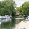
Grafton Lock

River Thames, Radcot Road, Vale of White Horse SN7 8DT, United Kingdom
Address is taken from a point 264 yards away.

Grafton Lock
is a minor waterways place
on the River Thames (above Oxford) between
Duke's Cut Junction (Junction of the River Thames with Duke's Cut (access to the Oxford Canal)) (21 miles and 1¾ furlongs
and 6 locks
to the east) and
Kelmscott (The village is a short walk from the moorings.) (1 mile and 3¼ furlongs
to the west).
The nearest place in the direction of Duke's Cut Junction is Grafton Lock Weir Exit (Channel leading to the Weir - No Access);
½ furlongs
away.
The nearest place in the direction of Kelmscott is Grafton Lock Weir Entrance (Channel leading to the Weir - No Access);
½ furlongs
away.
Mooring here is unrated.
Facilities: showers, toilets and water point.
This is a lock with a rise of 3f8.
Ye Olde Swan PH | 1 mile, 2 furlongs | |
Canal Bridge (Radcot) | 1 mile, 1¾ furlongs | |
Pidnell Bridge Drain Entrance No 1 | 1 mile, 1¾ furlongs | |
Radcot Bridge Backwater Entrance | 1 mile, ¾ furlongs | |
Grafton Lock Weir Exit | ½ furlongs | |
Grafton Lock | ||
Grafton Lock Weir Entrance | ½ furlongs | |
Kelmscott | 1 mile, 3¼ furlongs | |
Eaton Footbridge | 1 mile, 7½ furlongs | |
Buscot Lock Weir Exit No 2 | 3 miles, ¾ furlongs | |
Buscot Lock Weir Exit No 1 | 3 miles, 1¾ furlongs |
There are no links to external websites from here.
Why not log in and add some (select "External websites" from the menu (sometimes this is under "Edit"))?
Mouseover for more information or show routes to facility
Nearest water point
The nearest water point is here. Others are at:
In the direction of Osney Bridge
Radcot Lock — 2 miles, 1¼ furlongs and 1 lock away
On this waterway in the direction of Osney Bridge
Shifford Lock — 8 miles, 4½ furlongs and 3 locks away
On this waterway in the direction of Osney Bridge
Eynsham Lock — 18 miles, 5½ furlongs and 6 locks away
On this waterway in the direction of Osney Bridge
In the direction of Thames - Thames and Severn Canal - Coln Junction
Cotswold Boat Hire — 3 miles, 2½ furlongs and 2 locks away
On this waterway in the direction of Thames - Thames and Severn Canal - Coln Junction
Lechlade Marina — 5 miles, 1¾ furlongs and 3 locks away
On this waterway in the direction of Thames - Thames and Severn Canal - Coln JunctionNearest rubbish disposal
In the direction of Osney Bridge
Rushey Lock — 4 miles, 3½ furlongs and 2 locks away
On this waterway in the direction of Osney Bridge
Eynsham Lock — 18 miles, 5½ furlongs and 6 locks away
On this waterway in the direction of Osney Bridge
In the direction of Thames - Thames and Severn Canal - Coln Junction
St. John's Lock — 4 miles, 3½ furlongs and 2 locks away
On this waterway in the direction of Thames - Thames and Severn Canal - Coln Junction
Lechlade Marina — 5 miles, 1¾ furlongs and 3 locks away
On this waterway in the direction of Thames - Thames and Severn Canal - Coln JunctionNearest chemical toilet disposal
In the direction of Osney Bridge
Rushey Lock — 4 miles, 3½ furlongs and 2 locks away
On this waterway in the direction of Osney Bridge
Eynsham Lock — 18 miles, 5½ furlongs and 6 locks away
On this waterway in the direction of Osney Bridge
In the direction of Thames - Thames and Severn Canal - Coln Junction
St. John's Lock — 4 miles, 3½ furlongs and 2 locks away
On this waterway in the direction of Thames - Thames and Severn Canal - Coln Junction
Lechlade Marina — 5 miles, 1¾ furlongs and 3 locks away
On this waterway in the direction of Thames - Thames and Severn Canal - Coln JunctionNearest place to turn
In the direction of Osney Bridge
Grafton Lock Weir Exit — ½ furlongs and 1 lock away
On this waterway in the direction of Osney Bridge
Pinkhill Lock Weir Exit — 17 miles, 3 furlongs and 6 locks away
On this waterway in the direction of Osney Bridge
Thames - Wharf Stream Junction — 18 miles, 7¼ furlongs and 7 locks away
On this waterway in the direction of Osney Bridge
In the direction of Thames - Thames and Severn Canal - Coln Junction
Grafton Lock Weir Entrance — ½ furlongs and 1 lock away
On this waterway in the direction of Thames - Thames and Severn Canal - Coln Junction
St. John's Lock Weir Exit No 2 — 4 miles, 2½ furlongs and 2 locks away
On this waterway in the direction of Thames - Thames and Severn Canal - Coln Junction
St. John's Lock Weir Exit No 1 — 4 miles, 3¼ furlongs and 2 locks away
On this waterway in the direction of Thames - Thames and Severn Canal - Coln Junction
St. John's Lock Weir Entrance — 4 miles, 3¾ furlongs and 3 locks away
On this waterway in the direction of Thames - Thames and Severn Canal - Coln Junction
Ha'penny Bridge Winding Hole — 5 miles, 1 furlong and 3 locks away
On this waterway in the direction of Thames - Thames and Severn Canal - Coln Junction
Latton Junction — 14 miles, 4 furlongs and 8 locks away
Travel to Thames - Thames and Severn Canal - Coln Junction, then on the Cotswold Canals (Thames and Severn Canal - Main section) to Latton JunctionNearest self-operated pump-out
In the direction of Osney Bridge
Rushey Lock — 4 miles, 3½ furlongs and 2 locks away
On this waterway in the direction of Osney Bridge
Eynsham Lock — 18 miles, 5½ furlongs and 6 locks away
On this waterway in the direction of Osney Bridge
In the direction of Thames - Thames and Severn Canal - Coln Junction
St. John's Lock — 4 miles, 3½ furlongs and 2 locks away
On this waterway in the direction of Thames - Thames and Severn Canal - Coln JunctionNearest boatyard pump-out
In the direction of Osney Bridge
Oxford Cruisers Marina — 17 miles, 5½ furlongs and 6 locks away
On this waterway in the direction of Osney Bridge
In the direction of Thames - Thames and Severn Canal - Coln Junction
Cotswold Boat Hire — 3 miles, 2½ furlongs and 2 locks away
On this waterway in the direction of Thames - Thames and Severn Canal - Coln JunctionDirection of TV transmitter (From Wolfbane Cybernetic)
Wikipedia has a page about Grafton Lock
Grafton Lock is a lock on the River Thames in Oxfordshire, England. It is on the northern bank between Kelmscott and Radcot, about 1 mile (1.6 km) south of the hamlet of Grafton. The lock was built by the Thames Conservancy in 1896.
The weir is on the other side of the lock island at the upstream end.
Grafton Lock Meadow at the lock is a Site of Special Scientific Interest.
Other Wikipedia pages that might relate to Grafton Lock
[Grafton, Oxfordshire]
Faringdon. It is one of two hamlets in Grafton and Radcot civil parish. Grafton Lock is on the River Thames about 1 mile (1.6 km) south of the hamlet. v t
[Radcot Lock]
which is on the opposite side of the river from the lock, follows the northern bank to Grafton Lock. Locks on the River Thames "Environment Agency Dimensions
[Eaton Footbridge]
It is situated on the reach above Grafton Lock. The bridge was built in 1936 on the site of the last flash lock on the river which was in a weir known
[Thames Conservancy]
Radcot Lock (1892) Richmond Lock (1894) Grafton Lock (1896) Northmoor Lock (1896) Shifford Lock (1898) Iffley Lock (1927) Eynsham Lock (1928) King's Lock (1928)
[Locks and weirs on the River Thames]
There are 45 locks on the river, each with one or more adjacent weirs. These lock and weir combinations are used for controlling the flow of water down the
[Illinois Waterway]
of the Calumet River at Chicago to the mouth of the Illinois River at Grafton, Illinois. It is a system of rivers, lakes, and canals which provide a
[Buscot Lock]
Buscot Lock is a lock on the River Thames in England, near the village of Buscot, Oxfordshire. The lock was built of stone by the Thames Navigation Commission
[List of United States counties and county equivalents]
Statistical Area Coos 31,563 Berlin, NH-VT Micropolitan Statistical Area Grafton 89,886 Claremont-Lebanon, NH-VT Micropolitan Statistical Area Hillsborough
[List of Armed Services Editions]
1283 Shirley Graham There Was Once a Slave QQ (Mar. 1947) 1284 1284 C. W. Grafton My Name Is Christopher Nagel QQ (Mar. 1947) 1285 1285 John Myers Myers
Results of Google Search
Template:Grafton Lock map - WikipediaMain article: Grafton Lock. This is a route-map template for a UK waterway. For a key to symbols, see the Waterways legend. For information on using this ...
This template is within the scope of WikiProject UK Waterways, a collaborative effort to improve the coverage of UK Waterways on Wikipedia. If you would like to  ...
Grafton Lock is a lock on the River Thames in Oxfordshire, England. It is on the northern bank between Kelmscott and Radcot, about 1 mile (1.6 km) south of the  ...
Last Projected Forecast Time: Apr 27, 2020 07:00 PM -0500. U.S. Geological Survey (USGS) Data and Site Info for Mel Price (Alton) Lock and Dam: USGS ID: Â ...
The cheapest way to get from Lock Haven to Grafton costs only $28, and the quickest way takes just 4¼ hours. Find the travel option that best suits you.
Mar 1, 2019 ... flooding farmland. 16.2, For navigational purposes through Alton Lock and Dam control, the Corps will not allow the river to exceed this level, if at ...
The lock itself has been in existence since 1896, when the previous flash weir - called Day's Weir - was replaced by the manual-beam pound lock we see today.
The cheapest way to get from Gloucester to Grafton Lock costs only £7, and the quickest way takes just 53 mins. Find the travel option that best suits you.
Trewsbury Mead–Lechlade–Grafton Lock - Downstream: A History and Celebration of Swimming the River Thames - recounts the history of swimmers and the ...
Dec 2, 2019 ... GRAFTON -- Grafton police said there would be an increased police presence on Tuesday, Dec. 3 at Grafton High School following "a ...