Harlam Hill Lock No 1
Brown's Bridge, West Lindsey DN21 4UX, United Kingdom
Address is taken from a point 523 yards away.
Address is taken from a point 523 yards away.

Harlam Hill Lock No 1
is a minor waterways place
at the junction of
the River Ancholme (Main River)
with
the River Ancholme (unnavigable section).
Caistor - Ancholme Junction (Junction of the River Ancholme and the Caistor Canal)
is on
the River Ancholme (Main River),
2 miles and 7¾ furlongs
to the north.
Atterby Landing
is on
the River Ancholme (unnavigable section),
2½ furlongs
to the south.
The nearest place in the direction of Caistor - Ancholme Junction is Harlam Hill Lock Weir Exit (No Access);
1½ furlongs
away.
The nearest place in the direction of Atterby Landing is Harlam Hill Lock Weir Entrance (Channel leading to the Weir - No Access);
½ furlongs
away.
Mooring here is unrated.
There is a bridge here which takes pedestrian traffic over the canal.
This is a lock, the rise of which is not known.
| River Ancholme (Main River) | ||
|---|---|---|
| North Kelsey Landing | 4 miles, 1½ furlongs | |
| Redbourne Old River | 4 miles, ¼ furlongs | |
| Caistor - Ancholme Junction | 2 miles, 7¾ furlongs | |
| Brandy Wharf Bridge | 1 mile, 5½ furlongs | |
| Snitterby Bridge | 2½ furlongs | |
| Harlam Hill Lock Weir Exit | 1½ furlongs | |
| Harlam Hill Lock No 1 | ||
| River Ancholme (unnavigable section) | ||
| Harlam Hill Lock No 1 | ||
| Harlam Hill Lock Weir Entrance | ½ furlongs | |
| Atterby Landing | 2½ furlongs | |
| Owersby Landing | 6½ furlongs | |
| Winding Hole below Bishopbridge | 2 miles | |
| Bishopbridge Weir | 2 miles, 2½ furlongs | |
There are no links to external websites from here.
Why not log in and add some (select "External websites" from the menu (sometimes this is under "Edit"))?
Why not log in and add some (select "External websites" from the menu (sometimes this is under "Edit"))?
Mouseover for more information or show routes to facility
Nearest place to turn
In the direction of Humber - Ancholme Junction
Old River Ancholme Southern Junction — 7 miles, 1¾ furlongs and 1 lock away
On the River Ancholme (Main River) in the direction of Humber - Ancholme Junction
Old River Ancholme Northern Junction — 8 miles, 3¾ furlongs and 1 lock away
On the River Ancholme (Main River) in the direction of Humber - Ancholme Junction
In the direction of Bishopbridge Weir
Winding Hole below Bishopbridge — 2 miles and 1 lock away
On the River Ancholme (unnavigable section) in the direction of Bishopbridge WeirNo information
CanalPlan has no information on any of the following facilities within range:water point
rubbish disposal
chemical toilet disposal
self-operated pump-out
boatyard pump-out
Direction of TV transmitter (From Wolfbane Cybernetic)
There is no page on Wikipedia called “Harlam Hill Lock”
Wikipedia pages that might relate to Harlam Hill Lock
[River Ancholme]
parish was a Paleolithic handaxe discovered close to the site of the Harlam Hill Lock on a hummock of river gravels. This find dates anywhere from 500,000
[Snitterby]
River Ancholme, where it meets Owersby, to the east. Near Harlam Hill and Harlam Hill Lock, it meets Bishop Norton, to the south. It passes south of White
[Horkstow Bridge]
Waddingham pumping station B1205 Brandy Wharf Snitterby Bridge Atterby weir Harlam Hill lock (Current limit of navigation) Bypass weir Bishopbridge weir A631 Bishopbridge


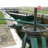
![Harlam Hill Lock on the New River Ancholme. For map of the river and details see: http://www.gov.uk/government/uploads/system/uploads/attachment_data/file/289826/gean0911budk-e-e.pdfHere, in November, the lockpit is empty and a sign on the bridge says the lock is closed.Harlam Hill Lock was designed by Sir John Rennie and built in 1827 at a cost of £2,027 as part of planned river improvements. It was formerly known as Snitterby Carr Lock and there was once a bridge there. An information board states that the present lock includes the original ground paddle casings. Ground paddles are covers over openings which let the water in and out. The two downstream pointing doors are unusual, being founded from light metal bars rather than the more traditional heavy wooden balance beams.For history of lock and local area see http://www.walkingbritain.co.uk/walks/walks/walk_b/2069/Sir John Rennie was John Rennie the Younger, and was responsible for the New River Ancholme Drainage System and for Horkstow (suspension) Bridge on the Ancholme - see [[SE9718]] and [[SE9719]]. His father, John Rennie the Elder, designed and had built the 19th century London Bridge, and his son Sir John was involved in the construction of the latter.http://nigelfishersbriggblog.blogspot.co.uk/2009/12/riverside-brigg-70-years-ago.html includes an irreverent account of the Rennies' work and a link to a book, Holmes of the Humber by Tony Watts (2009) containing a chapter with illustrations of the bridges of the Ancholme. Published by http://lodestarbooks.com/ by Chris – 29 November 2014](https://s1.geograph.org.uk/geophotos/04/26/22/4262253_46efd0dd_120x120.jpg)

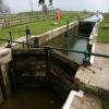
![Watery weedbed at Harlam Hill Lock. The lockpit is empty and a sign says the lock is closed.For map of the river and details see: http://www.gov.uk/government/uploads/system/uploads/attachment_data/file/289826/gean0911budk-e-e.pdfHere, in November, the lockpit is empty and a sign on the bridge says the lock is closed.Harlam Hill Lock was designed by Sir John Rennie and built in 1827 at a cost of £2,027 as part of planned river improvements. It was formerly known as Snitterby Carr Lock and there was once a bridge there. An information board states that the present lock includes the original ground paddle casings. Ground paddles are covers over openings which let the water in and out. The two downstream pointing doors are unusual, being founded from light metal bars rather than the more traditional heavy wooden balance beams.For history of lock and local area see http://www.walkingbritain.co.uk/walks/walks/walk_b/2069/Sir John Rennie was John Rennie the Younger, and was responsible for the New River Ancholme Drainage System and for Horkstow (suspension) Bridge on the Ancholme - see [[SE9718]] and [[SE9719]]. His father, John Rennie the Elder, designed and had built the 19th century London Bridge, and his son Sir John was involved in the construction of the latter.http://nigelfishersbriggblog.blogspot.co.uk/2009/12/riverside-brigg-70-years-ago.html includes an irreverent account of the Rennies' work and a link to a book, Holmes of the Humber by Tony Watts (2009) containing a chapter with illustrations of the bridges of the Ancholme. Published by http://lodestarbooks.com/ by Chris – 29 November 2014](https://s3.geograph.org.uk/geophotos/04/26/22/4262271_2b841098_120x120.jpg)


![Harlam Lock and Brown's Bridge on the New River Ancholme (2): aerial 2015. See also [[[4420241]]] and [[[4420234]]]. by Chris – 05 April 2015](https://s0.geograph.org.uk/geophotos/04/42/02/4420232_5e66833c_120x120.jpg)
![Harlam Lock on the New River Ancholme: aerial 2015. See also [[[4420241]]] and [[[4420232]]]. by Chris – 05 April 2015](https://s2.geograph.org.uk/geophotos/04/42/02/4420234_d94abeba_120x120.jpg)


